Wilton (Metro-North station)
- Wilton (Metro-North station)
Infobox Station
name=Wilton
style=MNRR New Haven
logo=
logo_size=
image_size=
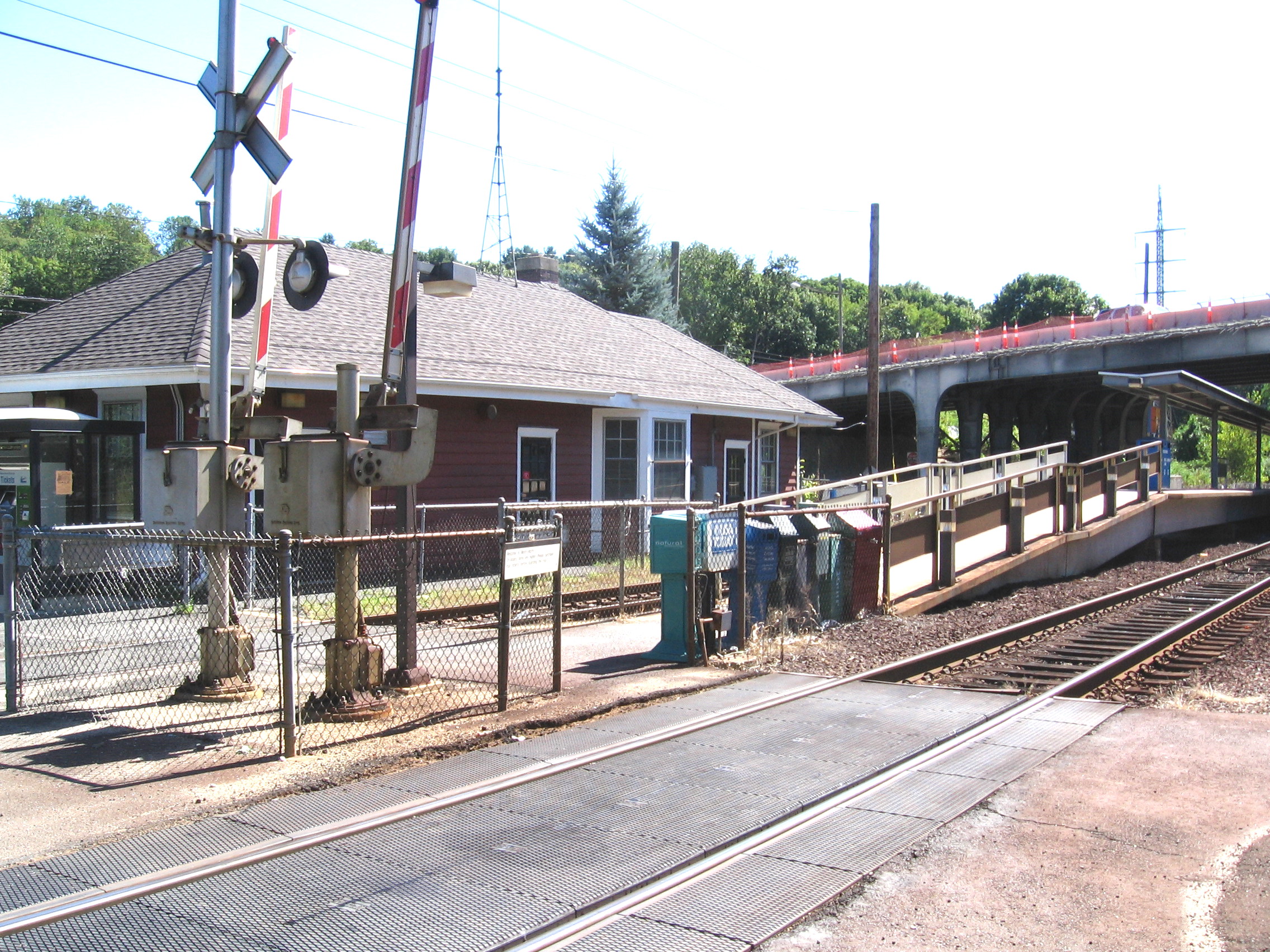
image_caption=Station house and platform, view from northwest
address=7 Station Road
Wilton, CT, 06897-2515
line=Metro-North:
other=Norwalk Transit District
Housatonic Area Regional Transit
platform=
tracks=
parking=212
bicycle=
passengers=
pass_year=2006
pass_percent=0
opened=
rebuilt=
ADA=yes
code=
owned=
zone=
services=
The Wilton Metro-North Railroad station serves residents of Wilton, Connecticut, U.S., via the Danbury Branch of the New Haven Line.
The station is 48.5 miles to Grand Central Terminal and the average travel time from there is 1 hour, 19 minutes regardless of through trains or transfers at Stamford or South Norwalk.
The station has 212 parking spaces, 105 owned by the state. [ [http://www.ct.gov/dotinfo/lib/dotinfo/ctgov/FinalParkingReport.pdf "Task 2: Technical Memorandum parking Inventory and Utilization: Final Report" submitted by Urbitran Associates Inc. to the Connecticut Department of Transportation, "Table 1: New haven Line Parking Capacity and Utilization", page 6, July 2003] ]
Connections
*Norwalk Transit District: Route 7 Link
*Housatonic Area Regional Transit; L
See also
* Connecticut Rail Commuter Council is the official state advocate for commuters and brings station problems to the attention of officials.
Notes
Pictures
External links
* [http://as0.mta.info/mnr/stations/station_detail.cfm?key=270 Metro-North Railroad - Wilton]
* [http://www.ct.gov/dotinfo/lib/dotinfo/ctgov/Wilton.pdf Connecticut Department of Transportation, "Condition Inspection for the Wilton Station" report, September 2002]
Wikimedia Foundation.
2010.
Look at other dictionaries:
Cannondale (Metro-North station) — Infobox Station name=Cannondale style=MNRR New Haven logo= logo size= image size=275 image caption=Station house and restaurant address=22 Cannon Road Wilton, CT, 06897 2625 line=Metro North: other=Norwalk Transit District Housatonic Area… … Wikipedia
Merritt 7 (Metro-North station) — Merritt 7 Trackside view of station shelter … Wikipedia
Wilton, Connecticut — Infobox Settlement official name = Wilton, Connecticut settlement type = Town imagesize = image caption = mapsize = 250x200px map caption = Location in Connecticut mapsize1 = map caption1 = subdivision type = NECTA subdivision name = Bridgeport… … Wikipedia
North East England — This article is about the region. For the European constituency, see North East England (European Parliament constituency). North East England North East region shown within England Geography Status Region Area … Wikipedia
North Albany, Albany, New York — Coordinates: 42°40′01″N 73°44′13″W / 42.66694°N 73.73694°W / 42.66694; 73.73694 … Wikipedia
December 2010 North American blizzard — For other 2010 blizzards in North America, see North American blizzards of 2010. December 2010 North American blizzard Infrared satellite image of the storm on Monday, December 27, 2010 (Day 2) Storm type: Blizzard Formed: Decemb … Wikipedia
Manors Power Station — in 2009 Official name Manors Power Station Country England Location … Wikipedia
Wellington Railway Station — Infobox Station name=Wellington type=Metlink regional rail image size= image caption=Wellington Railway Station Frontage at night address=Bunny Street, Wellington coordinates= coord|41|16|43|S|174|46|51|E|region:NZ WGN type:railwaystation… … Wikipedia
Malta Test Station — Malta Test Station, located in Malta, New York, is a former US Army fuel and explosives testing facility. It was built in 1945[citation needed] and used to test rocket engines, new fuels and explosives. It has also been used for and atomic energy … Wikipedia
Bridgeport, Connecticut — Bridgeport redirects here. For other uses, see Bridgeport (disambiguation). City of Bridgeport City … Wikipedia