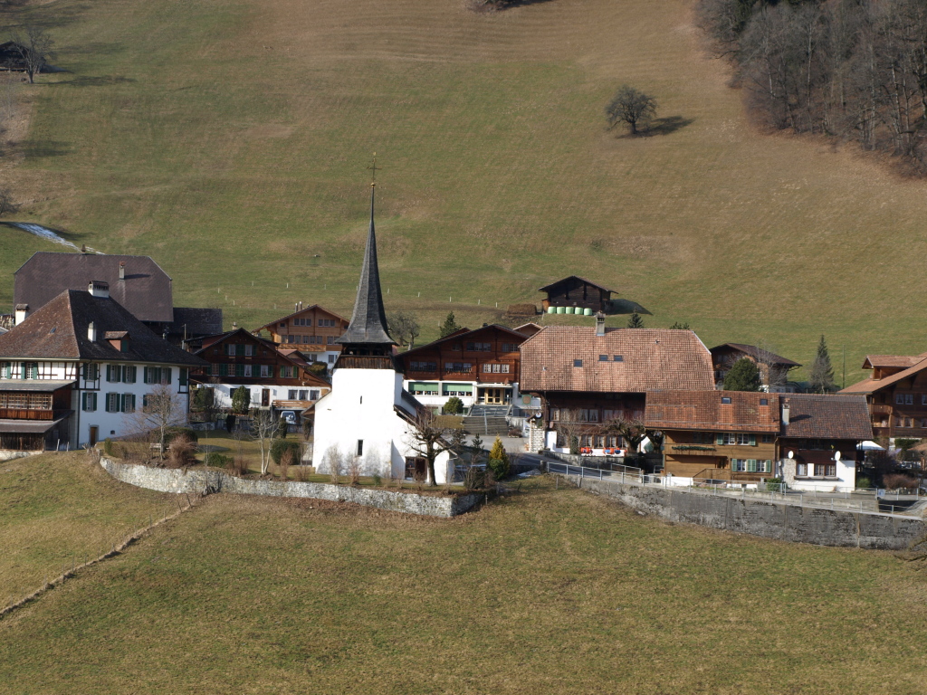
- Diemtigen
-
Diemtigen 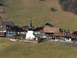
Country Switzerland 
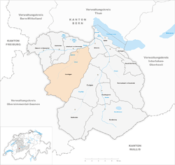
Canton Bern District Frutigen-Niedersimmental 46°38′N 7°33′E / 46.633°N 7.55°ECoordinates: 46°38′N 7°33′E / 46.633°N 7.55°E Population 2,154 (Dec 2010)[1] - Density 17 /km2 (43 /sq mi) Area 129.97 km2 (50.18 sq mi)[2] Elevation 609 m (1,998 ft) Postal code 3753 SFOS number 0762 Surrounded by Adelboden, Boltigen, Därstetten, Erlenbach im Simmental, Frutigen, Oberwil im Simmental, Reichenbach im Kandertal, Sankt Stephan, Wimmis, Zweisimmen Website www.diemtigen.ch
SFSO statistics
 DiemtigenMap of Diemtigen
Diemtigen is a municipality in the Frutigen-Niedersimmental administrative district in the canton of Bern in Switzerland.
In 1986, the community was awarded the Wakker Prize for preservation of its architectural heritage.
Contents
History
Diemtigen is first mentioned in 1257 as Diemtingen.[3]
Geography
Diemtigen has an area, as of 2009[update], of 129.97 km2 (50.18 sq mi). Of this area, 62.4 km2 (24.1 sq mi) or 48.0% is used for agricultural purposes, while 39.51 km2 (15.25 sq mi) or 30.4% is forested. Of the rest of the land, 2.27 km2 (0.88 sq mi) or 1.7% is settled (buildings or roads), 0.6 km2 (0.23 sq mi) or 0.5% is either rivers or lakes and 25.24 km2 (9.75 sq mi) or 19.4% is unproductive land.[4]
Of the built up area, housing and buildings made up 0.7% and transportation infrastructure made up 0.8%. 25.5% of the total land area is heavily forested and 3.7% is covered with orchards or small clusters of trees. Of the agricultural land, 0.3% is used for growing crops and 9.5% is pastures and 38.2% is used for alpine pastures. All the water in the municipality is in rivers and streams. Of the unproductive areas, 9.1% is unproductive vegatation and 10.3% is too rocky for vegatation.[4]
Demographics
Diemtigen has a population (as of 31 December 2010) of 2,154.[1] As of 2007[update], 2.7% of the population was made up of foreign nationals. Over the last 10 years the population has grown at a rate of 0.8%. Most of the population (as of 2000[update]) speaks German (98.2%), with Albanian being second most common ( 0.5%) and Serbo-Croatian being third ( 0.4%).
In the 2007 election the most popular party was the SVP which received 70% of the vote. The next three most popular parties were the local small left-wing parties (7.6%), the Green Party (6%) and the SPS (5.9%).
The age distribution of the population (as of 2000[update]) is children and teenagers (0–19 years old) make up 26.3% of the population, while adults (20–64 years old) make up 57.5% and seniors (over 64 years old) make up 16.2%. The entire Swiss population is generally well educated. In Diemtigen about 61.8% of the population (between age 25-64) have completed either non-mandatory upper secondary education or additional higher education (either university or a Fachhochschule).
Diemtigen has an unemployment rate of 0.83%. As of 2005[update], there were 420 people employed in the primary economic sector and about 145 businesses involved in this sector. 289 people are employed in the secondary sector and there are 46 businesses in this sector. 331 people are employed in the tertiary sector, with 79 businesses in this sector.[5] The historical population is given in the following table:[3]
year population 1764 1,138 1850 2,150 1900 2,014 1950 2,049 1970 1,913 2000 2,054 Wakker Prize
The Wakker prize is given each year by the Swiss Heritage Society to a Municipality of Switzerland for the development and preservation of its architectural heritage. In 1986, Diemtigen was given the prize for consistent planning that remained spared much of an area measuring 130 km2 (50 sq mi) from development. The scattered nature of the municipality made this more difficult, because there are many scattered land owners with different goals. However, the municipality was able to create a number of large landscape protection zones, which limited and concentrated holiday house areas to a few places.[6]
External links
- Official website
- Diemtigen in German, French and Italian in the online Historical Dictionary of Switzerland.
References
- ^ a b Swiss Federal Statistical Office - STAT-TAB, online database – Datenwürfel für Thema 01.2 - Bevölkerungsstand und -bewegung (German) accessed 29 September
- ^ Arealstatistik Standard - Gemeindedaten nach 4 Hauptbereichen
- ^ a b Diemtigen in German, French and Italian in the online Historical Dictionary of Switzerland.
- ^ a b Swiss Federal Statistical Office-Land Use Statistics 2009 data (German) accessed 25 March 2010
- ^ Swiss Federal Statistical Office accessed 10-Jul-2009
- ^ Wakker Prize accessed 10 July 2009
Adelboden | Aeschi bei Spiez | Därstetten | Diemtigen | Erlenbach im Simmental | Frutigen | Kandergrund | Kandersteg | Krattigen | Oberwil im Simmental | Reichenbach im Kandertal | Spiez | Wimmis
Canton of Bern | Districts of Canton Bern | Municipalities of the canton of Bern
 Categories:
- Municipalities of Bern
- Municipalities of Switzerland


Wikimedia Foundation. 2010.