- New York State Route 120A
-
NYS Route 120A
Route information Auxiliary route of NY 120 Maintained by NYSDOT, Westchester County and the village of Port Chester Length: 8.55 mi[3] (13.76 km) Existed: ca. 1931[1][2] – present Major junctions South end: 
 NY 120 / I-287 in Harrison

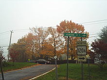
 Hutchinson River Parkway / Route 15 / Merritt Parkway in Rye Brook/Greenwich, CT
North end: NY 120 in North CastleLocation Counties: Westchester Highway system Numbered highways in New York
Interstate • U.S. • N.Y. (former) • Reference • County← NY 120NY 121  →
→New York State Route 120A (NY 120A) is a state highway in southern Westchester County, New York, in the United States. It serves as an alternate route to the southern half of NY 120 running along the New York–Connecticut state line. The southern terminus of route is at NY 120 in Harrison. Its northern terminus is at NY 120 in North Castle. Most of the route straddles the New York – Connecticut state line, and part of the route is physically located in Connecticut. However, this part of the highway is not recognized by Connecticut as "Route 120A", and is considered to be part of NY 120A by the New York State Department of Transportation.
Contents
Route description
 An erroneous CT 120A shield at the interchange between NY 120A and the Merritt and Hutchinson River Parkways in Greenwich, CT
NY 120A begins at NY 120 near the junction of NY 120 and Interstate 287 in the village of Harrison within the town of Purchase. It initially heads eastward along Westchester Avenue, passing through the village of Rye Brook on its way to the village of Port Chester. In Port Chester, Westchester Avenue is county-maintained with the unsigned designation County Route 112. NY 120A then continues onto King Street via North Pearl Street. King Street heads north, re-entering Rye Brook, then runs along the Connecticut state line. NY 120A connects to the Hutchinson River Parkway (New York) and the Merritt Parkway (Connecticut; co-signed as Route 15) by way of an interchange while running along the border. NY 120A proceeds into Connecticut, staying within the town of Greenwich, Connecticut, for about 3.6 miles (5.8 km). This portion of the road is still maintained by the New York State Department of Transportation, even though it is outside the state of New York. NY 120A re-enters New York in the town of North Castle, where it ends back at NY 120.
History
The portion of Westchester Avenue from Purchase Street in Harrison to North Pearl Street in Port Chester was originally designated as part of NY 119 in the 1930 renumbering of state highways in New York.[1] By the following year, a spur route connecting NY 119 to NY 120 in North Castle was assigned the NY 120A designation. It began at Westchester Avenue and went north to the Connecticut state line via Ridge Street, where it turned northwest to follow King Street to NY 120.[2] The section of King Street between Ridge Street and Port Chester was designated as NY 120B by 1932.[4]
Ca. 1938, NY 120A was truncated to consist only of the Ridge Street portion of its alignment while NY 120B was extended northwest along King Street to NY 120 in North Castle[5][6] and southward along NY 119 and Ridge Street to a terminus at NY 120 in Rye.[5][7] The NY 120B designation was eliminated by the following year, at which time NY 120A was reextended along King Street to North Castle and realigned east of Ridge Street to follow old NY 120B into Port Chester.[6][8] Ca. 1961, NY 119 was truncated on its east end to NY 22 in White Plains while NY 120 was rerouted to follow what had been NY 119A south to Rye along Purchase Street. The former routing of NY 119 and NY 120 from Purchase Street to downtown Port Chester became an extension of NY 120A.[9][10] The routing of NY 120A in Port Chester was modified slightly by 1990 to follow North Pearl Street between Westchester Avenue and King Street.[11]
On September 1, 1980, ownership and maintenance of NY 120A between a point just north of Sherwood Avenue and Lincoln Avenue (the Connecticut state line) was transferred from Westchester County to the state of New York as part of a highway maintenance swap between the two levels of government. The road was one of 10 highways exchanged during the swap.[12]
Major intersections
The entire route is in Westchester County.
Location Mile[3] Destinations Notes Harrison 0.00 NY 120 southWestern terminus of NY 120 / NY 120A overlap (northbound) 0.08 NY 120 north to I-287Eastern terminus of NY 120 / NY 120A overlap (northbound) Rye Brook 0.45 Lincoln Avenue (CR 64B) Port Chester 1.93  To US 1 via King Street
2.91 Putnam Avenue (NY 982C) Rye Brook/Greenwich, CT 4.30 Hutchinson River Parkway / Route 15 / Merritt ParkwayExit 30 (HRP) North Castle 8.55 NY 1201.000 mi = 1.609 km; 1.000 km = 0.621 mi References
- ^ a b Standard Oil Company of New York (1930). Road Map of New York (Map). Cartography by General Drafting.
- ^ a b Kendall Refining Company (1931). New York (Map). Cartography by H.M. Gousha Company.
- ^ a b "2008 Traffic Volume Report for New York State" (PDF). New York State Department of Transportation. June 16, 2009. p. 166. https://www.nysdot.gov/divisions/engineering/technical-services/hds-respository/NYSDOT%20TVR%202008%20by%20Route.pdf. Retrieved February 1, 2010.
- ^ Texas Oil Company (1932). Texaco Road Map – New York (Map). Cartography by Rand McNally and Company.
- ^ a b Shell Oil Company (1937). Shell Road Map – New York (Map). Cartography by H.M. Gousha Company.
- ^ a b Esso (1938). New York Road Map for 1938 (Map). Cartography by General Drafting.
- ^ Thibodeau, William A. (1938). The ALA Green Book (1938–39 ed.). Automobile Legal Association.
- ^ Standard Oil Company (1939). New York (Map). Cartography by General Drafting.
- ^ Gulf Oil Company (1960). New York and New Jersey Tourgide Map (Map). Cartography by Rand McNally and Company.
- ^ Sunoco (1961). New York and Metropolitan New York (Map). Cartography by H.M. Gousha Company (1961–62 ed.).
- ^ New York State Department of Transportation (1990). Glenville Digital Raster Quadrangle (Map). 1:24,000. http://www.nysgis.state.ny.us/gisdata/quads/drg24/dotpreview/index.cfm?code=ff49. Retrieved June 16, 2009.
- ^ New York State Legislature. "New York State Highway Law § 341". http://public.leginfo.state.ny.us/LAWSSEAF.cgi?QUERYTYPE=LAWS+&QUERYDATA=$$HAY341$$@TXHAY0341+&LIST=LAW+&TARGET=VIEW. Retrieved June 10, 2010.
External links
Categories:- State highways in New York
- Transportation in Westchester County, New York
- Port Chester, New York
- Greenwich, Connecticut
- Transportation in Fairfield County, Connecticut


Wikimedia Foundation. 2010.