- Mohale's Hoek
-
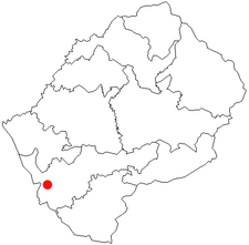
Mohale's Hoek is the capital city of Mohale's Hoek District in Lesotho. It had a population of approximately 24,992 in 2006.[1]
History
Mohale's Hoek had first been inhabited by the San who were found there by the Baphuthi around 1795. The Baphuthi settled in Kubake near the present Likuena High School while some settled at Thaba-Ts'oeu. Chief Moorosi of the Baphuthi is said to have been during the journey to this new home. They later settled below the foothills of Thaba-Linoha, north of the present Bethesda mission and the area was later called Maphutseng. Some Baphuthi inhabited the area bordering Senqu River, Morifi and across the river into what is now Quthing. After 1824, the area was inhabited by Mohale, the younger brother of Moshoeshoe around the 1830s.
On expansion of Moshoeshoe's kingdom into southern Lesotho, King Moshoeshoe sent his brother Mohale to administer the area where the Baphuthi and Basotho enjoyed a rather fragile friendship. After living for a while at Lifateng, Mohale established a substantial village at the place now known as Old Hoek (the present day Ha Ts'epo village) a few kilometres north of the present town. This village was destroyed in 1867 during the Seqiti War and was subsequently abandoned. In the year after the proclamation that made Lesotho British territory, an assistant commissioner was appointed to administer what was then called Cornet Spruit District - after the Makhaleng River. This would make Mohale's Hoek the second oldest of all the district headquarters towns in Lesotho, except that the town was completely destroyed during the Gun War of 1880. East to the town near the St Patrick's Cathedral are the Motlejoeng caves which were used by the celebrated cannibal, Motlejoa during the Lifaqane.
References
- ^ Lesotho Bureau of Statistics, Census Pre Results 2006.
External links
Coordinates: 30°09′S 27°28′E / 30.15°S 27.467°E
 Camptowns of LesothoButha-Buthe • Hlotse • Mafeteng • Maseru • Mohale's Hoek • Mokhotlong • Qacha's Nek • Quthing • Teyateyaneng • Thaba-TsekaCategories:
- Populated places in Lesotho
- Mohale's Hoek District
- Lesotho geography stubs

Wikimedia Foundation. 2010.