- Degehabur Zone
-
Degehabur Zone
Gobolka DhagaxbuurMap of Degehabur Zone Location within Ethiopia
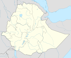
 Degehabur Zone
Coordinates: 8°15′N 43°45′E / 8.25°N 43.75°E Country Ethiopia Region Somali Zone Degehabur Time zone EAT (UTC+3) Degehabur Zone (Somali: Gobolka Dhagaxbuur) is one of the nine Zones in the Somali Region of Ethiopia. This zone is named after its largest city, Degehabur. Degehabur Zone is bordered on the south by Korahe, on the west by Fiq, on the northwest by the Oromia Region, on the north by Jijiga and Somalia, and on the east by Werder.
Degehabur Zone is facing a crisis in deforestation due to charcoal production which "requires burning trees that will take decades to grow back, if they ever do."[1]
Demographics
Based on figures from the Central Statistical Agency (CSA) in 2005, Deghabur has an estimated total population of 387,428, of whom 210,652 are men and 176,776 are women; 86,304 or 22.3% of its population are urban dwellers. Information is not available for the area of this zone, so its population density cannot be calculated.[2]
The 1997 national census reported a total population for this Zone of 304,907 in 72,010 households, of whom 168,211 were men and 136,696 were women; 57,866 or 18.98% of its population were urban dwellers. The largest ethnic group reported in Degehabur was the Somali (99.55%); a similar proportion spoke Somali (99.58%). Only 13,514 or 4.43% were literate.[3]
According to a May 24, 2004 World Bank memorandum, 1% of the inhabitants of Deghabur have access to electricity, this zone has a road density of 10.3 kilometers per 1000 square kilometers, the average rural household has 1.5 hectare of land (compared to the national average of 1.01 hectare of land and an average of 2.25 for pastoral Regions)[4] and the equivalent of 1.5 heads of livestock. 28.2% of the population is in non-farm related jobs, compared to the national average of 25% and an average of 28% for pastoral Regions. 23% of all eligible children are enrolled in primary school, and 3% in secondary schools. 100% of the zone is exposed to malaria, and none to Tsetse fly. The memorandum gave this zone a drought risk rating of 614.[5]
Agriculture
On 5-23 November 2003, the CSA conducted the first ever national agricultural census, of which the livestock census was an important component.[6] For the Somali Region, the CSA generated estimated figures for the livestock population (cattle, sheep, goats, camels, and equids) and their distribution by commissioning an aerial survey. For the Degehabur Zone, their results included:
Animal Estimated total number per sqk. cattle 51,536 1.4 sheep 1,395,779 56.6 (including goats) goats 721,925 56.6 (including sheep) camels 131,106 3.5 asses 5,415 0.1 (all equids) mules 68 0.1 (all equids) horses 19 0.1 (all equids) Notes
- ^ CHF International, Grassroots Conflict Assessment in the Somali Region (Aug. 2006), p. 19 (accessed 12 December 2008)
- ^ CSA 2005 National Statistics, Table B.3. Rural population numbers are believed to be underreported.
- ^ 1994 Population and Housing Census of Ethiopia: Results for Somali Region, Vol. 1 Tables 2.1, 2.2, 2.13 (accessed 12 January 2009). The results of the 1994 census in the Somali Region were not satisfactory, so the census was repeated in 1997.
- ^ Comparative national and regional figures comes from the World Bank publication, Klaus Deininger et al. "Tenure Security and Land Related Investment", WP-2991 (accessed 23 March 2006) This publication defines Benishangul-Gumaz, Afar and Somali as "pastoral Regions".
- ^ World Bank, Four Ethiopias: A Regional Characterization (accessed 23 March 2006).
- ^ "Livestock aerial survey in the Somali Region", CSA (November 2003), Tables 4, 6 (accessed 17 May 2009)
Coordinates: 8°15′N 43°45′E / 8.25°N 43.75°E
Afder Zone · Degehabur Zone · Fiq Zone · Gode Zone · Jijiga Zone · Korahe Zone · Liben Zone · Shinile Zone · Werder Zone Categories:


Wikimedia Foundation. 2010.