- Khorugh
-
Khorugh
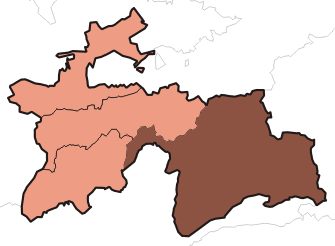
ХоруғLocation of Khorugh in Tajikistan
 Khorugh
Coordinates: 37°29′30″N 71°33′21″E / 37.49167°N 71.55583°E Country  Tajikistan
Province Gorno-Badakhshan Autonomous Province District Shughnon District Elevation 2,200 m (7,218 ft) Population (2003) – Total 30,000 Time zone GMT (UTC+5) – Summer (DST) GMT (UTC+5) Area code(s) +992 3522 The town of Khorugh (Tajik: Хоруғ, Persian: خاروغ ), also transliterated as Khoroq, Khorogh, Khorog, or Xoroq) is the capital of the Gorno-Badakhshan (Tajik: Kuhistoni Badakhshon, "Mountainous Badakhshan") Autonomous Province (GBAO) in Tajikistan. It is also the capital of the Shughnon District of Gorno-Badakhshan. It has a population of 28,000 (2000 census). Khorugh is situated 2,200 m above sea level in the Pamir Mountains (ancient Mount Imeon) at the confluence of the Ghund and Panj rivers. The city is bounded to the south (Nivodak) and to the north (Tem) by the deltas of the Shakhdara and Gunt, respectively. The two rivers merge in the eastern part of the city flow through the city, dividing it almost evenly until its delta in the Panj River, also being known as Amu Darya, or in antiquity the Oxus) on the border with Afghanistan. Khorugh is known for its beautiful poplar trees that dominate the flora of the city.
Contents
History
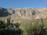 Typical scenery in the area
Until the late 19th century, Khorugh was in an area disputed between the Emir of Bukhara, Shah of Afghanistan, Russia and Britain. The Russians emerged the winners of the region after The Great Game, which fixed the current northern border of Afghanistan on the Panj River and established the territory of Russian Pamir around Khorugh. Before 1896, when the Russians arrived and built a fort, the main town in the area was Kala-i Bar Panj (or Bar Panja Qal'a) somewhat downriver on the Afghan side. Following the fall of czarist Russia and the rise of the Soviet Union, Khorugh became the capital of Gorno-Badakhshan in 1925. Soviet leaders encouraged the migration of settlers to the area with promises of pay, medals and automobiles, but with no industry and little arable land, the effort was not successful.
Migration is playing an increasingly important role in the life of Khorugh. Historically, migration was part of Soviet policy for development. In the early 1950s the Soviet government encouraged migration of residents of Rushan district of Gorno Badakhshan to other parts of Tajikistan, especially to the area of Qumsangir, situated in the southern part of today's Khatlon region as the area needed workforce. This policy of migration is still encouraged by the present government of Tajikistan with the hope of creating better environment for the inhabitants and, to some extent, regulate the population density and land use within the country. With regard to Khorugh, migration plays a key role in its expansion and development. Although the youth has a tendency to go to Russia, they do come back or send resources back to build new houses. As a result of remittances and new migration from rural areas, though still tiny, Khorugh is slowly expanding in many directions. One sign of this intense migration is that the gap, once existed between Khorugh and village Tem is now filled with newly built houses. The same is true about the gap between village Tem and village Proshinev.
Facilities
Modern Khorugh is one of the poorest areas of Tajikistan, with the charitable organization Aga Khan Foundation providing almost the only source of cash income. However, the city does have its own university (Khorugh State University), founded in 1992), twelve schools, and several hospitals. There is a museum and the second highest botanical garden in the world.
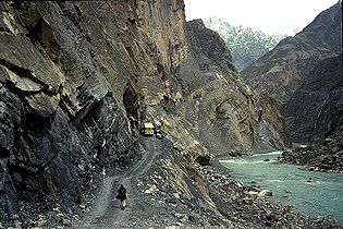 Along the Dushanbe–Khorugh highway
Khorugh is also host to one of three campuses of the University of Central Asia (UCA). The University was founded in 2000 by the governments of Kazakhstan, the Kyrgyz Republic and Tajikistan, and His Highness the Aga Khan. It is the world’s first internationally chartered institution of higher education. The UCA currently operates a School of Professional and Continuing Education (SPCE), with a School of Undergraduate Studies and a Graduate School of Development in the process of being established.
- Aga Khan Lycée, Khorugh
- University of Central Asia
- Khorugh State University
Transportation
There is a bridge to the Afghan side of the river. Khorugh is situated along the Pamir Highway at the point where it leaves the Panj valley and heads east up the Gunt valley. The Pamir highway is the main road in Gorno-Badakhstan and connects the Tajik capital of Dushanbe toward the west to the Republic of Kyrgyzstan to the northeast. The highway is very difficult to pass in both directions, especially during winter and spring. Khorugh also has a small airport, which can accommodate very small capacity airplanes like AN-28 and the Jet Yakovlev YAK-40 and helicopters.
Recently the Pamir Highway was connected to the Karakorum Highway of China and Pakistan, also known as KKH.
Climate
Khorugh experiences a semi-arid climate (Köppen climate classification BSk) with cold, relatively wet winters and hot, dry summers.
Climate data for Khorugh Month Jan Feb Mar Apr May Jun Jul Aug Sep Oct Nov Dec Year Average high °C (°F) −1.2
(29.8)0.6
(33.1)6.8
(44.2)15.7
(60.3)21.4
(70.5)26.6
(79.9)30.1
(86.2)30.4
(86.7)26.1
(79.0)18.2
(64.8)9.5
(49.1)2.3
(36.1)15.54
(59.98)Average low °C (°F) −11.2
(11.8)−8.9
(16.0)−1.7
(28.9)5.2
(41.4)8.6
(47.5)12.1
(53.8)15.2
(59.4)15.1
(59.2)9.9
(49.8)4.1
(39.4)−1.1
(30.0)−6.5
(20.3)3.40
(38.12)Precipitation mm (inches) 33.8
(1.331)35.5
(1.398)45.6
(1.795)42.2
(1.661)29.9
(1.177)8.4
(0.331)3.7
(0.146)1.4
(0.055)1.0
(0.039)5.6
(0.22)7.5
(0.295)11.5
(0.453)226.1
(8.902)Source: World Meteorological Organisation (UN) [1] Photo gallery
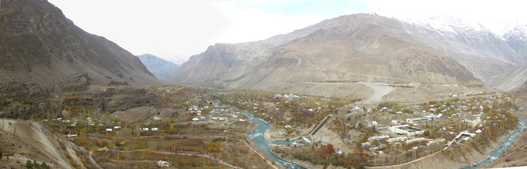
 Panorama of Khorugh from the north
 Panorama of Khorugh from the east
References
- ^ "World Weather Information Service – Khorog". United Nations. http://worldweather.wmo.int/110/c00911.htm. Retrieved 05 January 2011.
External links
- Gorgâni, Tirdâd (May 2005)."Welcome to Xoroq (Khorogh)" (web archive, 1 August 2008).
- Tourist Information Office in Khorog Pamirs Tourism Association
- A great homepage on the Tajik Pamirs
- [1] Airport of Khorugh.
- A Bird's Eye View of Khorog
Coordinates: 37°29′N 71°33′E / 37.483°N 71.55°E
Gorno-Badakhshan Autonomous ProvinceCapital: KhorughDistricts 
Main cities and towns Geography Darvoz Range · Vanj River · Vanj Range · Yazgulyam River · Yazgulem Range · Bartang River · Rushan Range · Gunt River · Shughnon Range · Sarikol Range · Shakhdara River · Shakhdara Range · Ishkoshim Range · Panj River · Sarez Lake · Zorkul Lake · Karakul Lake · Mayakovskiy Peak · Karl Marx PeakCategories:- Populated places in Gorno-Badakhshan


Wikimedia Foundation. 2010.