- New York State Route 75
-
This article is about the current alignment of NY 75. For the former alignment of NY 75 in Chautauqua County, see New York State Route 75 (1930–1932).
NYS Route 75

Map of the Buffalo area with NY 75 highlighted in redRoute information Maintained by NYSDOT Length: 20.85 mi[4] (33.55 km) History: Designated NY 62 in 1930;[1] renumbered to NY 75 ca. 1932[2][3] Major junctions South end:  NY 39 in Collins
 US 62 in Hamburg village

 I-90 / Thruway in Hamburg town
North end:  NY 5 in Hamburg town
Location Counties: Erie Highway system Numbered highways in New York
Interstate • U.S. • N.Y. (former) • Reference • County←  NY 74
NY 74NY 76  →
→←  NY 18
NY 18
NY 18B  →
→New York State Route 75 (NY 75) is a north–south state highway in Erie County, New York, in the United States. It extends for 20.85 miles (33.55 km) from an intersection with NY 39 in the Collins hamlet of Collins Center to an interchange with NY 5 in the town of Hamburg. The route passes through the village of Hamburg, which serves as the northern terminus of a 2-mile (3.2 km) overlap between NY 75 and U.S. Route 62 (US 62). Past Hamburg, NY 75 connects to the New York State Thruway (Interstate 90 or I-90) northwest of the village before ending a short distance from Lake Erie. The portion of NY 75 south of Hamburg is a two-lane rural highway; in contrast, the section north of the village is four lanes wide and serves commercial and residential areas.
The origins of NY 75 date back to 1930 when New York State Route 62 was assigned to an alignment extending from Great Valley to Buffalo via Hamburg and Athol Springs. NY 62 was renumbered to NY 75 ca. 1932 to eliminate numerical duplication with US 62, and the route was truncated to end in Hamburg in the late 1930s after most of it became part of US 219. The section of modern NY 75 south of Hamburg was initially New York State Route 18A, an alternate route of then-NY 18 through Collins and Eden. NY 18 was truncated ca. 1962 to begin in Niagara County, at which time NY 18A became part of NY 75.
Contents
Route description
NY 75 begins at an intersection with NY 39 in Collins Center, a small hamlet in the town of Collins. It initially heads northeastward as the two-lane Sisson Highway, serving a handful of homes on the northern edge of the community prior to entering an open area dominated by farmland. About 0.5 miles (0.8 km) from NY 39, the road curves northward, taking on a due north alignment as it heads across the rolling terrain that comprises most of northern Collins. The highway serves just one community, the hamlet of Whites Corners, on its way into the adjacent town of North Collins. Here, development along NY 75 remains limited at first, consisting of only a handful of isolated farms situated among fields or one of several forested areas. It quickly passes through Marshfield, located just past the town line, on its way toward Langford. A brief stretch of homes begins about 3 miles (5 km) into the town as the route enters Langford, located 5.5 miles (8.9 km) north of Collins Center.[5]
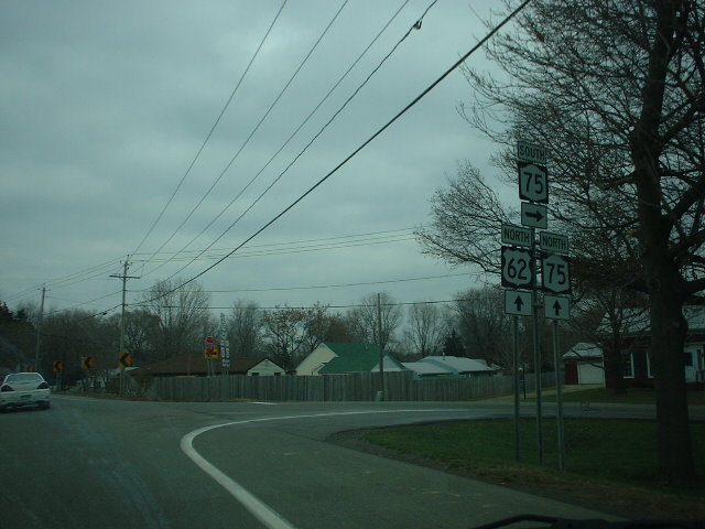
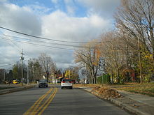 First southbound reassurance markers along the US 62 / NY 75 overlap in Hamburg
In the center of the community, NY 75 intersects Langford Road, designated as NY 249 west of the junction and County Route 39 (CR 39) east of NY 75. Past NY 249, the route exits Langford and heads across another stretch of fields and farms toward the Eden town line. NY 75 breaks from its due north routing just south of it, taking on a more westerly heading to avoid a valley surrounding the south branch of Eighteenmile Creek. It ultimately enters the valley, however, winding its way northward down the depression's southwestern side to reach the creek floor. From here, NY 75 follows the base of the valley to the northwest for 2.5 miles (4.0 km), serving a handful of homes situated along the forested creekside. The route eventually climbs out of the gully and heads due north for a short distance across more fields to a junction with US 62.[5]
At this point, NY 75 turns northeastward, overlapping with US 62 into the nearby town of Hamburg along Gowanda State Road. Development along the highway quickly rises in density from a large farm and a pocket of homes at the start of the concurrency to a series of residential streets across the town line that make up the hamlet of Water Valley. The influx of homes brings US 62 and NY 75 across the main channel of Eighteenmile Creek and into the village of Hamburg, where the highway changes names to Pierce Avenue. The two routes remain concurrent for three blocks to an intersection with Lake Avenue, where Pierce Avenue becomes Main Street. While US 62 continues east into Hamburg's central business district on Main Street, NY 75 follows Lake Street northward along the mostly residential western edge of the village.[5]
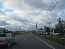 Heading away from the NY 5 interchange on NY 75 southbound in Hamburg
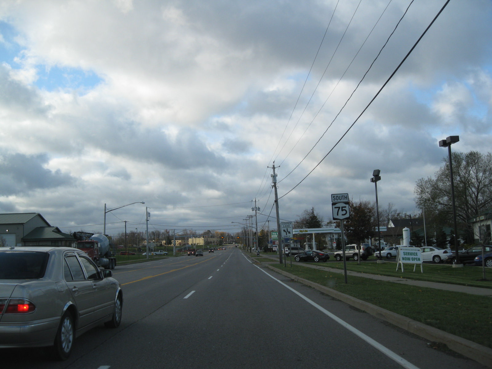
Outside of the village, NY 75 becomes Camp Road and begins to parallel the Buffalo Southern Railroad, separated from NY 75 by only a row of homes and businesses. While on this stretch, the highway widens from two to four lanes. After 0.5 miles (0.8 km), the route makes a turn to the northwest, passing under the railroad and entering the southeastern portion of a commercial strip that follows NY 75 for 1 mile (1.6 km) to New York State Thruway (I-90) exit 57. It continues past the Thruway for another 0.5 miles (0.8 km) before ceasing at a junction with US 20. Continuing on, the highway remains four lanes wide but serves primarily residential areas located in and around Athol Springs, a hamlet on the shores of Lake Erie.[5]
Just outside of Athol Springs, NY 75 passes under two railroad bridges, carrying the Norfolk Southern Railway-owned Lake Erie District line and the CSX Transportation-owned Lake Shore Subdivision line over the highway. On the other side of the overpasses, NY 75 curves northeastward as it becomes Saint Francis Drive, leaving Camp Road to continue northwestward to the lake as a two-lane street. The route continues on, passing south of Saint Francis High School before ending shortly afterward at a partial interchange with NY 5. NY 75 northbound merges directly into NY 5 eastbound, a limited-access highway, while NY 75 southbound begins as an off-shoot of NY 5 westbound. The remaining connections are made by way of a loop road leading from Big Tree Road, which NY 5 and NY 75 both intersect just south of the interchange.[5]
History
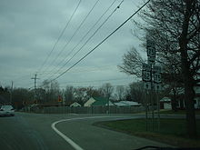 Southern terminus of NY 75's overlap with US 62 in Eden
All of what is now NY 75 was state-maintained by 1926.[6] In the 1930 renumbering of state highways in New York, the portion of modern NY 75 north of the village of Hamburg was designated as part of NY 62, a highway extending from Great Valley north to Buffalo.[1] The section between Collins Center and Eden gained a designation ca. 1931 when it became part of NY 18A, an alternate route of then-NY 18 between Collins and Eden.[2][1] NY 18A overlapped with NY 39 between the hamlets of Collins (where NY 18A began at NY 18) and Collins Center,[7] from where the route followed Sisson Highway north to rejoin NY 18 in Eden.[3] US 62 was extended into New York ca. 1932. As a result, the portion of NY 62 south of the hamlet of Athol Springs was renumbered to NY 75 to eliminate numerical duplication with the new U.S. Highway. The remainder of old NY 62 became part of an extended NY 5.[2][3]
When US 219 was extended into New York ca. 1935, it was overlaid on the pre-existing NY 75 from Great Valley to Hamburg, creating a lengthy overlap with the route.[8][9] The overlap was eliminated in the late 1930s when NY 75 was truncated on its southern end to the village of Hamburg.[10][11] Similarly, NY 18A was truncated to Collins Center on its southern end in the 1950s, eliminating its overlap with NY 39.[12][13] NY 18 continued to extend south of Niagara County until ca. 1962 when it was truncated to begin 35 miles (56 km) north of Hamburg in Lewiston. NY 18A, now separated from its parent route, became an extension of NY 75, which connected to NY 18A's former routing by way of an overlap with US 62 between Hamburg and Eden.[14][15]
Major intersections
The entire route is in Erie County.
Location Mile[4] Destinations Notes Collins 0.00 NY 39Hamlet of Collins Center Town of North Collins 6.62  NY 249
Hamlet of Langford; eastern terminus of NY 249 Eden 14.35 US 62 southSouthern terminus of US 62 / NY 75 overlap Village of Hamburg 16.29 US 62 northNorthern terminus of US 62 / NY 75 overlap Town of Hamburg 18.22 I-90 / ThruwayExit 57 (I-90 / Thruway) 18.97  US 20
US 2020.85 NY 5Hamlet of Athol Springs 1.000 mi = 1.609 km; 1.000 km = 0.621 mi References
- ^ a b c Standard Oil Company of New York (1930). Road Map of New York (Map). Cartography by General Drafting.
- ^ a b c Kendall Refining Company (1931). New York (Map). Cartography by H.M. Gousha Company.
- ^ a b c Texas Oil Company (1932). Texaco Road Map – New York (Map). Cartography by Rand McNally and Company.
- ^ a b "2008 Traffic Data Report for New York State" (PDF). New York State Department of Transportation. June 16, 2009. p. 209. https://www.nysdot.gov/divisions/engineering/technical-services/hds-respository/NYSDOT_Traffic_Data_Report_2008.pdf. Retrieved January 26, 2010.
- ^ a b c d e Yahoo! Inc. Yahoo! Maps – overview map of NY 75 (Map). Cartography by NAVTEQ. http://maps.yahoo.com/#mvt=m&lat=42.650681&lon=-78.807856&zoom=12&q1=42.493387%2C-78.850128&q2=42.691227%2C-78.855793&q3=42.778935%2C-78.853947. Retrieved February 19, 2011.
- ^ State of New York Department of Public Works (1926). Official Map Showing State Highways and other important roads (Map). Cartography by Rand McNally and Company.
- ^ Gulf Oil Company (1940). New York Info-Map (Map). Cartography by Rand McNally and Company.
- ^ Texas Oil Company (1934). Texaco Road Map – New York (Map). Cartography by Rand McNally and Company.
- ^ Sun Oil Company (1935). Road Map & Historical Guide – New York (Map). Cartography by Rand McNally and Company.
- ^ Shell Oil Company (1937). Shell Road Map – New York (Map). Cartography by H.M. Gousha Company.
- ^ Shell Oil Company (1940). Map of New York (Map). Cartography by H.M. Gousha Company.
- ^ Sunoco (1952). New York (Map). Cartography by Rand McNally and Company.
- ^ Gulf Oil Company (1958). New York and New Jersey Tourgide Map (Map). Cartography by Rand McNally and Company.
- ^ Sunoco (1961). New York and Metropolitan New York (Map). Cartography by H.M. Gousha Company (1961–62 ed.).
- ^ Esso (1962). New York with Sight-Seeing Guide (Map). Cartography by General Drafting.
External links
Categories:- State highways in New York
- Transportation in Erie County, New York


Wikimedia Foundation. 2010.