Oud-Maarsseveen

Oud-Maarsseveen
Oud-Maarsseveen
—  Village  —
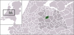
Oud-Maarsseveen in the municipality of Maarssen.
Coordinates: 52°9′31″N 5°5′20″E / 52.15861°N 5.08889°E / 52.15861; 5.08889Coordinates: 52°9′31″N 5°5′20″E / 52.15861°N 5.08889°E / 52.15861; 5.08889
Country Netherlands
Province Utrecht
Municipality Stichtse Vecht
Population (2005)
 – Total 270
Time zone CET (UTC+1)
 – Summer (DST) CEST (UTC+2)
Postal code

Oud-Maarsseveen is a village in the Dutch province of Utrecht. It is a part of the municipality of Stichtse Vecht, and lies about 7 km north of Utrecht.

The statistical area "Oud-Maarsseveen", which also can include the surrounding countryside, has a population of around 270.[1]

References

  1. ^ Statistics Netherlands (CBS), Statline: Kerncijfers wijken en buurten 2003-2005. As of 1 January 2005.


Wikimedia Foundation. 2010.

Игры ⚽ Нужен реферат?

Look at other dictionaries:

  • Oud-Maarsseveen — 52°9′31″N 5°5′20″E / 52.15861, 5.08889 …   Wikipédia en Français

  • Maarsseveen — is a former village in the Dutch province of Utrecht. It was located on the east bank of the Vecht River, opposite the village of Maarssen, and has now been completely absorbed by that town.From 1815 to 1949, Maarsseveen was a separate… …   Wikipedia

  • Maarsseveen — 52°8′27″N 5°4′25″E / 52.14083, 5.07361 …   Wikipédia en Français

  • Oud-Aa — 52°10′48″N 4°58′19″E / 52.18, 4.97194 …   Wikipédia en Français

  • Oud-Zuilen — 52°7′38″N 5°4′10″E / 52.12722, 5.06944 …   Wikipédia en Français

  • Oukoop (Utrecht) — 52°12′19″N 4°58′35″E / 52.20528, 4.97639 …   Wikipédia en Français

  • Breukelen — Héraldique …   Wikipédia en Français

  • Gieltjesdorp — 52°8′24″N 4°58′51″E / 52.14, 4.98083 …   Wikipédia en Français

  • Kockengen — 52°9′6″N 4°57′8″E / 52.15167, 4.95222 …   Wikipédia en Français

  • Laag-Nieuwkoop — 52°7′56″N 4°59′1″E / 52.13222, 4.98361 …   Wikipédia en Français

Share the article and excerpts

Direct link
Do a right-click on the link above
and select “Copy Link”