Omagh — This article is about the town of Omagh. For the film of same name, see Omagh (film). Coordinates: 54°35′N 7°17′W / 54.59°N 7.29°W / 54 … Wikipedia
Drumragh Sarsfields — Infobox GAA club club gaa = Drumragh Sarsfields irish = Droim Ratha Na Sarseíl crest = founded = 1972 province = Ulster county = Tyrone nickname = The Sarsfields colours = White Green grounds = Clanabogan kit1 =Senior pattern la= green shoulders… … Wikipedia
Drumragh Sarsfields GAC — Drumragh Sarsfields Droim Ratha Na Sarseíl Founded: 1972 County: Tyrone … Wikipedia
County Tyrone — Tyrone redirects here. For other uses, see Tyrone (disambiguation). County Tyrone Contae Thír Eoghain Coontie Tyrone … Wikipedia
Cookstown — For other towns of this name, see Cookstown (disambiguation). Coordinates: 54°38′49″N 6°44′42″W / 54.647°N 6.745°W / 54.647; 6.7 … Wikipedia
Drum Manor Forest Park — is a forest in Northern Ireland, south of the Sperrin Mountains and west of Lough Neagh. It was bought from a private owner in 1964 and opened to the public in 1970. See: Forests in the United Kingdom External links Homepage at the Forest Service … Wikipedia
Coalisland — Coordinates: 54°32′31″N 6°41′38″W / 54.542°N 6.694°W / 54.542; 6.694 … Wikipedia
Dungannon — For the town in Virginia, see Dungannon, Virginia. For the thoroughbred racehorse, see Dungannon (horse). For the former barony, see Dungannon (barony). Coordinates: 54°30′N 6°46′W / … Wikipedia
Clogher — For other uses, see Clogher (disambiguation). Coordinates: 54°25′00″N 7°12′00″W / 54.416667°N 7.2°W / 54.416667; 7.2 … Wikipedia
Dromore, County Tyrone — Not to be confused with Dromore, County Down. Coordinates: 54°30′48″N 7°27′32″W / 54.513309°N 7.458858°W / 54.51 … Wikipedia
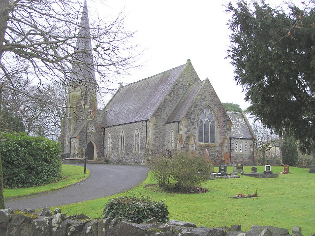
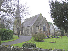 Clanabogan Church of Ireland