- Desaguadero River
-
For the river in Bolivia, see Desaguadero River (Bolivia).
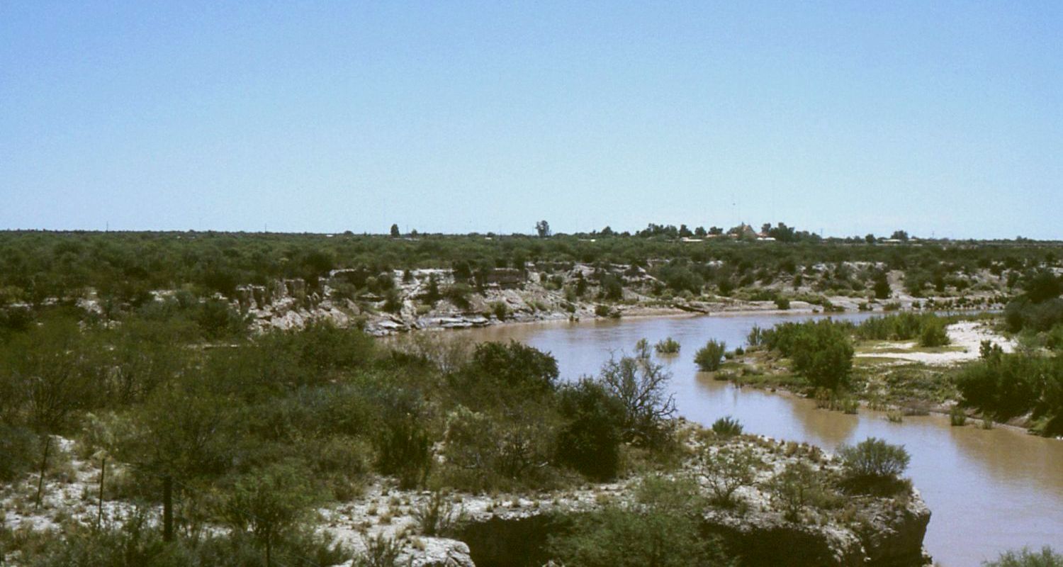
 The river near the town of Desaguadero, eastern Mendoza
The Desaguadero River is the general name of a river in western Argentina that receives a number of different names on its path of 1,515 kilometres, with its most important section named Desaguadero proper.
Contents
Spring
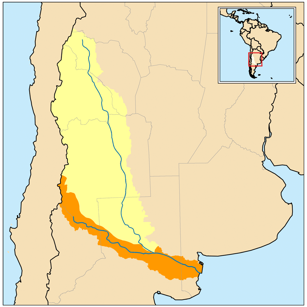
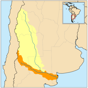 Map of the Colorado River (in orange) and Desaguadero River (in yellow) drainage basins
Its source, a spring, is located in the Andes around coordinates 27°47′18″S 68°36′17″W / 27.78833°S 68.60472°W, at 5,500 metres of height, on the southern slope of the Cerro Bonete mountain, in the north of La Rioja Province, near the limit with Catamarca Province.
In La Rioja the river is named, in order, of Río de Oro, Río Bonete and Jagüé, though its mainly known as either Vinchina or Bermejo, creating sometimes confusion with the Bermejo River located further north.
Cuyo
The river continues south-southeast to cross the east of San Juan Province, were it receives the waters of tributaries Jáchal River and San Juan River (the latter itself fed by the Mendoza River). As it gets closer to the provinces of Mendoza and San Luis, it reaches a deeper area where it created the Lagunas de Guanacache lagoons, currently almost dried out.
Leaving the lagoon areas the river is called Desaguadero ("outlet") and becomes the natural limit between Mendoza and San Luis provinces. From Mendoza it receives the tributaries Tunuyán, Diamante and Guandacol before reaching the parallel 36°S to then enter La Pampa Province. Shortly after it receives from the west the tributary Atuel River; the overflows of both rivers in that area form the Bañados del Atuel.
La Pampa
From these wetlands and down to the Urre Lauquén and La Salada lagoons, it receives the name of Chadileuvú or Chadileo, words in Mapuche that mean "Salty River" (Río Salado), another of the names it receives.
After Urre Lauquén it acquires yet another name - Curacó ("Stone Water"), finishing at the Colorado River near coordinates 38°50′07″S 64°58′47″W / 38.83528°S 64.97972°W.
Basin of the Desaguadero
The entire Desaguadero and its tributaries conform what is known as the Basin of the Desaguadero, located over a geologic fault that separates the west from the Sierras Pampeanas. The basin consists of around 260,000 km², covering the Cuyo region almost completely, and the north of La Pampa Province.
Its tributaries being mainly ice-thaw-fed rivers from the Andes, the current of the Desaguadero is strongest in early summer. The section that separates Mendoza from San Luis is contained by 6- to 8-metre high ravines with a maximum width of over 50 metres, but due to the deviation of its waters for irrigation channels in the provinces of San Juan, Mendoza and San Luis, the section called Curacó currently has an extremely low level, providing practically no water to the Colorado.
Categories:- Rivers of Argentina
- Rivers of Mendoza Province
- Geography of San Juan Province
- Geography of San Luis Province
- Geography of La Rioja Province
Wikimedia Foundation. 2010.