Chadderton Hall Park

Chadderton Hall Park
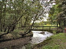
Chadderton Hall Park by the River Irk.

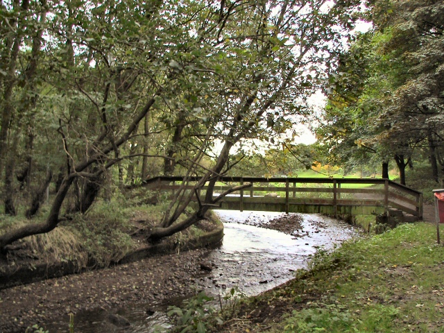
Chadderton Hall Park is a park in Chadderton, in the Metropolitan Borough of Oldham, Greater Manchester, England. Its roots stretch back to the 13th century being the land on which Chadderton Hall once stood. It contains a large field area with a small football pitch, a playground area, several flower gardens and a small cafe situated next to the Park's bowling green. The River Irk runs through the centre of the park.

Geography

Chadderton Hall Park is located on Chadderton Hall Road (B6195) towards the north of Chadderton. It lies at bottom of Chadderton heights. The geography of the park itself is like a bowl, the grass fields lie in the centre of the park at the lowest point and the land to either side of the fields is higher. This is because of the River Irk's natural valley but also because the central area of the park was once used as a lake.

History

Chadderton Hall Park was originally the grounds of Chadderton Hall. Chadderton Hall was first built in the 13th century by Geoffrey de Chadderton, this first hall was in Chadderton Fold slightly to the east of the current park. In 1629 a new hall was built at the site of the current park and was present there until the 20th century when it was demolished in 1939. It was at the end of the 19th Century that the area surrounding Chadderton Hall began to be used for public recreation. A boating lake and a menagerie, including a kangaroo and a lion, were established as part of a "Pleasure Garden". These features have long since been demolished but evidence of the boating lake can be seen by the hollowed out area where the playing fields now stand.

External links

Coordinates: 53°33′18″N 2°09′30″W / 53.5549°N 2.1583°W / 53.5549; -2.1583


Wikimedia Foundation. 2010.

Игры ⚽ Нужно сделать НИР?

Look at other dictionaries:

  • Chadderton — Coordinates: 53°32′46″N 2°08′33″W / 53.5462°N 2.1426°W / 53.5462; 2.1426 …   Wikipedia

  • North Chadderton School — Motto Preparing students for a life time of success Established 1959 Type Comprehensive foundation school Headteacher Joy Clarke Specialism Business and Enterprise …   Wikipedia

  • Chadderton Power Station — Chadderton A B power stations Chadderton B Power Station shortly before demolition in 1986 …   Wikipedia

  • Boundary Park — Ice Station Zebra Rochdale Road stand which houses Away Supporters. Full name Boundary Park Stadium Location …   Wikipedia

  • Clayton Hall Metrolink station — For the rapid transit station located in St. Louis, Missouri, see Clayton (St. Louis MetroLink).  Clayton Hall Manchester Metrolink Location Place …   Wikipedia

  • List of places in Greater Manchester — Location map+|Greater Manchester caption = Some of the larger settlements of Greater Manchester. float = right width = 400 places = Location map |Greater Manchester label = Oldham long = 2.1169 lat = 53.5444 background = white Location map… …   Wikipedia

  • Greater Manchester — Geografie Status: Zeremonielle Grafschaft Region: North West England Fläche …   Deutsch Wikipedia

  • Metropolitan Borough of Wigan — For the main settlement, see Wigan. Metropolitan Borough of Wigan   Metropolitan borough   Wigan Civic Centre …   Wikipedia

  • List of collieries in Lancashire 1854-present — The Lancashire coal field was the most prolific in England, the number of shafts sunk to gain coal number several thousand, for example, in 1958, Wigan undertook a survey of old shafts and located 500. In 1980 following several years of… …   Wikipedia

  • Oldham — For other uses, see Oldham (disambiguation). For the larger local government district, see Metropolitan Borough of Oldham. Coordinates: 53°32′40″N 2°07′01″W /  …   Wikipedia

Share the article and excerpts

Direct link
Do a right-click on the link above
and select “Copy Link”