- Malheur National Wildlife Refuge
-
Malheur National Wildlife Refuge Protected Area 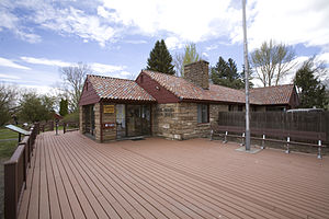 Refuge headquarters
Country United States State Oregon Region Harney County City 30 miles (48 km) south of Burns River Donner und Blitzen River Location Harney Basin - elevation 4,121 ft (1,256 m) - coordinates 43°15′57″N 118°50′39″W / 43.26583°N 118.84417°W [1] Founded in 1908  Harney Basin and surrounding area
 Location of the refuge in Oregon
Malheur National Wildlife Refuge is located roughly 30 miles (48 km) south of the town of Burns, Oregon. The refuge area is roughly T shaped with the southernmost base at Frenchglen, the left top at Malheur Lake and the right top at Harney Lake.
Named for an early pioneer, the refuge is a hotspot for birding, fishing and hiking.
Contents
Wildlife
Numerous wildlife occurs in the area, with as many as 320 species of birds and 58 species of mammals found in the refuge. A large number of birds and mammals can be found amongst the deserts, grasslands, marshes and rimrock. Malheur serves as a Pacific Flyway stop for the Northern Pintail and Tundra Swan, Lesser and Greater Sandhill Crane, Snow Goose and Ross’ Goose. Ducks, grebes, pelicans and trumpeter swans are drawn to the numerous ponds, marshes and lakes. Deer, antelopes, ducks, pheasants, thrashers and quails can be found in the upland areas amongst the sagebrush, greasewood and wild rye.[2]
Geography
The Donner und Blitzen River flows northward through the middle of the refuge, and is irrigated out to create a large artificial wetland, where once a natural wetland stood. The Donner und Blitzen River flows into Malheur Lake, which flows into Harney Lake forming a large salt sea (Harney Basin). This open water brings thousands of migrating birds through the wildlife refuge every year. Along with the extensive marshland, the total size is 187,000 acres (757 km2). Exceptionally hot in the summer, and cold in the winter, the late spring and early fall are popular times to visit this desert oasis.
In addition to being one of the most extensive freshwater marsh ecosystems in the western United States, Malheur NWR has sometimes generated controversy about land management practices.[3]
References
- ^ "Malheur National Wildlife Refuge". Geographic Names Information System (GNIS). United States Geological Survey. November 28, 1980. http://geonames.usgs.gov/pls/gnispublic/f?p=gnispq:3:::NO::P3_FID:1123711. Retrieved August 15, 2009.
- ^ "Malheur National Wildlife Refuge". U.S. Fish and Wildlife Service. http://www.fws.gov/refuges/profiles/index.cfm?id=13570. Retrieved August 11, 2009.
- ^ Durbin, Kathie (October 3, 1994). "Ranchers arrested at wildlife refuge". High Country News. http://www.hcn.org/issues/20/582. Retrieved August 15, 2009.
External links
Protected Areas of Oregon Federal State Arcadia Beach • Bob Straub • Bradley • Cape Kiwanda • Cape Lookout • Cape Meares • Clay Myers at Whalen Island • Del Rey Beach • Ecola • Elmer Feldenheimer • Fishing Rock • Fort Stevens • Gearhart Ocean • Haystack Hill • Hug Point • John Yeon • Manhattan Beach • Munson Creek Falls • Neahkahnie–Manzanita • Nehalem Bay • Oceanside Beach • Oswald West • Rockaway Beach • Sunset Beach • Sunset Highway Forest • Symons • Tolovana Beach • Tolovana Beach • Twin Rocks • Wilson River Highway Forest
Agate Beach • Alsea Bay • Beachside • Beaver Creek • Beverly Beach • Boiler Bay • Carl G. Washburne • Collins Creek • D River • Darlingtonia • Devils Lake • Devils Punch Bowl • Driftwood Beach • Ellmaker • Fogarty Creek • Gleneden Beach • Governor Patterson • H.B. Van Duzer • Heceta Head Lighthouse • Jessie M. Honeyman • Joaquin Miller Forest • L. Presley & Vera C. Gill • Lost Creek • Muriel O. Ponsler • Neptune • Neskowin Beach • Ona Beach • Otter Crest • Pritchard • Roads End • Rocky Creek • San Marine • Seal Rock • Smelt Sands • South Beach • Stonefield Beach • Tokatee Klootchman • W. B. Nelson • Whale Watching • Yachats • Yachats Ocean Road • Yaquina Bay
Albert H. Powers • Alfred A. Loeb • Arizona Beach • Bandon • Bolon Island Tideways • Bullards Beach • Cape Arago • Cape Blanco • Cape Sebastian • Conde B. McCullough • Coquille Myrtle Grove • Crissey Field • Elk Creek Tunnel Forest • Face Rock • Floras Lake • Geisel Monument • Golden and Silver Falls • Harris Beach • Hoffman • Humbug Mountain • Hutchinson • Maria C. Jackson • McVay Rock • Ophir • Otter Point • Paradise Point • Pistol River • Port Orford Cedar Forest • Port Orford Heads • Samuel H. Boardman • Seven Devils • Shore Acres • Sisters Rock • Sunset Bay • Sweet Myrtle • Umpqua • Umpqua Lighthouse • Umpqua Myrtle • William M. Tugman • Winchuck • Yoakam Point
Banks–Vernonia • Bonnie Lure • Government Island • L. L. "Stub" Stewart • Mary S. Young • Milo McIver • Tryon Creek • Willamette Stone
Ainsworth • Benson • Bonneville • Bridal Veil Falls • Crown Point • Dabney • Dalton Point • George W. Joseph • Guy W. Talbot • Historic Columbia River Highway • John B. Yeon • Koberg Beach • Lang Forest • Lewis and Clark • Lindsey Creek • Mayer • McLoughlin • Memaloose • Multnomah Falls • Portland Women's Forum • Rocky Butte • Rooster Rock • Seneca Fouts • Shepperd's Dell • Sheridan • Starvation Creek • Viento • Vinzenz Lausmann • Wyeth • Wygant
Alderwood • Bald Peak • Blachly Mountain Forest • Bowers Rock • Cascadia • Champoeg • Detroit Lake • Dexter • Elijah Bristow • Erratic Rock • Fall Creek • Fort Yamhill • Holman • Jasper • Lowell • Luckiamute • Maples • Maud Williamson • Molalla River • North Santiam • Sarah Helmick • Silver Falls • State Capitol • Thompson's Mills • Washburne • Willamette Mission
Ben Hur Lampman • Canyon Creek Forest • Casey • Collier Memorial • Illinois River Forks • Jackson F. Kimball • Joseph H. Stewart • Klamath Falls – Lakeview Forest • OC&E Woods Line • Prospect • Rough and Ready Forest • Stage Coach Forest • TouVelle • Tub Springs • Valley of the Rogue • Wolf Creek Inn
Cline Falls • Deschutes River • Dyer • Elliott Corbett • La Pine • Ochoco • Peter Skene Ogden • Pilot Butte • Prineville Reservoir • Redmond–Bend Juniper • Sisters • Smith Rock • The Cove Palisades • Tumalo • White River Falls
Bates • Battle Mountain Forest • Blue Mountain Forest • Booth • Catherine Creek • Chandler • Clyde Holliday • Crooked Creek • Deadman's Pass • Emigrant Springs • Farewell Bend • Fort Rock • Fort Rock Cave • Frenchglen Hotel • Goose Lake • Hat Rock • Hilgard Junction • Kam Wah Chung • Lake Owyhee • Minam • Ontario • Pete French Round Barn • Red Bridge • Succor Creek • Sumpter Valley Dredge • Ukiah–Dale Forest • Unity Forest • Unity Lake • Wallowa Lake • Wallowa Lake Highway Forest • Wallowa River
Bridge Creek • Dean Creek • Denman • E.E. Wilson • Elkhorn • Fern Ridge • Irrigon • Jewell Meadows • Klamath • Ladd Marsh • Lower Deschutes • Phillip W. Schneider • Prineville • Riverside • Sauvie Island • Snake River Islands • Summer Lake • Wenaha • White River • Willow Creek
Regions Portland metroBlue Lake • Cooper Mountain • Glendoveer • Howell • Oregon Zoo • Oxbow • Smith and Bybee • Mount Talbert
Cities PortlandForest Park • Washington Park
Heritage registers: National Register of Historic Places • National Historic Landmarks • National Natural Landmarks • World Network of Biosphere Reserves Categories:- National Wildlife Refuges in Oregon
- Protected areas of Harney County, Oregon
- Wetlands of Oregon
- Protected areas established in 1908


Wikimedia Foundation. 2010.