- Hardangervidda National Park
Infobox_protected_area
name = Hardangervidda National Park
iucn_category = II
caption =
locator_x =
locator_y =
location =Buskerud ,Hordaland , andTelemark ,Norway
nearest_city = Bergen
lat_degrees = 60
lat_minutes = 3
lat_seconds =
lat_direction = N
long_degrees = 7
long_minutes = 25
long_seconds =
long_direction = E
area = convert|3422|km2|sqmi|0|abbr=on
established = 1981
visitation_num =
visitation_year =
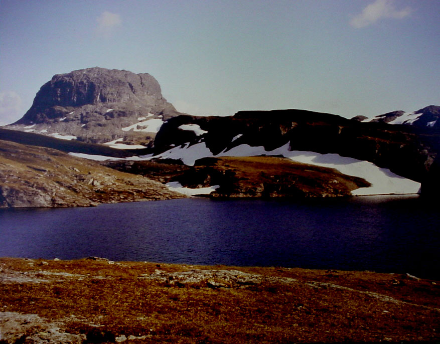
governing_body = Directorate for Nature ManagementHardangervidda National Park, at 3,422 square kilometers, is Norway's largest
national park . It spans fromNumedal andUvdal in the east andRøvelseggi andUllensvang in the west across theHardanger mountain plateau (Hardangervidda ). Designated as anational park in 1981, today it serves as a popular tourist destination for activities such ashiking ,climbing ,fishing , andcross-country skiing . TheNorwegian Mountain Touring Association (DNT) maintains a comprehensive network of huts and paths acrossHardangervidda . TheBergensbanen railway line and the main Highway 7 cross the plateau.It has the southernmost stock of several arctic animals and plants, including
arctic fox ,Snowy Owl , and others. Its wildreindeer flocks are among the largest in the world.Several hundred nomadic stone age settlements have been found in the area, most likely related to the migration of the reindeer. Ancient trails cross the plateau, linking western and eastern Norway; one example is the "Nordmannsslepa" linking
Eidfjord andVeggli in theNumedal valley withHol andUvdal .External links
* [http://english.dirnat.no/wbch3.exe?p=3043 Norwegian Directorate for Nature, information on Hardangervidda National Park]
Wikimedia Foundation. 2010.