- Smilde
Dutch town locator maps
mun_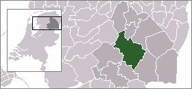
town_
caption = The town centre (dark green) and the statistical district (light green) of Smilde in the municipality of Midden-Drenthe.Smilde (coord|52|57|N|6|27|E|type:city(3460)) is a town in the Dutch province of
Drenthe . It is a part of the municipality ofMidden-Drenthe , and lies about 10 km southwest ofAssen .Smilde was a separate municipality until 1998, when it became a part of
Middenveld . [Ad van der Meer and Onno Boonstra, "Repertorium van Nederlandse gemeenten", KNAW, 2006. [http://www.knaw.nl/cfdata/publicaties/detail.cfm?boeken__ordernr=20061061] ]In 2001, the town of Smilde had 3460 inhabitants. The built-up area of the town was 1.2 km², and contained 1449 residences.Statistics Netherlands (CBS), [http://www.cbs.nl/nl-NL/menu/themas/milieu-natuur-ruimte/ruimte/publicaties/cartografie-geografie/geografische-data/2001-bevolkingskernen-in-nederland.htm "Bevolkingskernen in Nederland 2001"] . (Statistics are for the continuous built-up area).] The statistical area "Smilde", which also can include the surrounding countryside, has a population of around 4890.Statistics Netherlands (CBS), [http://statline.cbs.nl/ "Statline: Kerncijfers wijken en buurten 2003-2005"] . As of
January 1 ,2005 .]Smilde's most famous structure is the
partially guyed tower ofZendstation Smilde .Smilde was the birthplace of
Jacob Israël de Haan , the controversial anti-Zionist, Ultra-Orthodox activist who was assanianted atJerusalem in 1924.References
External links
* [http://www.kuijsten.de/atlas/dr/smilde.html Map of the former municipality in 1868]
Wikimedia Foundation. 2010.