- Burghsluis
Dutch town locator maps
mun_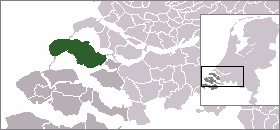
town_
caption = Burghsluis in the municipality of Schouwen-Duiveland.Burghsluis (coord|51|41|N|3|45|E|type:city(100)) is a town in the Dutch province of
Zeeland . It is a part of the municipality ofSchouwen-Duiveland , and lies about 22 km north ofMiddelburg ."ANWB Topografische Atlas Nederland", Topografische Dienst and ANWB, 2005.]References
Wikimedia Foundation. 2010.