- Muriaux
-
Muriaux Country Switzerland Canton Jura District Franches-Montagnes Coordinates 47°15′N 06°59′E / 47.25°N 6.983°ECoordinates: 47°15′N 06°59′E / 47.25°N 6.983°E Population 495 (Dec 2009)[1] - Density 29 /km2 (76 /sq mi) Area 16.89 km2 (6.52 sq mi) Elevation 947 m (3,107 ft) Postal code 2338 SFOS number 6753 Surrounded by Le Noirmont, Goumois, Les Pommerats, Saignelégier, La Chaux-des-Breuleux, Les Breuleux, Le Peuchapatte, Villeret(BE), Saint-Imier(BE) Website www.muriaux.ch
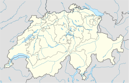
SFSO statisticsView map of Muriaux Muriaux is a municipality in the district of Franches-Montagnes in the canton of Jura in Switzerland. On 1 January 2009, the formerly independent municipality of Le Peuchapatte merged into the municipality of Muriaux.[2]
References
- ^ Swiss Federal Statistical Office, MS Excel document – Bilanz der ständigen Wohnbevölkerung nach Kantonen, Bezirken und Gemeinden (German) accessed 25 August 2010
- ^ Amtliches Gemeindeverzeichnis der Schweiz published by the Swiss Federal Statistical Office (German) accessed 14 January 2010
Le Bémont | Les Bois | Les Breuleux | La Chaux-des-Breuleux | Les Enfers | Les Genevez | Lajoux | Montfaucon | Muriaux | Le Noirmont | Saignelégier | Saint-Brais | Soubey
Canton of Jura | Municipalities of the canton of Jura | Switzerland
 Categories:
- Municipalities of the canton of Jura
- Municipalities of Switzerland
- Canton of Jura geography stubs
Wikimedia Foundation. 2010.

