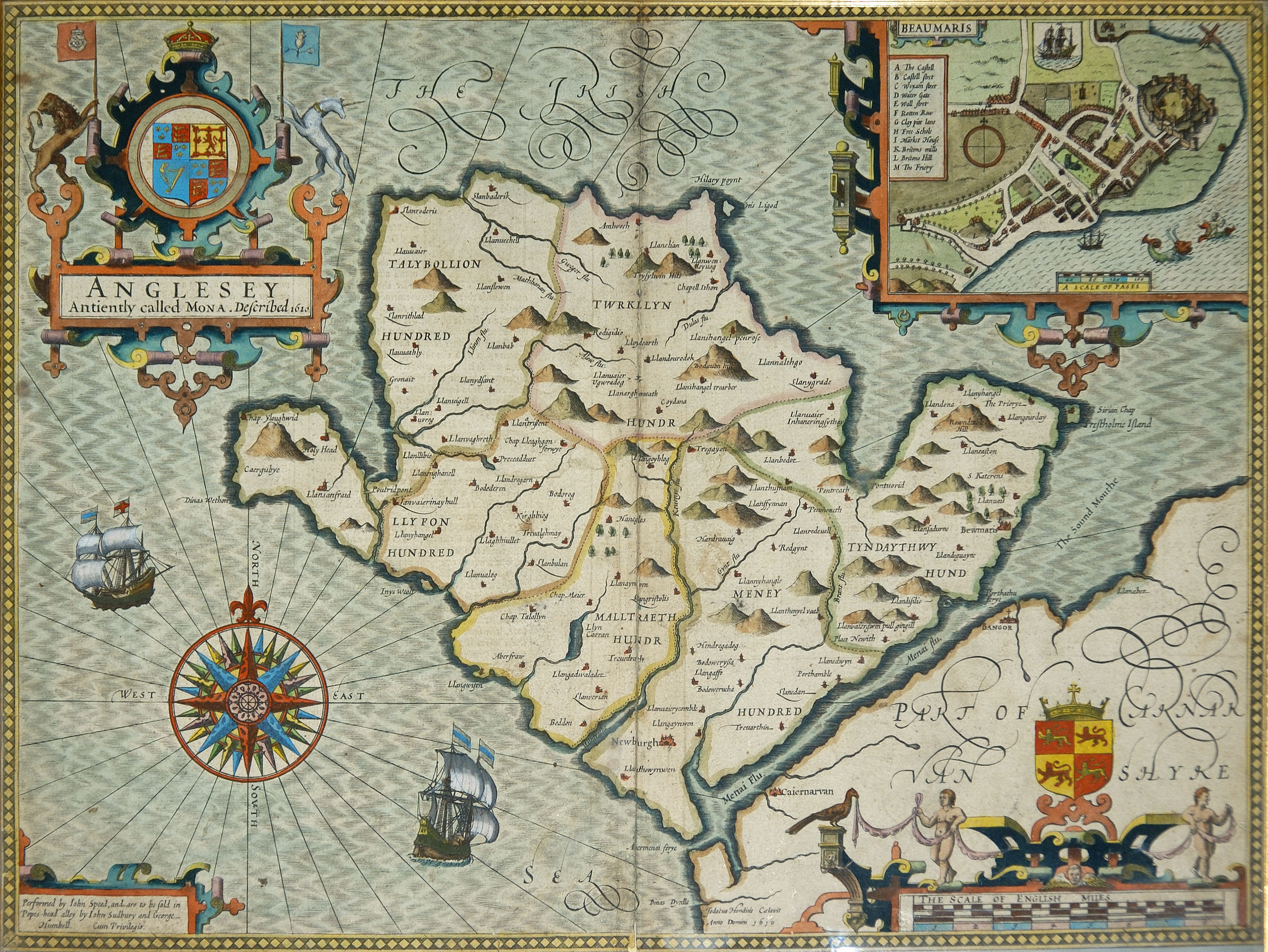
Anglesey — For other places with the same name, see Anglesey (disambiguation). Isle of Anglesey Ynys Môn Geography Area Total % Water … Wikipedia
List of islands of Wales — This is a list of the islands of Wales, the mainland of which is part of Great Britain, as well as a table of the largest Welsh islands by area.NameIsland Group / LocationAngleseyIrish SeaBardsey IslandGwyneddBarry IslandBristol Channel (linked… … Wikipedia
Newborough, Anglesey — Coordinates: 53°09′53″N 4°21′32″W / 53.16479°N 4.35900°W / 53.16479; 4.35900 … Wikipedia
Menai Bridge — For the bridges across the Menai Strait, see Menai Suspension Bridge and Britannia Bridge. Coordinates: 53°14′N 4°10′W / 53.23°N 4.16°W … Wikipedia
Aberffraw — is now a small village on the south west coast of Anglesey, Wales ( cy. Ynys Môn), by the west bank of the River Ffraw, at gbmapping|SH354693. The UK postcode begins LL63. Access by road is by way of the A4080 and the nearest rail station is… … Wikipedia
Din Lligwy — House foundations at Din Lligwy hut circle, Anglesey, August 2, 2004 Din Lligwy (or Din Llugwy) hut circle is an ancient village site near the east coast of Anglesey, close to the village of Moelfre, North Wales. Excavations in 1905 1907 produced … Wikipedia
Moelfre — For the Welsh hill, see Moelfre (hill). The Lifeboat station and Seawatch Centre … Wikipedia
Malltraeth — main street Malltraeth (origin: Mall (corrupt, blasted, desolate, + Traeth (beach)) is a small village in the southwest of Anglesey, in the area of Bodorgan. It is now at the end of a large bay, which used to extend much further inland, almost… … Wikipedia
List of islands of United Kingdom — The United Kingdom of Great Britain and Northern Ireland has thousands of islands within its territory and several external territories. This is a list of selected British islands grouped by Constituent country or Overseas territory. The largest… … Wikipedia
Liste der Inseln von Wales — Name Insel Gruppe / Verortung Anglesey Irische See Bardsey Island Gwynedd Barry Island Bristol Channel (verbunden mit einem Damm in den 1880er Jahren) Caldey Island Pembrokeshire Carreg Onnen … Deutsch Wikipedia
 Cribinau and the church in the sea

