- Arsuk
Infobox Settlement
name = Arsuk
official_name =
other_name =
native_name =
nickname =
settlement_type =
total_type =
motto =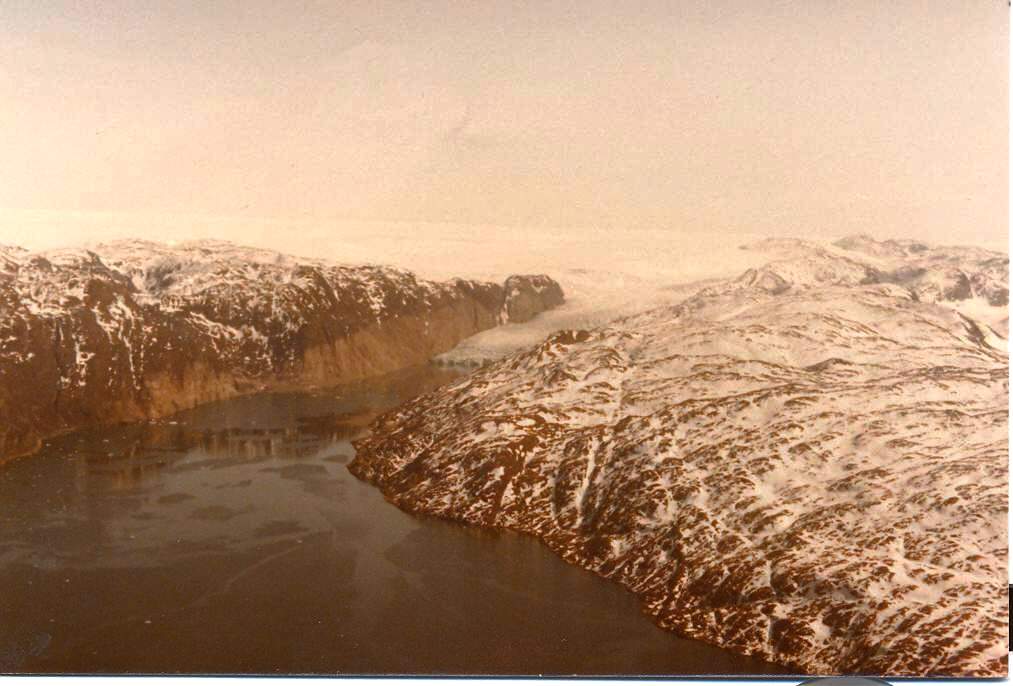
imagesize = 300px
image_caption = Arsuk Glacier, at the end of Arsuk Fjord
flag_size =
image_
seal_size =
image_shield =
shield_size =
image_blank_emblem =
blank_emblem_type =
blank_emblem_size =
mapsize =
map_caption =
mapsize1 =
map_caption1 =
image_dot_
dot_mapsize =
dot_map_caption =
dot_x = |dot_y =
pushpin_
pushpin_label_position =
pushpin_map_caption =Location within Greenland
pushpin_mapsize =300
subdivision_type = Country
subdivision_name =Kingdom of Denmark
subdivision_type1 = Province
subdivision_name1 = Greenland
subdivision_type2 = Municipality
subdivision_name2 = Paamiut
seat_type =
seat =
parts_type =
parts_style =
parts =
p1 =
p2 =
government_footnotes =
government_type =
leader_title =
leader_name =
leader_title1 =
leader_name1 =
established_title =
established_date =
area_magnitude =
unit_pref =
area_footnotes =
area_total_km2 =
area_land_km2 =
area_water_km2 =
area_total_sq_mi =
area_land_sq_mi =
area_water_sq_mi =
area_water_percent =
elevation_footnotes =
elevation_m =
elevation_ft =
elevation_max_m =
elevation_max_ft =
elevation_min_m =
elevation_min_ft =
population_as_of = 2005
population_footnotes =
population_note =
population_total =140
population_density_km2 =
population_density_sq_mi =
timezone =
utc_offset =
timezone_DST =
utc_offset_DST =
coor_type =
latd=61 |latm=10|lats= |latNS=N
longd=48 |longm=27|longs= |longEW=W
postal_code_type =
postal_code =
area_code =
website =
footnotes =Arsuk (founded 1805) is a village in southwest
Greenland in the municipality ofPaamiut . Population is 140 (as of 2005). Location is coord|61|10|N|48|27|Wat the mouth of the Arsuk Fjord which ends in the Arsuk glacier (see image).Arsuk is Greenlandic for "the beloved place".
References
* "Greenland and the Arctic". By Etain O'Carroll and Mark Elliott. Lonely Planet 2005. ISBN 1-74059-095-3.
* [http://www.statgreen.gl/dk/aarbog/Greenland%20in%20figures%202005.pdf "Greenland in Figures 2005"] Statistics Greenland. 3rd Edition, May 2005. ISSN 1604-7397External links
* [http://www.arsukfjorden.gl website of the Arsuk Fjord area] (Danish)
References

Wikimedia Foundation. 2010.