- Monifieth railway station
-
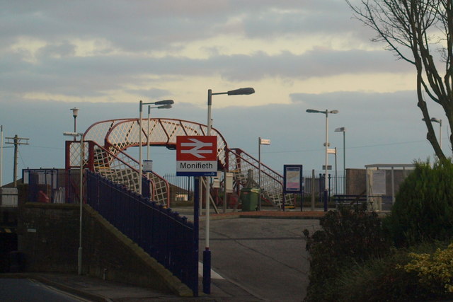
Monifieth 

Location Place Monifieth Local authority Angus Coordinates 56°28′47″N 2°49′06″W / 56.4797°N 2.8183°WCoordinates: 56°28′47″N 2°49′06″W / 56.4797°N 2.8183°W Operations Station code MON Managed by First ScotRail Number of platforms 2 Live arrivals/departures and station information
from National Rail EnquiriesAnnual rail passenger usage 2002/03 * 1,031 2004/05 *  1,333
1,3332005/06 * 1,7572006/07 * 1,8972007/08 * 2,1062008/09 *  2,082
2,0822009/10 * 1,170History 6 October 1838 Station opened National Rail - UK railway stations A B C D E F G H I J K L M N O P Q R S T U V W X Y Z * Annual passenger usage based on sales of tickets in stated financial year(s) which end or originate at Monifieth from Office of Rail Regulation statistics. Please note: methodology may vary year on year. Monifieth railway station serves the town of Monifieth near Dundee, Scotland. The station was opened on 6 October 1838 on the Dundee and Arbroath Railway. The original station buildings have since been demolished, and recovered parts used for the Birkhill railway station building on the Bo'ness and Kinneil Railway.
Services
British Rail operated local passenger services between Dundee and Arbroath until around 1990. Since these were discontinued, most of the intermediate stations have had only a very sparse service, provided so as to avoid the difficulty of formal closure procedures.
Summer 2008
Currently First ScotRail provides Monifieth with only one train a day in each direction to/from Edinburgh, Mondays to Saturdays, plus an early morning service to Glasgow with no return working. Although these offer through service to Edinburgh, they are not timed conveniently for passengers wishing to commute to Dundee. Consequently, patronage of the station is currently very low.
Sources
- Butt, R. V. J. (1995). The Directory of Railway Stations: details every public and private passenger station, halt, platform and stopping place, past and present (1st ed.). Sparkford: Patrick Stephens Ltd. ISBN 1-8526-0508-1. OCLC 60251199.
- Jowett, Alan (March 1989). Jowett's Railway Atlas of Great Britain and Ireland: From Pre-Grouping to the Present Day (1st ed.). Sparkford: Patrick Stephens Ltd. ISBN 1-8526-0086-1. OCLC 22311137.
- RAILSCOT History of Station
Preceding station  National Rail
Following station Balmossie First ScotRail
Edinburgh to Aberdeen Line
Mondays-Saturdays onlyBarry Links Historical railways Balmossie
Line and Station openDundee and Arbroath Railway Buddon
Line open; Station closedCategories:- Railway stations in Angus
- Former Dundee and Arbroath Railway stations
- Railway stations opened in 1838
- Railway stations served by First ScotRail
- DfT Category F2 stations
- Scotland railway station stubs
Wikimedia Foundation. 2010.