- Osthofen
-
Osthofen 

 OsthofenLocation of the town of Osthofen within Alzey-Worms district
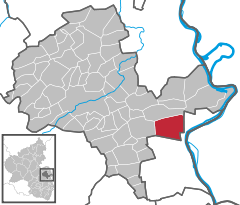
Coordinates 49°42′28″N 8°19′44″E / 49.70778°N 8.32889°ECoordinates: 49°42′28″N 8°19′44″E / 49.70778°N 8.32889°E Administration Country Germany State Rhineland-Palatinate District Alzey-Worms Stadtbürgermeister Bernd Müller (SPD) Basic statistics Area 27.11 km2 (10.47 sq mi) Elevation 89 m (292 ft) Population 8,312 (31 December 2010)[1] - Density 307 /km2 (794 /sq mi) Other information Time zone CET/CEST (UTC+1/+2) Licence plate AZ Postal code 67574 Area code 06242 Website www.osthofen.de Osthofen is a Verband-free town – one belonging to no Verbandsgemeinde, a kind of collective municipality – in the middle of the Wonnegau in the Alzey-Worms district in Rhineland-Palatinate, Germany. Osthofen was raised to town on 24 October 1970.
Contents
Geography
Location
The town lies in Rhenish Hesse where the river Seebach, a very short river that rises in neighbouring Westhofen and flows for only 9 km, empties into the Rhine.
History
Archaeological finds have established that the Osthofen municipal area was already settled at least four thousand years ago. The town had its first documentary mention in the Lorsch codex as Ostowa in a document dated to 784. It is believed that Osthofen was founded by people from either the now amalgamated village of Mühlheim or the Merovingian royal palace that once stood in Worms-Neuhausen.
On Osthofen’s Goldberg (mountain), a chapel to Saint Remigius might have been built as early as the 6th century. This is where the first major estate was, which by 1195 had grown into an Imperial castle. In Mühlheim, the Knights Templar likewise built a castle in 1215.
Politics
Town council
The council is made up of 24 honorary council members, who were elected at the municipal election held on 7 June 2009, and the mayor as chairman.
The municipal election held on 7 June 2009 yielded the following results[2]:
SPD CDU ödp FWG Total 2009 11 7 1 5 24 seats 2004 11 8 - 5 24 seats Mayors
- Wendelin Best (1822–1831)
- Johann Weißheimer II. (1831–1843)
- Georg Friedrich Knierim I. (1843-1850)
- Peter Berger (1851-1853)
- Friedrich Knierim I. (1853-1862)
- Nikolaus Nagel (1862-1864)
- Georg Friedrich Best II. (1864-1867)
- Jakob Beckenbach (1867-1870)
- Johann Rißler III. (1870-1883)
- Simon Friedrich Schill (1883-1892)
- Johann Rißler III. (1892-1897)
- Georg Jakob Konrad (1897-1912)
- Wilhelm Schmitt (1912-1923)
- Carl Brenner (1924-1933)
- Dr.Wilhelm Fuhrländer (1933-1935)
- Dr.Kurt Mildner (1935-1944)
- Heinrich Hundsdorf (1944-1945) (provisional)
- Heinrich Rhein (1945-1946)
- Ludwig Knobloch (1946-1948)
- Walter Aßmann (1948-1956)
- Albert Fischer (1956-1972)
- Günter Metzler (1973–1987)
- Klaus Hagemann (1987–1994)
- Bernd Müller (1994–present)
Coat of arms
The town’s arms might be described thus: Sable a lion rampant Or armed, langued and crowned gules, issuant from dexter chief the sun and in an arc from dexter to middle base three mullets, all of the second.
The town’s earliest seals come from the 14th century, but they show a crane under a cross, a composition of unknown meaning. The current arms are first found on seals from the 16th century, and the composition has not changed since. The arms were officially granted the town in 1651, and once again in 1959. The sun and stars (or heraldically, mullets) are canting charges, as they are meant to suggest the direction “east”, which is the first part of the town’s name, the German word being Ost(en). The lion is the Palatine Lion, recalling the town’s long history under Electoral Palatinate’s rule[3].
Culture and sightseeing
Buildings
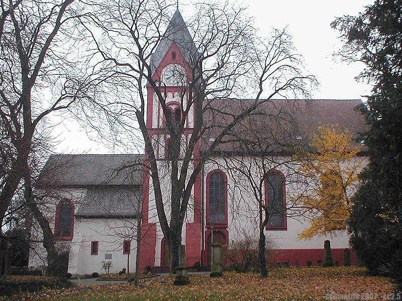
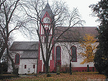 Bergkirche
- The Evangelical Bergkirche (“Mountain Church”) is believed to have stemmed from a chapel to Saint Remigius built in the 6th century beside which grew into an estate fortified with a castle over the course of the ages. Today’s church grew out of the castle and the chapel, with the churchtower, it is further believed, standing on the old keep’s foundations. The castle was converted many times, acquiring its current shape after a fire in the 19th century.
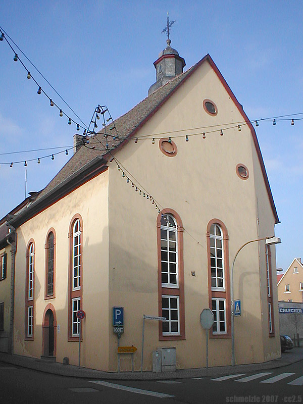
- Saint John’s Catholic Church (Johanniskirche) had its beginnings in a temple of the Order of Saint John, and in 1713 it was transferred to the Catholic parish (the Order is Protestant), which radically converted the building in 1792. The church’s altar was originally to be found in the Carmelite church in Worms.
- The Town Hall (Rathaus) was built in 1902 as a financial office.
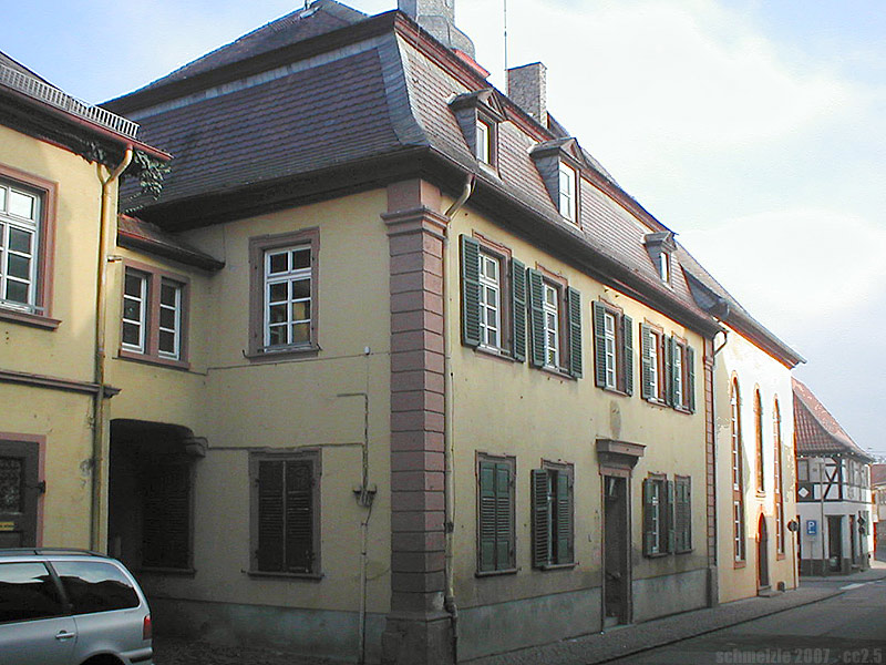
- The Old Town Hall (Altes Rathaus) was built in 1739 as the town’s second town hall.
- Into the so-called “Little Church” (Kleine Kirche), which directly neighbours the Old Town Hall, parts of the first town hall from 1581 have been incorporated.
- The Waterworks (Wasserwerk) from 1906 has a striking façade with Art Nouveau and Baroque Revival elements.
- The Jewish graveyard on Mettenheimer Chaussee was laid out in 1832 and is a memorial to the town’s Jewish community.
-
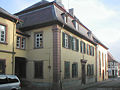
Old Town Hall
-
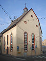
Kleine Kirche
Regular events
Since 1949, the Wonnegauer Winzerfest (“Wonnegau Winemakers’ Festival”) has been held yearly in Osthofen. Among this days-long event’s highlights are a great parade, the crowning of the Wonnegau Wine Queen and the traditional Monday wine tasting.
Economy and infrastructure
Osthofen is a state-recognized tourism centre, and under state planning also identified as a lower centre[4].
Transport
Osthofen has at its disposal a railway station with a connection to the Mainz–Ludwigshafen line. Formerly there were connections to the Osthofen–Rheindürkheim–Guntersblum line (on which there is still goods traffic as far as Worms-Rheindürkheim), the Osthofen–Westhofen line (locally known as the Gickelche) and the Osthofen–Gau-Odernheim line. The last two have since been torn up.
Nearby is also an Autobahn interchange onto the A 61, and towards the Rhine lies Bundesstraße 9.
Winegrowing
Osthofen belongs to the Wonnegau winegrowing zone in Rhenish Hesse. Within the town, 35 winegrowing businesses are active, and the planted vineyard area amounts to 465 ha. Some 68% of the wine made here is from white wine varieties (as at 2007). In 1979, there were still 116 such active businesses, but the planted vineyard area amounted to only 429 ha[4].
Established businesses
Osthofen is headquarters of the malting firm GlobalMalt.
Public institutions
The town is the location of the former Osthofen concentration camp, and a memorial site is found there today.
Famous people
Sons and daughters of the town
- Johann Georg Lehmann (b. 1744, d. 1817 in Frankenthal)
- Johann Weißheimer II. (b. 1797, d. 1883 in Osthofen)
- Chief building director Friedrich August von Pauli (b. 1802, d. 1883 in Bad Kissingen)
- Wendelin Weißheimer (b. 26 February 1838, d. 10 June 1910 in Nuremberg)
- Dr. Georg Wander - Creator of Ovaltine (b. 1841, d. 1897 in Bern, Switzerland)
- Dietrich Grün - Watch pioneer and founder of the “Gruen Watch Company” (b. 1847, d. 1910)
- Prelate Adam Schreiber (b. 1849, d. 1929 in Worms)
- Karl Heinrich Berger (b. 1861, d. 1933 in Kandern, Baden)
- Conductor Friedrich Best (b. 1876, d. 1936 in Heidenau, Saxony)
- Heinrich Beckenbach (b. 5 February 1880, d. 31 March 1964)
- Christian Filips (b. 22 November 1981)
Famous people associated with the town
- Johannes Grun (b. 1646 in Alzey, d. 1718 in Osthofen)
- Church adviser Philip Gerhard Pauli (b. 1750 in Alzey, d. 1816 in Osthofen)
- Professor Friedrich Magnus Schwerd (b. 1792 in Alzey, d. 1871 in Speyer)
- Professor Dr. Peter Muth (b. 1860 at the Neumühle above Mühlheim, d. 1909 in Osthofen)
- Klaus Hagemann former mayor and since 1994 SPD Member of the Bundestag
Further reading
- Brigitte Kazenwadel-Drews: Osthofen – Ein Rundgang durch die Geschichte. Heidelberg 27 October 2011.
References
- ^ "Bevölkerung der Gemeinden am 31.12.2010" (in German). Statistisches Landesamt Rheinland-Pfalz. 31 December 2010. http://www.statistik.rlp.de/fileadmin/dokumente/berichte/A1033_201022_hj_G.pdf.
- ^ Kommunalwahl Rheinland-Pfalz 2009
- ^ Description and explanation of Osthofen’s arms
- ^ a b Statistisches Landesamt Rheinland-Pfalz - Infothek
See also
External links
- Town’s official webpage (German)
- This article incorporates information from the German Wikipedia.
Albig · Alsheim · Alzey · Armsheim · Bechenheim · Bechtheim · Bechtolsheim · Bermersheim · Bermersheim vor der Höhe · Biebelnheim · Bornheim · Dintesheim · Dittelsheim-Heßloch · Eckelsheim · Eich · Ensheim · Eppelsheim · Erbes-Büdesheim · Esselborn · Flomborn · Flonheim · Flörsheim-Dalsheim · Framersheim · Freimersheim · Frettenheim · Gabsheim · Gau-Bickelheim · Gau-Heppenheim · Gau-Odernheim · Gau-Weinheim · Gimbsheim · Gumbsheim · Gundersheim · Gundheim · Hamm am Rhein · Hangen-Weisheim · Hochborn · Hohen-Sülzen · Kettenheim · Lonsheim · Mauchenheim · Mettenheim · Mölsheim · Monsheim · Monzernheim · Mörstadt · Nack · Nieder-Wiesen · Ober-Flörsheim · Offenheim · Offstein · Osthofen · Partenheim · Saulheim · Schornsheim · Siefersheim · Spiesheim · Stein-Bockenheim · Sulzheim · Udenheim · Vendersheim · Wachenheim · Wahlheim · Wallertheim · Wendelsheim · Westhofen · Wöllstein · Wonsheim · Wörrstadt Categories:
- Towns in Rhineland-Palatinate
- Alzey-Worms geography stubs


Wikimedia Foundation. 2010.