- Matlock, Derbyshire
-
Coordinates: 53°08′N 1°33′W / 53.14°N 1.55°W
Matlock 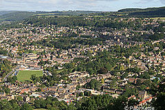
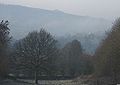
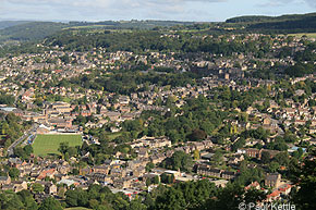
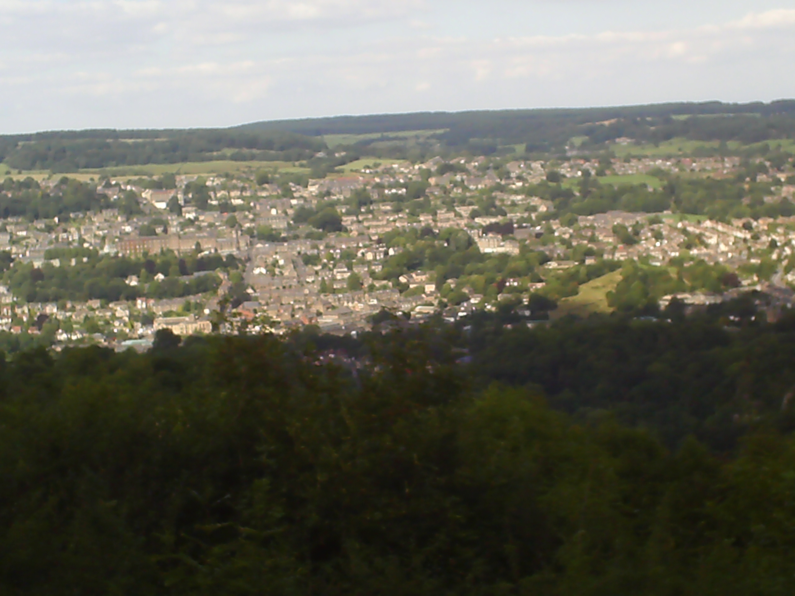
Matlock viewed from the nearby Riber Castle
 Matlock
Matlock shown within DerbyshirePopulation 10,689 (Parish) OS grid reference SK298601 Parish Matlock Town District Derbyshire Dales Shire county Derbyshire Region East Midlands Country England Sovereign state United Kingdom Post town MATLOCK Postcode district DE4 Dialling code 01629 Police Derbyshire Fire Derbyshire Ambulance East Midlands EU Parliament East Midlands UK Parliament Derbyshire Dales List of places: UK • England • Derbyshire Matlock is the county town of Derbyshire, England. It is situated at the south eastern edge of the Peak District, and forms part of the Sheffield City Region. The town is twinned with the French town Eaubonne. The former spa resort Matlock Bath lies immediately south of the town on the A6. Matlock, as a town, has a population of 10,689. The wider population of the Matlock urban area is approximately 20,000 (including Darley Dale, Tansley, Hackney and Matlock Bath). Often, the Matlock area is considered to include Wirksworth, due to the close proximity of the two towns. This would bring the area's population closer to 30,000.
Matlock is nine miles (14 km) south west of Chesterfield, surrounded by the cities of Derby (19 miles), Sheffield (20 miles), Nottingham (29 Miles) and the Greater Manchester conurbation (30 miles). Although officially occupying a central England position geographically, Matlock is in the west of Derbyshire in what is known as the Derbyshire Dales which includes the towns of Wirksworth, Bakewell and Ashbourne.
Contents
History
A former spa town, Matlock ( from the Old English for Moot Oak[1]) lies on the River Derwent, and has prospered from both the hydrotherapy industry and the mills constructed on the river and its tributary Bentley Brook. It was an unimportant collection of small villages — Matlock Town, Matlock Green, Matlock Bridge, Matlock Bank — until thermal springs were discovered in 1698.[2] The population increased rapidly in the 1800s, largely due to hugely popular hydros being built.[3] At one stage there were around twenty hydros, most on Matlock Bank. The largest was built in 1853 by John Smedley.[2][3] This closed in 1955,[3] and re-opened in 1956 [4] as the headquarters of the Derbyshire County Council. Matlock is also home to the Derbyshire Dales District Council as well as Matlock Town council.
Transportation
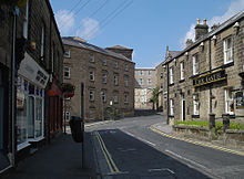
Bank Road Tram
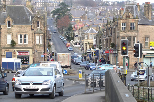
 Matlock taken from Matlock Bridge - looking up the hill of Bank Road across Crown Square (prior to bridge one way system).
In 1893, Matlock Cable Tramway, a cable tramway was built up Bank Road from Crown Square at Matlock Bridge to Wellington Street (at the top of Bank Road) with a stop half way up at Smedley Street where Smedley's Hydro (built by John Smedley) was situated. Conceived by Job Smith, the tram was inspired by San Francisco's famous cable cars, and cost £20,000. When it was built it was the steepest tramway in the world at a gradient of 1 in 5½, and it rose 300 feet (91 m). The fare was tuppence up, penny down. It closed in 1927[3] after losing business to cars and buses.
Railways
In 1849, the railway came to Matlock.[3] Matlock railway station was opened on the Manchester, Buxton, Matlock and Midlands Junction Railway, later the Midland, line between London and Manchester, until the section between Matlock and Buxton was closed in 1968 during the Beeching Axe. Network Rail considered re-opening the line, with a study carried out by the county council. Although it proved to be unfeasible in the short term, the track bed will be kept free of development as the study showed that the line could be economically viable from around 2025.[5] The section from Wye Dale (about 3 miles (4.8 km) east of Buxton) to Coombs viaduct, a point about a mile south-east of Bakewell, has now become the Monsal Trail, an 8.5-mile (13.7 km) walk and cycle trail.
Trains still run between Matlock and Derby on the Derwent Valley Line. Peak Rail, a preserved railway, runs steam trains on a section of the closed line between Matlock, Darley Dale and Rowsley. Previously it used its own station, Matlock Riverside, a short distance to the north of the mainline station, however as of 2011 both Peak Rail and trains on the Derwent Valley Line share the same station.
Hall Leys Park
Main article: Hall Leys ParkThe tram shelter from Crown Square is now in Hall Leys Park, a large Victorian park next to the River Derwent which opened in 1898. The park boasts a miniature railway, bandstand and a boating pond, with the oldest running powered boats in Britain, for many years, as well as tennis courts and a war memorial. There is an ongoing project to update and upgrade all the parks in the Matlock area - Hall Leys Park was the first to benefit from this and the children's play area has been greatly modernised. There has also been a skateboard park added replacing grass tennis courts. The park hosts an arts festival, Matlock Live, every June and the Matlock Victorian Christmas Weekend on the first weekend of December.
Bank Road
Bank Road runs from Crown Square up Matlock Bank, a steep hill which gives the road its name, to Wellington Street. Although many consider the whole incline to be Bank Road, just over half-way up beyond Smedley Street the road is called Rutland Street. Bank Road has many local landmark buildings along it - from the bottom of the hill (Crown Square) travelling north:
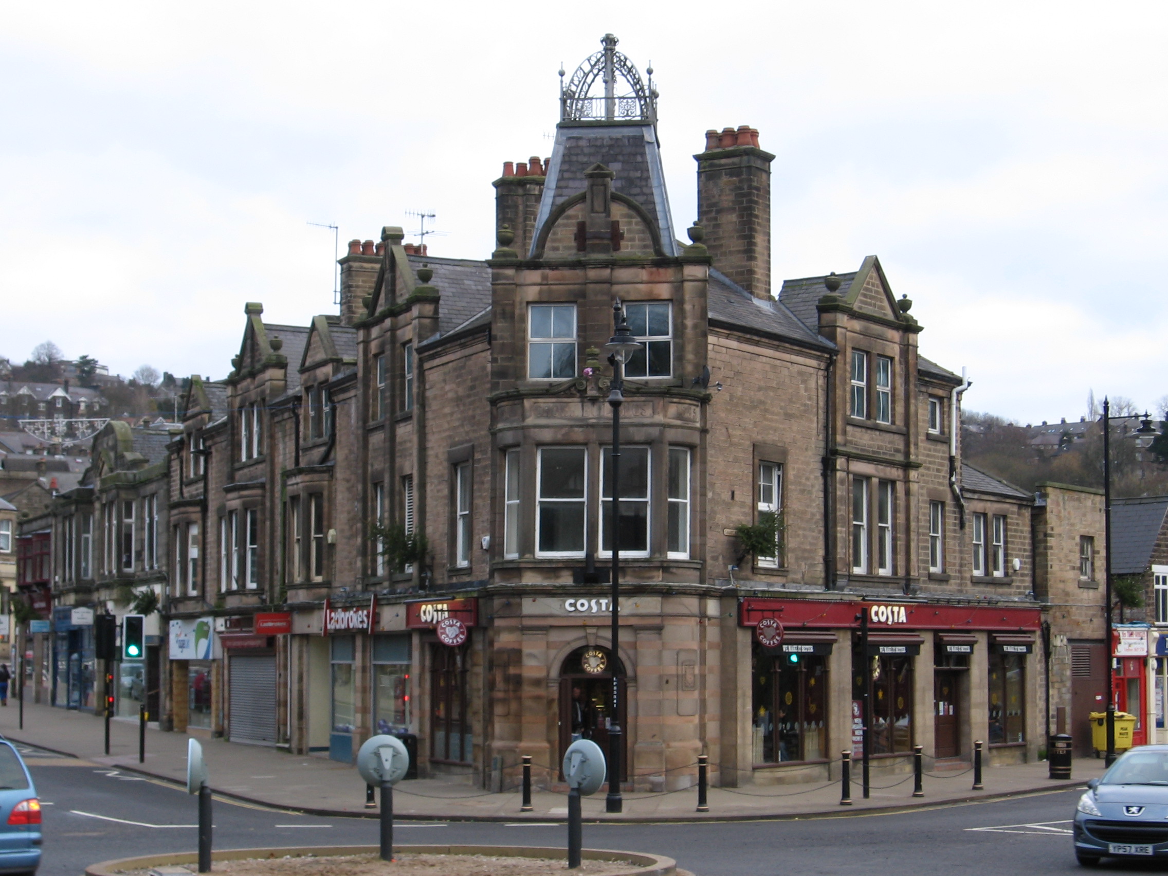
 Crown Buildings
- The Crown Hotel - the original site of the hotel which gave its name to Crown Square is now a building society office. This was built prior to 1899.[6] The Crown is now a Wetherspoon's pub just along Bakewell Road.
- Crown Buildings, opposite the original Crown Hotel at the bottom of Bank Road, was built in 1889 [6] and currently houses a cafe on its ground floor.
- Post Office and Sorting Office. These were built prior to 1922.[6]
- Police Station - built after the second world war.[3]
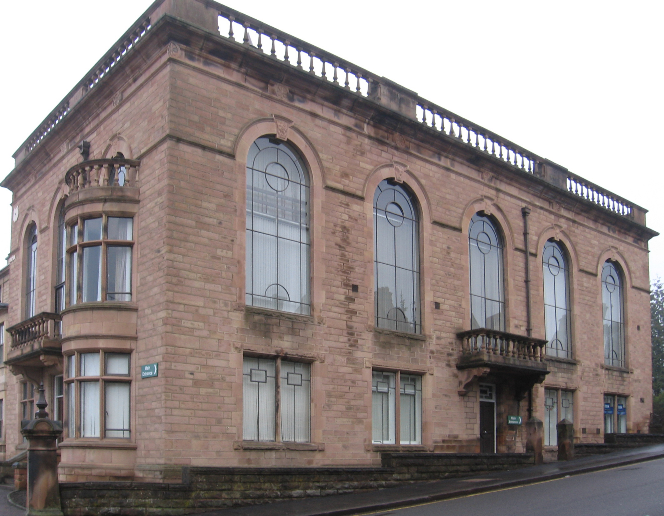
 Town Hall
- Derbyshire Dales District Council Offices. Formerly Bridge Hall, then a hydro called Bridge House (established by 1861). In 1894 the Matlock Urban District Council bought Bridge House hydro for use as the Town Hall and added a large wing in the Italianate style to house an assembly room etc. It was reopened in 1898 and also housed most local authority undertakings, magistrates courts, etc.[7] Following local government reorganisation in 1974, the Town Hall became the headquarters of West Derbyshire District Council (which later changed its name to Derbyshire Dales District Council). To enable the District Council to centralise its several offices spread over the district, the Town Hall was substantially extended in 1979.
- Our Lady & St. Joseph's Catholic Church - built in 1883 with a presbytery added in 1896. The church was described as a ‘mission’, established under St Mary’s of Derby. A church hall was built alongside in the 1990s.[7]
 Old Methodist Church above Old Sunday School
- Youth Hostel - a YHA youth hostel - Built in 1882 as Smedley Memorial Hospital. There is a later (Hunter) wing with a datestone of 1897 set further back from the road. The Youth Hostel opened in 1983 and closed on 30 September 2007.[7]
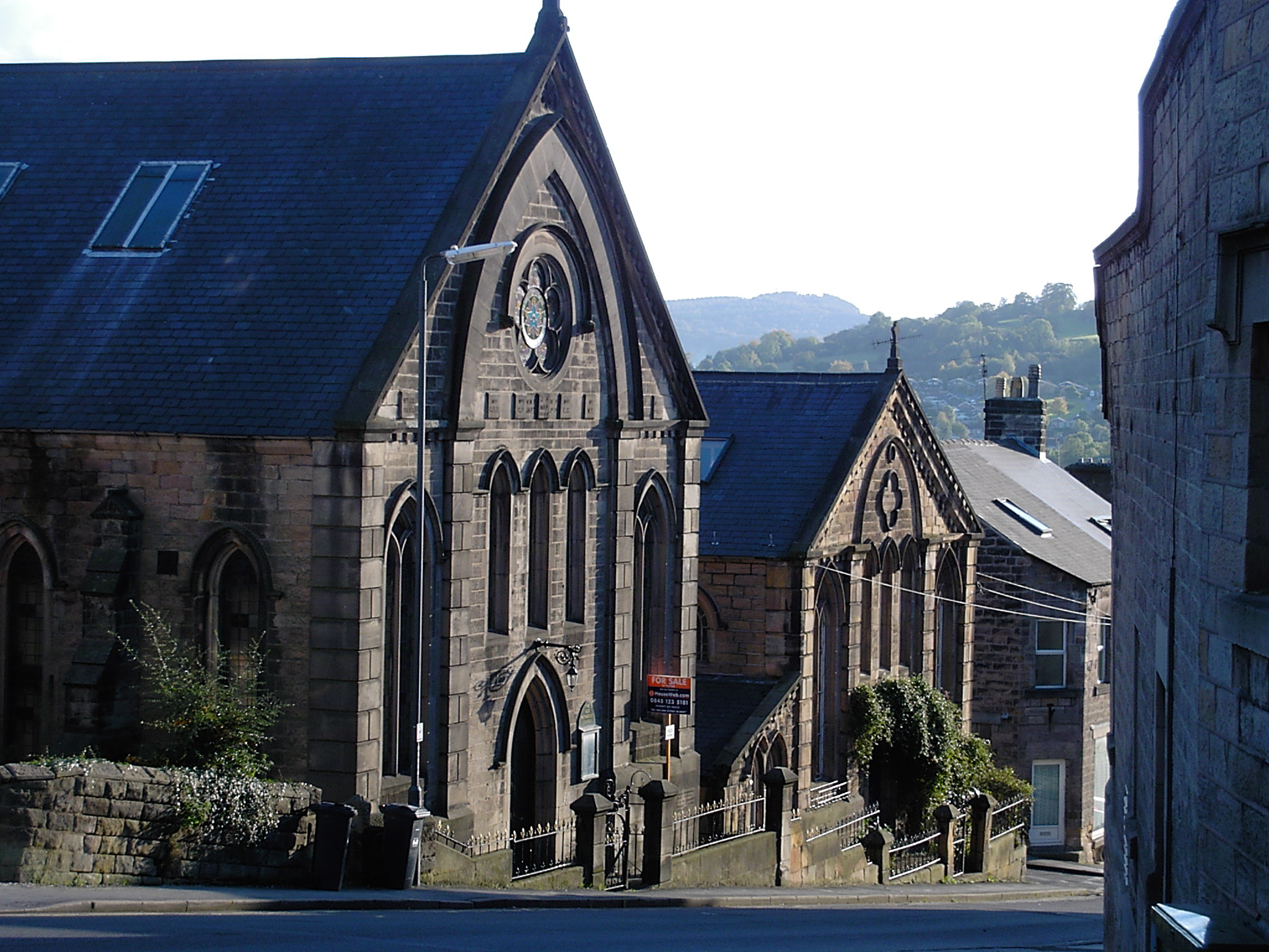
- Matlock Methodist & United Reformed Church - originally Matlock Wesleyan Chapel, and later the Trinity Methodist Church. The church was designed by C.O. Ellison of Liverpool, with additions designed by Horace G. Bradley. The neo-gothic church was originally built in 1882 without the slender steeple, which is now a landmark feature reaching above the roofs of neighbouring buildings, and, from higher levels, an elegant feature against the backdrop of the hills beyond. The Manse was built at the west of the site, fronting New Street.[7]
- Old Sunday School which is now a B&B.
- Old Methodist Church - the Primitive Methodist congregation was founded in 1838, although the current church on Bank Road, opposite the entrance to County Hall, was rebuilt in 1856 and the adjacent School Room below was added in 1878.[7] Until recently, the Old Methodist Church housed the Matlock Wurlitzer.[8]
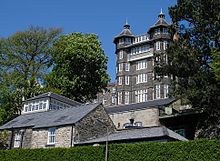
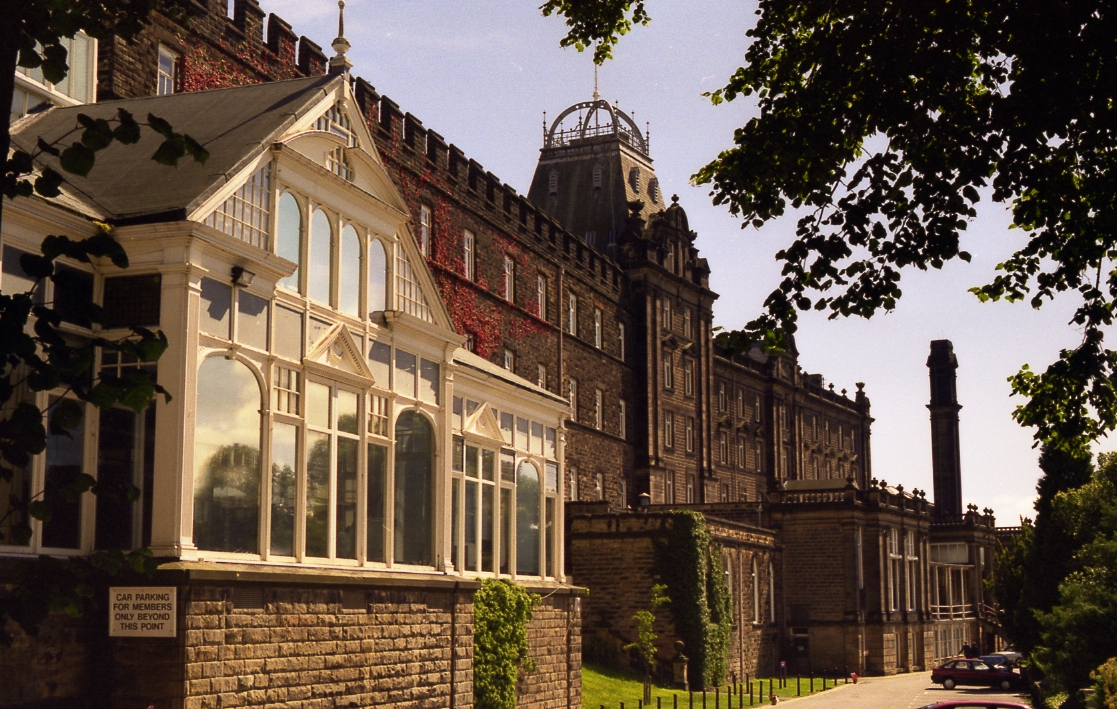
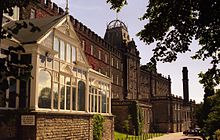 County Hall with Winter Gardens in foreground
- County Hall - formerly Smedley’s Hydro is a grade II listed building which dominates Matlock Bank. The earliest (western) section seen today was built in c.1867 by Smedley. Much of today's building was added after Smedley’s death in 1874. The first phase, in 1881, included the entrance hall and staircase, now in the middle section. In 1886, the eastern section was added by architect George Statham of Nottingham. Later extensions include the tall chimney, impressive for its height on the already prominent site, along with boiler house and bath in 1894. The domed glass Winter Gardens, which housed a ballroom, and the northern block on the other side of Smedley Street were added in 1901. The northern block was linked by the unusual two storey bridge over Smedley Street.[7]
The hydro closed in 1955 and re-opened in 1956 as “County Offices”, when Derbyshire County Council moved its headquarters from St Mary’s Gate in Derby. Its name was changed to “County Hall” during the 1990s. Part of the County Hall complex is seen in Women in Love, Ken Russell's Oscar winning 1969 film. As the Brangwen sisters walk out of their house (in reality No. 80, New Street) near the beginning of the film they are seen walking towards Bank Road.
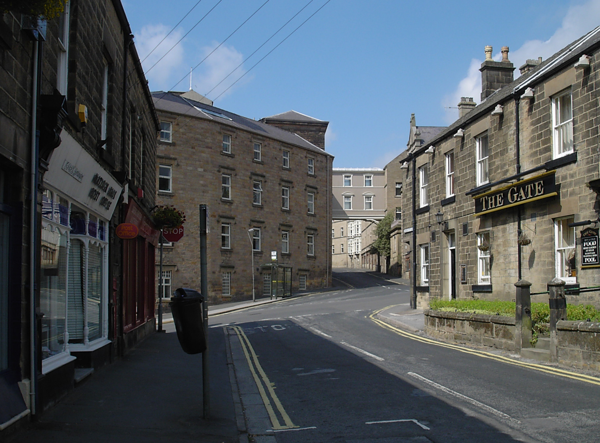
 The Gate and, across Bank Road, County Hall
 - Smedley Street traverses Bank Road. It has its own parade of shops and a post office (now closed). The east end of Smedley Street (known as Smedley Street East) is home to Laser Rail, a designer and manufacturer of rail measurement equipment now incorporated into Balfour Beatty's rail division.
 Rutland Court
- The Gate public house - There were known to have been numerous public houses on Matlock Bank, thought to have been the result of the ban on alcohol consumption within the hydros themselves, especially at Smedley’s. The whereabouts of many is no longer known. The Gate (dated 1869) was one of these, and still stands on the corner of Smedley Street and Bank Road, opposite Smedley's.[7]
NB. Beyond Smedley Street Bank Road is actually Rutland Street.
 Old tram depot, Bank Road (technically Rutland Street)
- Rutland Court - the former Matlock House Hydro stands prominently on the east side of Rutland Street. The hydro was built in 1863 and an engraving of 1870 shows that the main block, at least that which is visible from the roadside today, is largely unaltered.[7]
- Elmtree House - a former hydro, now 70-74 Rutland Street, was opened in 1862. It is located just to the north of the dominant Matlock House (now Rutland Court).[7]
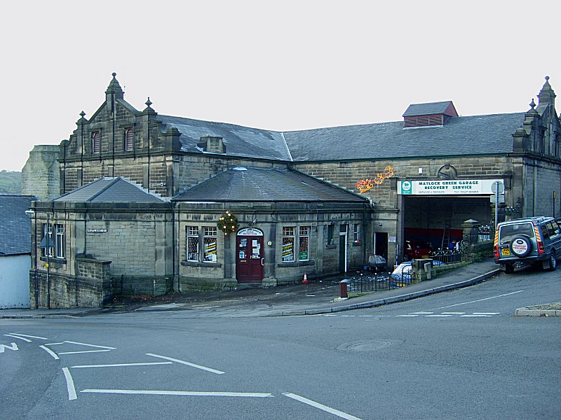
- The Old Tram Depot which is now a garage and car repair centre.
 Rockside Hydro
- Rockside Hydro - an imposing building with views across Matlock, is a grade II listed building, on higher ground above Smedley's and is distinctive for its two octagonal corner turrets with conical roofs topped by lanterns. Rockside was built circa 1860, but extended significantly by the firm of architects Parker and Unwin between 1901 and 1905, The building was also extended later in 1923 and 1928. An upper floor glazed conservatory with a glazed curved roof was added in c. 1923, and a block was added on Cavendish Road in 1928.[7] It probably isn't so well known that during the Second World War, Rockside Hall was used as an RAF psychiatric hospital, where mentally-scarred service personnel (mostly aircrew) were rehabilitated. It was somewhat unkindly known as "Hatters Castle" by locals.[9] The building became a hall of residence to Matlock College of Further Education in 1950 but following closure, stood empty and derelict for many years but has recently been renovated and converted into apartments. Large sections have been replaced, including the Cavendish Road block and the curved conservatory roof.
Sport
Matlock is home to Matlock Town Football Club. They are currently in the Northern Premier League Premier Division and play home matches at their Causeway Lane ground.
Matlock is also home to Matlock Cricket Club who play their games next to the football ground, and Matlock and District Swimming Club (also known as MAD Swimming) who train and compete in the nearby Matlock Lido.
Matlock has a regular rugby team who play their home matches at nearby Cromford Meadows. They run 3 senior teams and the 1st XV compete at Level 6 in the RFU league structure. Matlock Rugby Club also has a thriving minis and junior section with over 250 members all supported by fully qualified mini and junior coaches. In 2007 the club was awarded the Derbyshire Tigger Price Memorial trophy for the team of the year award
Education and the arts
Matlock creative and performing arts were enhanced in 2004 when the annual arts festival Matlock Live! began[citation needed]. It takes place in June or July each year featuring local musicians, dancers, artists, etc. The local secondary school, Highfields School, achieved status as a Performing Arts College due to its connections with Matlock Live![citation needed] As part of the summer event, Matlock Live invites Buskers / Street performers to form a busking trail around Matlock raising money for the charity Aquabox. More information on Matlock Live events can be found at the website. Matlock Music present a series of public concerts at Highfields School (Upper Lumsdale site).[10] Storytelling is also well represented with a monthly Storytelling Cafe at the Imperial Rooms.
History of education in Matlock
See also: Highfields School#History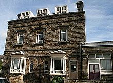 Ernest Bailey School (now County Council Records Office)
The first school in Matlock was founded in 1647 as a free school for local boys, originally funded by local George Spateman of Tansley and from 1668 by Anthony Wolley.[11] This school was rebuilt in 1829 and expanded in 1860 and 1889 and girls first attended in 1816.[11] This school has since been demolished[11] (the date is unknown).
Another school, All Saints Primary School was founded in 1875 to provide for the population of the newly developed Matlock Bank.[11] This school still operates and is the biggest primary school in Matlock. In 1897, a third school, the Council School, was constructed on Matlock Bank, at the junction of Smedley Street and Chesterfield Road.[11] It also still operates as Castle View Primary School.
Before Highfields School was founded in 1982, when the tripartite education system in Matlock ended, there were two secondary schools in Matlock; Charles White Secondary Modern (founded in 1956, and named after two local MPs, father and son, the latter of who died in 1956) and Ernest Bailey's Grammar School (founded in 1924 and named after its wealthy founder).[11]
As a Grammar school, Bailey's accepted students whose parents paid or who gained scholarships (by passing the Eleven plus exam) until fees were phased out, leaving scholarship as the only means of entry.[11] Everyone else attended Charles White, a Secondary modern school, hence it is estimated that Charles White students outnumbered Bailey's students 3:1.[11] White had been built especially by Derbyshire County Council to accommodate the children who couldn't attend Bailey's.[11]
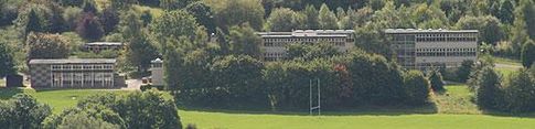 Charles White School (now Highfields Lower Site)
The two schools were merged to create Highfields, a comprehensive. The site of Charles White became lower site of Highfields, Ernest Bailey was converted to the county council record offices and a new school was built to house the new Upper Lumsdale site.[11]
The town centre development
For over 10 years, the council had proposed to allow a Sainsbury's supermarket to be built in Cawdor Quarry, a disused quarry next to the railway station. In early 2007 building work started, and it was opened on Thursday 4 October 2007. The access road for the supermarket forms part of a new one way system, whereby the A6 bypasses the town centre. A footbridge from the railway station allows pedestrian access to the supermarket from the town centre. A newly built bus station next to the train station is intended to create an integrated transport terminal.[12] However, several bus routes will continue to serve only the old Bus Station on Bakewell Road, making Matlock one of the smallest towns in Britain to boast two bus stations.
There has recently been a negative image of Matlock Town centre due to the limited retail offer for a town of Matlock's size which was identified in the Matlock Masterplan - a document produced by the district council. There has been a worry that many locals now choose to shop in neighbouring towns due to this perceived problem. There has been a call from some locals and the authorities for some national "High Street" retailers to set up in the town[citation needed]. The local council had a wider development planned for the future with key development sites on Bakewell Road, Firs Parade and Imperial Road which were identified in 2007 in the masterplan. However, as of December 2009 no movement on the development has been planned let alone started.
Matlock on film and television
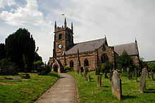 St Giles Church, featured in Women in Love
- Coming Down the Mountain, The BBC drama was set partly in Matlock although nothing was filmed there.
- Women in Love, Ken Russell's Oscar winning 1969 film, uses a house at the top of New Street (No. 80) as the home of the Brangwen sisters, Gudrun and Ursula. The house is currently a B&B. St. Giles' Church in Church Street was the setting for the wedding of Laura Crich.
- Peak Practice, the ITV series, used locations in Matlock, including Highfields School, Victoria Hall Gardens and Henry Avenue, although the main village location is Crich and nearby Fritchley.
- Dead Man's Shoes, the 2004 film by Shane Meadows, was filmed in and around Matlock.
- In Denial of Murder, 2005 BBC dramatisation of Matlock Mercury editor Don Hale's campaign to free Stephen Downing.
Youth Hostels
The Youth Hostels Association (YHA) has its national headquarters in the former Severn Trent Water building on Dimple Road, Matlock. YHA has had two hostels in the town. The first (1933–1934) in Tor Dale and the second (1983–2007) in Bank Road. Despite the close proximity of the Head Office, Bank Road closed in 2007 as part of a restructuring exercise. It has subsequently been redeveloped.
Nearby places
Neighbouring towns and villages. 
Buxton, Manchester Bakewell Chesterfield, Sheffield Ashbourne 
Alfreton  Matlock

Wirksworth Derby Nottingham Famous residents
- Simon Groom, the DJ and former Blue Peter presenter.
- Philip Whitehead, MP,
- Christopher Green, comedy performer and writer
- Isy Suttie, comedian and actress.
- Duncan Keith, defenceman for the Chicago Blackhawks of the NHL has family from Matlock
- Iain O'Brien, Former New Zealand Test cricketer.
- Rhythm Plate, musicians and producers.
Gallery
-
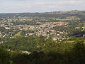
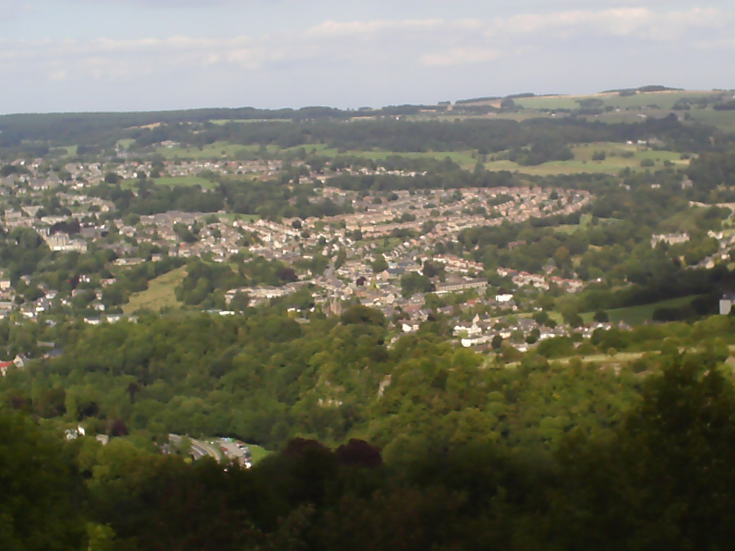
Matlock morning view from east, Lumsdale.
-
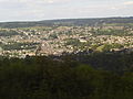
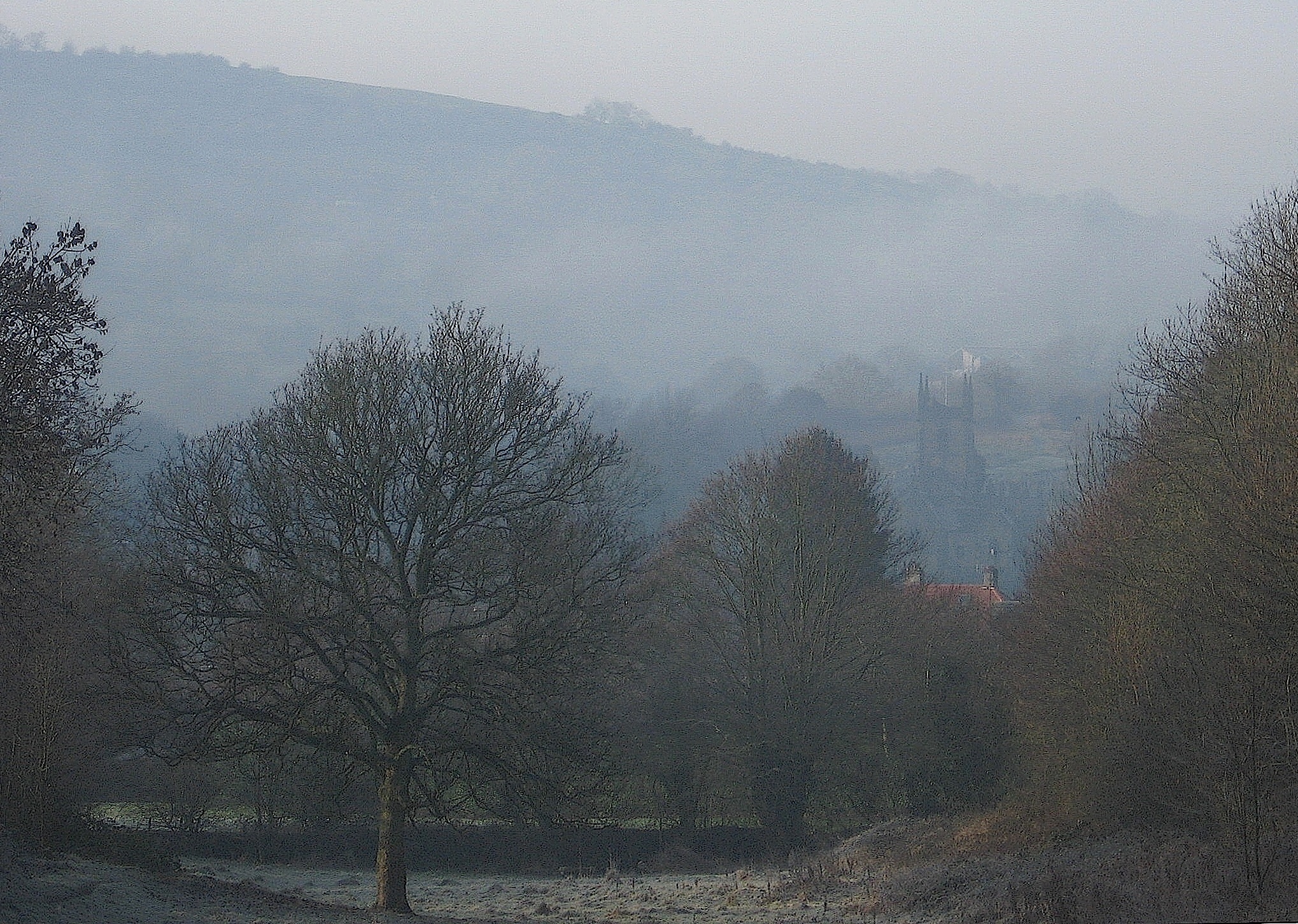
Matlock viewed from a nearby ridge.
-
The town enjoys the Sun's rays as shade approaches.
-
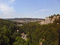
The town as seen from the nearby cable cars.
References
- ^ Matlock A Key To English Placenames, English Place Name Society database
- ^ a b "Matlock & Matlock Bath: Water Cures", Matlock & Matlock Bath (The Andrews Pages), http://www.pd65.dial.pipex.com/matlock/water.htm, retrieved 2 June 2010
- ^ a b c d e f "Matlock Bank: Conservation Area Appraisal. 02: Origins & Development", Matlock Bank Conservation Area, Derbyshire Dales District Council, December 2007, http://www.derbyshiredales.gov.uk/Images/2%20Origins%20and%20Development_tcm19-83827.pdf, retrieved 28 June 2010. See downloadable attachments at bottom of page.
- ^ "Matlock County Hall". Derbyshire Arts Partnership. http://www.artsderbyshire.org.uk/find_artist/articles/derbyshire_heritage/places/spotlight_matlock_county_hall/default.asp. Retrieved 2010-12-28.
- ^ "Derby to Manchester rail project". Derbyshire County Council. http://www.derbyshire.gov.uk/transport_roads/transport_planning/derby_manchester_rail_project/default.asp. Retrieved 2010-12-28.
- ^ a b c "Matlock Bridge Conservation Area Architecture". Derbyshire Dales District Council. http://www.derbyshiredales.gov.uk/Images/Matlock%20Bridge%20Conservation%20Area%20Appraisal%20-%2004%20-%20Architectural%20and%20Historic%20Quality_tcm19-83858.pdf. Retrieved 2011-01-01.
- ^ a b c d e f g h i j "Matlock Bank Conservation Area Architecture". Derbyshire Dales District Council. http://www.derbyshiredales.gov.uk/Images/Matlock%20Bank%20Conservation%20Area%20Appraisal%20-%2004%20-%20Architectural%20and%20Historic%20Quality%20-%20Part%201_tcm19-83831.pdf. Retrieved 2011-01-01.
- ^ "Matlock Wurlitzer". Theatre Organs website. http://theatreorgans.com/au/opus/UPDATES/UD2192.htm. Retrieved 2011-01-01.
- ^ "Rockside Hall photo". Geograph website. http://www.geograph.org.uk/photo/614906. Retrieved 2011-01-01.
- ^ http://:www.matlockmusic.org.uk
- ^ a b c d e f g h i j "Matlock's Schools in Earlier Times", Matlock and Matlock Bath (The Andrews Pages), http://www.andrewspages.dial.pipex.com/matlock/schools.htm, retrieved 2 June 2010
- ^ Matlock Area Action Plan
External links
- MatlockPeople.co.uk - Local news, events, galleries and discussion about Matlock
- MatlockOnline.co.uk - Dedicated to Matlock
- Extensive site on the history of Matlock and Matlock Bath.
- Remarkably extensive, well-presented bibliog. of writings on Matlock and Matlock Bath
- 140 (Matlock) Squadron Air Training Corps (Air Cadets)
- Matlock Live! website
- Matlock news from the Derby Telegraph
- Matlock Music website
- For descriptions of Matlock over several centuries.
- Matlock Mercury, local newspaper
- County Council Feasibility Study Derbyshire County Council (2004) Derby to Manchester Railway Matlock to Buxton / Chinley Link Study. Main Report, Volume 1A: Version: Final. This report also has detailed plans of the line.
- The Crown (Wetherspoon's) pub
- Derbyshire Dales District Council website
- Steep Turnpike Evangelical Church, Matlock website
- Matlock Methodist & United Reformed Church website
- Derbyshire County Council website
Ceremonial county of Derbyshire Unitary authorities Boroughs or districts Major settlements - Alfreton
- Ashbourne
- Bakewell
- Belper
- Bolsover
- Buxton
- Chapel-en-le-Frith
- Chesterfield
- Clay Cross
- Darley Dale
- Derby
- Dronfield
- Eckington
- Glossop
- Hadfield
- Heanor
- Ilkeston
- Killamarsh
- Langley Mill
- Long Eaton
- Matlock
- Melbourne
- New Mills
- Ripley
- Sandiacre
- Shirebrook
- Staveley
- Swadlincote
- Whaley Bridge
- Wirksworth
See also: List of civil parishes in Derbyshire
Rivers Topics Categories:- County towns in England
- Spa towns in England
- Towns and villages of the Peak District
- Towns in Derbyshire


Wikimedia Foundation. 2010.