- Cuyahoga County Airport
-
Cuyahoga County Airport
Robert D. Shea Field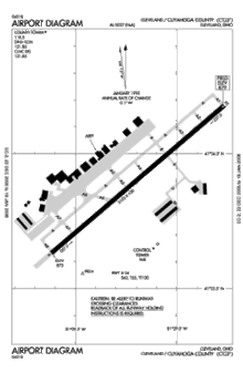
FAA diagram of Cuyahoga County Airport IATA: CGF – ICAO: KCGF Summary Airport type Public Operator Cuyahoga County Serves Cleveland, Ohio Location Highland Heights
Richmond Heights
Willoughby HillsElevation AMSL 879 ft / 267.9 m Coordinates 41°33′54.44″N 81°29′10.87″W / 41.5651222°N 81.4863528°WCoordinates: 41°33′54.44″N 81°29′10.87″W / 41.5651222°N 81.4863528°W Website Runways Direction Length Surface ft m 6/24 5,102 1,555 Asphalt Cuyahoga County Airport (IATA: CGF, ICAO: KCGF), also known as Robert D. Shea Field, is an airport located in northeastern Cuyahoga County, Ohio, about 10 miles (16 km) east of Cleveland, Ohio, and sits on the border of three cities: Highland Heights, Richmond Heights and Willoughby Hills (Lake County).
Contents
Facilities
Cuyahoga County Airport covers 640 acres (259 ha) and has one runway:
- Runway 6/24: 5,102 x 100 ft (1,555 x 30 m), Surface: Asphalt
- Fuel available: 100LL JET-A JET-A1+
- Parking: hangars and tiedowns
- Airframe service: MAJOR
- Powerplant service: MAJOR
- Bottled oxygen: HIGH
- Bulk oxygen: NONE
Airport operational statistics
- Aircraft based on the field: 206
- Single engine airplanes: 96
- Multi engine airplanes: 18
- Jet airplanes: 91
- Helicopters: 1
- Aircraft operations: avg 185/day
- 53% transient general aviation
- 27% local general aviation
- 20% air taxi
- <1% military
Airlines
- Corporate Wings
- Hangars, Terminal Lounge, Aircraft Cleaning/Maintenance.
- Flight Options
External links
- Cuyahoga County Airport
- FAA Airport Diagram (PDF), effective 20 October 2011
- Resources for this airport:
- AirNav airport information for KCGF
- ASN accident history for CGF
- FlightAware airport information and live flight tracker
- NOAA/NWS latest weather observations
- SkyVector aeronautical chart, Terminal Procedures for KCGF
Categories:- Airports in Ohio
- Buildings and structures in Cuyahoga County, Ohio
- Transportation in Cuyahoga County, Ohio
- Transportation in Lake County, Ohio
- Midwestern United States airport stubs
- Ohio building and structure stubs

Wikimedia Foundation. 2010.