- Hamsey
-
Coordinates: 50°54′N 0°00′E / 50.90°N 0.00°E
Hamsey 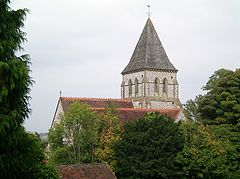
St. Peter's Church, Offham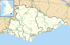
 Hamsey
Hamsey shown within East SussexArea 11.44 km2 (4.42 sq mi) [1] Population 574 (2007)[1] - Density 129.9 /sq mi (50.2 /km2) OS grid reference TQ409128 - London 42 miles (68 km) N Parish Hamsey District Lewes Shire county East Sussex Region South East Country England Sovereign state United Kingdom Post town LEWES Postcode district BN7, BN8 Dialling code 01273 Police Sussex Fire East Sussex Ambulance South East Coast EU Parliament South East England UK Parliament Lewes Website http://www.hamsey.net/ List of places: UK • England • East Sussex Hamsey is a civil parish in the Lewes District of East Sussex, England. It is located three miles (5 km) north of Lewes on the Prime Meridian. The original village, now abandoned apart from the church and a few cottages, lay on an island in the River Ouse; the parish consists of the villages of Hamsey with Offham and Cooksbridge being the main centres of population in the parish.
Contents
Offham
This village is on the A275 just north of Lewes and next to the Chalk Pit and the woods surrounding it. It has a pub, the Blacksmiths Arms.
Cooksbridge
Cooksbridge is centred around its railway station and has a primary school and a pub, the Rainbow.
Landmarks
There are two Sites of Special Scientific Interest that fall within the parish, Clayton to Offham Escarpment and Offham Marshes. Clayton to Offham Escarpment lies on the South Downs and stretches across many parishes. Its chalk grassland, woodland and scrub supporting a wide variety of breeding birds.[2] Offham Marshes, fully contained within the parish, is an area of alluvial grazing marsh. Its biological interest is due to its large amphibian population and several other scarce insect life.[3]
Another landmark is Mount Harry, a 194 metres (636 ft) hill which falls within the National Trust Blackcap nature reserve.[4]
Hamsey
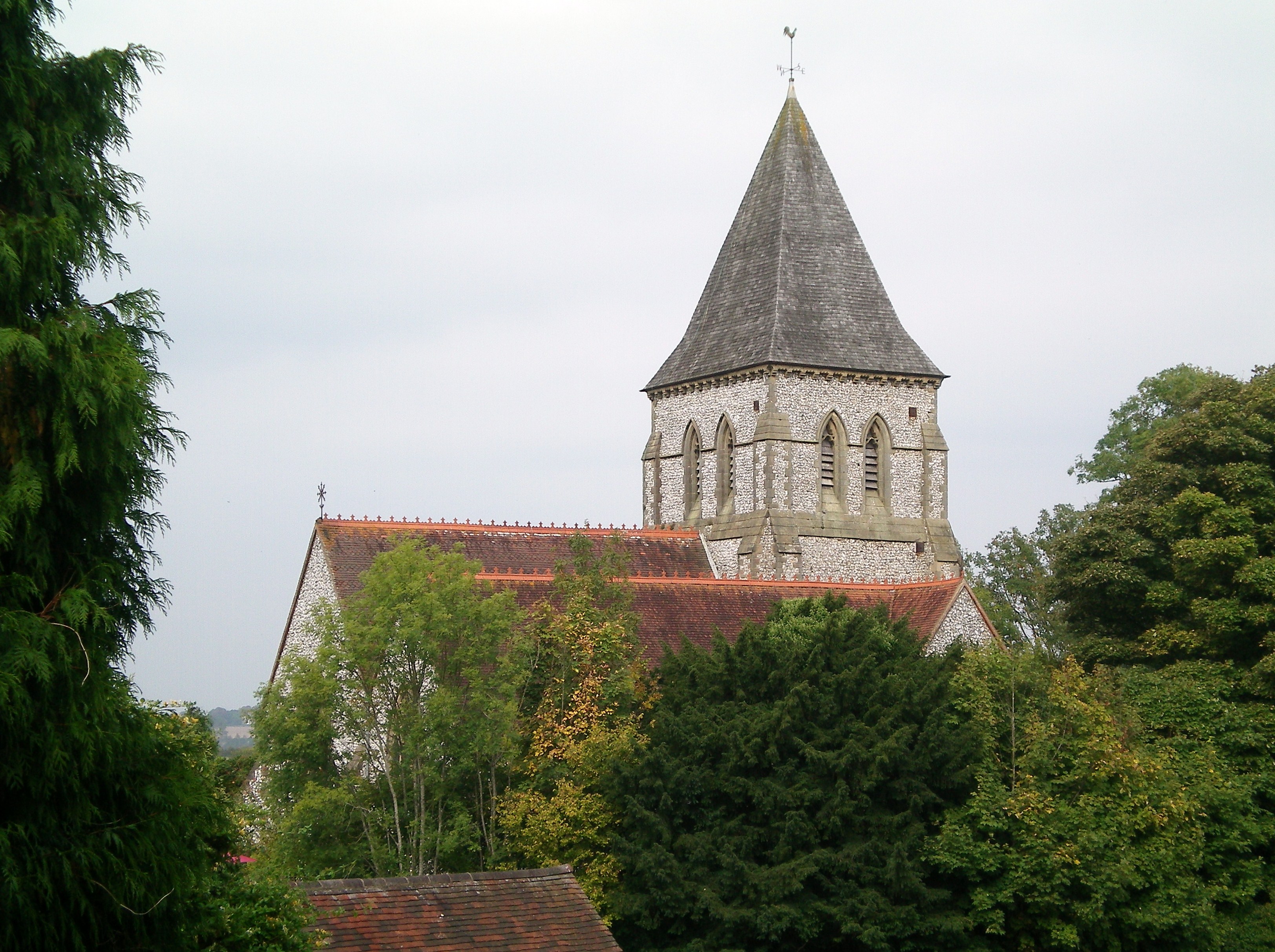
The main part of Hamsey is a group of fairly large houses including the large country house Hamsey House. Further south, on the banks of the River Ouse, there is a collection of converted farm buildings known as Hamsey Place, where there is a large pond with Canada geese. From here there is a lane that ends with St. Peter's Church. This was a prosperous church with a large congregation until the Black Death decreased the local population so much that by the 19th century it was decided that a new church should be built in the previous hamlet of Offham (this one was also dedicated to St. Peter). It was finished in the 1840s. At one point around this time the parish council were actually considering demolishing Hamsey Church.
References
- ^ a b "East Sussex in Figures". East Sussex County Council. http://www.eastsussexinfigures.org.uk/webview/. Retrieved 26 April 2008.
- ^ "Natural England - SSSI". English Nature. http://www.english-nature.org.uk/special/sssi/sssi_details.cfm?sssi_id=1002124. Retrieved 6 October 2008.
- ^ "Natural England - SSSI". English Nature. http://www.english-nature.org.uk/special/sssi/sssi_details.cfm?sssi_id=1005745. Retrieved 6 October 2008.
- ^ "Blackcap". Countryside Sites. Brighton & Hove City Council. http://www.brighton-hove.gov.uk/index.cfm?request=c1192054. Retrieved 7 June 2009.
External links
Towns Lewes · Newhaven · Peacehaven · Telscombe · Seaford
Villages / hamlets Barcombe · Barcombe Cross · Barcombe Mills · Beddingham · Bishopstone · Chailey · Denton · Ditchling · East Blatchington · East Chiltington · Falmer · Firle · Glynde · Hamsey · Iford · Kingston near Lewes · Newick · North Chailey · Piddinghoe · Plumpton · Plumpton Green · Ringmer · Rodmell · Spithurst · South Heighton · Southease · St Ann Without · St John Without · South Chailey · South Street · Streat · Tarring Neville · Telscombe Cliffs · Town Littleworth · Westmeston · Wivelsfield · Wivelsfield Green
Other areas Categories:- Villages in East Sussex
- Lewes
- Local government in East Sussex

Wikimedia Foundation. 2010.