- Deception Pass Bridge
-
Deception Pass Bridge
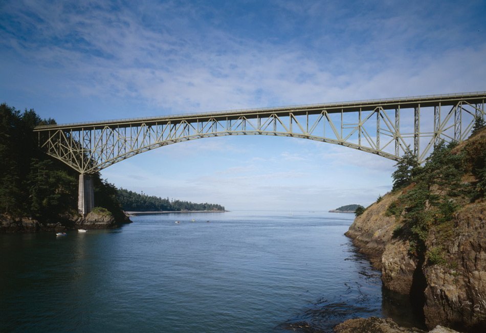
 Deception Pass Bridge, connecting Whidbey Island to Pass Island.
Location: SR 20
Island and Skagit counties, Washington United States
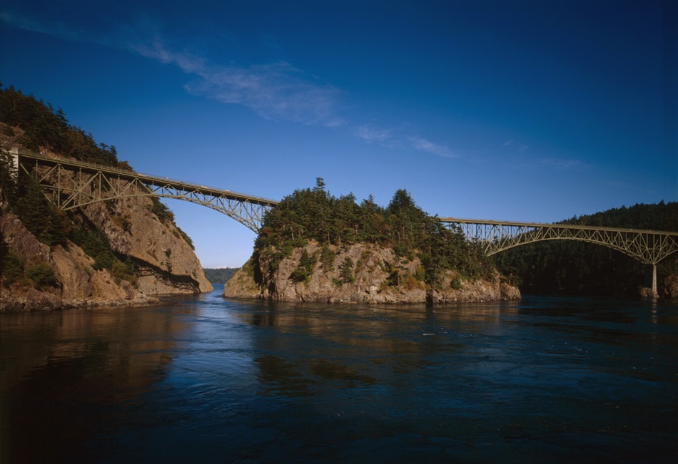
Nearest city: Oak Harbor Anacortes Coordinates: 48°24′22″N 122°38′41″W / 48.40611°N 122.64472°WCoordinates: 48°24′22″N 122°38′41″W / 48.40611°N 122.64472°W Built: 1934-35 Governing body: Washington State Department of Transportation MPS: Historic Bridges/Tunnels in Washington State TR NRHP Reference#: 82004285 Added to NRHP: July 16, 1982 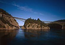 Both Canoe Pass and Deception Pass Bridges, looking east
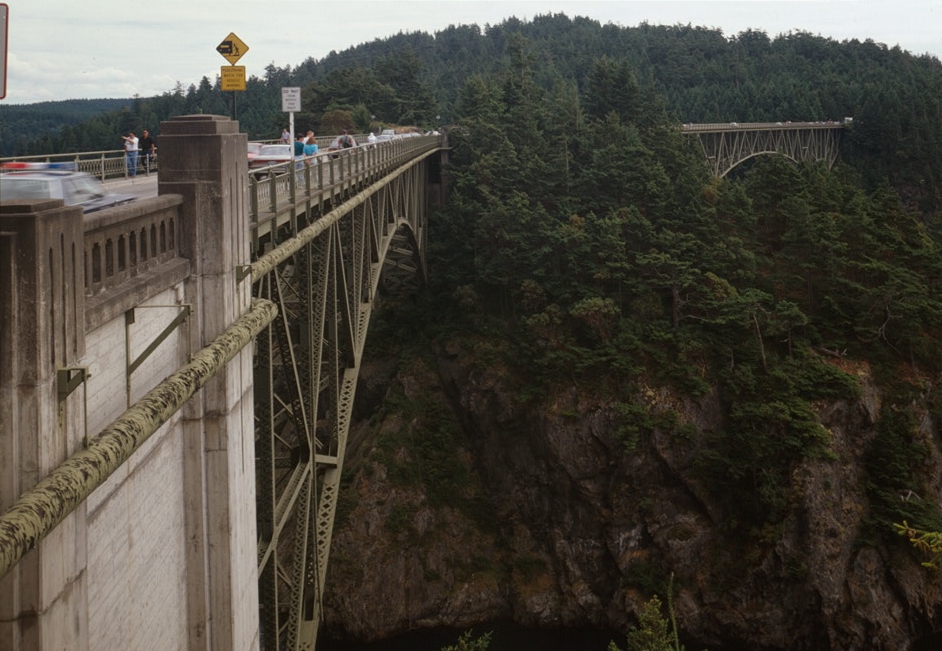
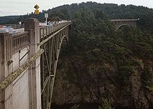 View from Skagit County, looking south
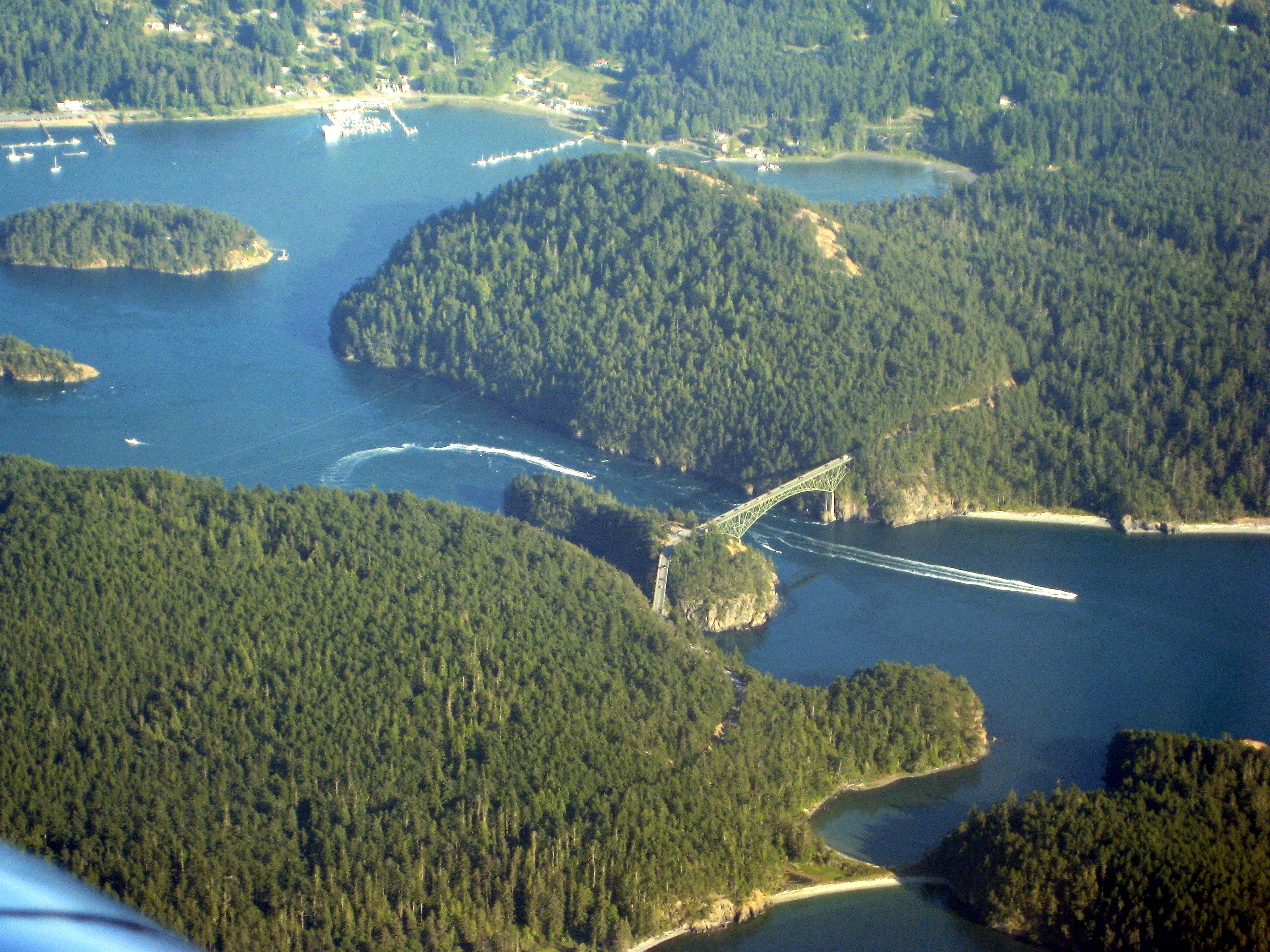
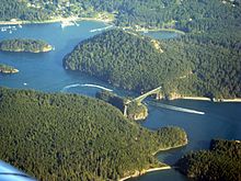 Aerial view
The Deception Pass Bridge is a two-lane bridge connecting Whidbey Island to Fidalgo Island in the U.S. state of Washington. It was a Washington State Highways project, and included project elements built by young workers from the Civilian Conservation Corps. Completion of the bridge was a factor in the decision to build Naval Air Station Whidbey Island and helped Oak Harbor, Washington flourish. The bridge is a commonly-photographed landmark of the Puget Sound region.
History
In the spring of 1792, Joseph Whidbey, master of HMS Discovery and Captain Vancouver's chief navigator proved that it was not really a small bay as charted by the Spaniards (hence the name "Deception"), but a deep and turbulent channel that connects the Strait of Juan de Fuca with the Saratoga Passage, which separates the mainland from what they believed was a peninsula (actually Fidalgo Island and Whidbey Island). Thomas Coupe, a sea captain and founder of Coupeville, was the only man ever to sail a full-rigged ship through the strait discovered by Whidbey.
In the early years of the 20th century, travelers of the horse-and-buggy era used an unscheduled ferry to cross from Fidalgo Island to Whidbey Island. To call the ferry, they banged a saw with a mallet and then sat back to wait.
The bridge, one of the scenic wonders of the Pacific Northwest, is actually two spans, one over Canoe Pass to the north, and another over Deception Pass to the south. Construction began in August 1934, and the completed bridge was dedicated at noon on July 31, 1935. The Wallace Bridge and Structural Co. of Seattle, Washington provided 460 tons of steel for the 511-foot Canoe Pass arch and 1130 tons for the 976-foot Deception Pass span. The cost of the New Deal-era construction was $482,000, made possible through the Public Works Administration and county funds.
In 1982, the bridge was listed in the National Register of Historic Places.
It cost more to paint the spans in 1983 than to build them in 1935. They were painted again in 1997.
Bridge Facts
- Height from water to roadway: about 180 feet, depending on the tide
- Roadway: two 11 foot lanes, one in each direction
- Sidewalks: 3 foot sidewalk on each side
- Width of bridge deck: 28 feet
- Total length: 1487 feet (more than a quarter mile)
- Canoe Pass: one 350-ft arch and three concrete T-beam approach spans
- Deception Pass: two 175-ft cantilever spans, one 200-ft suspended span, and four concrete T-beam approach spans
- Vehicle crossings: 20,000 per day, average
- Maximum speed of current in Deception Pass at flood/ebb tide: 9 kts
- Maximum speed of current in Canoe Pass at flood/ebb tide: 10 kts
External links
- Deception Pass Bridge satellite view from Virtual Earth
- Deception Pass Park Foundation webpage
- Deception Pass Bridge at Structurae
- Maritime Heritage Network
U.S. National Register of Historic Places Topics Lists by states Alabama • Alaska • Arizona • Arkansas • California • Colorado • Connecticut • Delaware • Florida • Georgia • Hawaii • Idaho • Illinois • Indiana • Iowa • Kansas • Kentucky • Louisiana • Maine • Maryland • Massachusetts • Michigan • Minnesota • Mississippi • Missouri • Montana • Nebraska • Nevada • New Hampshire • New Jersey • New Mexico • New York • North Carolina • North Dakota • Ohio • Oklahoma • Oregon • Pennsylvania • Rhode Island • South Carolina • South Dakota • Tennessee • Texas • Utah • Vermont • Virginia • Washington • West Virginia • Wisconsin • WyomingLists by territories Lists by associated states Other Categories:- Bridges completed in 1935
- Buildings and structures in Island County, Washington
- Bridges on the National Register of Historic Places in Washington (state)
- Buildings and structures in Skagit County, Washington
- Civilian Conservation Corps in Washington (state)
- Transportation in Island County, Washington
- Transportation in Skagit County, Washington
- Road bridges in Washington (state)
Wikimedia Foundation. 2010.