- Khuzdar District
Infobox Pakistan district
district = Khuzdar District
area =
population =
pop_year =
density =
established = 1974
nazim =Sardar Naseer Ahmed Moosiani
naib_nazim =Sher Dil Khan Tambrani
seats =
tehsils = 5
languages =Brahvi language
website =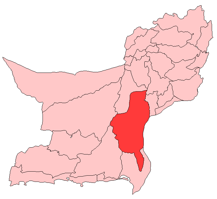
region = Balochistan
caption =Khuzdar (Urdu: خضدار ) district is located in the centre of Balochistan province of
Pakistan .Khuzdar is the capital of Khuzdar district. It is a district and divisional headquarter town in Balochistan. Khuzdar was notified as a separate district on 1st March 1974. Previously, it was included inKalat District .Khuzdar used to be the main city ofJhalawan state. The district is subdivided into five tehsils:Khuzdar ,Nal ,Zehri ,Karkh andWadh . It is at the apex of a narrow valley at an elevation of 1,237 m (4.000 feet).University is established at the outskirts of Khuzdar [http://www.buetk.edu.pk Balochistan University of Engineering & Technology Khuzdar] , known as the heart of Balochistan. The city of Khuzdar is situated on National Highway linking Pakistan, Iran and Turkey. It is at a distance of about 400 km from Karachi and 300 km from Quetta, both of them being main cities of the country. The city is facilitated with an Airport, near the university. The former college, now university is constructed on the foot-hills and is spread over an area of 200 acres. The clean and calm environment makes the university an ideal place for academic and research activities.
Administration
The district is administratively subdivided into five
tehsil s, these are: [ [http://www.nrb.gov.pk/lg_election/union.asp?district=78&dn=Khuzdar Tehsils & Unions in the District of Khuzdar - Government of Pakistan] ]*
Khuzdar
*Karkh
*Naal
*Wadh
*Zehri Demography
The population of Khuzdar district is estimated to be over 525,000 in 2005. Over 99% of the people of the area are
Muslim s. The major tribes in the district areBizenjo ,Jattak ,Muhammad Hasni (Mammasani) ,Zehri ,Mengal ,Ahmadzai , andJamot , . Over 95% of the districts population speak theBrahvi language .References
Wikimedia Foundation. 2010.