- New Jersey Route 159
-
Route 159
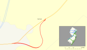
NJ 159 is highlighted in redRoute information Maintained by NJDOT Length: 1.36 mi[2] (2.19 km) Existed: 1953 (1941 as Route 6M)[1] – present Major junctions West end:  US 46 in Montville
 CR 506 in Fairfield
East end:  US 46 / CR 627 in Fairfield
Highway system New Jersey State Highway Routes
Interstate and US←  Route 158
Route 160  →
→Route 159 is a short, 1.36-mile (2.19 km) highway in the Montville and Fairfield areas. Route 159's southern and northern termini are both interchanges with U.S. Route 46. There are county routes also present at both termini. Route 159 is called locally as Bloomfield Avenue, Oak Road, and Clinton Road during its length.
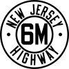
Route 159 is a former alignment of U.S. Route 46, until the highway was bypassed in 1941. At that time, U.S. Route 46 also had the designation State Highway Route 6, and when the bypass opened in 1941, the original alignment was designated Route 6M. The 6-M designation lasted just twelve years, when in 1953, it was renumbered as Route 159.
Contents
Route description
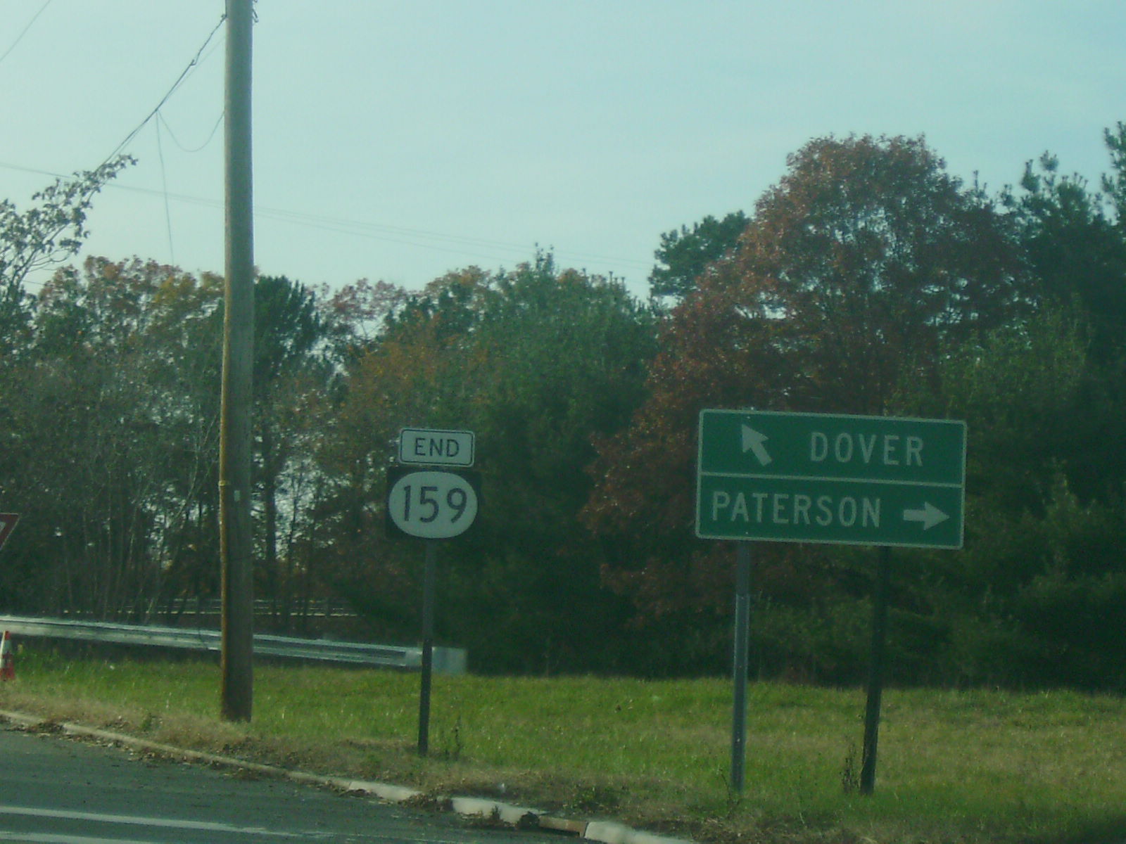
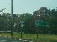 The terminus of NJ 159 at US 46 in Montville
New Jersey Route 159 begins at an interchange of U.S. Route 46 westbound and County Route 506's western terminus. Route 159 heads eastward, following a divided Bloomfield Avenue (County Route 506) along a commercial strip near the Passaic River. The highway continues, crossing the river, and passing West Essex Park. Nearby to the south are the park's woodlands and to the north, across the divided highway, is a large commercial development. Right after West Essex Park ends, Route 159 comes to another interchange, where it leaves Bloomfield Avenue and Route 506 and turns to the north along Oak Road.[3]
Route 159 begins its process northward, and parallels the commercial development that was only accessible westbound. During the curve away from Bloomfield Avenue, the highway intersects with County Route 614 (Brook Road) at an at-grade intersection. Route 159 continues its curve, intersecting with Clinton Road, a spur of Route 614. The Oak Road moniker ends at that intersection, where it changes to Clinton Road, a continuation of Route 614's right-of-way. With the commercial development to the south of Route 159 now, the highway progresses its way westward.[3]
Along Clinton Road, Route 159 passes some residences to the north, and intersects with Ray Place, which connects to the commercial development to the nearby south. There is an intersection with Ludsin Lane, which dead-ends in a local commercial area. After that, there is an intersection with Industrial Road, which serves some industrial development in the area. Route 159 begins to parallel U.S. Route 46 once again, leaving the commercial development behind. Eastbound U.S. Route 46 provides an exit to (but not an entrance from) Route 159. A short distance later, Route 159 ends at a traffic light-controlled intersection with U.S. Route 46, 1.36 miles (2.19 km) north of where it began. County Route 627 continues the right-of-way as Plymouth Street past the eastern terminus of Route 159.[3]
History
 Route 6M (1941-1953)
The alignment that Route 159 currently takes was originally an alignment of U.S. Route 46. In 1941, construction finished of a new bypass of the communities of The Caldwells and Fairfield, where Route 159's northern terminus occurs. U.S. Route 46 at the time also had the internal designation of New Jersey State Highway Route 6, which gave the bypassed segment of 6/46 the designation of New Jersey State Highway Route 6-M. Route 6-M remained intact for twelve years, when the 1953 renumbering of state highways occurred. Route 6-M and its parent, Route 6, were decommissioned. Route 6 remained U.S. Route 46, and Route 6-M was redesignated as New Jersey Route 159.[1]
The bridge taking westbound Route 159 (Bloomfield Avenue at that point) over U.S. Route 46 eastbound and into U.S. Route 46 westbound (at the western terminus of Route 159) was undergoing replacement, and was re-opened for traffic on December 24, 2009.[4] Construction period is August 2009 to February 2010. Construction will continue until the end of the construction period, though the bridge is open for traffic.[5]
Major intersections
County Location Mile[2] Destinations Notes Morris Montville 0.00 US 46Western terminus of NJ 159, interchange. Essex Fairfield Township 0.45 CR 506 east (Bloomfield Avenue)1.23 US 46Interchange. 1.36 US 46Eastern terminus of NJ 159. 1.000 mi = 1.609 km; 1.000 km = 0.621 mi See also
 U.S. Roads portal
 New Jersey portal
References
- ^ a b Alpert, Steve; Moraeski, Dan (2009). "159". Dan Moraeski. Alps' Roads. pp. 1. http://www.alpsroads.net/roads/nj/log/9.html#159. Retrieved 2009-02-22.
- ^ a b New Jersey Department of Transportation straight line diagram, NJ 159PDF (55.3 KB)
- ^ a b c Yahoo! Inc. Yahoo! Maps – overview map of NJ 159 (Map). Cartography by NAVTEQ. http://maps.yahoo.com/#mvt=h&lat=40.867459&lon=-74.313186&zoom=18&q1=40.859101%2C-74.325288&q2=40.867905%2C-74.311705&w0=40.86305489382944%2C-74.31408762931824. Retrieved 2009-02-22.
- ^ "Montville bridge over Route 46 reopens after construction". Daily Record. 2009-12-24. http://www.dailyrecord.com/article/20091224/UPDATES01/91224019/Montville-bridge-over-Route-46-reopens-after-construction.
- ^ "Route 159 Westbound over Route U.S. 46 Eastbound Bridge Superstructure Replacement Project Montville Township, Morris County". NJ Department of Transportation. 2009-07-16. http://www.state.nj.us/transportation/community/meetings/documents/handout071609dh.pdf. Retrieved 2009-07-27).
External links
Categories:- State highways in New Jersey
- Transportation in Essex County, New Jersey


Wikimedia Foundation. 2010.