- Boho, County Fermanagh
Infobox Irish Place|thumb|left|name = Boho
irish = Botha
map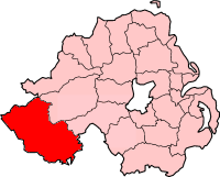
pin coords =
north coord = | west coord =
province =Ulster
county =County Fermanagh
NI district =Fermanagh
UK constituency = Fermanagh and South Tyrone
stdcode = 028, +44 28
posttown =
postcode =
population =
census yr = 2001
web = www.fermanagh.gov.ukBoho (pronounced "Bo") ( _ga. Botha) is a parish or group of townlands situated 7 miles south west of
Enniskillen ,County Fermanagh ,Northern Ireland .Neolithic Origins
Botha or Boho is the plural of Both(bǒh) the ancient word for tent, hut or booth. This is a truncation of the original
Botha Muintir Fialain , the tent's or hut's of the family/people of Fialain, an ancient tribe who lived in the district [cite book |title=The Origin and History of Irish Names of Places|author=Patrick Weston Joyce|publisher=Longmans, Green and Co |year=1898 |pages=Item notes: v.1 Page 305|Original from Oxford University|Digitized= Aug 10, 2007|571 pages] . Evidence of neolithic habitation in the area can be seen in the townland of Reyfad which contains neolithic patterned stones which are classified as a scheduled monument (grid ref H1120 4615) [cite web |title=Sceduled Historic Monuments, EHS |url= http://www.ni-environment.gov.uk/scheduled_monuments1to31mar07.pdf] [cite web |title=irish megaliths |url=http://www.irishmegaliths.org.uk/fermanagh.htm] . Modern evidence ofneolithic habitation was uncovered in 1880 when an ancient settlement was discovered 21 feet beneath the surface of a peat bog (the coal bog) [cite journal |author=Plunkett Thos |journal=Nature |title=An ancient settlement in the peat near Boho |year=1881 ] [cite article |title= Annual 50th Meeting of British Association for the Advancement of Science |Publisher= J. Murray|page=236 |year=1880|Original from Harvard University Digitized Mar 11, 2008] . Later Bronze Age evidence of habitation came in the form of a copper knife reported by George Coffey (1901) which is on display in the "Dublin collection" [cite journal |author=George Coffey |title= Irish Copper Celts |journal= The Journal of the Anthropological Institute of Great Britain and Ireland |Volume= 31 |year= 1901 |pages=265-279 |url=http://www.jstor.org/sici?sici=0959-5295(190101%2F06)31%3C265%3AICC%3E2.0.CO%3B2-1&cookieSet=1] . Iron Age artifacts are represented by discovered in the Carn townland of Boho (1953), which consist of remnants of a hearth at the foot of an escarpment dating to first millennium AD [cite journal |author=Proudfoot E V B |Year= 1953 |title=A rath at Boho, Fermanagh |journal=Ulster J. Archaeol. |volume=16. |pages=41-57] . Later evidence of Danish raiders to this area came in the form of an iron spear head, found in a Cromleac in Boho which is now kept at the National Museum of Ireland in Dublin [cite book |title=Treasures of the National Museum of Ireland. Irish Antiquities |author= Roger Stalley |editor=Patrick F Wallace & Raghnall Ó Floinn |Publisher=Gill and Macmillan in association with The Boyne Valley Honey Company |year= 2002 |pages=315pp |ISBN= 0 7171 2829 6] [cite book |author= William Gregory Wood Martin |title= Pagan Ireland; an Archaeological Sketch: A Handbook of Irish Pre-Christian Antiquities |Publisher= Longmans, Green, and co., |year=1895 | page=301 |Original from Harvard University |Digitized= Mar 3, 2008 |pages=689 |url=http://books.google.com/books?id=uGIWAAAAYAAJ&pg=PA301&lpg=PA301&dq=boho+Pagan+Ireland%3B+an+Archaeological+Sketch:+A+Handbook+of+Irish+Pre-Christian+Antiquities&source=web&ots=TLXX3FTfGe&sig=AwQ_bGTUu1fepO0hExpVRRwIvkQ&hl=en&sa=X&oi=book_result&resnum=1&ct=result] . Centuries later Boho merits a mention in The Annals of the Four Masters (1487) pertaining to the death of Teige, the son of Brian, son of Auliffe Maguire, who had first been Parson of Botha, and Vicar of Cill-Laisre [cite book |title=The Annals of the Four Masters Part 12 |url=http://www.ucc.ie/celt/online/T100005D/text012.html] and again in 1498 there are reports of Maine, the son of Melaghlin, son of Matthew Mac Manus, slain inBotha-Muintire-Fialain , by the sons of Cathal O'Gallagher [cite book |title=The Annals of the Four Masters part 13 |url= http://www.ucc.ie/celt/online/T100005D/text013.html] . This tribe can also be found pronounced as Faoláin, faolan or Farrel [cite web |title=surnames data base |url=http://www.familytreedna.com/public/whalen] [cite book |title=Annala Rioghachta Eireann : Annals of the kingdom of Ireland Volumes 5 and 6, History To 1603|author=O'Clery, Michael, 1575-1643; O'Clery, Cucogry, d. 1664; O'Mulconry, Ferfeasa, fl. 1636; O'Duigenan, Cucogry, fl. 1636; O'Clery, Conary, fl. 1636; O'Donovan, John, 1809-1861 |publisher=Hodges, Smith |year=1861?] The name of a local school Portora is supposed to be from the Irish Port Abhla Faoláin, 'landing place of the apple trees of Faolán'; the school is on the north-west edge of Enniskillen [cite web |title=THE OSCHOLARS LIBRARY |url=http://www.oscholars.com/TO/Appendix/Library/sammon.htm] .Places of interest
Boho graveyard has the remains of a 12th century
high cross -shaft featuring Adam and Eve and the serpent on its east face.Noon's Hole lies about 3 miles (5 km) north west of Boho, at 250 feet this pothole is one of the deepest in
Ireland .1km from the crossroads in Boho is The Linnet Inn, one of the last few remaining thatched public houses left in Ireland. Owned for over thirty years by Brian McKenzie it boasts an impressive open hearth fire and unique cave bar at the back.
Other places of interest include the Church of Ireland at Farnaconnell, 1.2 miles (2 km) north west and the St Faber's Church at Carrickbeg which houses the 12th century high cross in the graveyard.
Boho High Cross
The High Cross in Boho graveyard (grid ref H1167 4621) is on an eminence overlooking the Roman Catholic Church of St Faber's (named after its patron St Feadhbar or Faber) in the townland of Toneel North [cite web |title=Explore Bréifne |url= http://www.breifne.ie/content.asp?ID=1882] [cite journal |author=Donnelly C MacDonald P Murphy E and Beer N |year=2003; published 2005 |title= Excavations at Boho High Cross, Toneel North, County Fermanagh |journal=Ulster Journal of Archaeology |volume=62 |pages= 121-42] . Ecclesiastical use of this site dates to the Early Christian period. The cross estimated to be 1000 years old and comprises a weathered shaft and accompanying socketed base of red sandstone. Excavation of the cross suggested that the cross was moved to its present position after 1832, when the site was first reused for Roman Catholic worship, the new church being built in the original graveyard slightly south of the old [Donnelly, C., P. MacDonald, E. Murphy and N. Beer, (2003; published 2005) Excavations at Boho High Cross, Toneel North, County Fermanagh, Ulster Journal of Archaeology 62, 121-42.] [cite web |title=Excavations at Boho High Cross |url=http://www.qub.ac.uk/schools/CentreforArchaeologicalFieldworkCAF/Reports/DataStructureReports/Filetoupload,64239,en.pdf] The base of the cross was alleged to be a bullán which men would resort to in cases of childless marriages [cite book |author= William Gregory Wood-Martin |title=Traces of the Elder Faiths of Ireland: A Folklore Sketch; a Handbook of Irish Pre-Christian Traditions |publisher=Longmans, Green, and co |year=1902 |Volume=Item notes: v.2 |page=247 |Digitized= Nov 21, 2005 |url=http://books.google.com/books?id=B0W-gRqS3XEC&pg=RA2-PA247&lpg=RA2-PA247&dq=boho+graveyard+prechristian&source=web&ots=iwde4REo14&sig=I1dKNv2UXTU3X3Q5UEmCMnc01Zo&hl=en&sa=X&oi=book_result&resnum=1&ct=result#PRA2-PA247,M1] . The existing doorway of the nearby Church of Ireland was thought to have originated from the pre-reformation church at Toneel North which in turn was also thought to be a pre-christian pagan amphitheatre. There was another church in Boho parish supposedly called Templemollem or the Church of the Mill. [cite web |author= REV. CANON James Blennerhassett, Kilsaran Rectory, Castlebellingham |title= Clogher clergy and parishes microform: being an account of the clergy of the Church of Ireland in the Diocese of Clogher from the earliest period with historical notices of the several parishes churches etc |year=1929 |url=http://www.archive.org/stream/MN5034ucmf_0/MN5034ucmf_0_djvu.txt]
Noon's Hole
Noon's Hole, (grid ref H12684431) lies about 5km N.W. from the centre of Boho on the border between the parishes of Boho and Devenish in the Townland of Old Barr. At 250 feet, this pothole was thought to be the deepest in Ireland but this honour passed to Reyfad Pot which has been explored to a depth of 300 feet [cite web |title=askaboutirland |url=http://www.askaboutireland.ie/show_narrative_page.do?page_id=1954] [cite web |title=List of caves in the UK |url=http://en.wikipedia.org/wiki/List_of_caves_in_the_United_Kingdom] . This was only superseded on the 7th of August 2008 when a Polish caver descended 103 metres or 338 feet in a cave in
County Mayo [cite web |title=Cave explorer plumbs new depths in Mayo |url=http://www.duikforum.nl/duik-nieuws-engels/25708-cave-explorer-plumbs-new-depths-mayo.html] . Noon's Hole used to be called "Sumera" meaning abyss but gained notoriety, and the new name of "Noon", after a notorious murder took place there. Ordnance Survey maps still use both names.Dominick Noone (original spelling) was a highwayman of strange appearance since he wore his yellow hair in ringlets down to the waist. He was a member of the illegal organization known as the Ribbonman but subsequently became an informer. In 1826, he was lured by fellow Ribbonmen to his death in the hills of Boho where he was bludgeoned and flung into the depths of the Sumera. Unfortunately his body caught on a ledge in the cave and was recovered when eight days later the police, local gentry, three magistrates and a great crowd gathered at the brink of the hole. Planks were put across the hole and a well-sinker named Cavanagh was lowered to bring up the remains. The body was then carried to a chapel for a wake but local people blocked the doorway preventing entrance. The murderers of Noone were never caught.In 1879 a long ballad was composed about the event. The penultimate verse goes.
Within the mountain nature made,A deep and dismal cave,That suited well the murderers said,To be a traitor's grave,They flung the lifeless body below -A groan they thought it gave.
Bottomless pit
So that is the story of Dominick Noone. But what of the pothole itself? A Sumera is a bottomless pit and locals treated it as a supernatural area and viewed it with suspicion and fear. However, in August 1895, a Frenchman, M. Martel explored the cave for the first time descending to 60 feet but it was not until 1912 that a group called the Yorkshire Ramblers reached the bottom. This group consisted of four men, Dunn, Kentish, Major Wingfield and Ernest A Baker who made the descent using a 105 feet rope ladder which had been built for them by Fermanagh ships chandlers and timber merchants. For illumination they wore candles in their hats and occasionally lit magnesium strips to enhance the light. Not a lot
And what did they find on reaching the bottom? Not a lot. A "dungeon like place" some 20 feet by 6 feet wide with a small passage leading off. However after 20 feet, this passage ended in water reaching to the roof so they couldn't proceed any further. A stream pours over the edge into the pothole so climbers are constantly inundated with this deluge. At the bottom it disappears to eventually emerge about half a mile away at Ooghboragan .
Comparison sketch of pothole and City HallBelfast City Hall could easily fit in the depth of Noons Hole.
Aghanaglack Tomb
In 1938 a cairn was excavated in the townland of Aghanaglack on the outskirts of Boho by Oliver Davies which proved to be a “double court tomb” [ cite journal |author=Davies,O |year=1939 |title= Excavation of a horned cairn at Aghanaglack, Co. Fermanagh |journal=J. Roy. Soc. Antiq. Ireland |volume=69 |pages=21–38] [cite book |author= Oliver Davies and T. C. Darvill |year=1980 |volume=15(2) |title=Court Cairns (Man,New Series) |pages=375-377 |page=375 |publisher=Royal Anthropological Institute of Great Britain and Ireland |url=http://www.jstor.org/sici?sici=0025-1496(198006)2%3A15%3A2%3C375%3ACC%3E2.0.CO%3B2-B&cookieSet=1] . The Tomb can be found at an altitude of 729ft (grid ref H 097 435) in a clearing in a local plantation known as Ballintempo Forest which was formerly a bog [cite web |title=Peatlands |author=Environment and heritage service |url=http://www.peatlandsni.gov.uk/places/index.htm] . This site has easy access and provides good views on of the surrounding countryside [ cite web |title= Breifne tours |url= http://www.passport-breifne.com/Attractions/Attractionindetail.cfm/showme/33] . The tomb contains twin galleries aligned east, west. One branch has a length of 4 meters, terminating with a 2 meter tall stone, whereas the other half stretches 1 meter and abuts the local bedrock [ Cite web |title= Aghanaglack Dual Court Tomb |author= GoIreland |url=http://www.goireland.com/fermanagh/aghanaglack-dual-court-tomb-attraction-tombs-id14889.htm] . The tomb contained bronze age and stone age items, pots, arrowheads and the remains of two children [ cite web |title= Meaglithomania |url=http://www.megalithomania.com/show/site/1467/Aghnaglack.htm ] [ cite web |title= Aghanaglack Dual Court Tomb |author= Irish antiquities |url=http://irishantiquities.bravehost.com/fermanagh/aghnaglack/aghnaglack.html] .
Agriculture
The Boho area consists mainly of farmland which is devoted to the breeding of cattle and sheep. One of the difficulties in farming in this area apart from the high rainfall is that limestone grassland is short on some essential nutrients for cows in the winter such as copper, selenium, phosphorus and magnesium and a result of this cattle are given salt blocks to lick during the winter months [cite web|first= Vets Workshop 13th September 2007|title= animal health and welfare in the Burren |url=http://www.burrenlife.com/docs/Burren%20Vets%20Workshop%20Report%20-%20Animal%20Health%20&%20Welfare%20Issues%20on%20Burren%20Winterages.pdf] . Cattle are kept indoors in the winter months and fed a diet of silage and protein supplement with the occasional bale of hay. There is little arable land in Boho and this is usually set aside for domestic use. Due to low farming revenues there are few people employed as full-time farmers in the area, rather people farm land but their income is from a “normal job'. Unfortunately, the positive side to rural poverty and low intensity agriculture is that Boho contains a lot of species rich hay meadows, pastures and excellent semi-natural habitats [ cite web |first=Department of agriculture Northern Ireland.|title= Flourish In Fermanagh
url=http://www.ruralni.gov.uk/index/environment/countryside_management_main/pubs/cmbpress/cmbpress07/flower-rich-hay-meadows.htm] [cite web |first= Jeanelle McFetridge |title=Countryside Management Branch, Department of Agriculture and Rural Development(DARD)|url= http://www.ruralni.gov.uk/index/environment/countryside_management_main/pubs/cmbpress/cmbpress05/first_class_hay_meadows.htm] .A lot this land belongs to the environmentally sensitive areas (ESA) scheme, with some designated as sites of special scientific interest (SSSI) or as special areas of conservation (SAC). Farmers can receive environmentally sensitive area payments for low intensity farming, i.e. cutting a meadow after it has seeded (ESA scheme) [cite journal |author= C.N.R. Critchley, M.J.W. Burke and D.P. Stevens |title= Conservation of lowland semi-natural grasslands in the UK: a review of botanical monitoring results from agri-environment schemes |journal= Biological Conservation |volume=115 |pages=263–278 |year=2004 |pmid=9227864 |doi=10.1016/S0006-3207(03)00146-0
url=http://www.sciencedirect.com/science?_ob=ArticleURL&_udi=B6V5X-48J4518-4&_user=2139851&_rdoc=1&_fmt=&_orig=search&_sort=d&view=c&_version=1&_urlVersion=0&_userid=2139851&md5=cd22a47c4d9de813587dddb6f5ca0100] .Traditionally in this area cows were fed hay in the winter months as far up as the early 1980s but silage has overtaken this practice because it contains more nutrients.Traditional hay making in the Boho was communal endeavour and neighbours of the farmer and his family would gather round to help "win" the hay before any sign of rain. This was a long and arduous job compared to modern standards. Local people might even take a day off their regular job for this sole purpose. The meadow was cut by scythe (originally) and then later by tractor with a side mounted mower blade . The grass swaiths would be turned over by means of a hay rake and if the grass was dry enough it would be tedded with the ubiquitous pitch fork. The tedder would lift nearly as much as he/she could with a pitchfork and then shake it out vigorously all over the ground. Once it was dry enough, the loose hay would be gathered into rows again with rakes (this tedding might be repeated another time depending on how dry the grass was). The rows could also be made into small "laps" or "lappins” which are circularised stacks of dried grass [cite book |author= E. Estyn Evans |title= Irish Folk Ways |year=2001|publisher= Courier Dover Publications |page=153 | ISBN=048641440X, 9780486414409 |pages=352 |url=http://books.google.com/books?id=HjDPRIC6QhwC&pg=PA153&lpg=PA153&dq=laps+hay&source=web&ots=eYSFZOeMjw&sig=V0jRBhs1RLFZ-cUeC1w0tIA7D0w&hl=en&sa=X&oi=book_result&resnum=7&ct=result] . The invention of a hay- right ortedding machine which attached to the PTO of a tractor speeded up this process. After this came the building of the hay ruck. In Boho, depending on the moisture of the ground, it was traditional to place some branches on the ground or some old hay to stop the bottom of the new ruck getting wet. The ruck was then constructed by two or three people pitching up hay to a person on top of the ruck (usually a child) who tramped the hay down so that it was compact. When the ruck was high enough, usually the height of the person pitching the hay plus the length of their pitch fork, somebody would pull out the bottom circumference of the ruck and pitch that hay up on top as well. Two hay ropes made with a twister were usually thrown over the top of the ruck at right angles to each other and secured by pulling out a piece of hay at the bottom of the ruck and making another short attachment with that to twist together with main ropes. After this was done, the ruck would be “dressed” by raked down on the outside so that water would run of the top during the rain. The surrounding ground was raked for hay and transferred over to the next ruck [cite web |title=Manx farming and country life The hay harvest |url= http://www.gov.im/lib/docs/mnh/education/manxfarmingcountrylife/3%20THE%20HAY%20HARVEST.pdf] [cite book |author= Jonathan Bell |title=Ulster Farming Families 1930-1960: 1930-1960 |publisher=Ulster Historical Foundation |year=2005 |ISBN=190368854X, 9781903688540 |pages=132 |url=http://books.google.com/books?id=-yX9mk0SRWkC&pg=PA36&lpg=PA36&dq=ruck++hay+ireland&source=web&ots=sH2fz7O3RY&sig=CpDeIpahzTssvkJ1B5iLAr40tzc&hl=en&sa=X&oi=book_result&resnum=7&ct=result |page=36] . The highlights of “winning the hay” would having tea and “fadge” [cite book |author= Henry H. Glassie |title= All Silver and No Brass: An Irish Christmas Mumming |Publisher= Indiana University Press |year=1975| ISBN= 0253304709, 9780253304704 |pages =192|page= 156 |url=http://books.google.com/books?id=YkSds6SsGhYC&pg=PA156&lpg=PA156&dq=fadge+fermanagh&source=web&ots=4FVTQjOOi4&sig=7RSzt-7KYw41MJnXoZ-bWq5NCe0&hl=en&sa=X&oi=book_result&resnum=3&ct=result#PPA156,M1 ] in the meadows or riding on the hay if it was brought to the hay shed. Later on in the 70's and 80's the square baler was introduced which revolutionised haymaking making it less labour intensive. The 1980s-90's saw the introduction in the area of the circular disk mower which were used to directly transfer freshly cut grass to the silage pit. The changing technology was also reflected the sociological changes since hay making was no longer such a communal activity [cite web |title=Irish culture and customs |author=bridget haggerty |url=http://www.irishcultureandcustoms.com/ACustom/Haymaking.html] .Geological Environment
The area of Boho is replete with
potholes and other interesting geological formations due to the nature of the substratum which is mainly composed ofDartry limestone . One such formation is known asBoho Caves which is the seventh longest cave system in Northern Ireland and is the only example of joint controlled caves in Northern Ireland. The caves are decorated with karst features such as stalactites, stalgmites, cave curtains and flowstones [cite web |title=boho caves |url=http://www.ni-environment.gov.uk/area_interest_sitesview?SiteNo=ASSI144] . The water for the caves originates from Aghanaglack River [cite web |title=Cave Habitats |url=http://www.habitas.org.uk/escr/summary.asp?Item=385] [cite web |title=UK caves |url= http://www.ukcaves.co.uk/onecave-boho] . It is also has the only known modern Irish record for the cave dwelling water beetle, "Agapus biguttatus" [cite web |title=ASSI |url=http://www.ni-environment.gov.uk/area_interest_sitesview?SiteNo=ASSI144] . Other cave systems in the Boho area include the Reyfad-Pollnacrom-Polltullybrack cave system as mentioned above which is noted by the Northern Ireland environmental agency as being the most important underground karst site in Northern Ireland [cite web |title=NI government |url=http://www.ni-environment.gov.uk/landscape/country_landscape/6/6-geo.htm] . Other interesting geological features include limestone pavement formations that emanate from the adjacentBarr region around Noon's hole-Arch Cave and other hill plateau's which are also described as nationally significant by the environmental agency [cite web |title=NI government |url=http://www.ni-environment.gov.uk/landscape/country_landscape/6/6-geo.htm] .Flora and fauna
As a consequence of the local geology and low intensity farming practices, the Boho area has an amazing diversity of floral habitat types which is almost unparalleled in the whole of Northern Ireland. These range from open freshwater lakes to high calcareous grasslands and upland bogs. Fen Meadow is a classic Boho habitat type consisting of a wet field locally described as a bog meadow typified by devil’s-bit scabious, bog thistle, sedges and maybe tormentil, purple moor-grass and rushes. In NI this type of area only covers 0.4% of the total land area. Drier habitats include
Calcareous grassland which covers less than 0.1% of the land area ofNorthern Ireland and in recent years has undergone an 7% decrease. This habitat is only recorded in the Fermanagh district from the Boho-Knockmore region toCuilcagh Mountain Park which is now aEuropean Geopark . The habitat is typified by a rich abundance of species (such as blue moor-grass, wild-mountain thyme, lady's bedstraw, fairy flax and lady's-mantle as well as fescue grasses, sweet vernal grass, bent grass, crested dog's-tail grass, carnation sedge and devil's-bit scabious) on the thin layer of soil which covers the limestone rock. The Boho habitat type is bog-land typified by species such asBell heather ,Cross leaved heath andLing (common heather). Other interesting bog plants to look out for areSundews (which are carnivorous) andBog asphodle s. The woodlands of Boho consists of a mixture of Plantation woodlands and Seminatural Broadleaf Woodlands (mainly ash and hazel. Reference for most of the above habitats comes from a report published for the Northern Ireland Countryside Survey 2000 [cite journal| author = Cooper A and McCann T | title = Cooper, A., McCann, T. and Meharg, M.J., 2002. Sampling Broad Habitat change to assess biodiversity conservation action in Northern Ireland.| journal=Journal of Environmental Management | volume=67 |pages= 283–290.| url=http://www.sciencedirect.com/science?_ob=MiamiImageURL&_imagekey=B6WJ7-4869VS9-3-7&_cdi=6871&_user=2139851&_check=y&_orig=search&_coverDate=03%2F31%2F2003&view=c&wchp=dGLbVzz-zSkWz&md5=c1c2f3f9d93191c510e95ed68be7128d&ie=/sdarticle.pdf ] . As well as these rich ecological resources, Boho is also well known for its small field sizes which consequently translate into field boundaries consisting of lots of hedges and dry stone walls. Indeed in the whole of Northern Ireland it could be said that Fermanagh has the smallest field size, maybe 20 – 30 fields per square kilometre, whereas counties such as Antrim may only have 3-8 fields which cover the same areacite article |author=Cooper A and McCann T | title= THE NORTHERN IRELAND COUNTRYSIDESURVEY 2000 Summary Report on Broad Habitats |year=2002 |url= http://www.ni-environment.gov.uk/nics2000report.pdf] .cheduled species
Added to the importance of the above habitats, the Boho area includes a lot of rare and protected plant species known as priority species including Irish eyebright ("Euphrasia salisburgensis" var. "hibernica") which is located on the western edges of Boho near Knockmore cliffs, cite web|title= Scheduled species
url=http://www.habitas.org.uk/priority/species.asp?item=14729] Swedish Pouchwort ("Calypogeia suecica"), a bryophyte last found in Aghahoorin near Boho in 1961,cite web|title= Scheduled species |url=http://www.habitas.org.uk/priority/species.asp?item=35786] Bee orchid ("Orphrys apifera") located close to Boho, Mountain avens ("Dryopteris octopetala"), Birds nest orchid ("Neottia nidus-avis"), Marsh Helleborine ("Epipactis palustris"), Small White Orchid ("Pseudorchis albida"), also known as the White Mountain Orchid, Blue-eyed grass ("Sisyrinchium bermudiana"), which belongs to the American element of the Irish flora i.e. those plants being absent from any other part of Eurasia but exist in North America, Green Flowered Helleborine ("Epipactis phyllanthes"), Cornish heath ("Erica vagans"), Yellow bird’s Nest ("Monotropa hypopitys"), and Birds nest orchid ("Neottia nidus-avis") found around Boho caves cite web|title= Scheduled species |url=http://www.habitas.org.uk/flora/index.html] .Animals
Wikimedia Foundation. 2010.