Ormiston Pound

Ormiston Pound
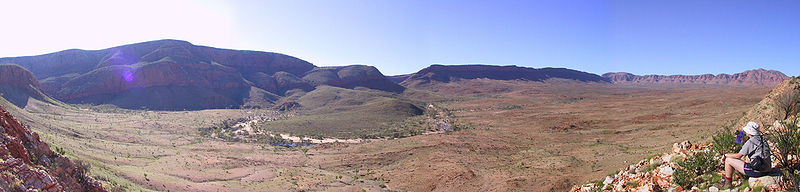
The western half of Ormiston Pound with Mount Giles in the foreground

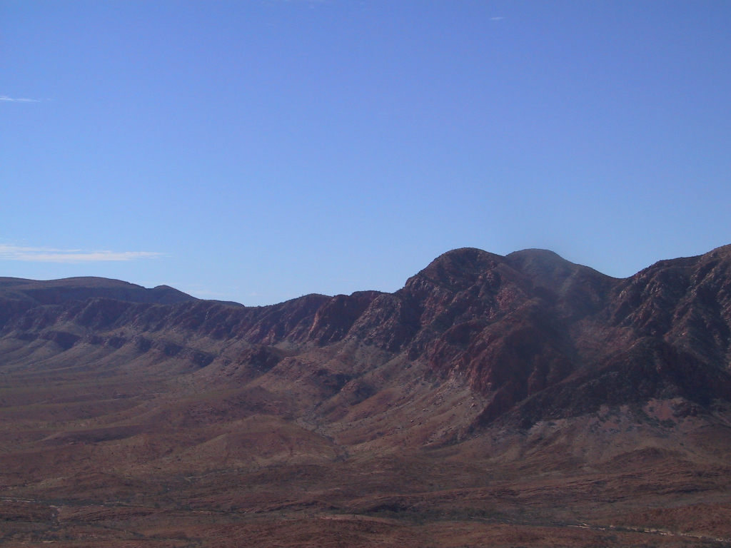
Ormiston Pound is a ring of mountains punctuating the MacDonnell Ranges, in the West MacDonnell National Park, approximately 135 kilometres west of Alice Springs[1] in the Northern Territory, Australia. It lies at roughly the half way point in the celebrated Larapinta Trail and offers spectacular views from its circumference of Mount Sonder, Gosses Bluff crater and the surrounding range.

The Pound, a ring of mountains, is dominated by Mount Giles, which forms its eastern boundary. The western boundary is formed by the Ormiston Gorge, a popular tourist destination.

The pound is accessible from a road in the west, which travels between Glen Helen and Alice Springs. There is a popular waterhole at the bottom near the gorge, as well as several lookouts. The entire pound ecompasses 46.55 square kilometres. The famous Finke River passes Ormiston Gorge in the west.

Contents

Citations

  1. ^ West MacDonnell National Park Fact Sheet, Parks and Wildlife Commission of NT

See also

External links

Panorama

Ormiston Pound panorama

Coordinates: 23°38′18″S 132°48′57″E / 23.6382°S 132.8158°E / -23.6382; 132.8158


Wikimedia Foundation. 2010.

Игры ⚽ Нужен реферат?

Look at other dictionaries:

  • Macdonnell Ranges — Blick über die West MacDonnell Ranges vom Larapinta Trail in der Nähe von Glen Helen Luftaufnah …   Deutsch Wikipedia

  • Mount Giles — See also Mount Giles (Antarctica) Mount Giles Mount Giles from the opposite side of Ormiston Pound in the south Elevation …   Wikipedia

  • MacDonnell Ranges — p1 MacDonnell Ranges Blick über die West MacDonnell Ranges vom Larapinta Trail in der Nähe von Glen Helen Höchster Gipfel …   Deutsch Wikipedia

  • Мак-Доннелл (горы) — Мак Доннелл Высшая точка: г. Зил (1531 м) Расположение: Австралия, Северная территория …   Википедия

  • Мак-Доннелл (хребет) — Мак Доннелл …   Википедия

  • West MacDonnell National Park — Infobox protected area of Australia | name = West MacDonnell National Park iucn category = II caption = locator x = 143 locator y = 95 nearest town or city = Alice Springs coordinates = coord|23|26|11|S|132|25|05|E|type:landmark region:AU area =… …   Wikipedia

  • MacDonnell Ranges — The MacDonnell Ranges of the Northern Territory, are a 644 km (400 mile) long series of mountain ranges located in the centre of Australia (coord|23|42|S|132|30|E|region:AU NT), and consist of parallel ridges running to the east and west of Alice …   Wikipedia

  • Larapinta Trail — Infobox Hiking trail Name= Larapinta Trail Photo=Larapinta Trail.jpg Caption=Along the Larapinta trail from a ridge of the West MacDonnell Ranges. Location=Northern Territory, Australia Length=Convert|223|km|mi|0 Start/End Points= Alice Springs,… …   Wikipedia

  • Mount Sonder — from the east Elevation 1,380 m (4,528 ft) AHD  …   Wikipedia

  • Parc national MacDonnell Ouest — La chaine MacDonnell Parc national MacDonnell Ouest Catégorie UICN II (parc national) Emplacement …   Wikipédia en Français

Share the article and excerpts

Direct link
Do a right-click on the link above
and select “Copy Link”