- Colden Common
-
Coordinates: 50°59′52″N 1°18′51″W / 50.9979°N 1.3141°W
Colden Common 
 Colden Common
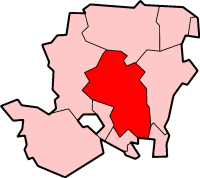
Colden Common shown within HampshirePopulation 3,681 (2001 census) OS grid reference SU475225 District City of Winchester Shire county Hampshire Region South East Country England Sovereign state United Kingdom Postcode district SO24 Dialling code 01962 Police Hampshire Fire Hampshire Ambulance South Central EU Parliament South East England UK Parliament Winchester Website Colden Common Parish Council List of places: UK • England • Hampshire Colden Common is a village and civil parish in Hampshire, England, lying just east of the M3 motorway between Winchester and Southampton. The nearest town is Eastleigh to the south west. Colden Common is in the Winchester District. To the east are the South Downs and to the west is the River Itchen. The village lies north of the hamlet of Fisher's Pond and the village of Fair Oak, and south of the village and parish of Twyford.
Contents
History
Colden Common became an independent civil parish (the lowest tier of local government) as recently as 1932 having initially been part of the parishes of Twyford and Owslebury. The Ecclesiastical Parish of Colden Common was formed in 1843[citation needed] with Holy Trinity Church built the following year and situated on the southern boundary of the parish.
In the sixteenth century the hamlet of Brambridge, then in Owslebury Parish, was granted by Bishop Fox to the newly-founded Corpus Christi College, Oxford. In 1609-10 Brambridge was granted to John Pierson, together with lands belonging to three recusants, Ursula Uvedale, Richard Bruning and Thomas Welles. Gilbert Welles was granted Brambridge by Charles I in 1636 and the property remained in the Welles family until the late eighteenth century, when it passed to a cousin, Walter Smythe. Walter Smythe's eldest daughter, Maria, became Mrs. Fitzherbert, and spent her childhood at Brambridge House. Maria is said to have lived for a while in a cottage at Colden Common when her first husband, Edward Weld, died. One of the rooms in the old Brambridge House was consecrated as a Roman Catholic chapel, but after the Catholic Relief Act a small chapel was built in the village and endowed by Mrs. Fitzherbert in about 1782[citation needed] v
Colden Common has grown significantly during the past 15 years with the addition of new housing stock.
Amenities
Colden Common has both Anglican and Methodist churches. There is a community centre located at the centre of the village. Colden Common used to have a Parish Hall until it was demolished in 2006, now there is a housing development on the site of the Parish Hall. Colden Common primary school is also at the heart of the village and is in the catchment area for Kings' School in Winchester.
The pubs within the boundaries of the village are: The Rising Sun, The Black Horse, The Queens Head, The Fishers Pond, and The Dog and Crook.
There are several shops in the parish including The Co-operative (brand).
Marwell Wildlife is situated just outside the parish boundaries, in the parish of Owslebury, though the main entrance is on the parish boundary, where the parishes meet.
Transport and road network
- There are two major roads in Colden Common—the B3354 and the B3335. The B3354 is known as the Main Road whilst it passes through the village, and the B3335 is called Highbridge Road. These two roads meet at a fork, just north of the village, outside the parish boundary. Within the parish boundary, the two roads are joined by Church Lane/Brambridge to the south and Spring Lane to the north.
- Southampton Airport is 5 miles south of the village.
- The M3 Motorway is 3 miles west of the village. Junction 11, which is north of the village, down the B3354 and B3335 roads, is in Twyford Down which is south of Winchester. The other junction, which is closer to the village, is Junction 12, which is west of the village, north of Eastleigh and near Allbrook; the junction is down the B3335 and A335 (Highbridge Road, Allbrook Hill (B3335) and Allbrook Way (A335)) (Tall vehicles can't go this way because there is a relatively low bridge in Allbrook, under the railway line to London); an alternative route to Junction 12 from Colden Common, but again for light and short vehicles only, is down Kiln Lane, Otterbourne Hill and Winchester Road through Otterbourne, There is a weak bridge over the River Itchen over Kiln Lane and also low bridge so heavy and tall vehicles can't go this way either, the only way for heavy or tall vehicles to get the M3 from Colden Common is via Junction 11.
Colden Common in the news
"The Tyre Pyre"
Colden Common hit the headlines when on 12 February 1974 a tyre depot (in a disused claypit in Vears Lane) caught fire. At 9:43 in the evening the local fire brigade received the first call. An estimated 65,000 to 70,000 tons of tyres were alight. The event was dubbed the "Tyre Pyre".[1]
Victor the Giraffe
In Marwell Zoological Park, on 20 September 1977, a giraffe called Victor did the splits and could not get up again. Despite desperate attempts to help Victor, he later died of a heart attack.[citation needed]
External links
References
Categories:- Civil parishes in Winchester
- Villages in Hampshire

Wikimedia Foundation. 2010.