- Malua Bay, New South Wales
-
Malua Bay
New South Wales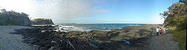
Panorama taken at Malua Bay.
 Malua Bay
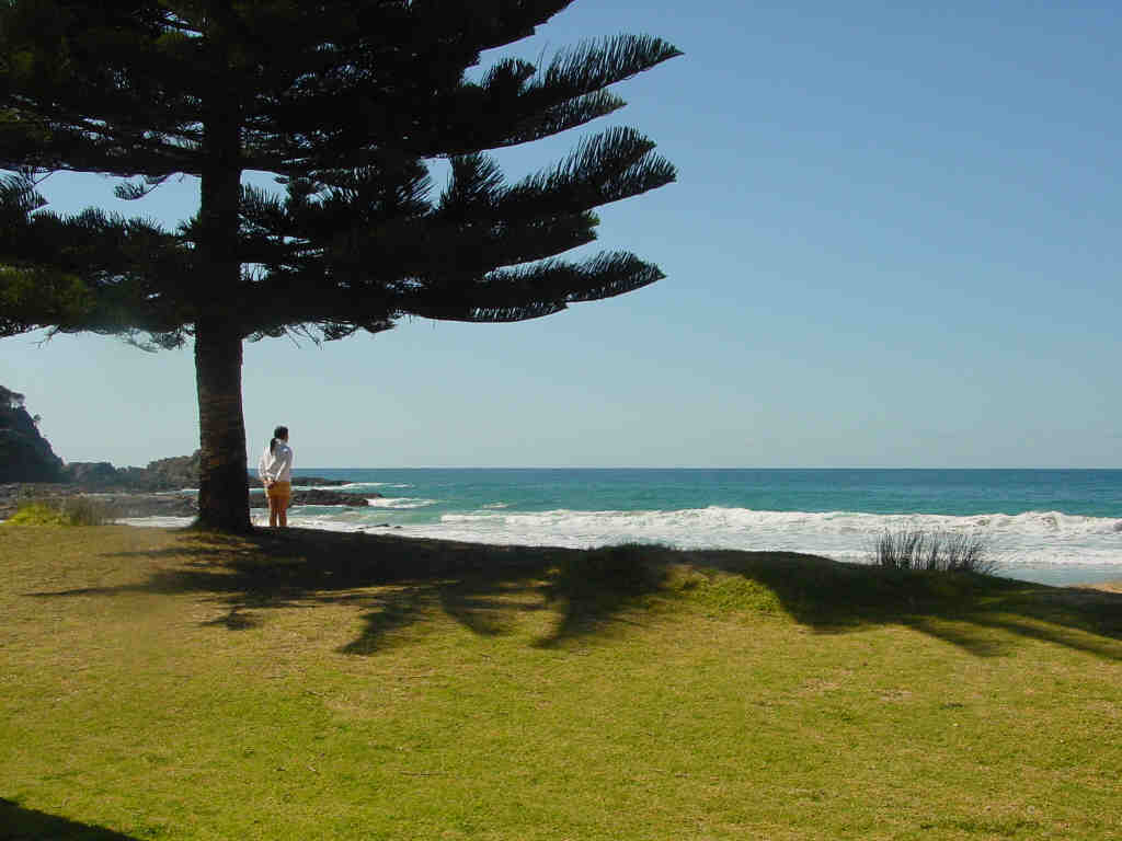
Population: 1,907 (2006 Census)[1] Postcode: 2536 LGA: Eurobodalla Shire State District: Bega Federal Division: Eden-Monaro Localities around Malua Bay: Lilli Pilli Mogo Malua Bay Tasman Sea Rosedale 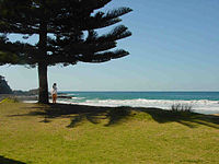 Watching the surf at Malua Bay
Malua Bay (postcode: 2536) is a locality in the South Coast region of the state of New South Wales, Australia. It is situated in the Eurobodalla Shire. At the 2006 census, Malua Bay had a population of 1,907 people.[1]
Malua Bay is located on George Bass Drive, about 15 minutes’ drive from the town of Batemans Bay. It is about 280 km (170 mi) south of Sydney, and 160 km east of Canberra via the Kings Highway.
Facilities
- Malua Bay website
- Batemans Bay Surf Life Saving Club
- Malua Bay Bowling & Recreation Club
- LJ Hooker Malua Bay
Transport
References
- ^ a b Australian Bureau of Statistics (25 October 2007). "Malua Bay (Urban Centre/Locality)". 2006 Census QuickStats. http://www.censusdata.abs.gov.au/ABSNavigation/prenav/LocationSearch?collection=Census&period=2006&areacode=UCL149800&producttype=QuickStats&breadcrumb=PL&action=401. Retrieved 26 October 2009.
South Coast, New South Wales Cities: Townships: Basin View · Batehaven · Batemans Bay · Bawley Point · Bega · Bemboka · Bermagui · Berry · Bodalla · Boydtown · Broulee · Callala Bay · Candelo · Cobargo · Congo · Culburra Beach · Dalmeny · Eden · Greenwell Point · Huskisson · Hyams Beach · Kianga · Kioloa · Lake Conjola · Malua Bay · Manyana · Merimbula · Milton · Mogo · Mollymook · Moruya · Mystery Bay · Narooma · Nelligen · Nerrigundah · Pambula · Pambula Beach · Potato Point · Pyree · Rosedale · Sanctuary Point · South Durras · St Georges Basin · Tathra · Tilba · Towamba · Tura Beach · Tuross Head · Ulladulla · Vincentia · Wandandian · Wolumla · WonboynLocal Government Areas: National Parks: Ben Boyd · Bournda · Biamanga · Budawang · Clyde River · Conjola · Deua · Eurobodalla · Gulaga · Jerrawangala · Kooraban · Mimosa Rocks · Monga · Morton · Mount Imlay · Murramarang · South East Forest · WadbilligaCoordinates: 35°42′S 150°11′E / 35.7°S 150.183°E
Categories:- Towns in New South Wales
- Towns in the South Coast, New South Wales
- Bays of New South Wales
- New South Wales geography stubs


Wikimedia Foundation. 2010.