- Nasushiobara, Tochigi
-
Nasushiobara
那須塩原市— City — 
FlagLocation of Nasushiobara in Tochigi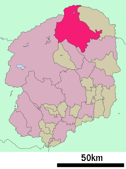

 Nasushiobara
Coordinates: 36°58′N 140°3′E / 36.967°N 140.05°ECoordinates: 36°58′N 140°3′E / 36.967°N 140.05°E Country Japan Region Kantō Prefecture Tochigi Government – Mayor Jin Kurikawa Area – Total 592.82 km2 (228.9 sq mi) Population (April 1, 2011) – Total 117,402 – Density 198.04/km2 (512.9/sq mi) Time zone Japan Standard Time (UTC+9) City symbols - Tree Pine - Flower Yatsuo Tsutsuji (Rhododendron pentaphyllum var. nikoense) Phone number 0287-62-7117 Address 108-2, Kyōkonsha, Nasushiobara-shi, Tochigi-ken
325-8501Website Nasushiobara City Nasushiobara (那須塩原市 Nasushiobara-shi) is a city located in northern Tochigi Prefecture, Japan. Nasushiobara is the northernmost city in the Kantō region of Japan, bordering Fukushima Prefecture to the north, as well as nationally famous Nikkō City and the town of Nasu within Tochigi.
The city was founded on January 1, 2005 with the merger of the former city of Kuroiso and the towns of Nishinasuno and Shiobara, both previously constituent towns of the separate Nasu District. In April 1, 2011, the city had an estimated population of 117,402, with a density of 198.04 persons per km² and an estimated 44,320 households. The total area is 592.82 km².
With three train stations on the JR East Tōhoku Main Line, as well as northern Tochigi's only shinkansen station (at Nasushiobara Station), Nasushiobara serves as a gateway for tourism in northern Tochigi. The neighboring town of Nasu, famous for its mountain hot springs (onsen) and for the Nasu Imperial Villa, can be accessed by bus from Nasushiobara's Kuroiso Station.[1] Within Nasushiobara, the onsen resort town of Shiobara is also a popular tourist destination. The city also claims northern Tochigi's only multiplex movie theater and outlet mall.
In 2010 an 18-year-old boy died after a beating by a group of teens in a local park. [2]
Contents
Transportation
Train Stations
Roads
The Tōhoku Expressway runs through Nasushiobara, with two interchanges within the city at the Nishinasuno Interchange and the Kuroiso Interchange. National Routes 4 and 400 also run through the city.
External links
 Media related to Nasushiobara, Tochigi at Wikimedia Commons
- Nasushiobara official site (English)
 Tochigi Prefecture
Cities - Ashikaga
- Kanuma
- Mooka
- Nasukarasuyama
- Nasushiobara
- Nikkō
- Ōtawara
- Oyama
- Sakura
- Sano
- Shimotsuke
- Tochigi
- Utsunomiya (capital)
- Yaita

Districts See also: Towns and villages by districtCategories:- Cities in Tochigi Prefecture
- Tochigi geography stubs


Wikimedia Foundation. 2010.