- Coombe Hill Canal
-
Coombe Hill Canal The frozen canal from the terminal wharf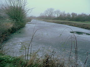
Date of act 1792 Date completed 1796 Date closed 1876 Start point Coombe Hill wharf End point Wainlode Hill Connects to River Severn Locks 1 Status unnavigable Coombe Hill Canal Legend

River Severn 
B4213 Haw Bridge 
Combe Hill wharf 

Apperley Ct to Wainlode Hill Road bridge 


Entrance lock (dis) River Severn The Coombe Hill Canal was a canal in Gloucestershire, south west England, that ran 2.75 miles (4.43 km)[1] from Coombe Hill Basin to the River Severn near Wainlode Hill. It opened in 1796 and closed 80 years later in 1876, after the only lock was damaged by flooding. The meadows around the canal are now a nature reserve managed by the Gloucestershire Wildlife Trust.
Contents
History
The canal was authorised in 1792 and was probably open in 1796.[2] The cost of construction was about £5000 and the completed canal could take barges of 60-70 tons.[2] It was meant to carry goods to Cheltenham but the local geography made that impossible.[3] There was a gap of nearly five miles between the canal and the town, so the canal was not as useful as it might have been.[3] In 1810 the canal was leased to a group of three men for £400 per annum.[2] In 1822 the canal was leased to a number of committeemen from the Worcester and Birmingham Canal.[2] In 1829 they renewed their lease for another 21 years at £500 per annum[2] and in 1844 offered to buy the canal for £8,750, but they later withdrew the offer.[4] In 1849 the lease was taken up by the Staffordshire and Worcestershire Canal, which was unable to make the canal pay, and when it surrendered the lease in 1867 cargo fell to 1,800 tons per annum.[4] The Coombe Hill Canal company then asked the engineer of the Gloucester and Sharpness Canal to provide a report.[4] The report took the view that the canal could not be made profitable and it would be best turned into an oyster bed.[4] Despite this the canal company tried to run the canal itself for a few years before selling it for £520 in 1871.[4]
The canal was resold for £1000 in 1873 [4] but in 1876 it was abandoned due to the new owners being unable to afford to repair flood damage to the lock that connected it to the River Severn.[3]
Status
In 1954 the canal was registered as a Site of special scientific interest.[5] In 2000 and 2004 the meadows around the middle of the canal were purchased by the Gloucestershire Wildlife Trust, which is restoring the wetland.[6] The canal is the home of a number of rare and uncommon beetle species, and of two species of fly that have not been found anywhere else in the UK.[5]
Points of interest
Point Coordinates
(Links to map resources)OS Grid Ref Notes Coombe Hill wharf 51°56′37″N 2°10′02″W / 51.9435°N 2.1673°W SO885272 Terminus Road bridge 51°56′14″N 2°13′12″W / 51.9372°N 2.2201°W SO849265 Entrance lock 51°56′09″N 2°13′22″W / 51.9357°N 2.2229°W SO847263 Jn with River Severn See also
Bibliography
References
- ^ Hadfield 1985, p. 322
- ^ a b c d e Hadfield 1985, pp. 147–149
- ^ a b c Green 1999, p. 36
- ^ a b c d e f Hadfield 1985, pp. 281–282
- ^ a b "Coombe Hill Canal SSSI notification" (PDF). Natural England. http://www.english-nature.org.uk/citation/citation_photo/1000789.pdf. Retrieved 2008-01-22.
- ^ "Coombe Hill Nature Reserve" (PDF). Gloucestershire Wildlife Trust. http://www.gloucestershirewildlife.co.uk/gwt/gwtlog.nsf/WEBARTICLES/DE52B6A3EFA1F1D48025742A0071AAD4/$FILE/CoombeHill.pdf?OpenElement. Retrieved 2010-07-29.
External links
Categories:- Canals in Gloucestershire
- Sites of Special Scientific Interest in Gloucestershire
- Canals linked to the River Severn
Wikimedia Foundation. 2010.