- Clarendon, South Australia
-
Clarendon
South Australia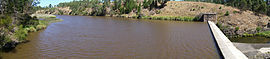
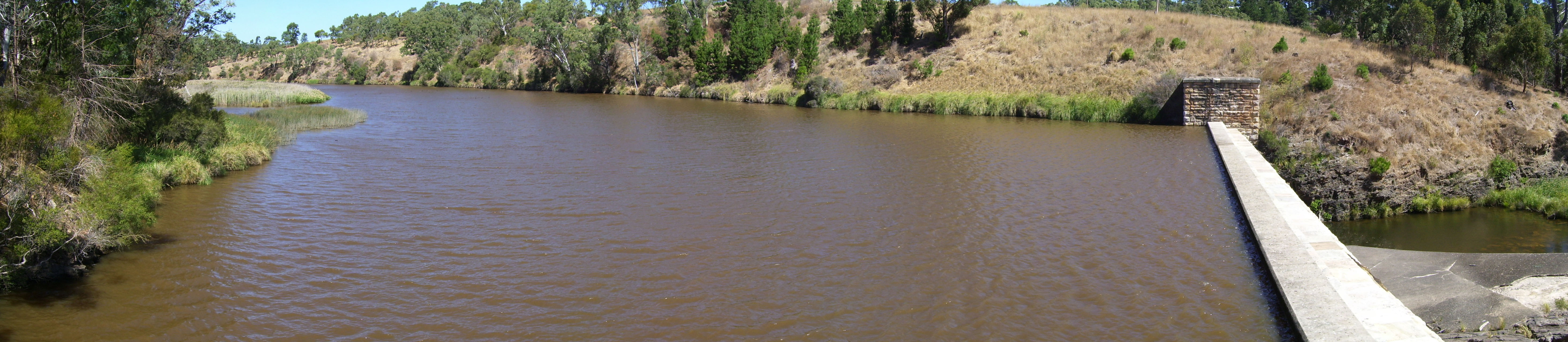
Clarendon Weir
 Clarendon
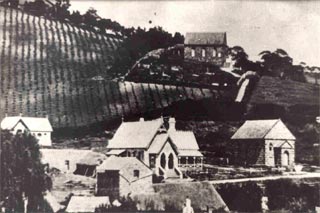
Population: 638 (2006 Census)[1] Established: 1840 Postcode: 5157 Elevation: 188 m (617 ft) Location: 35.5 km (22 mi) from Adelaide LGA: City of Onkaparinga Federal Division: Division of Mayo Suburbs around Clarendon: Happy Valley Chandlers Hill Cherry Gardens Woodcroft Clarendon Dorset Vale Onkaparinga Hills Blewitt Springs Kangarilla 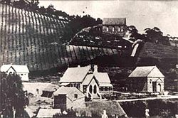 Vineyards and Police Station, date unknown
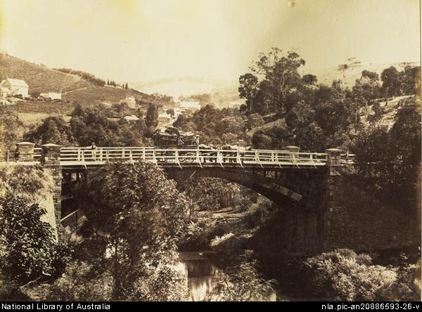
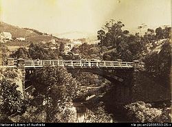 Clarendon bridge around 1869
Clarendon (pronounced /ˈklærəndən/) is a small town in the Adelaide Hills, about 30 km south of the Adelaide CBD.
The Clarendon Weir is located in the town area on the Onkaparinga River.
History
- See also: European settlement of South Australia
In 21 October 1840, Richard Blundell was granted the title to Section 801 Hundred of Noarlunga.[1] This was subsequently subdivided and by 1866 the town was described as a regional centre ‘in the midst of a fine agricultural district, where wheat, peas, and potatoes are largely grown’.[2]
Early trade was built around local vineyards and around proximity to the Onkaparinga River.[3] From 1894 to 1896 the Clarendon Weir was constructed, enhancing the local economy.
In the last 20 years a restoration programme has seen the town's heritage buildings restored.[4]
Notes
- ^ Australian Bureau of Statistics (25 October 2007). "Clarendon (State Suburb)". 2006 Census QuickStats. http://www.censusdata.abs.gov.au/ABSNavigation/prenav/LocationSearch?collection=Census&period=2006&areacode=SSC43331&producttype=QuickStats&breadcrumb=PL&action=401. Retrieved 2011-03-28.
External links
- Clarendon, South Australia is at coordinates 35°06′35″S 138°37′46″E / 35.109658°S 138.629351°ECoordinates: 35°06′35″S 138°37′46″E / 35.109658°S 138.629351°E
- ClarendonSA.com.au – Book detailing the historic buildings in the local area, written and illustrated by a local artist
Adelaide Hills, South Australia Major Townships Birdwood · Clarendon · Echunga · Gumeracha · Hahndorf · Littlehampton · Lobethal · Macclesfield · Meadows · Mount Barker · Mylor · Nairne · Oakbank · Stirling · WoodsideAttractions See also Suburbs of the City of Onkaparinga Aberfoyle Park · Aldinga · Aldinga Beach · Blewitt Springs · Chandlers Hill · Cherry Gardens · Christie Downs · Christies Beach · Clarendon · Coromandel East · Coromandel Valley · Darlington · Dorset Vale · Flagstaff Hill · Hackham · Hackham West · Happy Valley · Huntfield Heights · Ironbank · Kangarilla · Lonsdale · McLaren Flat · McLaren Vale · Maslin Beach · Moana · Morphett Vale · Noarlunga Centre · Noarlunga Downs · O'Halloran Hill · O'Sullivan Beach · Old Noarlunga · Old Reynella · Onkaparinga Hills · Port Noarlunga · Port Noarlunga South · Port Willunga · Reynella · Reynella East · Seaford · Seaford Heights · Seaford Meadows · Seaford Rise · Sellicks Beach · Sellicks Hill · Tatachilla · The Range · Whites Valley · Willunga · Willunga South · WoodcroftCategories:- Adelaide Hills, South Australia
- Towns in South Australia
- South Australia geography stubs

Wikimedia Foundation. 2010.