- 2002 Pacific typhoon season
Infobox hurricane season
Basin=WPac
Year=2002
Track=2002 Pacific typhoon season summary.jpg
First storm formed=January 12 ,2002
Last storm dissipated=December 11 ,2002
Strongest storm name=Fengshen
Strongest storm winds=100
Strongest storm pressure=920
Average wind speed=10
Total storms=26 official, 2 unofficial
Total hurricanes=15
Total intense=8 (unofficial)
Fatalities=311
five seasons=2000, 2001, 2002, 2003, 2004|}The 2002 Pacific typhoon season had no official bounds; it ran year-round in 2002, but mosttropical cyclones tend to form in the northwesternPacific Ocean between May and November. [http://www.typhoon2000.ph/garyp_mgtcs/may03sum.txt] These dates conventionally delimit the period of each year when most tropical cyclones form in the northwesternPacific Ocean .The scope of this article is limited to the Pacific Ocean, north of the equator and west of the
International Date Line . Storms that form east of the date line and north of the equator are called hurricanes; see2002 Pacific hurricane season . Tropical Storms formed in the entire west pacific basin are assigned a name by the Tokyo Typhoon Center. Tropical depressions in this basin have the "W" suffix added to their number. Tropical depressions that enter or form in the Philippine area of responsibility are assigned a name by thePhilippine Atmospheric, Geophysical and Astronomical Services Administration or PAGASA. This can often result in the same storm having two names.torms
In storm information below, wind-speed advisories differ from the
Joint Typhoon Warning Center (JTWC) to the JMA as the JTWC uses theUnited States criteria of 1-minute mean to designate maximum sustained winds, while the JMA uses the 10-minute mean wind criteria to designate tropical cyclone maximum sustained winds. This difference generally results in JTWC maximum winds appearing higher than the maximum winds described by the JMA for the same cyclone.Most of the 31 cyclones that developed this year either remained out at sea or were weak at landfall.Tropical Storm Tapah (Agaton)
Infobox Hurricane Small
Basin=WPac
Track=Tapah 2002 track.pngJanuary 12
Dissipated=January 13
10-min winds=40
1-min winds=50
Pressure=996South east ofYap onJanuary 8 http://www.typhoon2000.ph/garyp_mgtcs/jan02.txt] . TheJoint Typhoon Warning Centre , issued anTropical Cyclone Formation Alert , on the Developing system onJanuary 9 . OnJanuary 10 it was designated Agaton by PAGASA & 01W by the JTWC with an initial Wind Speed of 30kts . [ftp://ftp.met.fsu.edu/pub/weather/tropical/GuamStuff/2002/Jan/2002011015-WTPN.PGTW Jtwc 01W Advisory Number 1] TheJapan Meteorological Agency upgraded the System onJanuary 12 to Tropical Storm Tapah, which was submitted byMalaysia , and refers to a fresh waterCatfish . [ [http://www.jma.go.jp/jma/jma-eng/jma-center/rsmc-hp-pub-eg/tyname.html Japan Meteorological Agency | RSMC Tokyo-Typhoon Center | Names of Tropical Cyclones ] ] . Later that day Tapah reached its peak 1 minute wind speed of 50kts [ftp://ftp.met.fsu.edu/pub/weather/tropical/GuamStuff/2002/Jan/2002011215-WTPN.PGTW JTWC Advisory number 09] and started to weaken as Tapah was experiencing some shear with most of the deep convection sheared to the north of theLow Level Circulation Center . [ftp://ftp.met.fsu.edu/pub/weather/tropical/GuamStuff/2002/Jan/2002011303-WDPN.PGTW] It was downgraded to aTropical Depression on13 January [ftp://ftp.met.fsu.edu/pub/weather/tropical/GuamStuff/2002/Jan/2002011321-WTPN.PGTW] and then dissipated the next dayTyphoon Mitag (Basyang)
Infobox Hurricane Small
Basin=WPac
Track=Mitag 2002 track.pngFebruary 28
Dissipated=March 08
10-min winds=95
1-min winds=140
Pressure=930Typhoon Hagibis
Infobox Hurricane Small
Basin=WPac
Track=Hagibis 2002 track.pngMay 16
Dissipated=May 21
10-min winds=95
1-min winds=140
Pressure=935evere Tropical Storm Noguri (Espada)
Infobox Hurricane Small
Basin=WPac
Track=Noguri 2002 track.pngJune 8
Dissipated=June 10
10-min winds=60
1-min winds=85
Pressure=975Typhoon Rammasun (Florita)
Infobox Hurricane Small
Basin=WPac
Track=Rammasun 2002 track.pngJune 29
Dissipated=July 6
10-min winds=85
1-min winds=110
Pressure=945Typhoon Chataan (Gloria)
Infobox Hurricane Small
Basin=WPac
Track=Chataan 2002 track.pngJune 29
Dissipated=July 11
10-min winds=95
1-min winds=130
Pressure=930July 2 , 55 mph Tropical Storm Chataan passed throughChuuk , causing numerous mudslides on the island. The storm continued to the northwest, passing close toGuam before reaching a peak of 150 mph winds on the 7th. Chataan turned to the northeast, and became extratropical on the 11th. Chataan killed 55 and $59.8 million in damage between Chuuk and Guam, making it the first typhoon to hit the area sinceTyphoon Paka in 1997.Typhoon Halong (Inday)
Infobox Hurricane Small
Basin=WPac
Track=Halong 2002 track.pngJuly 7
Dissipated=July 16
10-min winds=85
1-min winds=135
Pressure=945evere Tropical Storm Nakri (Hambalos)
Infobox Hurricane Small
Basin=WPac
Track=Nakri 2002 track.pngJuly 9
Dissipated=July 12
10-min winds=50
1-min winds=40
Pressure=983Typhoon Fengshen
Infobox Hurricane Small
Basin=WPac
Track=Fengshen 2002 track.pngJuly 14
Dissipated=July 27
10-min winds=100
1-min winds=145
Pressure=920Tropical Storm Kalmaegi
Infobox Hurricane Small
Basin=WPac
Track=Kalmaegi 2002 track.pngJuly 20
Dissipated=July 21
10-min winds=35
1-min winds=30
Pressure=1002A Tropical Cyclone formation Alert was issued on July 19 for an Tropical Disturbance that was located east of the international Date Line. The Next day the Disturbance crossed the international date line and was classifed as a Tropical Depression by the JMA. The JMA then upgraded the depression to a tropical storm and named it Kalmaegi. The JTWC then issued their first advisory on Tropical Depression 15W (Kalmaegi). On July 21st Both agencies issued their final advisories on Kalmaegi as weak outflow and vertical wind sheer caused Kalmaegi to dissipate that day.
Typhoon Fung-wong (Kaka)
Infobox Hurricane Small
Basin=WPac
Track=Fung-Wong 2002 track.pngJuly 20
Dissipated=July 27
10-min winds=70
1-min winds=65
Pressure=960evere Tropical Storm Kammuri (Lagalag)
Infobox Hurricane Small
Basin=WPac
Track=Kammuri 2002 track.pngAugust 3
Dissipated=August 5
10-min winds=55
1-min winds=50
Pressure=980Tropical Depression 16W formed at 0600 UTC on the
August 2 as it tracked west-northwestward. The system turned northward the next day under the influence of a low to mid-level ridge over theEast China Sea . The depression turned back to the west shortly later as it became less influenced by the southwesterly monsoon flow. The system was consolidating, and six hours later, the cyclone was upgraded to Tropical Storm Kammuri. Soon afterwards, a surge in the southwest monsoon was pushing Kammuri on an east-northeast and the cyclone started to lift out of the monsoon trough. Kammuri made landfall with winds of 60 mph (50 kts) at 2200 UTC, just east ofShanwei . The storm began to accelerate ahead of an approaching mid-latitude low-pressure system and was downgraded to a tropical depression at midday as it moved farther inland. The surface cyclone dissipated over the mountainous coastline of eastern China and its remnants linked up with a cold front byAugust 5 .107 people died because of Kammuri and the direct economic losses are estimated at 4.219 billion yuan. The reported number of collapsed houses was 20,182. [ [http://australiasevereweather.com/cyclones/2003/summ0208.txt] Dead link|date=March 2008]
Typhoon Phanfone
Infobox Hurricane Small
Basin=WPac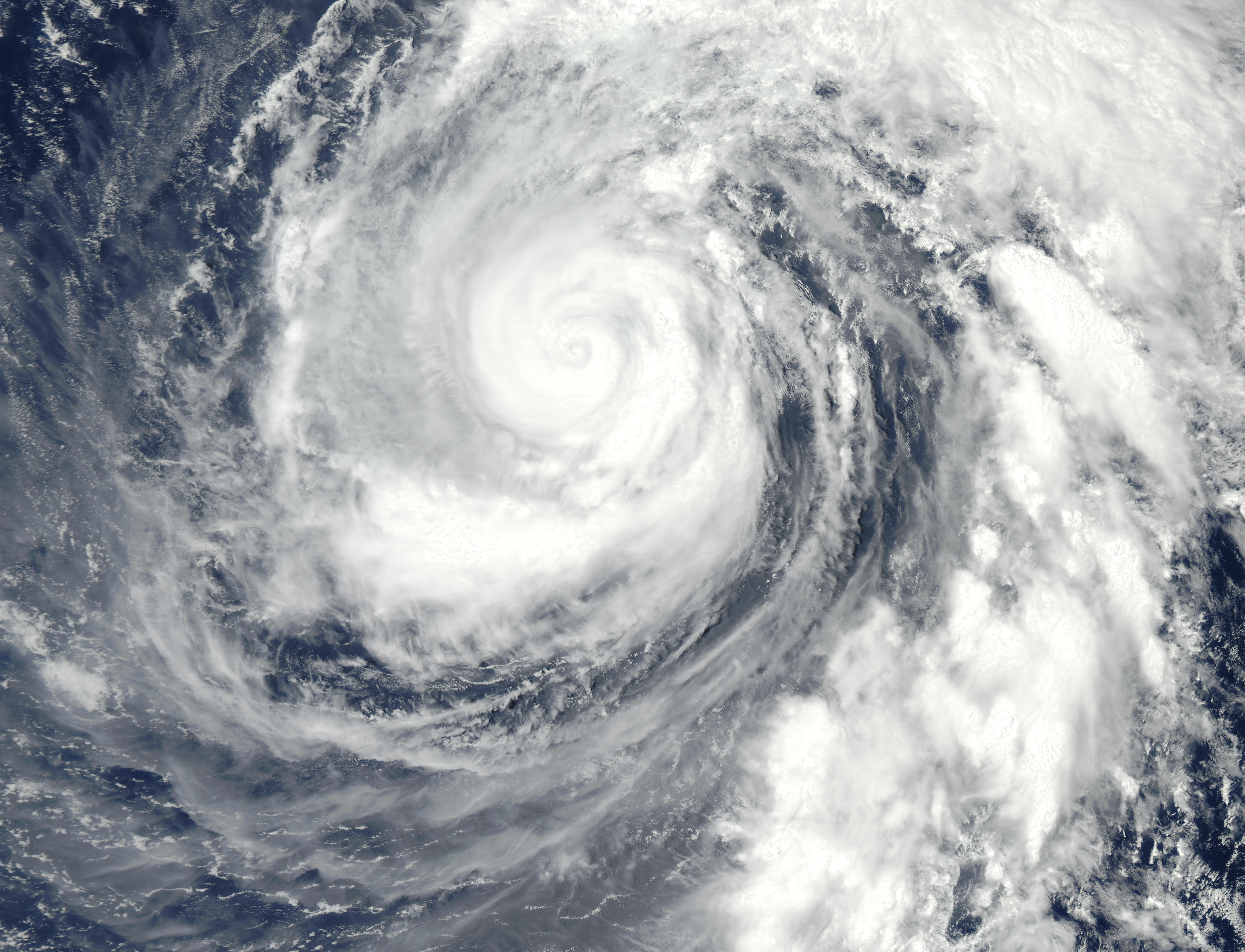
Track=Phanfone 2002 track.pngAugust 12
Dissipated=August 21
10-min winds=85
1-min winds=135
Pressure=940Tropical Storm Vongfong (Milenyo)
Infobox Hurricane Small
Basin=WPac
Track=Vongfong 2002 track.pngAugust 18
Dissipated=August 19
10-min winds=40
1-min winds=55
Pressure=985Thai Metrological Department (TMD) to be a redevelopment of Tropical Storm 18W (Milenyo). However when the JTWC started to issue advisories for this tropical depression they did not consider this depression to be a redevelopment of Tropical Storm 18W , instead they considered it to be a new Tropical Depression designating it Tropical Depression 20W.Early on
August 18 both the JTWC and the JMA upgraded the Tropical Depression to a Tropical Storm with the JMA designating it as Tropical Storm Vongfong. The name Vongfong was submitted by Maco China and is a wasp.Typhoon Rusa
Infobox Hurricane Small
Basin=WPac
Track=Rusa 2002 track.pngAugust 23
Dissipated=September 1
10-min winds=80
1-min winds=115
Pressure=950South Korea , it caused torrential flooding, causing 113 casualties (with 71 missing) and nearly $6 billion in damage (2002 USD). The name Rusa was retired after this year.Typhoon Sinlaku
Infobox Hurricane Small
Basin=WPac
Track=Sinlaku 2002 track.pngAugust 29
Dissipated=September 8
10-min winds=80
1-min winds=110
Pressure=950Typhoon Ele
Infobox Hurricane Small
Basin=WPac
Track=Ele 2002 track.pngAugust 30
Dissipated=September 9
10-min winds=90
1-min winds=115
Pressure=940August 27 and strengthened into Tropical Storm Ele six hours later. Despite the nearby presence of Alika, Ele developed rapidly and strengthened into a hurricane onAugust 28 . After contributing to the demise of Alika, Ele continued strengthening. It reached Category 2 intensity late onAugust 28 and became a major hurricane 6 hours later. Ele then crossed theInternational Date Line and became a typhoon. Typhoon Ele turned to the northwest after crossing the dateline and continued to strengthen. It reached Category 4 before turning north and weakening again. After briefly restrengthening back into a Category 4, the typhoon declined and turned to the northwest. Ele fell to a tropical storm onSeptember 7 , a depression onSeptember 9 , and dissipated shortly after that. Ele was of no threat to land.ref|CPHCEleTropical Storm Hagupit
Infobox Hurricane Small
Basin=WPac
Track=Hagupit 2002 track.pngSeptember 10
Dissipated=September 12
10-min winds=45
1-min winds=45
Pressure=990Tropical Storm Changmi
Infobox Hurricane Small
Basin=WPac
Formed=September 21
Dissipated=September 22
10-min winds=45
Pressure=985 [http://www.jma.go.jp/jma/jma-eng/jma-center/rsmc-hp-pub-eg/Besttracks/bst2002.txt]Tropical Storm Mekkhala
Infobox Hurricane Small
Basin=WPac
Track=Mekkhala 2002 track.pngSeptember 25
Dissipated=September 28
10-min winds=45
1-min winds=55
Pressure=990Typhoon Higos
Infobox Hurricane Small
Basin=WPac
Track=Higos 2002 track.pngSeptember 26
Dissipated=October 2
10-min winds=95
1-min winds=135
Pressure=930Tokyo, Japan onOctober 1 as a 90 mph typhoon, the 3rd strongest landfall here since 1945. 9 deaths and widespread flooding can be attributed to Higos.evere Tropical Storm Bavi
Infobox Hurricane Small
Basin=WPac
Track=Bavi 2002 track.pngOctober 9
Dissipated=October 13
10-min winds=55
1-min winds=70
Pressure=985evere Tropical Storm Maysak
Infobox Hurricane Small
Basin=WPac
Track=Maysak 2002 track.pngOctober 27
Dissipated=October 30
10-min winds=55
1-min winds=75
Pressure=980Typhoon Huko
Infobox Hurricane Small
Basin=WPac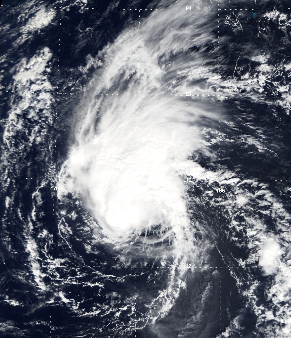
Track=Huko 2002 track.pngNovember 3
Dissipated=November 7
10-min winds=75
1-min winds=75
Pressure=985International Dateline . Hurricane Huko crossed the International Dateline early onNovember 3rd and in to the Japan Meteorological Agency's (JMA) Area of responsibilty who redesignated it as a Typhoon and assigned the international designation of TY 0224. After moving in to the western pacific it reached its peak 10 minute wind speeds of 75 knots. cite web|url=http://www.jma.go.jp/jma/jma-eng/jma-center/rsmc-hp-pub-eg/AnnualReport/2002/Text/Text2002.pdf|publisher=JMA|title=Typhoon Huko|accessdate=2008-08-29] Huko maintianed this strength for a couple of days as it moved towards the west. Huko movedwest-northwest ward over the sea north of theMarshall Islands and then onNovember 5th it then made a slow turn towards the North-west after passing to theNorth ofWake Island . Later that day Huko was downgraded to a severe tropical storm as it recurved towards the northeast and then into a Tropical storm early the next day. OnNovember 7th both the JTWC andJMA issued their final advisories on Huko as it had become Extra tropical. The remnant low of Huko moved back to in the Central Pacific later that day and continued moving westwards. cite web|url=http://www.prh.noaa.gov/cphc/summaries/2002.php#huko|publisher=CPHC|title=Hurricane Huko|accessdate=2008-08-26] cite web|url=http://metocph.nmci.navy.mil/jtwc/atcr/2002atcr/2002atcr.pdf|publisher=JTWC|title=Hurricane Huko|accessdate=2008-08-29]Typhoon Haishen
Infobox Hurricane Small
Basin=WPac
Track=Haishen 2002 track.pngNovember 20
Dissipated=November 25
10-min winds=85
1-min winds=95
Pressure=955Typhoon Pongsona
Infobox Hurricane Small
Basin=WPac.jpg)
Track=Pongsona 2002 track.pngDecember 3
Dissipated=December 11
10-min winds=90
1-min winds=130
Pressure=940United States .cite web|author=Federal Emergency Management Agency|year=2003|title=Super Typhoon Pongsona: The First 100 Days Over $300 Million In Disaster Relief And Assistance|accessdate=2007-07-27|url=http://www.fema.gov/news/newsrelease.fema?id=2240] The name "Pongsona" was contributed byNorth Korea and is the Korean name for the garden balsam. Pongsona developed out of an area of disturbed weather onDecember 2 , and steadily intensified to reach typhoon status onDecember 5 . OnDecember 8 it passed through Guam and theNorthern Marianas Islands while near its peak 10-min winds of 175 km/h (110 mph). It ultimately turned to the northeast, weakened, and became extratropical onDecember 11 .Considered by some to be the worst typhoon to have struck
Guam , Pongsona produced strong wind gusts peaking at 278 km/h (173 mph), which left the entire island without power and destroyed about 1,300 houses. With strong building standards and experience from repeated typhoon strikes, there were no fatalities directly related to Pongsona, though there was one indirect death from flying glass. Damage on the island totaled over $700 million (2002 USD, $800 million 2007 USD), making Pongsona among the five costliest typhoons on the island. The typhoon also caused heavy damage on Rota and elsewhere in theNorthern Marianas Islands , and as a result of its impact, the name was retired.Other storms
These systems were not officially named as tropical storms by the JMA, although the JMA might have monitored them as tropical depressions. They were, however, designated as tropical cyclones by the Philippines (PAGASA), China (CMA), and/or the Joint Typhoon Warning Center (JTWC).
Tropical Depression 03W (Caloy)
Infobox Hurricane Small
Basin=WPac
WarningCenter=PAGASA
Track=3-W 2002 track.pngMarch 18
Dissipated=March 25
10-min winds=30
1-min winds=30
Pressure=1000Mindanao Philippines . Later that day the JTWC upgraded the disturbance to a Tropical Depression and assigned the number 03W to it. PAGASA then issued their first advisory on Tropical depression Caloy the next day as it approached the Mindanao on the 21st, the center then turned toward the west-northwest, crossing the Philippine islands of Bohol, Cebu, Negros and Panay before moving into the South China Sea. After crossing Tropical depression Caloy, then moved northwest across the South China Sea, towards the Vietnamese coast with both the JTWC issuing their final advisory onMarch 25th . When Tropical Depression 03W crossed the southern and centralPhilippines onMarch 21 and 22nd, it caused 35 casualties and $1.7 million in damage.Tropical Depression 04W
Infobox Hurricane Small
Basin=WPac
Track=4-W 2002 track.pngApril 05
Dissipated=April 06
1-min winds=30
Pressure=1000On April 5th a Tropical Cyclone Formation Alert was issued on a tropical disturbance which was located south east of Wake Island. Later that day the JTWC upgraded it to Tropical Depression 04W with peak winds of 30kts. On April 7th the JTWC declared the depression Extra tropical and released their final advisory on the depression.
Tropical Depression 06W (Dagul)
Infobox Hurricane Small
Basin=WPac
WarningCenter=PAGASA
Track=6-W 2002 track.pngMay 27
Dissipated=May 30
10-min winds=30
1-min winds=30
Pressure=1002May 27 by the JTWC on a developing system in the South China sea. Early the next day both PAGASA, and JTWC upgraded the system with the JTWC designating it as Tropical Depression 06W whilst PAGASA named the system Dagul. Dagul moved slowly north east towards Taiwan. The JTWC issued its final advisory on Tropical depression 06W the next day as it had become Extra tropical however PAGASA continued to monitor Dagul for another day until it made landfall in Taiwan onMay 30 .Tropical Storm 13W (Juan)
Infobox Hurricane Small
Basin=WPac
WarningCenter=PAGASA
Track=13-W 2002 track.pngJuly 17
Dissipated=July 23
10-min winds=30
1-min winds=35
Pressure=997Mindanao in the Philippines. Moving west-northwestward at 6 kts, the depression accelerated to 12 kts and turned north-northwestward towards the central Philippines. Tropical Depression Juan then crossed Samar early on the 19 July with the Maximum Sustained Winds estimated at 30 kts. On 20 July the JTWC Upgraded Juan to Tropical Storm Status with peak wind speeds of 35kts. Within their next advisory the JTWC downgraded Juan to tropical depression status. Tropical Depression Juan then moved over Luzon Island. The system then moved into the South China Sea on the 22 July. However as the LCCC and the convection were dissipating the JTWC issued their final warning early that day. However PAGASA continued to issue advisories on Juan’s Remnants for another day before releasing their final advisory on July 23. Damage in the Philippines was estimated at $25 Million with Juan causing 18 Deaths.Tropical Depression 17W
Infobox Hurricane Small
Basin=WPac
Track=17-W 2002 track.pngAugust 05
Dissipated=August 06
1-min winds=25
Pressure=999South-east of Japan, onAugust 5 , by the JTWC. The disturbance was upgraded to Tropical Depression 17W later that day with peak wind speeds of 25 knots. However the depression did not develop any further, and the final advisory was released later that day due to Moderate vertical shear, a weak outflow, and coolsea surface temperature s. [ [https://metocph.nmci.navy.mil/jtwc/atcr/2002atcr/2002atcr.pdf cover ] ]Tropical Storm 18W (Milenyo)
Infobox Hurricane Small
Basin=WPac
WarningCenter=PAGASA
Track=18-W 2002 track.pngAugust 10
Dissipated=August 14
10-min winds=30
1-min winds=35
Pressure=997August 8 . ATropical Cyclone Formation Alert was issued onAugust 10 , by TheJoint Typhoon Warning Center (JTWC), who upgraded the disturbance to Tropical Depression 18W later that day when they issued their first advisory. PAGASA then issued their first warning on the depression, designating it as Milenyo. The JTWC then upgraded the depression to Tropical Storm status onAugust 12 , However neither PAGASA nor the JMA upgraded the system to Tropical Storm status as they both analysed the depression as having peak winds of 30 kts. The JTWC then downgraded the system to a tropical depression early onAugust 13 due to it having its Low Level Circulation Centre exposed. Later that day tropical depression 18W (Milenyo) made landfall onLuzon ,Philippines ; there were no casualties reported though. The JTWC issued their last advisory onAugust 13 after the depression made landfall.Tropical Depression 27W
Infobox Hurricane Small
Basin=WPac
Track=27-W 2002 track.pngOctober 16
Dissipated=October 20
1-min winds=30
Pressure=1000October 16 , a tropical disturbance formed about 700 nautical miles northeast ofSaipan . Later that day, aTropical Cyclone Formation Alert was issued by theJoint Typhoon Warning Center {JTWC}. The next day the JTWC designated the system Tropical Depression 27W. However, it failed to develop any further and dissipated onOctober 19 due to a weak outflow and moderate vertical shear.Tropical Depression 28W
Infobox Hurricane Small
Basin=WPac
Track=28-W 2002 track.pngOctober 17
Dissipated=October 19
1-min winds=30
Pressure=1000International Dateline .citeweb|last=|first=|title=Summary of Western North Pacific and North Indian Ocean Tropical Cyclones|work=JTWC|publisher=Joint Typhoon Warning Center|date=| url=https://metocph.nmci.navy.mil/jtwc/atcr/2002atcr/contents/contents.html|format=|doi=|accessdate =2007-12-17] Later that day theJoint Typhoon Warning Center Issued aTropical Cyclone Formation Alert on the developing system. cite web|last=|first=|title=Tropical Cyclone Formation Alert|work=JTWC|publisher=Joint Typhoon Warning Center|date=2002-10-17|url=ftp://ftp.met.fsu.edu/pub/weather/tropical/GuamStuff/2002/Oct/2002101719-WTPN.PGTW|format=| doi=| accessdate=2007-12-17] It was then designated as Tropical Depression 28W the next day cite web|last=|first=|title=Tropical Depression 28W Warning Nr 1|work=JTWC|publisher=Joint Typhoon Warning Center|date=2002-10-18 |url=ftp://ftp.met.fsu.edu/pub/weather/tropical/GuamStuff/2002/Oct/2002101803-WTPN.PGTW|format=|doi =|accessdate=2007-12-17] . However it did not develop any further and quickly dissipated due to shear.torm names
Western North Pacific tropical cyclones are named by the RSMC Tokyo-Typhoon Center of the
Japan Meteorological Agency . Names are selected from the following sequential list, there is no annual list. Names were contributed by 13 members of theESCAP/WMO Typhoon Committee , except forSingapore . The 13 nations or territories, along withMicronesia , each submitted 10 names, which are used in alphabetical order by the English name of the country. The first storm of 2002 was named Tapah and the final one was named Pongsona.Two central pacific storms, Hurricane Ele 02C and Hurricane Huko 03C, crossed into this basin. They became Typhoon Ele and Typhoon Huko keeping their original name and "C" suffix.
Philippines The
Philippine Atmospheric, Geophysical and Astronomical Services Administration (PAGASA) uses its own naming scheme for tropical cyclones within its area of responsibility. Lists are recycled every four years.Retirement
The names Chataan, Rusa, and Pongsona were retired after this year.They were replaced with Matmo, Nuri, and Noul.
ee also
*
List of Pacific typhoon seasons
*2002 Pacific hurricane season
*2002 Atlantic hurricane season
*2002 North Indian Ocean cyclone season
*South-West Indian Ocean cyclone seasons: 2001-02, 2002-03
*Australian region cyclone seasons: 2001-02, 2002-03
*South Pacific cyclone seasons: 2001-02, 2002-03References
External links
* [http://www.jma.go.jp/jma/jma-eng/jma-center/rsmc-hp-pub-eg/AnnualReport/2003/Text/Text2003.pdf 2002 Annual Report from RSMC Tokyo-Typhoon Center]
* [http://www.typhoon2000.ph Typhoon2000 Philippine typhoon website] .
* [http://www.typhoon2000.ph/plotting/PhilippineTyphoonChart.gifPhilippine Area of Responsibility] .
* [https://metocph.nmci.navy.mil/jtwc.html Joint Typhoon Warning Center] .
* [http://www.weather.gov.hk/informtc/sound/tc_pronunciatione.htm Meaning of Tokyo Typhoon Centre names] .
* [http://www.okinawatimes.co.jp/eng/20020907.html Trail of a Terrible Typhoon]
Wikimedia Foundation. 2010.