Amaroo, Australian Capital Territory
- Amaroo, Australian Capital Territory
Infobox Australian Place | type = suburb
name = Amaroo
city = Canberra
state = Australian Capital Territory
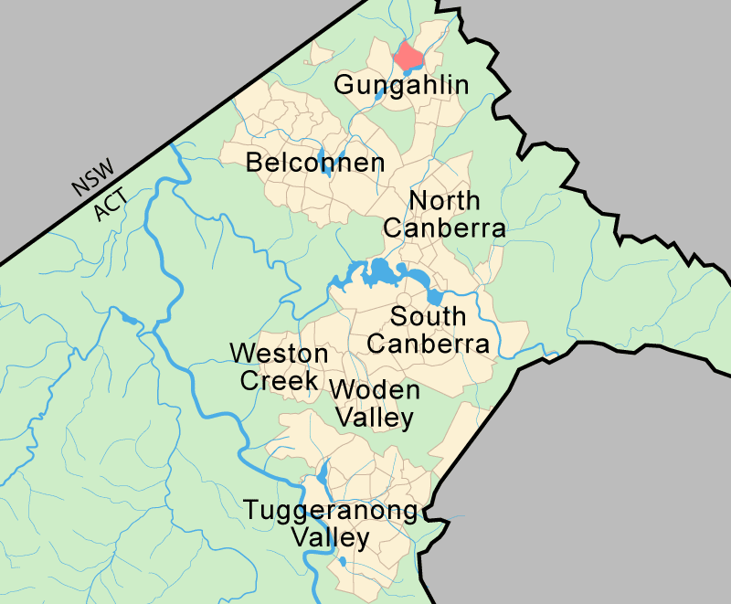
lga = Gungahlin
ACTgov = Molonglo
fedgov = Fraser
est = 1994
postcode = 2914
pop = 3,232 (2001 census)
propval = $355,000 (2005) [http://allhomes.com.au/c/ah?a=uisu&i=10]
near-nw =
near-n =
near-ne = Bonner
near-w = Ngunnawal
near-e = Forde
near-sw =
near-s = Gungahlin
near-se = Gungahlin
Amaroo is a suburb in the Canberra, Australia district of Gungahlin. The postcode is 2914. It was gazetted on 18 October 1991. Streets are named after Australian rivers and lakes.
It is next to the suburbs of Ngunnawal, Gungahlin, Moncrieff, Forde, Bonner and Jacka. The suburb is bounded by Mirrabei Drive, Yerrabi pond, and Horse Park Drive. It has two schools next to each other, Amaroo School and Good Shepherd Catholic primary.
Geology
Amaroo is underlaid by the Canberra Formation from the late middle Silurian age.The area was studied in more detail than many other parts of Canberra by J P Ceplecha from the ANU in 1971.Most of Amaroo is based on slaty shale and mudstone.A 125m wide band oriented north north east of dacite and quartz andesite is in the centre. A patch of
tuff is under the south west corner.
The structure of the rock has been determined by folding. The folds are aligned north-north east and plunge to the south south west. There are two short faults in the mid south that are marked on the surface by quartz. A long fault runs parallel with the folding axis along the south east side along Ginninderra Creek determining its orientation. [Henderson G A M and Matveev G, Geology of Canberra, Queanbeyan and Environs 1:50000 1980.]
References
Wikimedia Foundation.
2010.
Look at other dictionaries:
Moncrieff, Australian Capital Territory — Moncrieff Canberra, Australian Capital Territory Postcode: 2914 … Wikipedia
Ngunnawal, Australian Capital Territory — Ngunnawal Canberra, Australian Capital Territory Population: 8,9 … Wikipedia
Jacka, Australian Capital Territory — Infobox Australian Place | type = suburb name = Jacka city = Canberra state = Australian Capital Territory lga = Gungahlin est = 1991 postcode = 2913 pop = propval = near nw = near n = near ne = near w = Taylor near e = Bonner near sw = Moncrieff … Wikipedia
Gungahlin, Australian Capital Territory — Infobox Australian Place | type = suburb name = Gungahlin city = Canberra state = Australian Capital Territory lga = Gungahlin ACTgov = Molonglo fedgov = Fraser est = 1998 postcode = 2912 pop = propval = $344,000 (2005) [… … Wikipedia
Mitchell, Australian Capital Territory — Mitchell Canberra, Australian Capital Territory Population: 4 (2006 … Wikipedia
Bonner, Australian Capital Territory — Infobox Australian Place | type = suburb name = Bonner city = Canberra state = Australian Capital Territory lga = Gungahlin ACTgov = Molonglo fedgov = Fraser est = postcode = 2914 pop = propval = near nw = near n = near ne = near w = near e =… … Wikipedia
Forde, Australian Capital Territory — Infobox Australian Place | type = suburb name = Forde city = Canberra state = Australian Capital Territory lga = Gungahlin ACTgov = Molonglo fedgov = Fraser est = postcode = 2914 pop = propval = near nw = Bonner near n = Bonner near ne = near w … Wikipedia
Nicholls, Australian Capital Territory — Nicholls Canberra, Australian Capital Territory Population: 6,990 ( … Wikipedia
Holt, Australian Capital Territory — Infobox Australian Place | type = suburb name = Holt state = Australian Capital Territory city = Canberra caption = lga = Belconnen postcode = 2615 est = 1972 propval = AU$275,000 (2005) [http://allhomes.com.au/c/ah?a=uisu i=382] pop = ACTgov =… … Wikipedia
Crace, Australian Capital Territory — Crace Canberra, Australian Capital Territory Population: 0 Established: 2009 Postcode … Wikipedia