- 2007 Pacific typhoon season
Infobox hurricane season
Basin=WPac
Year=2007
First storm formed=March 31 ,2007
Last storm dissipated=November 28 ,2007
Strongest storm name=Sepat
Strongest storm pressure=910
Strongest storm winds=110
Average wind speed=10
Total depressions=29
Total storms=24
Total hurricanes=14
Total intense=4 (unofficial)
Fatalities=At least 160
Da
five seasons=2005, 2006, 2007, 2008, 2009|}The 2007 Pacific typhoon season had no official bounds; it ran year-round in 2007, but most
tropical cyclone s tend to form in the northwesternPacific Ocean between May and November. [http://www.typhoon2000.ph/garyp_mgtcs/may03sum.txt] These dates conventionally delimit the period of each year when most tropical cyclones form in the northwestern Pacific Ocean.The scope of this article is limited to the Pacific Ocean, north of the
equator and west of theinternational date line . Storms that form east of the date line and north of the equator are called hurricanes; see2007 Pacific hurricane season . Tropical Storms formed in the entire West Pacific basin are assigned a name by theJapan Meteorological Agency (JMA). Tropical depressions in this basin have the "W" suffix added to theirJoint Typhoon Warning Center identifier. In addition, thePhilippine Atmospheric, Geophysical and Astronomical Services Administration (PAGASA) assigns names to tropical cyclones (including tropical depressions) that enter or form in the Philippine area of responsibility. These names, however, are not in common use outside of the Philippines. This can also result in the same storm having 2 names.This was an average year by number of storms, but this season was unusual for the lack of overall impact this year. Only 160 deaths and about 1.6 billion dollars (USD) in damage are attributted to the whole season, which is lower than usual, and only 1 Category 5 developed this year, which was the lowest number since none developed in 1950, although it was tied with some other years.
torms
In storm information below, please note that on the following list, storms are listed by Tropical Depression number, and therefore Mitag (23W), which is on the naming list before Hagibis (24W), is listed after Hagibis, having been the later storm to form, despite being the earlier to attain Tropical Storm status. Please also note that wind-speed advisories differ from the
Joint Typhoon Warning Center (JTWC) to the JMA as the JTWC uses theUnited States criteria of 1-minute mean to designate maximum sustained winds, while the JMA uses the 10-minute mean wind criteria to designate tropical cyclone maximum sustained winds. This difference generally results in JTWC maximum winds appearing higher than the maximum winds described by the JMA for the same cyclone.Typhoon Kong-rey
Infobox Hurricane Small
Basin=WPac
Track=Kong-rey 2007 track.pngApril 1
Dissipated=April 6
10-min winds=80
1-min winds=100
Pressure=960March 26 , the JTWC identified a broad area of low pressure in the Western North Pacific. It moved west-northwestward over the next few days, slowly gaining organization. According to theJapan Meteorological Agency , it became a tropical depression onMarch 30 . The next day, theJoint Typhoon Warning Center issued aTropical Cyclone Formation Alert due to an increased consolidation of the low-level circulation of the system. The JTWC issued its first warning on Tropical Depression 01W late that evening local timeJTWC . [ftp://ftp.met.fsu.edu/pub/weather/tropical/GuamStuff/2007033115-WTPN.PGTW "TROPICAL DEPRESSION 01W WARNING NR 001"] . March 31, 2007.] . As it continued to strengthen, the JTWC upgraded it to a tropical storm,JTWC . [ftp://ftp.met.fsu.edu/pub/weather/tropical/GuamStuff/2007033121-WTPN.PGTW "TROPICAL STORM 01W (KONG-REY) WARNING NR 002"] . March 31, 2007.] the first of the season. The JMA followed suit, and named the system Kong-rey.JTWC via Webcitation.org: [http://www.webcitation.org/5NzuYyYjM "Pacific-NW: Tropical Storm 0701 Kong-rey (0701) Upgraded From Tropical Depression"] . March 31, 2007] The name was submitted by Cambodia, and refers to a character in a Khmer legend, which is also the name of a mountain.Japan Meteorological Agency . RSMC Tokyo-Typhoon Center. [http://www.jma.go.jp/jma/jma-eng/jma-center/rsmc-hp-pub-eg/tyname.html List of names for tropical cyclones adopted by the Typhoon Committee for the western North Pacific Ocean and the South China Sea] .]Kong-rey continued to organize and intensified into a severe tropical storm early the next morning local time. [http://www.webcitation.org/5Nzufwag5 WebCite query result ] ] The JTWC then upgraded it to a typhoon on
April 2 .ftp://ftp.met.fsu.edu/pub/weather/tropical/GuamStuff/2007040203-WTPN.PGTW] As the system took a more poleward track towards theNorthern Mariana Islands , theNational Weather Service office inGuam noted that damaging winds were now not expected on the island. Elsewhere in the Marianas, preparations were made and flights were cancelled in anticipation of the typhoon. Kong-rey passed through the islands in the early hours of the morning onApril 3 local time. The JMA upgraded Kong-rey to a typhoon later that afternoon, [http://www.webcitation.org/5NzurAe5Y WebCite query result ] ] as it developed an eye. It strengthened slightly further before encounteringwind shear and coldersea surface temperature s and was downgraded back to a severe tropical storm onApril 4 . As Kong-rey accelerated towards the northeast, it began undergoingextratropical transition early onApril 5 and the JTWC issued its final warning.ftp://ftp.met.fsu.edu/pub/weather/tropical/GuamStuff/2007040503-WTPN.PGTW] The JMA issued its final warning on the morning ofApril 6 after it had completed extratropical transition. No casualties or major damage was reported.Typhoon Yutu (Amang)
Infobox Hurricane Small
Basin=WPac
Track=Yutu 2007 track.pngMay 17
Dissipated=May 23
10-min winds=95
1-min winds=130
Pressure=935May 15 , a significant consolidation of organisation in a tropical disturbance located south-southeast ofGuam led toDvorak technique numbers equating to a windspeed of 45 kt from theAir Force Weather Agency . Later that day, theJapan Meteorological Agency designated the system a tropical depression, and theJoint Typhoon Warning Center issued aTropical Cyclone Formation Alert . [ [http://www.webcitation.org/5OsVeLOvw "TROPICAL CYCLONE FORMATION ALERT 151021Z MAY 07"] via Webcitation.org] The next day, the JMA began issuing full advisories on the tropical depression. It developed slowly, resulting in a reissuance of the TCFA later that day. In this second TCFA, the JTWC noted "an increasingly well-defined" low-level circulation centre. [ [http://www.webcitation.org/5OsVVNnd6 "TROPICAL CYCLONE FORMATION ALERT 161021Z MAY 07"] via Webcitation.org] The JTWC upgraded the system to Tropical Depression 02W at 1200 UTC, based on satellite intensity estimates andQuikSCAT . [JTWC. [ftp://ftp.met.fsu.edu/pub/weather/tropical/GuamStuff/2007051615-WDPN.PGTW "PROGNOSTIC REASONING FOR TROPICAL DEPRESSION 02W WARNING NR 01"] ]The JMA designated 02W as Tropical Storm Yutu early on
May 17 , as the system strengthened further. The name 'Yutu' was contributed byChina , and refers to a rabbit in a Chinesefable . The JTWC followed suit 3 hours later, upgrading the system to Tropical Storm 02W as it moved quickly westwards, heading forYap . Tropical storm warnings and watches were put in place for most of the Yap State, but were later cancelled after Yutu passed through quickly.It then took a northwesterly turn, entered the PAGASA area of responsibility on
May 18 as it reached severe tropical storm strength, [ [http://www.webcitation.org/5OvItpCgk WebCite query result ] ] and was named "Amang". Later that day, the JTWC upgraded it to a typhoon, and identified a "distinct eye feature", [ftp://ftp.met.fsu.edu/pub/weather/tropical/GuamStuff/2007051815-WDPN.PGTW] and the JMA upgraded the severe tropical storm to a typhoon at 1800 UTC as it continued to intensify. It began to recurve towardsIwo Jima , undergoingrapid intensification , [ [http://www.webcitation.org/5OxtdN1za WebCite query result ] ] with "enhanced poleward outflow and low verticalwind shear ". [ftp://ftp.met.fsu.edu/pub/weather/tropical/GuamStuff/2007052015-WDPN.PGTW] It reached its peak on the evening ofMay 20 , as a strong Category 4-equivalent typhoon, just short of becoming a super typhoon.Despite moving into cooler waters, its strong poleward outflow helped it to maintain a high intensity, while carrying a 20 nautical mile-wide eye, on the early morning of
May 21 . [ [http://www.webcitation.org/5OzUSAWvv WebCite query result ] ] It then began to gradually weaken, passing overOkinotorishima and near Iwo Jima that day as it sped off to the northeast. Maximum winds on Iwo Jima occurred around 1500 UTC that day, with 66 kt (122 km/h, 76 mph) sustained gusting to 104 kt (193 km/h, 120 mph), when a minimum central pressure of 976 hPa was recorded. [ [http://www.webcitation.org/5P0yVygEO WebCite query result ] ] It then startedextratropical transition , and the JTWC issued its final warning on the morning ofMay 22 . The JMA issued its last advisory after extratropical transition completed a day later.Tropical Storm Toraji
Infobox Hurricane Small
Basin=WPac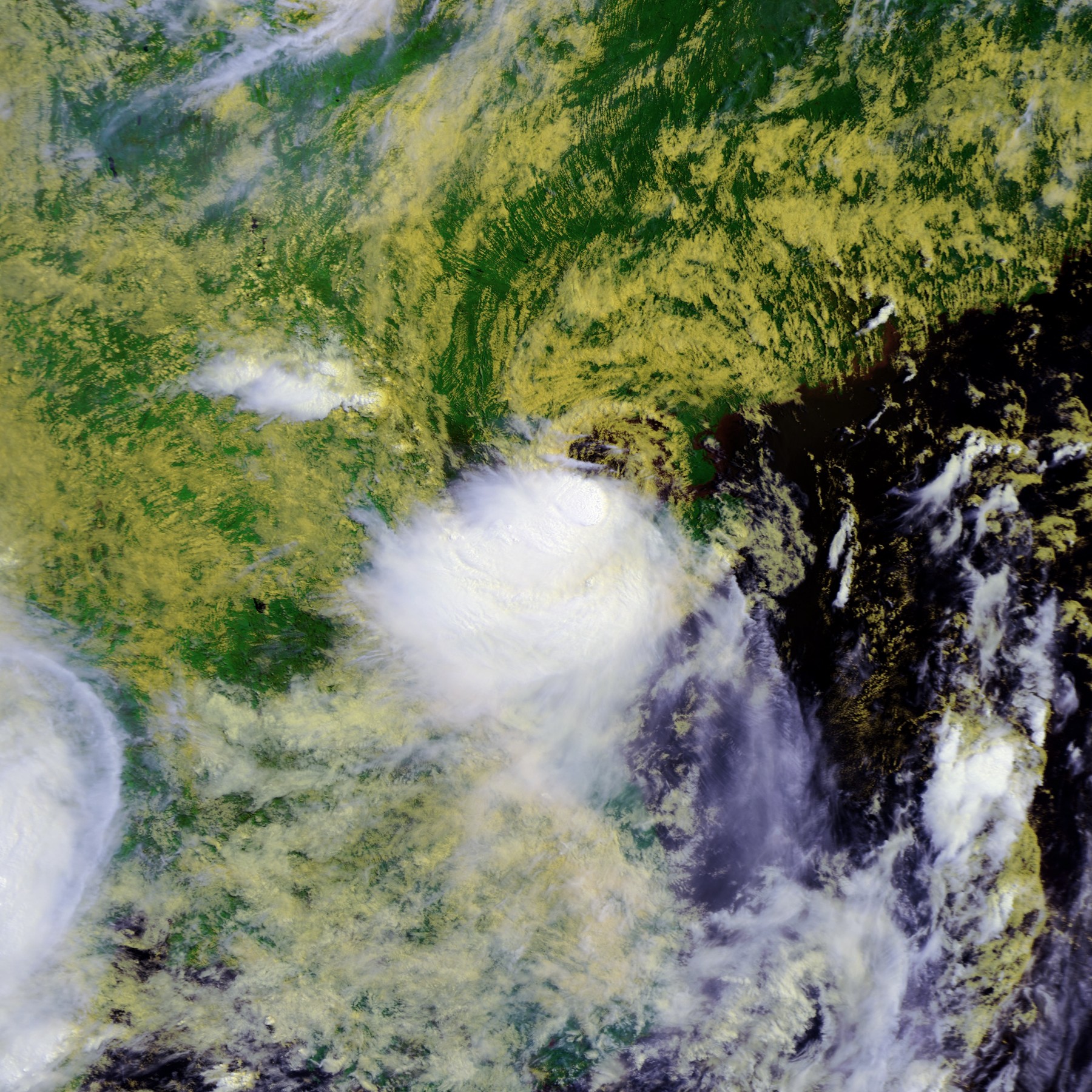
Track=Toraji 2007 track.pngJuly 4
Dissipated=July 5
10-min winds=35
1-min winds=35
Pressure=994South China Sea onJuly 2 and gradually consolidated over the next two days as it moved west-northwestward. ATropical Cyclone Formation Alert was issued by theJoint Typhoon Warning Center on the morning ofJuly 4 , and later that day the disturbance was upgraded straight to a tropical storm just south-east ofHainan Island . It made landfall on the island shortly after. China claimed that a tropical depression formed in the morning onJuly 2 , made landfall in Hainan later that afternoon with maximum sustained winds of 15 m/s (55 km/h, 35 mph) [ [http://news.tq121.com.cn/index.php?id=31962 热带低压将西北行 明天进入北部湾渐向广西沿海靠近 ] ] and deepened to 988hPa [http://weather.unisys.com/hurricane/archive/07070506] before making its second landfall. In response to the storm, Guangxi evacuated nearly 147 thousand people. [ [http://www.cma.gov.cn/qxxw/t20070706_201895.phtml “桃芝”登陆广西自治区政府启动防御台风4级预案 ] ]The
Japan Meteorological Agency upgraded the tropical depression to Tropical Storm Toraji on the morning ofJuly 5 while it was in theGulf of Tonkin , after the centre of the storm had emerged back over water. The name "Toraji" was contributed byNorth Korea and refers to the broad bellflower ("platycodi radix").Toraji made landfall in
Vietnam around 1200 UTC later that evening, having not strengthened much while over the Gulf of Tonkin. The JMA never analysed the storm beyond 994 hPa and minimal tropical storm strength. The JTWC issued its last advisory after landfall, and the JMA followed suit shortly after.Typhoon Man-yi (Bebeng)
Infobox Hurricane Small
Basin=WPac
Track=Man-yi 2007 track.pngJuly 9
Dissipated=July 16
10-min winds=95
1-min winds=125
Pressure=930Joint Typhoon Warning Center began to track an area of disturbed weather just north of theequator onJuly 4 . The circulation centre and surrounding convection started to take shape, although the system was in a "marginal upper-level environment" with moderate verticalwind shear . [ftp://ftp.met.fsu.edu/pub/weather/tropical/GuamStuff/2007070516-ABPW.PGTW] ftp://ftp.met.fsu.edu/pub/weather/tropical/GuamStuff/2007070606-ABPW.PGTW] Surface pressure drops of less than 0.5 mb (hPa) were observed onJuly 6 , as the system moved westward. Early onJuly 7 , theJapan Meteorological Agency (JMA) listed the system as a weak tropical depression. Hours later, theJoint Typhoon Warning Center (JTWC) issued aTropical Cyclone Formation Alert , as the system consolidated further with "deep convective banding" and improving upper-level conditions. [ftp://ftp.met.fsu.edu/pub/weather/tropical/GuamStuff/2007070702-WTPN.PGTW]The JTWC issued its first warning on Tropical Depression 04W later that day, [ [http://www.webcitation.org/5Q9mpNBC9 WebCite query result ] ] and forecast a gradual intensification, as weak to moderate wind shear and weak poleward outflow balanced the effect of high ocean heat content. [ [http://www.webcitation.org/5Q9oJj1Rv WebCite query result ] ] The JMA began issuing full tropical cyclone advisories on the tropical depression at the same time. [ [http://www.webcitation.org/5Q9q46k4h WebCite query result ] ] As the depression gained more organisation, it was upgraded to a tropical storm that night by the JTWC. [ftp://ftp.met.fsu.edu/pub/weather/tropical/GuamStuff/2007070721-WTPN.PGTW] The JMA finally upgraded it to a tropical storm later that evening as the large system consolidated, naming it "Man-yi". [ [http://www.webcitation.org/5QBbpbGO7 WebCite query result ] ] The name "Man-yi" was contributed by
Hong Kong , and is the Chinese name of astrait turnedreservoir (theHigh Island Reservoir ). Man-yi continued to organize and became a severe tropical storm onJuly 9 , when downed electricity lines caused widespread power outages onGuam . [ [http://www.guampdn.com/apps/pbcs.dll/article?AID=/20070710/NEWS01/707100310 Storm exposes GPA vulnerabilities"] by Gaynor Dumat-ol Daleno, "Pacific Daily News ",10 July 2007 ] Tropical storm warnings and typhoon watches were put in place for most ofYap State at some point during the storm. Strong waves from the typhoon capsized a ship 375 miles to the northwest ofGuam , killing three and leaving six missing. [cite web|author=Associated Press|year=2007|title=At Least 3 Die in Shipwreck After Log Carrier Runs Into Typhoon Man-Yi|accessdate=2007-07-14|url=http://www.foxnews.com/story/0,2933,289301,00.html]The JTWC upgraded the storm to a typhoon on the afternoon of
July 10 , based onDvorak technique satellite intensity estimates of 65 kt by both the JMA and the JTWC. Early the next day, the system entered the Philippine Area of Responsibility and was named "Bebeng" by PAGASA. At the same time, the JMA upgraded Man-yi to a typhoon.Moving over warmer waters, Man-yi underwent
rapid deepening late onJuly 11 and early onJuly 12 as it churned towardsOkinawa inJapan . TheUnited States Military upgraded theTropical Cyclone Condition of Readiness (TCCOR) levels for Kantō, Yokosuka, Sasebo andOkinawa on the afternoon ofJuly 12 as Man-yi neared the islands. [ [http://www.webcitation.org/5QHA9Lvr2 WebCite query result ] ] Man-yi was upgraded twice to super-typhoon strength over the next day as it passed through the prefecture, with a 1-minute peak of 155 mph. The passage of Man-yi resulted in 37 injuries and widespread power outages inOkinawa . [ [http://www.ndtv.com/convergence/ndtv/story.aspx?id=NEWEN20070018886 NDTV.com: Typhoon Man-Yi injures 37 ] ] The TCCOR level for Okinawa was downgraded to 1R (recovery) onJuly 13 while Kantō, Yokosuka and Sasebo's levels were all upgraded in anticipation of the typhoon. [ [http://www.webcitation.org/5QIp5bcPS WebCite query result ] ] Man-yi made brief landfall inKagoshima Prefecture onKyūshū early the next day before turning to the east and making brief landfalls inKōchi Prefecture onShikoku and inWakayama Prefecture onHonshū .As it interacted with land and started to undergo
extratropical transition , the typhoon weakened and was downgraded to a tropical storm by the JTWC and a severe tropical storm by the JMA. It became extratropical onJuly 15 according to the JTWC and hence it issued its final advisory. The JMA issued its final advisory two days later.Typhoon Usagi
Infobox Hurricane Small
Basin=WPac
Track=Usagi 2007 track.pngJuly 29
Dissipated=August 4
10-min winds=90
1-min winds=120
Pressure=945July 26 , theJoint Typhoon Warning Center identified an area of disturbed weather east of theMariana Islands . This area moved westward and increased in organization, and theJoint Typhoon Warning Center issued aTropical Cyclone Formation Alert on the system onJuly 27 . [ [http://listserv.uiuc.edu/wa.cgi?A2=ind0707d&L=wx-tropl&T=0&P=49131 WX-TROPL Archives - July 2007, week 4 (#368) ] ] TheJapan Meteorological Agency designated the system a tropical depression later that day. [ [http://listserv.uiuc.edu/wa.cgi?A2=ind0707d&L=wx-tropl&T=0&P=52496 WX-TROPL Archives - July 2007, week 4 (#393) ] ] The next day, the JMA began issuing advisories on the depression, and the JTWC followed suit, designating it Tropical Depression 05W. [ftp://ftp.met.fsu.edu/pub/weather/tropical/GuamStuff/2007072815-WTPN.PGTW]The system quickly strengthened as it approached the Mariana Islands, and the JTWC upgraded it to a tropical storm six hours later. [ftp://ftp.met.fsu.edu/pub/weather/tropical/GuamStuff/2007072821-WTPN.PGTW] The JMA did so early on
July 29 , designating the system as Tropical Storm Usagi. [ [http://listserv.uiuc.edu/wa.cgi?A2=ind0707e&L=wx-tropl&T=0&P=920 WX-TROPL Archives - July 2007, week 5 (#7) ] ] The name "Usagi" was contributed by Japan, and means "rabbit " in Japanese. TheNational Weather Service office inGuam issued tropical storm warnings forPagan Island andAgrihan in the Northern Marianas shortly after the system was upgraded. [ [http://listserv.uiuc.edu/wa.cgi?A2=ind0707d&L=wx-tropl&T=0&P=60506 WX-TROPL Archives - July 2007, week 4 (#455) ] ]Usagi passed between Pagan and Agrihan later on July 29, [ [http://listserv.uiuc.edu/wa.cgi?A2=ind0707e&L=wx-tropl&T=0&P=1031 WX-TROPL Archives - July 2007, week 5 (#8) ] ] and began to quickly strengthen. The JTWC upgraded it to a typhoon later that day, citing
Dvorak technique numbers indicating an estimate of 65 knots (120 km/h, 75 mph) and a developing eye. [ftp://ftp.met.fsu.edu/pub/weather/tropical/GuamStuff/2007072921-WTPN.PGTW] The system gradually turned toward the northwest, and the JMA upgraded it to a severe tropical storm early onJuly 30 , [ [http://listserv.uiuc.edu/wa.cgi?A2=ind0707e&L=wx-tropl&T=0&P=10178 WX-TROPL Archives - July 2007, week 5 (#80) ] ] and then to a typhoon onJuly 31 as it passed to the south ofIwo Jima . [ [http://listserv.uiuc.edu/wa.cgi?A2=ind0707e&L=wx-tropl&T=0&P=23783 WX-TROPL Archives - July 2007, week 5 (#185) ] ] Usagi moved northwest over warm waters, reaching peak intensity onAugust 1 before weakening due to coolingsea surface temperature s and increasing wind shear as it approachedKyūshū . Usagi made landfall onAugust 2 nearNobeoka, Miyazaki as a rapidly weakening typhoon, and it was downgraded to a severe tropical storm shortly after. The system continued weakening rapidly as it moved across Kyūshū andHonshū , and the JMA downgraded it to a tropical storm later that day. [ [http://www.webcitation.org/5QnoxwrSd WebCite query result ] ]The JTWC downgraded the system to a tropical storm late on
August 2 and issued its last advisory early onAugust 3 as it began to undergo extratropical transition. Usagi then made further landfalls on northern Honshū inAomori Prefecture before becoming fully extratropical onAugust 4 , leading the JMA to stop advisories. Usagi was responsible for 18 injuries inKyūshū. [BBC News. [http://news.bbc.co.uk/2/hi/asia-pacific/6928931.stm Typhoon Usagi hits southern Japan] . August 3, 2007.]Typhoon Pabuk (Chedeng)
Infobox Hurricane Small
Basin=WPac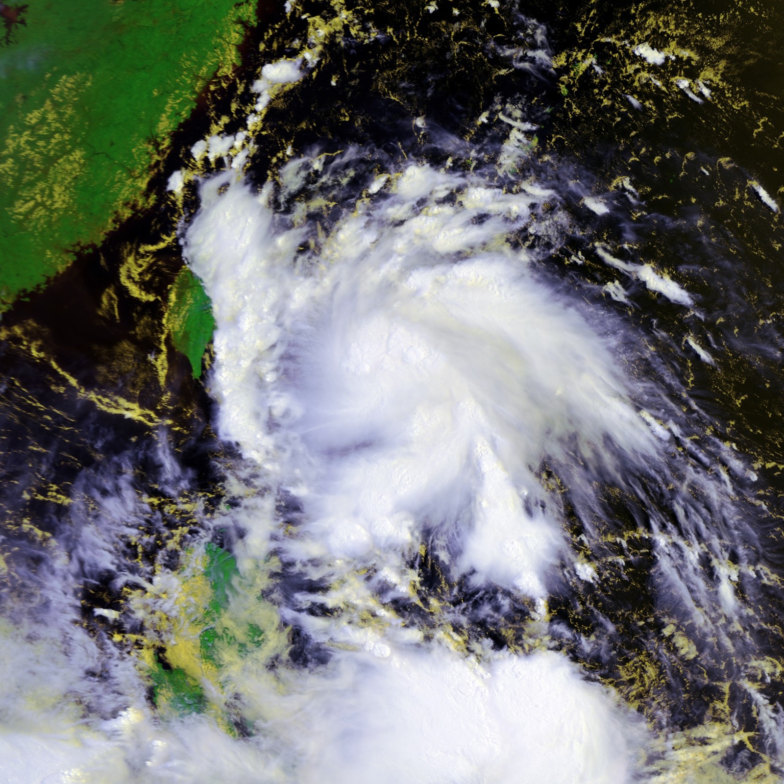
Track=Pabuk 2007 track.pngAugust 5
Dissipated=August 9
10-min winds=65
1-min winds=70
Pressure=975Chuuk early onJuly 31 . The system moved west-northwestward over the next several days with little change in organization. OnAugust 4 , however, organized convection quickly began to redevelop, and theJapan Meteorological Agency began monitoring it as a tropical depression. The system continued to strengthen, and theJoint Typhoon Warning Center issued aTropical Cyclone Formation Alert on the system early the next day, noting that its environment was "strongly favorable for development". [ [http://www.webcitation.org/5QrV9UEcZ WebCite query result ] ] TheJapan Meteorological Agency designated the system Tropical Storm Pabuk shortly after. [ [http://www.webcitation.org/5QrUisG7f WebCite query result ] ] The name "Pabuk" was submitted byLaos , and refers to a large freshwater fish in theMekong River . The JTWC designated the system Tropical Storm 07W at about the same time, and onAugust 5 PAGASA named the system Chedeng. As Pabuk continued to move to the northwest, it gained some organisation as it slowly developed outflow. [ftp://ftp.met.fsu.edu/pub/weather/tropical/GuamStuff/2007080603-WDPN.PGTW] It was upgraded by the JMA to a severe tropical storm onAugust 6 . Moving westwards towardsTaiwan , an area of convection south of Pabuk separated and formed its own low-level circulation. Pabuk's upper-level outflow inhibited this new area of convection. Strengthening slightly, Pabuk was upgraded to a typhoon on the morning ofAugust 7 . The JTWC downgraded Pabuk to a tropical storm later that day, with the JMA downgrading Pabuk shortly before landfall. It made landfall in southernTaiwan around 1630 UTC according to Taiwan radar and crossed the southern tip of theHengchun Peninsula inPingtung County . The JTWC re-upgraded Pabuk to a typhoon at its next advisory, however, citing a small eye at landfall, [ftp://ftp.met.fsu.edu/pub/weather/tropical/GuamStuff/2007080721-WTPN.PGTW] before downgrading it to a tropical storm again three hours later. [ [http://www.webcitation.org/5QvfbvBTE WebCite query result ] ]After passing over Taiwan, Pabuk took aim at
Hong Kong . [ [http://www.webcitation.org/5Qw3hcrHE WebCite query result ] ] TheHong Kong Observatory and Macau'sMeteorological and Geophysical Bureau both hoisted strong wind signal 3 onAugust 9 as the system passed to the south of Hong Kong. The JMA downgraded the storm to a tropical depression later that day and issued its final public advisory, with the JTWC following suit shortly after. The tropical depression then turned back to the east-northeast onAugust 10 [ftp://ftp.met.fsu.edu/pub/weather/tropical/Tokyo/2007081000.RJTD] , forcing the HKO to re-issue signal 3. The HKO also warned that winds were expected to strengthen further locally, and that the Hong Kong Education Bureau had suspended all classes for the day. [ [http://www.webcitation.org/5Qyz1SfjJ WebCite query result ] ] The HKO upgraded Pabuk to a tropical storm [ [http://www.info.gov.hk/gia/wr/200708/10/P200708100166.htm PRESS WEATHER NO. 103 - TROPICAL CYCLONE BULLETIN (SIGNAL NO. 3)] ] and subsequently issued the gale or storm warning signal 8 at 2:30 p.m. HKT (0630UTC ) later that day as Pabuk moved closer to the territory. [ [http://www.info.gov.hk/gia/wr/200708/10/P200708100252.htm PRESS WEATHER NO. 131 - TROPICAL CYCLONE BULLETIN (SIGNAL NO. 8)] , 14:52 HKT on August 11, 2007.] This was replaced by signal 3 later that night as Pabuk took another turn in direction and headed west inland intoGuangdong . Early next morning, Pabuk resumed a northeasterly track, edging once again closer to the Pearl River Delta [ [http://www.info.gov.hk/gia/wr/200708/11/P200708110058.htm PRESS WEATHER NO. 044 - TROPICAL CYCLONE BULLETIN (SIGNAL NO. 1)] , 04:45 HKT on August 11, 2007.] before it weakened further and HKO cancelled all signals. [ [http://www.info.gov.hk/gia/wr/200708/11/P200708110107.htm PRESS WEATHER NO. 081 - CANCELLING OF TC SIGNALS (URGENT)] , 08:35 HKT on August 11, 2007.]At least 11 people were killed in the
Philippines by Pabuk. [ [http://www.nytimes.com/2007/08/09/world/asia/09asiastorms.html Storms Rake Philippines and Vietnam - New York Times ] ]Tropical Storm Wutip (Dodong)
Infobox Hurricane Small
Basin=WPac
Track=Wutip 2007 track.pngAugust 8
Dissipated=August 8
10-min winds=35
1-min winds=30
Pressure=990August 5 , and was first mentioned by theJoint Typhoon Warning Center in its Significant Tropical Weather Outlook onAugust 6 . [ftp://ftp.met.fsu.edu/pub/weather/tropical/GuamStuff/2007080622-ABPW.PGTW] TheJapan Meteorological Agency designated it a tropical depression later that night. [ [ftp://ftp.met.fsu.edu/pub/weather/tropical/Tokyo/2007080618.RJTD "TROPICAL DEPRESSION 1002 HPA AT 14N 128E WEST SLOWLY."] ] By the next day, although still attached to Pabuk and being inhibited by shearing from an upper-level outflowanticyclone over Pabuk, [ftp://ftp.met.fsu.edu/pub/weather/tropical/GuamStuff/2007080706-ABPW.PGTW] the JTWC issued aTropical Cyclone Formation Alert . [ftp://ftp.met.fsu.edu/pub/weather/tropical/GuamStuff/2007080710-WTPN.PGTW] As Pabuk moved away, the depression gradually strengthened, and the JMA designated it Tropical Storm Wutip early onAugust 8 . [ [http://www.webcitation.org/5QveYQwBH WebCite query result ] ] The name "Wutip" was submitted byMacau , and means "butterfly ". It struggled against land interaction, however, and did not strengthen considerably, remaining poorly organised. The storm quickly weakened, and the JMA issued its last advisory on Wutip early onAugust 9 , downgrading it to a tropical depression. The JTWC issued its last advisory shortly after.Three people were killed and 17 others injured in the
Philippines by Tropical Storm Wutip. [ [http://www.reliefweb.int/rw/rwb.nsf/db900sid/LRON-75WDVR?OpenDocument&rc=3&emid=FL-2007-000125-PHL ReliefWeb: Tropical storm Wutip kills 3 in Philippines, 17 hurt] ]Typhoon Sepat (Egay)
Infobox Hurricane Small
Basin=WPac
Track=Sepat 2007 track.pngAugust 12
Dissipated=August 19
10-min winds=110
1-min winds=140
Pressure=910Northern Mariana Islands onAugust 11 . Early the next day, the JMA began issuing advisories on the depression, [ [http://www.webcitation.org/5R27gMhi1 WebCite query result ] ] and the JTWC followed suit, designating it Tropical Depression 09W. [ftp://ftp.met.fsu.edu/pub/weather/tropical/GuamStuff/2007081209-WTPN.PGTW] Twelve hours later, the JTWC upgraded the tropical depression to a tropical storm [ftp://ftp.met.fsu.edu/pub/weather/tropical/GuamStuff/2007081215-WTPN.PGTW] based onDvorak technique satellite intensity estimates andftp://ftp.met.fsu.edu/pub/weather/tropical/GuamStuff/2007081215-WDPN.PGTW] the storm exhibiting tightly-curved convective bands. An upper-level low helped to reducewind shear that had been affecting the storm. The JTWC also warned of the possibility ofrapid intensification . The JMA upgraded the depression to a tropical storm later that day [ftp://ftp.met.fsu.edu/pub/weather/tropical/Tokyo/2007081218.RJTD] and named it Sepat, a name contributed byMalaysia referring to a freshwater fish species.By early on
August 13 , Sepat had moved into PAGASA's area of responsibility and attained the local name "Egay". The JMA upgraded Sepat to a severe tropical storm shortly after. [ftp://ftp.met.fsu.edu/pub/weather/tropical/Tokyo/2007081306.RJTD] Late that night, Sepat underwent rapid intensification as expected, and was upgraded by the JTWC to a super typhoon the next morning.ftp://ftp.met.fsu.edu/pub/weather/tropical/GuamStuff/2007081503-WDPN.PGTW] Sepat slowed in forward speed and took a turn from a west-southwest motion to a more poleward one.ftp://ftp.met.fsu.edu/pub/weather/tropical/GuamStuff/2007081515-WDPN.PGTW] Continuing to intensify,ftp://ftp.met.fsu.edu/pub/weather/tropical/GuamStuff/2007081603-WDPN.PGTW] Sepat reached a peak minimum central pressure of 910 hPa on the morning ofAugust 16 . [ [http://www.webcitation.org/5R7nAjOR1 WebCite query result ] ] Highocean heat content and goodequator ward outflow allowed Sepat to maintain its intensity, but aneyewall replacement cycle began later that night, resulting in weakening.ftp://ftp.met.fsu.edu/pub/weather/tropical/GuamStuff/2007081615-WDPN.PGTW] It made landfall in easternTaiwan betweenTaitung andHualien on the morning ofAugust 18 local time at around 5 a.m. (2100 UTCAugust 17 ) [ftp://ftp.met.fsu.edu/pub/weather/tropical/GuamStuff/2007081803-WDPN.PGTW] and weakened to a minimal typhoon. [cite web|url=http://www.webcitation.org/5RAux0QOD|title=www.webcitation.org/5RAux0QOD ] After crossing the island, Sepat held on to minimal typhoon intensity before weakening to a severe tropical storm that night. [cite web|url=http://www.webcitation.org/5RBaYJ7 DL|title=www.webcitation.org/5RBaYJ7 DL ] It made a second landfall, in mainland China, about 24 hours after landfall on Taiwan and was downgraded to a tropical storm the next morning. It further weakened inland and the JMA issued its final advisory on the morning ofAugust 20 .On
August 15 , monsoon rains brought by Typhoon Sepat flooded and paralyzed traffic inMetro Manila . [ [http://newsinfo.inquirer.net/breakingnews/metro/view_article.php?article_id=82753 (UPDATE 3) 'Egay' floods Metro, closes schools, offices - INQUIRER.net, Philippine News for Filipinos ] ] Classes and services in government offices were suspended untilAugust 17 . [ [http://newsinfo.inquirer.net/breakingnews/metro/view_article.php?article_id=82675 (UPDATE) Classes at all levels suspended in NCR - INQUIRER.net, Philippine News for Filipinos ] ]Typhoon Fitow
Infobox Hurricane Small
Basin=WPac
Track=Fitow 2007 track.pngAugust 29
Dissipated=September 8
10-min winds=70
1-min winds=80
Pressure=965August 28 , an area of disturbed weather that had lingered east-northeast ofSaipan became better organised. TheJoint Typhoon Warning Center initiated warnings on Tropical Depression 10W the next morning, [ [http://www.webcitation.org/5RRO8fMD7 WebCite query result ] ] and the JMA initiated advisories on a tropical depression the same day. [ [http://www.webcitation.org/5RRdq2DRO WebCite query result ] ] Under favourable conditions, the system intensified quickly, becoming Tropical Storm Fitow by afternoon [ [http://www.webcitation.org/5RRvY3wO7 WebCite query result ] ] and a severe tropical storm by the evening ofAugust 29 . [ [http://www.webcitation.org/5RSTzZ1BY WebCite query result ] ] The name "Fitow" was contributed by theFederated States of Micronesia , and is Yapese for a beautiful fragrant flower.Rapid intensification ensued, [ftp://ftp.met.fsu.edu/pub/weather/tropical/GuamStuff/2007083003-WDPN.PGTW] and Fitow became a typhoon early onAugust 30 . [ [http://www.webcitation.org/5RTxllIjg WebCite query result ] ] Fitow made landfall nearTokyo ,Japan late onSeptember 6 [ftp://ftp.met.fsu.edu/ub/weather/tropical/GuamStuff/2007090621-WTPN.PGTW] [ftp://ftp.met.fsu.edu/pub/weather/tropical/GuamStuff/2007090703-WTPN.PGTW] as a minimal typhoon. [ [http://www.webcitation.org/5Rf3A48i4 WebCite query result ] ] The JMA downgraded Fitow to a severe tropical storm early onSeptember 7 [ [http://www.webcitation.org/5RfLticGc WebCite query result ] ] , and a tropical storm later that day. [ [http://www.webcitation.org/5RgCLvEx1 WebCite query result ] ] The cyclone degenerated into a remnant low onSeptember 8 . [ [http://www.webcitation.org/5RhC3MCKm WebCite query result ] ]In Japan, seven people were killed,cite news|page=A13|title=Typhoon slams China's eastern coast|work=
Vancouver Sun |author=Joan Feng|publisher=Agence France-Press |date=2007-09-19] and at least 50 were injured, as Fitow brought strong winds and heavy rain. Over 80,000 houses experienced apower outage . Transport in and around Tokyo was also affected, with nearly 200 flights cancelled and many commuter trains suspended. In the Tama area west of central Tokyo, flood warnings were issued for theTama River , and many homeless people who lived along its banks were swept away. [cite news |title=Typhoon Fitow hits central Japan |url=http://news.bbc.co.uk/2/hi/asia-pacific/6982850.stm |publisher=BBC News |date=2007-09-07 |accessdate=2007-10-13 ]evere Tropical Storm Danas
Infobox Hurricane Small
Basin=WPac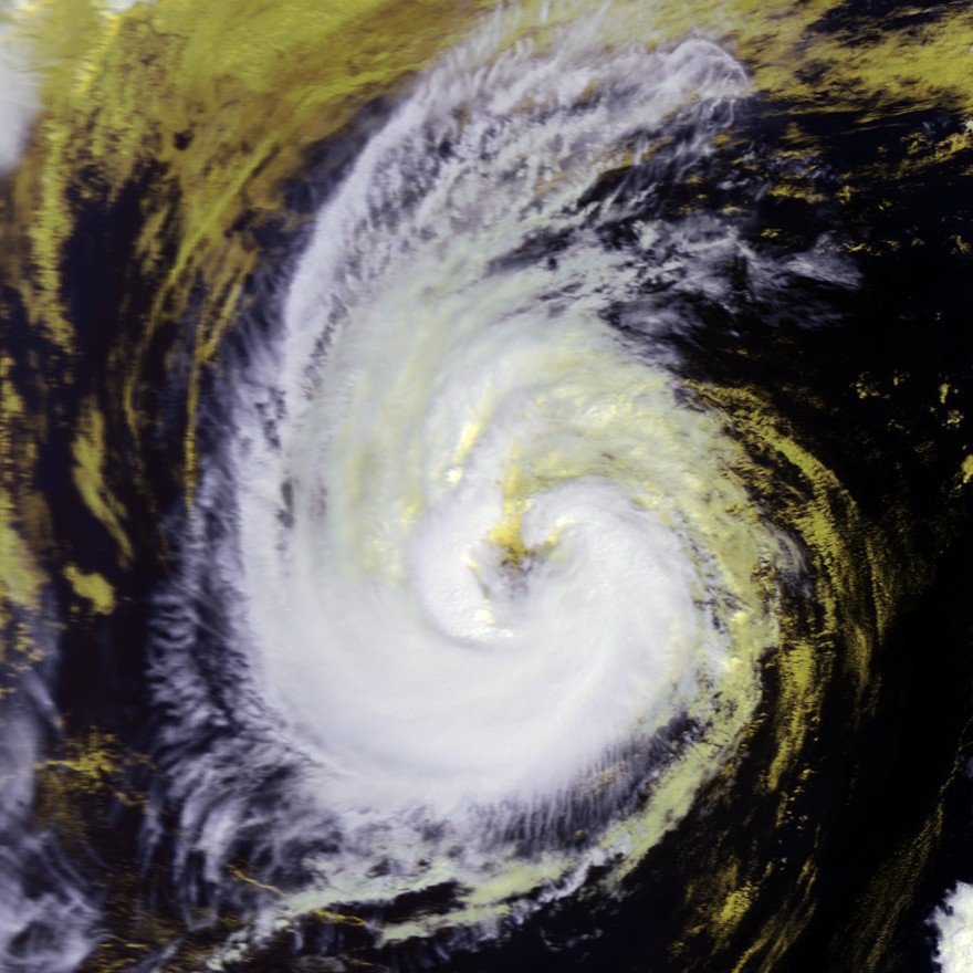
Track=Danas 2007 track.pngSeptember 7
Dissipated=September 11
10-min winds=55
1-min winds=65
Pressure=990Wake Island formed early onSeptember 3 and tracked north then northwest, becoming more organised, and onSeptember 6 was recognised as a full tropical depression by the JMA. [ [http://www.webcitation.org/5RemhDQnW WebCite query result ] ] A TCFA was issued on the same day. [ [http://www.webcitation.org/5Rg8d8IOC WebCite query result ] ] The storm continued northwest-ward towardJapan , becoming Tropical Storm Danas early onSeptember 7 . [ [http://www.webcitation.org/5Rg8MV1L7 WebCite query result ] ] The storm slowed its westward movement and headed north, and then northeast, becoming a severe tropical storm onSeptember 9 . [ [http://www.webcitation.org/5RjRT64U4 WebCite query result ] ] By the 11th, cooler waters had weakened the storm down to a tropical storm [ [http://www.webcitation.org/5RmNHITAt WebCite query result ] ] and the storm degenerated into a remnant low later that day. [ [http://www.webcitation.org/5RmeUUSrW WebCite query result ] ] The name "Danas" was submitted by thePhilippines and is defined in the Filipino language as "to go through a negative experience" [ [http://www.bansa.org/dictionaries/tgl/?dict_lang=tgl&type=search&data=danas Tagalog English Dictionary ] ]Typhoon Nari (Falcon)
Infobox Hurricane Small
Basin=WPac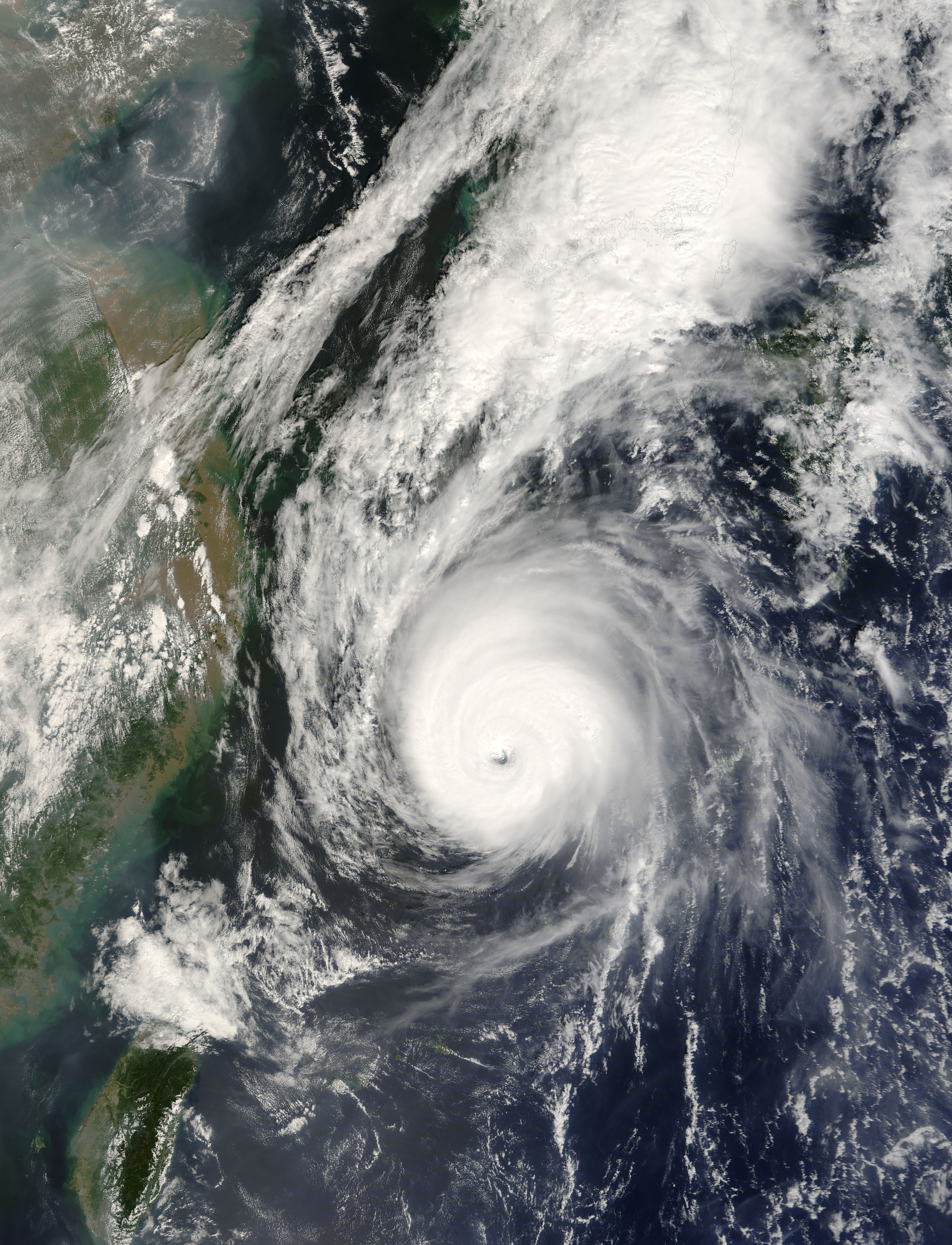
Track=Nari 2007 track.pngSeptember 13
Dissipated=September 17
10-min winds=100
1-min winds=125
Pressure=935Guam onSeptember 10 and moved northwestward, slowly increasing in organisation. TheJapan Meteorological Agency began monitoring the system as a tropical depression the next day. The depression continued to organise and strengthen, and theJoint Typhoon Warning Center issued aTropical Cyclone Formation Alert on it during the afternoon ofSeptember 12 , and began issuing advisories on Tropical Depression 12W an hour later. The JMA followed suit early onSeptember 13 and initiated advisories on the system; PAGASA named the system Falcon shortly after. The depression continued to intensify, and the JMA upgraded it to Tropical Storm Nari later that morning. The storm then underwent rapid intensification that afternoon and evening, strengthening from a tropical depression to a typhoon in just 18 hours. The JMA upgraded Nari to a severe tropical storm late that afternoon, and by late that evening, Nari was upgraded to a typhoon. Nari reached its peak on September 14th, and began weakening soon afterwards. It turned extratropical right afterlandfall inSouth Korea at tropical storm strength. At least 20 people have been killed or are missing due to the flooding caused by Nari. Rainfall totals reached a record 590 mm (23.2 in) inJeju , South Korea. The name "Nari" was submitted bySouth Korea , and meanslily .Typhoon Wipha (Goring)
Infobox Hurricane Small
Basin=WPac
Track=Wipha 2007 track.pngSeptember 16
Dissipated=September 19
10-min winds=100
1-min winds=135
Pressure=925Naha, Okinawa early onSeptember 13 . This area gradually became better organised, and a TCFA was issued late onSeptember 14 . [ftp://ftp.met.fsu.edu/pub/weather/tropical/GuamStuff/2007091422-WTPN.PGTW] The JMA upgraded the storm to a tropical depression onSeptember 15 , [ [http://www.webcitation.org/5Rs2go3sQ WebCite query result ] ] and the JTWC soon followed suit with Tropical Depression 13W. [ftp://ftp.met.fsu.edu/pub/weather/tropical/GuamStuff/2007091509-WTPN.PGTW] PAGASA named the storm "Goring" later that day. OnSeptember 16 , the storm had gained enough organisation to be designated as a tropical storm. [ [http://www.webcitation.org/5RsyICRTz WebCite query result ] ] OnSeptember 17 , the storm underwent rapid intensification and quickly strengthened into a typhoon. It continued to strengthen rapidly and was upgraded by the JTWC to a super typhoon early onSeptember 18 . In the early hours, local time, ofSeptember 19 , Wipha slammed intoFuding , near theFujian -Zhejiang provincial border in China. However, before the storm made landfall it weakened slightly, becoming a Category 3-equivalent typhoon.Wipha originally threatened to pass over
Shanghai , which would have made it the most destructive Chinese typhoon in over a decade. However, it veered to the south, making a direct impact unlikely. Throughout the Shanghai and Fujian-Zhejiang area, nearly 2 million persons evacuated, including 1.5 million in Zhejiang and 291 thousand from low-lying areas, due to the threat from Wipha. TheXinhua News Agency considered the evacuations to be the region's most extensive in over a half century.Boats, ferries, and ships were called back in to port to take refuge in harbors. At both airports in Shanghai, at least twenty flights were canceled and fifty postponed. The typhoon also caused
FIFA to reschedule four matches in the Women's World Cup. [BBC News. [http://news.bbc.co.uk/sport1/hi/football/women/7002403.stm Typhoon hits Women's Cup schedule] . September 19, 2007.]Flooding was severe. In the area, at least 80 streets were flooded and brought water levels in several rivers and reservoirs to dangerous levels. In total, nine people were killed and damage was estimated at over $880 million (USD).USA Today. [http://www.usatoday.com/weather/storms/2007-10-02-typhoon-china_N.htm?csp=34 Thousands flee as typhoon nears China] . October 2, 2007.]
Tropical Storm Francisco
Infobox Hurricane Small
Basin=WPac
Track=Francisco 2007 track.pngSeptember 23
Dissipated=September 25
10-min winds=40
1-min winds=45
Pressure=990Hong Kong early onSeptember 19 . It was recognised as a minor tropical depression by the JMA on the 21st, and upgraded to a full depression on the 23rd. [ [http://www.webcitation.org/5S3qa7aQr WebCite query result ] ] The JTWC recognised Tropical Depression 15W at the same time. [ftp://ftp.met.fsu.edu/pub/weather/tropical/GuamStuff/2007092303-WTPN.PGTW] Nine hours after being delcared a full depression, the JMA and the JTWC upgraded it to Tropical Storm Francisco. [ [http://www.webcitation.org/5S4UaQjO1 WebCite query result ] ] [ftp://ftp.met.fsu.edu/pub/weather/tropical/GuamStuff/2007092315-WTPN.PGTW] The storm traveled due west and overWenchang on Hainan Island onSeptember 24 . Land interaction and moderate wind shear caused Francisco to weaken to a tropical depression as warnings were discontinued. [ [http://www.webcitation.org/5S7hhRaOo WebCite query result ] ] [ftp://ftp.met.fsu.edu/pub/weather/tropical/GuamStuff/2007092421-WTPN.PGTW] [ftp://ftp.met.fsu.edu/pub/weather/tropical/GuamStuff/2007092503-WTPN.PGTW] The name 'Francisco' was submitted by theUnited States and is a commonChamorro man's name. [ [http://www.weather.gov.hk/informtc/sound/tc_pronunciatione.htm The Meaning of New Tropical Cyclone Names in 2004 ] ]evere Tropical Storm Lekima (Hanna)
Infobox Hurricane Small
Basin=WPac
Track=Lekima 2007 track.pngSeptember 30
Dissipated=October 4
10-min winds=60
1-min winds=70
Pressure=975Philippines gradually developed. PAGASA was first to upgrade it, declaring it Tropical Depression Hanna onSeptember 27 , and upgrading it to a tropical storm the next day. It made landfall in centralLuzon early onSeptember 29 , and shortly thereafter the JMA declared the system Tropical Storm Lekima. It continued to strengthen and was upgraded to a severe tropical storm onSeptember 30 (the JTWC upgraded it to a typhoon) and remained at such until landfall. It dissipated over land onOctober 5 http://www.webcitation.org/5TQqW8gCY.]Tropical Storm Lekima brought heavy rains to Luzon causing a landslide that killed eight people, including three children, in Ifugao province, while another person was found dead in
Quezon City . [http://www.philstar.com/index.php?Headlines&p=49&type=2&sec=24&aid=2007093094 Philippine Star - Articles ] ] [http://www.gmanews.tv/story/62573/Hanna-leaves-9-dead GMANews.TV - ‘Hanna’ leaves 9 dead - Nation - Official Website of GMA News and Public Affairs - Latest Philippine News - BETA ] ] Torrential rains also caused landslides, flooding, infrastructure damage, and disruption of transportation service in other parts of the country. Over 100,000 people were evacuated in southernChina as the storm approached, and more than 20,000fishing boats were recalled back to theharbor s.On
October 3 , Lekima made landfall inVietnam as a severe tropical storm. About 100,000 houses were destroyed and at least 42 people were reported dead or missing in Vietnam. [Deutsche Welle . [http://www.dw-world.de/dw/function/0,,12215_cid_2807674,00.html?maca=en-rss-en-all-1573-rdf Central Vietnam hit by typhoon Lekima] . October 4, 2007.]Typhoon Krosa (Ineng)
Infobox Hurricane Small
Basin=WPac
Track=Krosa 2007 track.pngOctober 2
Dissipated=October 8
10-min winds=105
1-min winds=130
Pressure=925Philippines . PAGASA declared it a tropical depression (Ineng) early onOctober 1 , and the JMA and JTWC soon followed. It was upgraded to a tropical storm early onOctober 2 , named Krosa. Rapid intensification took place on October 2 and it was upgraded to a typhoon by the JTWC by midday. As it intensified, it gained a wide, ragged eye and began to track to the west, becoming a typhoon by the JMA early onOctober 3 . It continued to rapidly intensify that day before leveling off as a Category 4-equivalent typhoon onOctober 4 . Fluctuations in intensity soon followed as Krosa approachedTaiwan , as the JMA upgraded it to 105 kt and the JTWC to a super typhoon early onOctober 5 . It slowly weakened afterward before making landfall in northeasternTaiwan onOctober 6 . At least 17 people were reported injured there, as the typhoon headed forChina . An evacuation of 730,000 people from China'sZhejiang andFujian provinces was ordered on the evening of October 6. [cite news|title=After Pounding Taiwan, Typhoon Krosa Approaches Coast of China|publisher=Voice of America News|url=http://www.voanews.com/english/2007-10-06-voa23.cfm|date=2007-10-06|accessdate=2007-10-06]Tropical Storm Haiyan
Infobox Hurricane Small
Basin=WPac
Track=Haiyan 2007 track.pngOctober 5
Dissipated=October 6
10-min winds=40
1-min winds=50
Pressure=994International Date Line with a cold center onSeptember 30 . Wind gusts at the centre of the low reached severe gale on theBeaufort scale on . The JMA had previously monitored the system as a tropical depression. It was short-lived and weakened back to a tropical depression, dissipating later that day.JTWC upgraded Haiyan as Tropical Storm 27W in post analysis. It was announced when 2007 Annual Tropical Cyclone Report was issued in May 2008.
evere Tropical Storm Podul
Infobox Hurricane Small
Basin=WPac
Track=Podul 2007 track.pngOctober 6
Dissipated=October 7
10-min winds=55
Pressure=985October 6 , a tropical depression east ofJapan was upgraded to Tropical Storm Podul while racing northeast. It was short-lived over the northwest Pacific and degenerated into a remnant low early onOctober 7 .It was upgraded to severe tropical storm status by JMA in post analysis.http://www.jma.go.jp/jma/jma-eng/jma-center/rsmc-hp-pub-eg/Besttracks/bst2007.txt]
Tropical Storm Lingling
Infobox Hurricane Small
Basin=WPac
Track=Lingling 2007 track.pngOctober 12
Dissipated=October 15
10-min winds=45
1-min winds=40
Pressure=994October 9 , a disturbance from the North Central Pacific crossed theInternational Date Line , and became a tropical depression in the North Western Pacific, just east of the Date Line onOctober 11 . [ [http://www.webcitation.org/5SWAzzSEc WebCite query result ] ] It was upgraded to Tropical Storm Lingling by the JMA, [ [http://www.webcitation.org/5SWtsoDt1 WebCite query result ] ] and to Tropical Storm 18W by the JTWC, early onOctober 12 . [ftp://ftp.met.fsu.edu/pub/weather/tropical/GuamStuff/2007101215-WTPN.PGTW] Lingling headed northeast, and gradually became weaker. OnOctober 13 , the JTWC issued its final advisory, [ftp://ftp.met.fsu.edu/pub/weather/tropical/GuamStuff/2007101321-WTPN.PGTW] and two days later the JMA did the same. [ [http://listserv.uiuc.edu/wa.cgi?A2=ind0710c&L=wx-tropl&T=0&P=1026 WX-TROPL Archives - October 2007, week 3 (#9) ] ]Typhoon Kajiki
Infobox Hurricane Small
Basin=WPac
Track=Kajiki 2007 track.pngOctober 19
Dissipated=October 22
10-min winds=90
1-min winds=115
Pressure=945October 17 , and tracked north-east. The JMA and the JTWC declared this area a tropical depression very early onOctober 19 . [ftp://ftp.met.fsu.edu/pub/weather/tropical/GuamStuff/2007101903-WTPN.PGTW] Six hours later, it was upgraded to Tropical Storm Kajiki. [ [http://www.webcitation.org/5ShXB0dMR WebCite query result ] ] Rapid intensification continued; another six hours later, it was upgraded to a severe tropical storm. [ [http://www.webcitation.org/5ShnjC4qG WebCite query result ] ] [ [http://www.webcitation.org/5SiCIUtOh WebCite query result ] ] Kajiki became a typhoon early onOctober 20 as it rapidly intensified. [ [http://www.webcitation.org/5SijywSQR WebCite query result ] ] The storm reached peak intensity as it hitIwo Jima and then gradually began weakening.evere Tropical Storm Faxai (Juaning)
Infobox Hurricane Small
Basin=WPac
Track=Faxai 2007 track.pngOctober 26
Dissipated=October 27
10-min winds=55
1-min winds=40
Pressure=975October 25th , an area of disturbed weather was classified as a tropical depression by the JMA; [ [http://www.webcitation.org/5SrUUPt8d WebCite query result ] ] early the next day the JMA named it Tropical Storm Faxai as it moved north-west. [ [http://www.webcitation.org/5SrmYij3V WebCite query result ] ] The JTWC picked the system up as a tropical depression early on the 26th, [ftp://ftp.met.fsu.edu/pub/weather/tropical/GuamStuff/2007102603-WTPN.PGTW] but declared it extratropical twelve hours later without strengthening it to a tropical storm. [ftp://ftp.met.fsu.edu/pub/weather/tropical/GuamStuff/2007102615-WTPN.PGTW] PAGASA declared the system Tropical Storm Juaning around the same time the JTWC picked it up. [ [http://www.webcitation.org/5SsCpomiS WebCite query result ] ] [ [http://www.webcitation.org/5SsqfOC9b WebCite query result ] ] Later onOctober 26 , the JTWC resumed advisories as a tropical storm. [ftp://ftp.met.fsu.edu/pub/weather/tropical/GuamStuff/2007102621-WTPN.PGTW] The JMA declared Faxai a severe tropical storm asOctober 27 began; [ [http://www.webcitation.org/5StRY4oC0 WebCite query result ] ] the same day, the JTWC stopped issuing advisories once more due to Faxai having completed its extratropical transition. [ftp://ftp.met.fsu.edu/pub/weather/tropical/GuamStuff/2007102703-WTPN.PGTW] The JMA also stopped issuing advisories on the same day. [ [http://www.webcitation.org/5SuGeYDTC WebCite query result ] ]Typhoon Peipah (Kabayan)
Infobox Hurricane Small
Basin=WPac
Track=Pepiah 2007 track.pngNovember 3
Dissipated=November 9
10-min winds=70
1-min winds=75
Pressure=970Philippines onNovember 2 . it was designated as Tropical Depression 21W & Tropical Depression Kabayan by PAGASA onNovember 3 [ [http://www.webcitation.org/5T5FZbU1I WebCite query result ] ] [ftp://ftp.met.fsu.edu/pub/weather/tropical/GuamStuff/2007110309-WTPN.PGTW] . It then went on to rapidly develop later that day and was upgraded to Tropical Storm Peipah by the JMA onNovember 3 [ [http://www.webcitation.org/5T4mbRaQY WebCite query result ] ] . Pepiah is a popular pet fish inMacau . Early onNovember 4 it was upgraded to a severe tropical storm [ [http://www.webcitation.org/5T5UyqVBu WebCite query result ] ] . Later that day, just before landfall in the northern Philippines, the JTWC upgraded it to a typhoon [ftp://ftp.met.fsu.edu/pub/weather/tropical/GuamStuff/2007110415-WTPN.PGTW] . Upon landfall inPalanan ,Isabela Province , it pounded strong winds over Northern Luzon, thus unroofing houses, downing power lines and blocking many roads. [ [http://www.gmanews.tv/story/67167/Kabayan-makes-landfall-in-Isabela-crosses-north-Luzon GMANews.TV - ‘Kabayan’ makes landfall in Isabela, crosses north Luzon] ] Once it emerged in thePhilippine Sea , the JMA also upgraded it to a typhoon [ [http://www.webcitation.org/5T8sqnrpz WebCite query result ] ] . The strengthening trend was short-lived, though, as hindered outflow weakened the system onNovember 7 [ftp://ftp.met.fsu.edu/pub/weather/tropical/GuamStuff/2007110703-WDPN.PGTW] . It dissipated onNovember 9 before reachingVietnam .Tropical Storm Tapah
Infobox Hurricane Small
Basin=WPac
Track=Tapah 2007 track.pngNovember 11
Dissipated=November 13
10-min winds=35
1-min winds=35
Pressure=996Chuuk onNovember 6 and began moving northwestward. The system slowly increased in organization, and theJapan Meteorological Agency began monitoring it as a tropical depression early onNovember 10 . The JMA initiated advisories on the depression early onNovember 11 , and theJoint Typhoon Warning Center issued aTropical Cyclone Formation Alert on the system shortly after. Later that day, the JTWC designated the system Tropical Depression 22W. [ftp://ftp.met.fsu.edu/pub/weather/tropical/GuamStuff/2007111115-WTPN.PGTW] The system began to organize more quickly as it moved northward, and the JMA upgraded it to Tropical Storm Tapah early onNovember 12 , [ [http://www.webcitation.org/5THeOsiMO WebCite query result ] ] with the JTWC upgrading it to Tropical Storm 22W shortly after. [ftp://ftp.met.fsu.edu/pub/weather/tropical/GuamStuff/2007111203-WTPN.PGTW] Later that day both the JTWC and the JMA downgraded Tapah to a tropical depression, and released their final advisories, [ [http://www.webcitation.org/5TJOW3O3g WebCite query result ] ] as Tapah had a poorly defined low level circulation center, due to its beginning extratropical transition. [ftp://ftp.met.fsu.edu/pub/weather/tropical/GuamStuff/2007111221-WTPN.PGTW] Tapah then dissipated early onNovember 13 [ [http://www.webcitation.org/5UESO8HdM WebCite query result ] ]The name "Tapah" was submitted by
Malaysia , and refers to afresh water catfish .Typhoon Mitag (Mina)
Infobox Hurricane Small
Basin=WPac
Track=Mitag 2007 track.pngNovember 20
Dissipated=November 27
10-min winds=80
1-min winds=95
Pressure=955November 20 an area of disturbed weather east of thePhilippines strengthened and was classified as Tropical Storm Mitag by the JMA. The JTWC followed suit not long afterwards. The storm strengthened significantly early onNovember 21 and became a severe tropical storm. Later that day, the JTWC upgraded Mitag to a typhoon, and the JMA also upgraded it late that evening.Philippine officials started the evacuation of about 200,000 people on November 23, mostly from the
Bicol Region as the Mitag approaches the coast. The province of Albay has declared astate of calamity . [Philippine Daily Inquirer. [http://newsinfo.inquirer.net/breakingnews/regions/view_article.php?article_id=102692 Close to 200,000 evacuated in Bicol as ‘Mina’ nears--NDCC] ]As Mitag remained stationary in the
Philippine Sea for a day as a Category 2-equivalent typhoon, it changed its course and instead of hittingCatanduanes and theBicol Region , it will make a landfall at the Aurora-Isabela area. [Philippine Daily Inquirer. [http://newsinfo.inquirer.net/breakingnews/regions/view_article.php?article_id=102740 ‘Mina’ maintains strength, ‘almost stationary’--PAGASA] ] Nonetheless, PAGASA announced that there is still a possibility of the typhoon to once again change its course. The storm turned northwest towards northernLuzon and made landfall late onNovember 25 . It tracked across the island and was downgraded to a severe tropical storm before emerging back over water onNovember 26 . It turned back to the east before reachingTaiwan , and became extratropical onNovember 27 .Ten persons were reportedly killed due to the effects of Typhoon Mina. [ [http://www.gmanews.tv/story/70218/10-killed-88000-families-flee-homes-as-Mina-whips-Luzon GMANews.TV - 10 killed, 88,000 families flee homes as ‘Mina’ whips Luzon - Nation - Official Website of GMA News and Public Affairs - Latest Philippine News - BETA ] ]
Typhoon Hagibis (Lando)
Infobox Hurricane Small
Basin=WPac
Track=Hagibis 2007 track.pngNovember 18
Dissipated=November 28
10-min winds=70
1-min winds=80
Pressure=970November 18 TheJoint Typhoon Warning Center issued aTCFA on a Tropical Disturbance located east of thePhilippines . Later that day the disturbance was upgraded to a Tropical Depression 23W by the JTWC. PAGASA also declared it Tropical Depression Lando early onNovember 19 , and also upgraded it to a tropical storm soon after. The JTWC also upgraded it to a tropical storm that day. Early onNovember 21 , the storm strengthened into a severe tropical storm. Later that afternoon, the JTWC upgraded Hagibis to typhoon status, and the JMA followed late that evening. The storm then wobbled off the coast ofVietnam beginning onNovember 22 where it gradually weakened. ByNovember 24 , due to its interaction with Typhoon Mitag, the storm turned back eastward in theSouth China Sea towards the Philippines once again. The JTWC issued its final advisory onNovember 27 , although it was maintained by the JMA as it made landfall once again over the Philippines. It weakened to a depression east of the Philippines onNovember 28 and the JMA issued its final advisory.Hagibis caused the deaths of nine people, all in the
Visayas andMindanao island groups. [ [http://www.gmanews.tv/story/69416/Lando-floods-landslides-kill-9-5-hurt-2-missing---NDCC 'Lando' floods, landslides kill 9, injure 5 - NDCC] GMANews.tv]The name "Hagibis" was submitted by the
Philippines and is defined in the Filipino dictionary as "rapid". [ [http://www.bansa.org/dictionaries/tgl/?dict_lang=tgl&type=search&data=hagibis Tagalog English Dictionary ] ]Other storms
These systems were not officially named as tropical storms by the JMA, although the JMA might have monitored them as tropical depressions. They were, however, designated as tropical cyclones by the Philippines (PAGASA), China (CMA), Thailand (TMD), and/or the JTWC.
TMD Tropical Depression (TD2)
Infobox Hurricane Small
Basin=WPac
WarningCenter=TMD
Formed=May 1
Dissipated=May 5
10-min winds=30
Pressure=1006OnApril 26 , an area of disturbed weather formed east of theMalay Peninsula . OnMay 1 , theThai Meteorological Department (TMD) upgraded the same low pressure cell to a tropical depression (TD2) in theGulf of Thailand . [ [http://www.webcitation.org/5OYVtqA60 WebCite query result ] ] It made landfall 10 hours later in Amphoe Pathiu,Chumphon Province . [ [http://www.webcitation.org/5OflZMymj WebCite query result ] ] It then passed over theIsthmus of Kra into theAndaman Sea .The TMD warned residents about heavy rainfall and possible flooding in western provinces during the system's passage. In
Ratchaburi Province , disaster response teams prepared for the evacuation of settlements in mountaineous terrain on May 3. [ [http://etna.mcot.net/query.php?nid=29216 MCOT English News ] ] The next day,Prachuap Khiri Khan Province was declared a disaster zone after low-lying areas were flooded with waters up to one metre deep. In the capital municipality, a prison was inundated, necessitating the evacuation of prisoners to Ratchaburi. In addition, a portion of rail was flooded, but train services were not disrupted. InSurat Thani Province , mudslides halted traffic in the municipal area. Multiple landslide warnings were also issued in other provinces. [ [http://etna.mcot.net/query.php?nid=29232 MCOT English News ] ] TD2 caused about 18,485,400 Baht in damage.http://severe.worldweather.wmo.int/tcc/document/review/Thailand.doc]This system was not considered to be a tropical depression by any other agencies while in the Gulf of Thailand, but was tracked by the
Joint Typhoon Warning Center . The storm reached a maximum wind speed of 30 knots and a minimum pressure of 1006. [http://www.webcitation.org/5OYVzOINu WebCite query result ] ] [http://www.webcitation.org/5OYl5MHmi WebCite query result ] ]
* [http://www.webcitation.org/5OflclAEW Operational Track] provided by TMDJTWC Tropical Depression 06W
Infobox Hurricane Small
Basin=WPac
Track=6-W 2007 track.pngAugust 2
Dissipated=August 6
1-min winds=30
Pressure=1000South China Sea onJuly 31 . Despite strongwind shear in the area, the system gradually increased in organization as it remained nearly stationary, and theJoint Typhoon Warning Center issued aTropical Cyclone Formation Alert on the system onAugust 2 . [ [http://www.webcitation.org/5QnnpEgiU WebCite query result ] ] The JTWC classified the system as Tropical Depression 06W shortly after, [ [http://www.webcitation.org/5QnmeN9vY WebCite query result ] ] with the JMA designating it a tropical depression at the same time. [ [http://www.webcitation.org/5QnmkpKYv WebCite query result ] ] Despite strongwind shear in the area, the system slowly intensified as it meandered along the coast ofVietnam , and the JTWC upgraded it to a tropical storm early onAugust 4 . [ [http://www.webcitation.org/5Qpk7PTqg WebCite query result ] ] However, later that day, the JTWC downgraded the storm back to a depression due to the loss of most of the convection. [ [http://www.webcitation.org/5Qr36gUbH WebCite query result ] ]At least 60 people died in
Vietnam due to extensive floods . [ [http://vnexpress.net/Vietnam/Xa-hoi/2007/08/3B9F906A/ VnExpress - Lu lich su cuop di 32 sinh mang o mien Trung ] ] Total rainfall from 06W in Vietnam throughout the course of the storm was over 24 inches (610 mm). [http://www.latimes.com/news/nationworld/world/wire/sns-ap-vietnam-storm,1,6489764.story] Total rainfall in Hainan during the passage of the tropical storm was 231.6mm. [http://mb.hainan.gov.cn/gov/text/qxxx081208071.txt] In Thailand, the remnants of the storm lead to 2 casualties and about 272,757,962 Baht of damage.The storm was downgraded to a tropical depression in post-storm analysis. [http://metocph.nmci.navy.mil/jtwc/best_tracks/2007/2007s-bwp/bwp062007.txt]
JTWC Tropical Depression 14W
Infobox Hurricane Small
Basin=WPac
Track=14-W 2007 track.pngSeptember 20
Dissipated=September 21
1-min winds=30
Pressure=1000Guam early onSeptember 19 . It was recognised as a minor tropical depression by the JMA later that day. OnSeptember 20 , the JTWC initiated advisories on Tropical Depression 14W. [ftp://ftp.met.fsu.edu/pub/weather/tropical/GuamStuff/2007092015-WTPN.PGTW] Initially forecast to become a tropical storm, it was impacted by strong vertical wind shear and degenerated into a remnant low onSeptember 21 . [ftp://ftp.met.fsu.edu/pub/weather/tropical/GuamStuff/2007092115-WTPN.PGTW]JTWC Tropical Depression 25W
Infobox Hurricane Small
Basin=WPac
Track=25-W 2007 track.pngNovember 25
Dissipated=November 27
10-min winds=25
1-min winds=25
Pressure=1004On
November 24 an area of disturbed area formed about 400 nm south east of Guam. cite web|url=ftp://ftp.met.fsu.edu/pub/weather/tropical/GuamStuff/2007112310-ABPW.PGTW|publisher=JTWC|title=ABPW10 PGTW 24-11-07|accessdate=2008-09-12] During the following day the JTWC issued a TCFA on the developing system whilst the JMA designated it as a minor tropical depression. cite web|url=ftp://ftp.met.fsu.edu/pub/weather/tropical/Tokyo/2007112500.RJTD|publisher=JMA|title=JMA WWJP25 Warning 25-11-07 00z|accessdate=2008-09-12] cite web|url=http://www.webcitation.org/5Tbiry5gO|publisher=JTWC|title=JTWC TCFA 25-11-07|accessdate=2008-09-12] On November 26 the JTWC designated the depression as Tropical depression 25W cite web|url=ftp://ftp.met.fsu.edu/pub/weather/tropical/GuamStuff/2007112609-WTPN.PGTW|publisher=JTWC|title=JTWC Advisory 25-11-07 09z|accessdate=2008-09-12] Over the next couple of days it tracked towards the north west maintaining its peak wind speeds of 25 kts (45 km/h 30 mph). cite web|url=http://199.9.2.143/tcdat/tc07/WPAC/25W.NONAME/trackfile.txt|publisher=JTWC|title=JTWC Best track 27W|accessdate=2008-09-12] The depression then started its extra tropical transition on September 27 as it interacted with theBaroclinic zone , the JTWC then issued its final warning on 25W. cite web|url=ftp://ftp.met.fsu.edu/pub/weather/tropical/GuamStuff/2007112715-WTPN.PGTW|publisher=JTWC|title=JTWC Advisorys 27-11-07 15z|accessdate=2008-09-12] This was because the depression would succumb to the increasing vertical sheer and decreasing sea surface temperatures as it completed its extra tropical transition. cite web|url=ftp://ftp.met.fsu.edu/pub/weather/tropical/GuamStuff/2007112721-WTPN.PGTW|publisher=JTWC|title=JTWC Advisory 27-11-07 21z|accessdate=2008-09-12]JTWC Tropical Depression 26W
Infobox Hurricane Small
Basin=WPac
Track=26-W 2007 track.pngNovember 28
Dissipated=November 29
10-min winds=25
1-min winds=25
Pressure=1000On November 26 an area of disturbed weather formed
south-east ofYap . cite web|url=http://www.webcitation.org/5TdQKPwDS|publisher=JTWC|title=ABPW10 PGTW 26-11-07|accessdate=2008-09-12] The next day the JTWC issued a TCFA on the developing system. cite web|url=http://www.webcitation.org/5TesVwrGK|publisher=JTWC|title=TCFA 27-11-07|accessdate=2008-09-12] OnNovember 28 , the JMA declared it as a minor tropical depression, whilst later that day the JTWC followed suit and designated it as a tropical depression, with the JTWC assigning the number 26W to the depression. cite web|url=hftp://ftp.met.fsu.edu/pub/weather/tropical/Tokyo/2007112812.RJTD|publisher=JMA|title=JMA Advisory 28-11-07 12z|accessdate=2008-09-12] cite web|url=ftp://ftp.met.fsu.edu/pub/weather/tropical/GuamStuff/2007112815-WTPN.PGTW|publisher=JTWC|title=JTWC Advisory 28-11-07 15z|accessdate=2008-09-12] However the Tropical depression quickly became extratropical later that day with the JTWC issuing their final advisory on the storm later that day. cite web|url=ftp://ftp.met.fsu.edu/pub/weather/tropical/GuamStuff/2007112821-WTPN.PGTW|publisher=JTWC|title=JTWC Advisory 28-11-07 21z|accessdate=2008-09-12] However the JMA continued to monitor the Depression until it dissipated the next day. cite web|url=ftp://ftp.met.fsu.edu/pub/weather/tropical/Tokyo/2007112906.RJTD|publisher=JMA|title=JMA Advisory 29-11-07 06z|accessdate=2008-09-12]Accumulated Cyclone Energy (ACE) Rating
ee also
*
List of Pacific typhoon seasons
*2007 Pacific hurricane season
*2007 Atlantic hurricane season
*2007 North Indian Ocean cyclone season
*South-West Indian Ocean cyclone seasons: 2006-07, 2007-08
*Australian region cyclone seasons: 2006-07, 2007-08
*South Pacific cyclone seasons: 2006-07, 2007-08References
External links
* [http://www.typhoon2000.ph Typhoon2000 Philippine typhoon website]
* [https://metocph.nmci.navy.mil/jtwc.html Joint Typhoon Warning Center]
* [http://www.jma.go.jp/jma/jma-eng/jma-center/rsmc-hp-pub-eg/tyname.html Meaning of typhoon names (JMA)]
* [http://www.jma.go.jp/en/typh/ Japan Meteorological Agency - Tropical Cyclone Information] [http://www.jma.go.jp/jp/typh/ (日本語)]
* [http://agora.ex.nii.ac.jp/digital-typhoon/ Digital Typhoon - Typhoon Images and Information]
* [http://www.pagasa.dost.gov.ph/ PAGASA - Tropical Cyclone Information for the Philippines]
* [http://www.hko.gov.hk/wxinfo/currwx/tc_pos.htm Tropical Cyclone Information issued by Hong Kong]
* [http://www.cwb.gov.tw/V5e/forecast/typhoon/Data/PTA/TyphAll_Eng.htm Tropical Cyclone Information issued by Taiwan]

Wikimedia Foundation. 2010.