- Narellan, New South Wales
-
Narellan
Sydney, New South Wales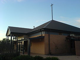
St Thomas' Anglican ChurchPopulation: 3,644 (2001) Postcode: 2567 Location: 60 km (37 mi) from Sydney CBD LGA: Camden Council Region: Macarthur Region State District: Camden Federal Division: Macarthur Suburbs around Narellan: Kirkham Harrington Park Currans Hill Elderslie Narellan Narellan Vale Spring Farm Spring Farm Narellan Vale Narellan is a suburb of the Macarthur Region of Sydney in the state of New South Wales, Australia in Camden Council.
Contents
History
The area now known as Narellan was probably originally home to the Tharawal people, based in the Illawarra region, although the Western Sydney-based Darug people and the Southern Highlands-based Gandangara people were also known to have inhabited the greater Camden area. Very early relations with British settlers were cordial but as farmers started clearing and fencing the land affecting food resources in the area, clashes between the groups arose until 1816 when a number of indigenous people were massacred and the remainder retreated from direct conflict with the settlers.
In 1805, wool pioneer John Macarthur was granted 5,000 acres (20 km²) at Cowpastures (now Camden). After the land was cleared, it was used for farming for most of the next 200 years until Sydney's suburban sprawl reached the town of Camden and modern suburbs like Narellan were subdivided into housing blocks.[1]
Sport and recreation
Narellan was home to the Oran Park Raceway motor racing circuit,which is being redeveloped into a new residential suburb.
Churches
People
Demographics
In the 2001 Australian Bureau of Statistics Census, the suburb of Narellan had a population of 3,644 people. Like its neighbouring suburbs, Narellan is predominantly Australian born (83%) families with young children (53%) living in detached houses (90%). The number of people aged 65 and over (8%) is substantially less than the national average (13%).[2]
Notable residents
- Jimmy Sharman, boxing promoter
- James Tyson, wealthy pastoralist
Governance
Narellan lies in the central ward of Camden Council, currently represented by Fred Anderson, Rob Elliott and Debby Dewbery. It sits within the state electorate of Camden, represented by Labor's Geoff Corrigan, the former Mayor of Camden, and the federal electorate of Macarthur, represented by Liberal's Pat Farmer, the former ultra-marathon runner.
See also
- Jacks Gully landfill
References
- ^ ""The History of Camden"". Camden Historical Society. http://www.camden.nsw.gov.au/page/history.html. Retrieved 2007-06-14.
- ^ Australian Bureau of Statistics (9 March 2006). "Narellan (State Suburb)". 2001 Census QuickStats. http://www.censusdata.abs.gov.au/ABSNavigation/prenav/LocationSearch?collection=Census&period=2001&areacode=SSC12651&producttype=QuickStats&breadcrumb=PL&action=401. Retrieved 2007-06-30.
External links
- Narellan, New South Wales is at coordinates 34°02′42″S 150°44′13″E / 34.04511°S 150.73706°ECoordinates: 34°02′42″S 150°44′13″E / 34.04511°S 150.73706°E
Suburbs and localities within Camden Council · Macarthur · South-western Sydney · Sydney Bickley Vale · Camden · Camden South · Catherine Field · Cobbitty · Currans Hill · Elderslie · Ellis Lane · Grasmere · Harrington Park · Kirkham · Leppington · Mount Annan · Narellan · Narellan Vale · Oran Park · Smeaton Grange · Spring FarmCategories:- Suburbs of Sydney
- Australian Aboriginal placenames
- Sydney geography stubs

Wikimedia Foundation. 2010.