- Mount Coot-tha, Queensland
-
"Mount Coot-tha" redirects here. For the Queensland electoral division, see Electoral district of Mount Coot-tha.
Mount Coot-tha
Brisbane, Queensland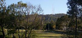
Mount Coot-tha and the Television TowersPostcode: 4066 LGA: City of Brisbane, Toowong Ward State District: Indooroopilly
Mount Coot-tha
MoggillFederal Division: Ryan Suburbs around Mount Coot-tha: Enoggera Reservoir The Gap Bardon Brookfield Mount Coot-tha Toowong Kenmore Chapel Hill Indooroopilly Mount Coot-tha, which is 287 metres above sea level, has the highest peak in Brisbane, Queensland, Australia.
Mount Coot-tha forms the eastern extent of the Taylor Range and is a prominent landmark approximately 6 km to the west of the Brisbane central business district. Visible from much of the city, Mount Coot-tha is a popular bushland tourist destination including the Brisbane Botanic Gardens and Sir Thomas Brisbane Planetarium, as well as a mountain drive, bike trails, parks including a waterfall, and television and radio towers. Mount Coot-tha is the source of Ithaca Creek.
Mount Coot-tha is also a suburb of Brisbane.
Contents
History
Before the Moreton Bay penal settlement, Mount Coot-tha was the home of the Turrbal Aboriginal people.[1]
Early Brisbane people called it One Tree Hill when bush at the top of the hill was cleared except for one large eucalypt tree. The Aboriginal people of the area used to come to the area to collect ‘ku-ta’ (honey) that was produced by the native stingless bee. Mount Coot-tha (Place of Honey), a derivative of (the indigenous term), replaced the former title ‘One Tree Hill' in 1880 when the area was declared a Public Recreation Reserve.
The Lookout
Mount Coot-tha is one of Brisbane's most popular tourist destinations and is a popular stop with bus tours. Of particular note is the Lookout, which includes the Kuta Cafe, Summit Restaurant, and Gift Shop.
 360 degree view of Brisbane City from the Lookout
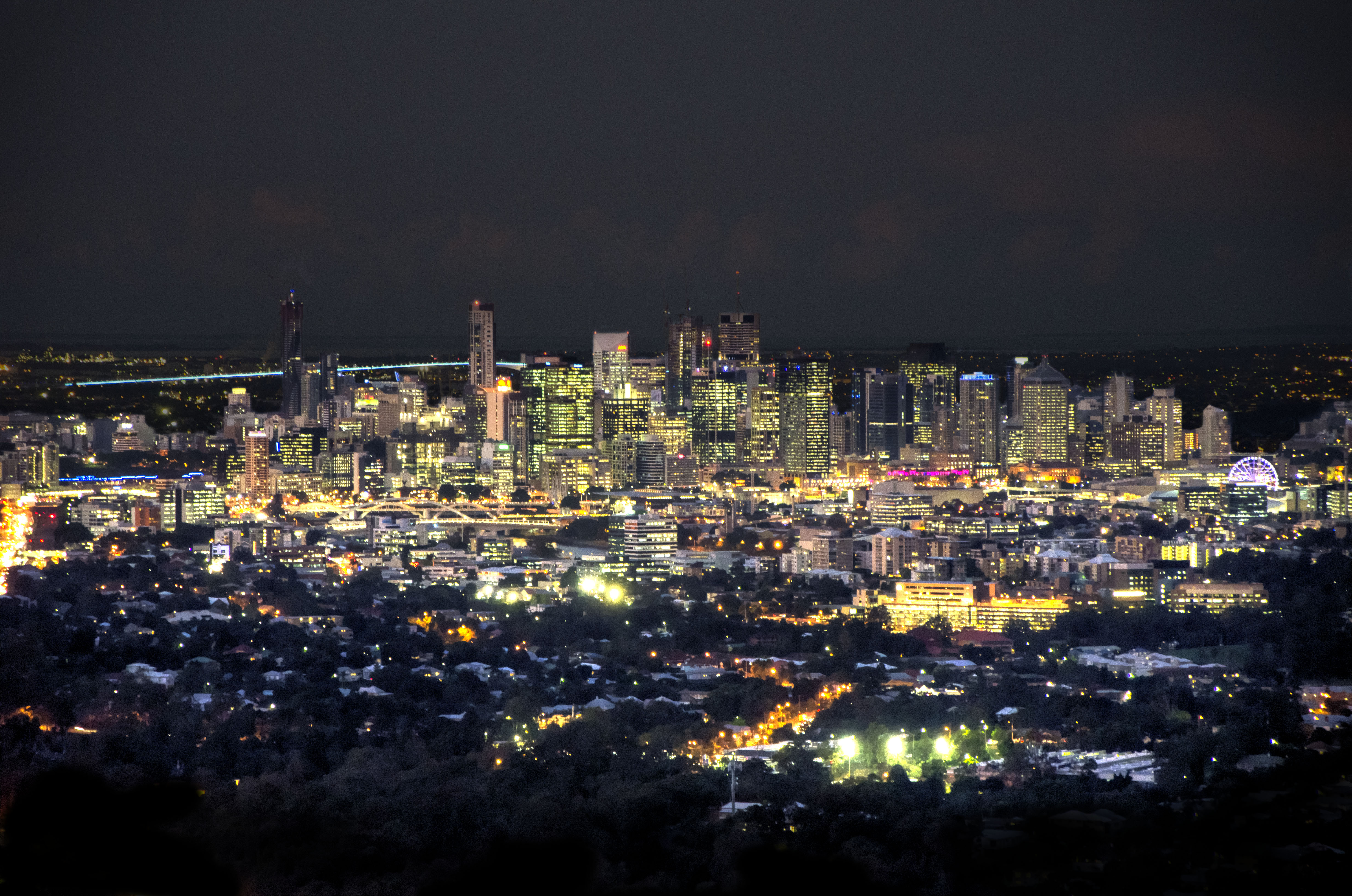
 Brisbane at night
The lookout, restaurant and cafe allow for panoramic views of the City. A function centre adjoins the restaurant. Well-known British astronomer Sir Patrick Moore gave a night-time public lecture about the stars of the southern hemisphere at the lookout in 1988, in conjunction with Patrick Moore being a guest speaker at a dinner of the Southern Astronomical Society at Toowong in Queensland.[2][3]
Sir Samuel Griffith Drive
Sir Samuel Griffith Drive is a tourist drive circling the peak, providing access to the lookout, cafe, gift shop and restaurant. The scenic drive, from the base of Mount Coot-tha to the lookout, is a winding, climbing journey that offers spectacular views of the greater Brisbane area and of the mountains and coastline that disappear into the horizon.
The Mount Coot-tha Reserve
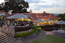 Cafe at the lookout
The Mount Coot-tha Reserve contains more than 1,500 hectares of natural bushland, including J C Slaughter Falls along Ithaca Creek, as well as native wildlife.[1] Mount Coot-tha Reserve also shares a border with Brisbane Forest Park, which adds a further 25,000 hectares.[1]
Television and radio towers
On a ridge near the summit on the other side of Mount Coot-tha, are the television transmission towers for the Brisbane television stations SBS, ABC, Ten (TVQ-10), Nine (QTQ-9), Seven (BTQ-7) and community access television station 31 Digital . Part of the Brisbane suburb of The Gap is located on the foothills beneath the television towers.
Most of the FM Brisbane radio stations also transmit from Mount Coot-tha.
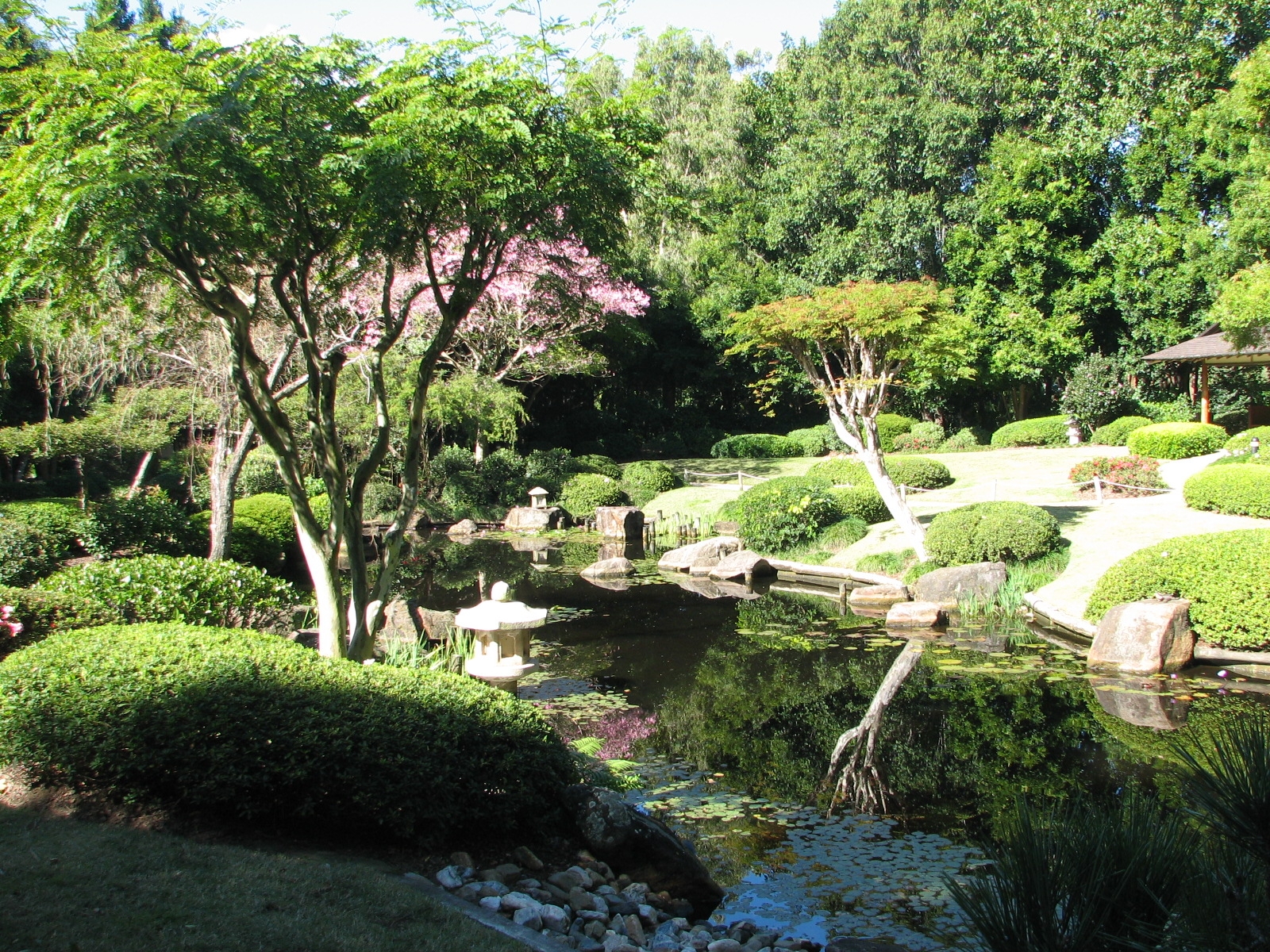
Mount Coot-tha Botanic Gardens
 Japanese Gardens at Mount Coot-tha Botanic Gardens
At the base of Mount Coot-tha are the Brisbane Botanic Gardens, Mount Coot-tha, which has a tropical plants hothouse and also the Sir Thomas Brisbane Planetarium within its grounds.
Walking tracks
There are several popular walking tracks around Mount Coot-tha, one of which includes an art display comprising works produced by local Aboriginal artists. The tracks vary in difficulty, with most involving some uphill sections or steps. Tracks around Mount Coot-tha are often used by hikers training to walk the Kokoda Track in Papua New Guinea as the terrain and climate are considered similar. On 20 November 2005, one of the Mount Coot-tha trails, the Currawong trail, was renamed the Kokoda trail in honour of the Australian soldiers who marched the Kokoda Track during World War II. During World War II, the hill was used as a military base by the RAAF and the US Navy. It was converted to a vast explosives depot and at one stage held more than 120 000 tonnes of explosive weapons. When darkness fell the lookout bristled with search lights in an amazing display as soldiers kept an eye out for enemy planes.
Mountain bike trails
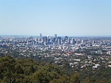 View of the cityscape from the Mount Cooth-tha Lookout
The Western side of Mount Coot-tha Forest or Gap Creek Reserve as it is known to the locals is a haven for Brisbane mountain bike riders. The establishment of a world class mountain bike trail network by the Brisbane City Council has created a diverse range of recreational experiences for off-road cyclists.
The mountain bike trails at Mount Coot-tha have been assigned a grading under the International Mountain Bicycling Association , Trail Difficulty Rating System. The multi-use trails in Mount Coot-tha provide the least degree of technical challenge to mountain bike riders, however many of them are steep and loose. Pay special attention when riding over the erosion control banks (water bars) which have been the downfall of many a novice rider. The trail ratings provide a guide to the relative difficulty of each trail.
The multi-use tracks are used by horses, pedestrians and mountain bikers. Each year orienteering events are held on the in the area.
Transport
Mount Coot-tha can be reached by Brisbane Transport Bus 471 (Translink) or the Brisbane City Council's CitySights Bus. A short taxi ride from Toowong is also possible. There is limited car parking at the peak.
See also
- Brisbane native plants
- List of mountains in Australia
References
- ^ a b c Mount Coot-tha Forest track map — (Brisbane City Council)
- ^ Southern Astronomical Society — Astronomy Astronomical Events
- ^ Taylor Range Observatory. P.E. Anderson. January 2000.
External links
- University of Queensland: Queensland Places: Mount Coot-tha
- Mount Coot-tha
- Mountain Bike Trails Info
- Mount Coot-tha Lookout
- Brisbane parks and gardens (Government website)
Coordinates: 27°28′50″S 152°57′15″E / 27.4806°S 152.9541°E
Categories:- Suburbs of Brisbane
- Mountains of Queensland
- Visitor attractions in Brisbane
- Mountain biking venues in Australia


Wikimedia Foundation. 2010.