- Satara (city)
-
सातारा
Satara

The city of Maratha warriors, history, kings, pensioners and nature — city — Clockwise from top: Chaarbhinti, Natraj Mandir, The name of the city 'Satara' in three different scripts: Modi, Devnagri and Roman; Kshetra Mahuli, Ajinkyatara Fort, and the panorama of Satara city.
Coordinates 17°41′29″N 74°00′03″E / 17.69139°N 74.00092°ECoordinates: 17°41′29″N 74°00′03″E / 17.69139°N 74.00092°E Country India State Maharashtra District(s) Satara Mayor Mrs. Smita Ghodake Population
• Density
108,043 (2001[update])
• 266.77 /km2 (691 /sq mi)
Time zone IST (UTC+05:30) Area
10484 km2 (4048 sq mi)
• 742 metres (2,434 ft)
Website www.satara.nic.in Satara
 pronunciation (help·info) (Marathi: सातारा (Devnagri),
  (Modi)) is a city located in the Satara District of Maharashtra state of India. The town is 2320 ft. above sea-level, near the confluence of the Krishna and its tributary river Venna. The city was the capital of the Maratha empire in the 17th century, hence one of the the historical cities of Maharashtra. This city is the capital of Satara Tehsil, as well as Satara District.
Contents
Toponymy
The name of the city is derived from the seven hills surrounding the city. Saat (सात) meaning seven in Marathi and Tara (तारा) meaning hill, thus forming the word 'Satara'. Historians agree that the name of the city has its origins in the seven hills overlooking the city. The seven hills are Ajinkyatara, Sajjangad, Yawateshwar, Jarandeshwar, Nakdicha Dongar, Kitlicha Dongar, and Pedhyacha Bhairoba.
History
Ancient
The oldest Dynasty ruling Satara is said to be the Rashtrakutas. The oldest Rashtrakutas are believed to be from ancient Kuntala in the valley of river Krishna. King Manank ruled from 350 - 375 C.E. and had built his capital in Maanpur (now Maan in Satara district). The Vakatakas of Vidarbha, another Rashtrakuta rulers were in conflict with Manank. Subsequently the Rashtrakutas became feudatories to the Chalukyas and came into prominence under Dantidurga around 753 CE.
The empire of Chandragupta II, known as Mahendraditya Kumargupta I, extended as far as Satara district in Deccan when he ruled between 451 AD to 455 AD. The Mauryan empire in the Deccan was followed by the rules of Satavahans for about two centuries between 550 A.D. to 750 AD.
Medieval
The first Muslim invasion of the Deccan took place in 1296. In 1636 the Nizam Shahi dynasty came to an end. In 1663 Shivaji conquered Parali & Satara fort. After the death of Shivaji, Aurangzeb's son Muhammad Azam Shah conquered Satara fort (Ajinkyatara) after a 6month siege. later won by Parshuram Pratinidhi in 1706. In 1708 Chattrapati Shahu,the son of Chhatrapati Sambhaji, was crowned on the Satara fort. The direct descendents of Raja Shivaji continue to live in Satara. The current king of Satara, Udayanraje Bhonsale is the 13th descendent of Shivaji Maharaj.
British
After their victory in the Third Anglo-Maratha War in 1818, the British Empire annexed most of the Maratha territory to Bombay Presidency, but restored the titular Raja Pratap Singh, and assigned to him the principality of Satara, an area much larger than the present district. As a result of political intrigues, he was deposed in 1839, and his brother Shahji Raja was placed on the throne. This prince died without any male heirs,and as a result Satara was eventually annexed by the British government, and added to Bombay Presidency.
During the independence struggle,a type of Parallel Government known as Prati Sarkar came into existence.The people of Satara,under the leadership of Krantisinha Nana Patil,ousted the British officials and took power into their hands. During Quit India Movementof 1942, this parallel government replaced British government for 4.5 years from August 1943 to May 1946. Similar ousters of British power in other areas,led to the formation of similar Parallel Governments in Midnapore in West Bengal and Purnia in Uttar Pradesh. Such was the efficiency and power of these Parallel Governments that for nearly 4.5 years, the British did not even try to capture these areas, fearing defeat;which shows the popular nature of these governments.
Features of Satara city
- Satara is well known for its sweet: 'Kandi Pedhe'.
- This city was one of the capitals of the Maratha Empire.
- Also, this city was one of the centers of Indian Independence Movement.
- It is situated near confluence of two rivers: Krishna and Venna.
- If we see the panorama of city from Jarandeshwar at night, we can see the number '17', due to the lighting on the roads.
- Satara city is the only city, in which the unique statue of Chhatrapati Shivaji Maharaj is there at Powai Naka. This is the unique statue, because Chh. Shivaji maharaj standing near a canon, and such kind of statue of Chhatrapati Shivaji maharaj is not anywhere.
Geography
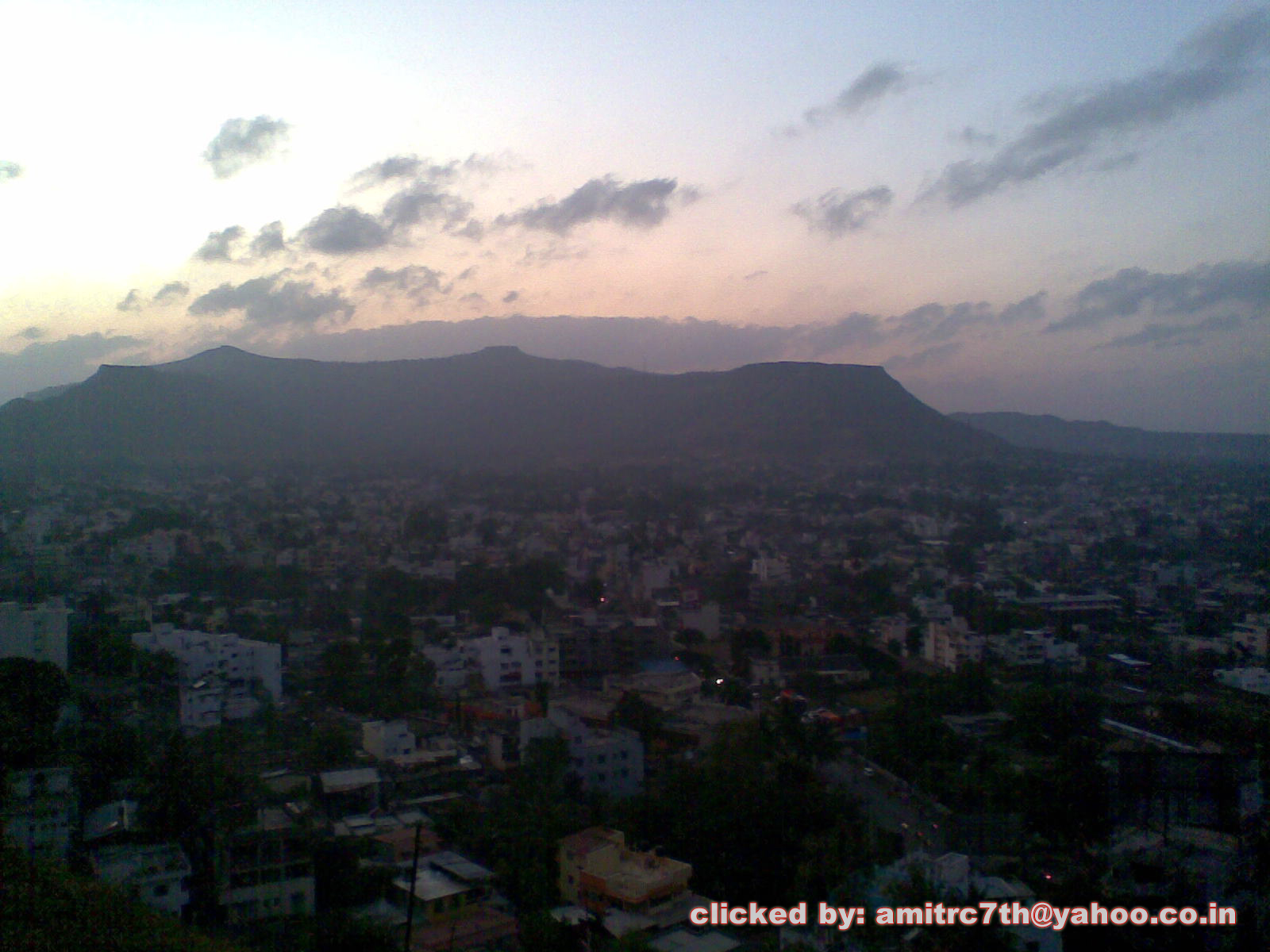
 View of Satara City at sunset from Chaarbhinti (Clicked at 11 December, 2010; 1815 hrs.(IST)
Satara is located at 17°41′N 73°59′E / 17.68°N 73.98°E.[1] It has an average elevation of 742 metres (2434 feet).
Satara is located in the western part of Maharashtra. Satara district is bounded by Pune district to the north, Solapur district to the east, Sangli district to the south and Ratnagiri district to the west. Raigad district lies to its north-west. Satara District has an area of 10,480 km², and a population of 2,796,906 (2001).
The Sahyadri range, separates the district from Ratnagiri on the western side The black rock Mahadeo range starts about 10 m north of Mahabaleshwar and stretches east and south-east across the whole of the district
The main rivers of Satara district are Koyna and Krishna. The Krishna is one of the three largest sacred rivers of southern India. Approximately 172 km of the river course falls inside the district. The Krishna river begins on the eastern brow of the Mahabaleshwar plateau and the source is about 4500 ft. above sea level. Kudali, Urmodi, Venna and Tarali are small feeder rivers (tributaries) of Krishna. Koyna is the largest tributary of the Krishna in the district. These two rivers met each other in Karad. There is formed a famous place called "Pritisangam" . Neera and Manganga rivers are the two representative of the Bhima drainage in the north and north-eastern parts of the district respectively.
Climate
Satara City is surrounded by seven hills. Since it is in hilly area, its climate is tropical wet and dry. The temperature of Satara City is varies in the range 39°C-45°C in Summer and 5°C-20°C in winter. Due to Monsoon, we can experience the rainy season between the period June to early October. In this area, near about 1000 mm rainfall occurs during monsoon. The best time period to visit Satara City is between September to March.
Tourism
The famous tourist points near Satara City are:
- Vajrai Waterfall (वजराई धबधबा)
- Ajinkyatara Fort (अजिंक्यतारा किल्ला)
- Sajjangad Fort (सज्जनगड किल्ला)
- Chaarbhinti (चारभिंती)
- Natraj Mandir (नटराज मंदिर)
- Bhairoba Hill (भैरोबाची टेकडी)
- Kuraneshwar (कुरणेश्वर)
- Jaradndeshwar (जरंडेश्वर)
- Yawateshwar (यवतेश्वर)
- Kas Lake and Kas Plateau (कास तलाव आणि कास पठार)
- Bamnoli (बामणोली)
- Thosegar Waterfalls (ठोसेघर धबधबा)
- Chalkewadi (चाळकेवाडी)
- Rajwada (राजवाडा)
- Sangam Mahuli (संगममाहुली)
- Kshetra Mahuli (क्षेत्रमाहुली) etc.
Kas Lake and Kas Pleatue
Kas Lake ls on a distance of 23 km from Satara city. While going to this lake you will have a beautiful nature around you. Total road of 22km is hilly, going from Kaas Plateau which is called as Maharashtra's Valley of Flowers. In monsoons, the climate here is at its best. Once you start going on to the plateau you will find a Sai Temple, some of the bungalows located the bank of the hills and very small villages of 15-20 houses.
Kaas Plateau is really a Valley of Flowers. You can enjoy the scene of widespread carpet of flowers, of different species (including some exclusive and rare species), colors and variety. spread over acres of land on the Kas platue. The lateritic plateau of Kass has becomes home to millions of tiny flowers in late monsoons. More than 300 varieties of wild flowers, herbs, orchids, shrubs, insectivorous plants etc. can be seen here in the time span form August to November (Best time is 15th Aug to 15th Oct). This plateau overlooks the lush evergreen forests that serves as a water catchment area of Koyna Dam, Chandoli National Park and Koyna Wildlife Sanctuary was recently declared as “Sahyadri Tiger reserve". In monsoon the whole area transforms into an unbelievable carpets of flowers like yellow carpets of Smithia and Sonki flowers, Pink carpets of Balsam, Purple carpets of Karvi etc….
It is a dream destination not only for avid botanists but also for those who appreciate nature. These carpets change colours almost every week depending on the dominant flowers during that time.
Demographics
As of 2001 India census,[2] Satara had a population of 108,043. Males constitute 52% of the population and females 48%. Satara has an average literacy rate of 80%, higher than the national average of 74%: male literacy is 84%, and female literacy is 76%. In Satara, 10% of the population is under 6 years of age.
Education
Schools in Satara City
- New English School.
- Anant English School.
- Shri Bhavani Vidya Mandir.
- Sou.Sushila Devi Salunkhe Girls Highschool.
- Annasaheb Kalyani Vidyalaya.
- Abasaheb Chirmule Vidya Mandir.
- Bhimabai Ambedkar Kanya Vidyamandir.
- Dr. J. W. Airan Academy ( formerly known as Narmada Education Academy).
- Kanyashala.
- Maharaja Sayajirao Vidyalaya.
- KSD Shanbhag Vidhyalaya.
- Universal Knowledge School
- Nirmala Convent High School.
- Mona School.
- Navin Marathi Shala.
- Deccan Education Society's English Medium School.
- Sainik School, Satara.
- Satara English Medium School.
- Saint Paul's School.
- Sahas International School.
- Podar International School.
- Gurukul English Medium school.
Colleges in Satara City
 Yashwantrao Chavan Institute of Science, Satara: One of the top science colleges in Maharashtra state.
- Department of Pharmacy, Satara Polytechnic Satara,near Anant English School, Satara
- Karmaveer Bhaurao Patil College of Engineering and Polytechnic, Satara
- Gourishankar Polytechnic, Limb
- Lal Bahaddur Shastri College, Satara
- Azad College Of Education, Satara
- Chhatrapati Shivaji Arts College, Satara
- Dhananjay Gadgil Vanijya Mahavidyalay, Satara
- Ismailsaheb Mulla Law College, Satara
- Satara College of Engineering and Management, Limb
- Chhabda College of Engineering, Raigaon
- Yashawantrao Chavan Institute of Science, Satara
- Satara Polytechnic, Satara
- Satara College Of Pharmacy, Degoan
- Samarth Educational Trusts Sawkar College of Pharmacy (D. Pharmacy)
- Samarth Educational Trusts Arvind Gavali College of Pharmacy (B. Pharmacy)
- Aryangla Vaidyak Mahavidyalaya (B.A.M.S.)
- Sawkar Medical College (B.H.M.S.)
Further reading
- Paul H. von Tucher: Nationalism: Case and crisis in Missions - German Missions in British India 1939 - 1946. Diss. Erlangen 1980. Author's edition Erlangen/Germany 1980. [1], [2], [3] and [4] in Satara 1940-1946.
- Wilhelm Filchner: Life of a Researcher (chapter XXIII). Wilhelm Filchner was interned from September 1941 until November 1946 in the Parole Camp in Satara. Later on he lived in Poona in the Maharashtra state of India.
- Selections from the Historical Records of the Hereditary Minister of Baroda. Consisting of letters from Bombay, Baroda, Poona and Satara Governments. Collected by B.A. Gupte. Calcutta 1922.
- Malik, S.C. Stone Age Industries of the Bombay & Satara Districts, M. Sayajirao University Baroda 1959.
- Irawati Karve, Jayant Sadashiv Randadive, The Social Dynamics of a Growing Town and Its Surrounding Area. Deccan College ,1965, Poona. ISBN B0000CQW3J
- Valunjkar, T. N. Social Organization, Migration & Change in a Village Community, Deccan College Poona 1966.
References
- ^ Falling Rain Genomics, Inc - Satara
- ^ "Census of India 2001: Data from the 2001 Census, including cities, villages and towns (Provisional)". Census Commission of India. Archived from the original on 2004-06-16. http://web.archive.org/web/20040616075334/http://www.censusindia.net/results/town.php?stad=A&state5=999. Retrieved 2008-11-01.
External links
- Satara Photo Gallery and Video Gallery
- Welcome to Satara
- Satarainfo
- dasbodh.com - Site dedicated to Dasbodh and Samarth Ramdas Swami (contains Dasbodh in various languages plus all the literature of Samarth Ramdas Swami)
 This article incorporates text from a publication now in the public domain: Chisholm, Hugh, ed (1911). Encyclopædia Britannica (11th ed.). Cambridge University Press.
Satara district topics History 
Geography Cities and towns Lok Sabha constituencies Madha · SataraVidhan Sabha constituencies Satara State of MaharashtraCapital: Mumbai
Topics Regions Districts Million-plus cities
in MaharashtraOther cities with
municipal corporationsCategories:- Cities and towns in Satara district


Wikimedia Foundation. 2010.