- Operation IceBridge
-
Operation IceBridge is a 2009–2015 NASA mission that aims to monitor changes in polar ice from a fixed-wing aircraft. It is a temporary replacement for the ICESat satellite.
Equipment
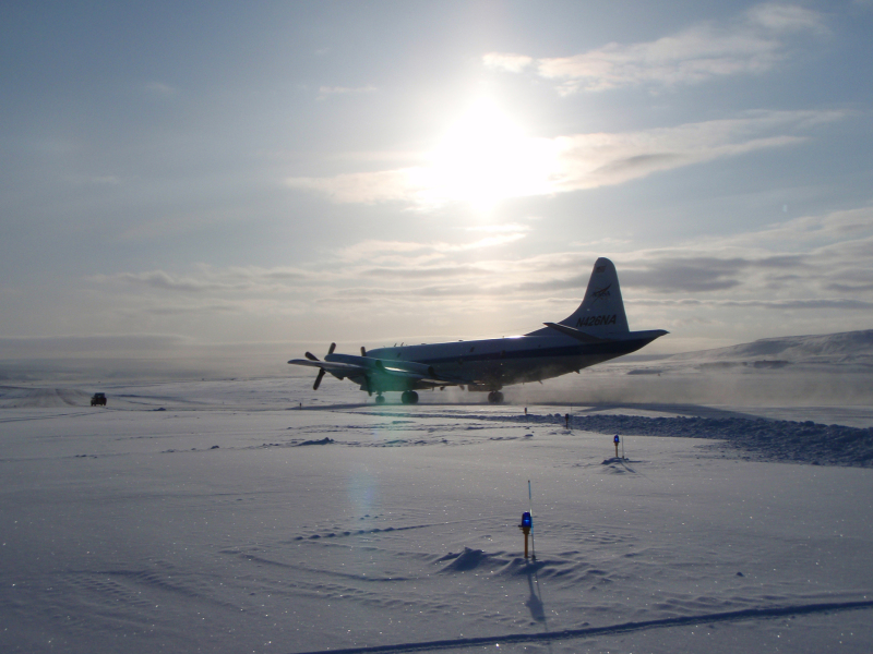
 The P-3 Orion aircraft used in Operation IceBridge
Since 2003 NASA has used a satellite, ICESat (Ice, Cloud, and land Elevation Satellite), for observing polar ice. ICESat was retired in February 2010 due to a technical malfunction, leaving NASA without a satellite dedicated to ice observance. A new satellite is not expected to be launched until 2015.[1][2] NASA therefore introduced the IceBridge program which utilizes an aircraft to make similar measurements.
The drawback to using an aircraft instead of a satellite is that a satellite can observe a far wider area. However, the aircraft carries many additional instruments, which offer much more detailed information than a satellite can provide.[2] Air flights began in March 2009[3] using a DC-8. Beginning in 2010, a P-3 Orion has been used instead.[4]
The aircraft carries many specialized pieces of equipment. Among these is the Airborne Topographic Mapper, a laser that measures the surface elevation of the ice. Also on board is a Gravimeter, an instrument capable of measuring the shape of cavities in the ice. There are numerous other pieces of equipment on board, including the Laser Vegetation Imaging Sensor, the Multichannel Coherent Radar Depth Sounder, a Snow Radar, and the Ku-Band Radar Altimeter.[4]
Research
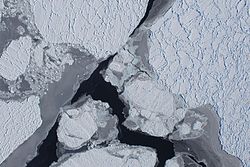 An aerial photo, taken during the Operation IceBridge mission, depicting Pine Island Glacier
The project, headed by Seelye Martin from the University of Washington, will use three-dimensional mapping to provide a clearer picture of Arctic and Antarctic areas.[5] The overall goal is to discover the causes of polar ice melting and rises in sea level by collecting data from specific glaciers. Pine Island Glacier is one such area of focus. There, Operation IceBridge has been observing the underside of the ice-sheet using an advanced radar, as well as closely monitoring an area of Pine Island Glacier, known as the ice tongue, that, were it to melt, would allow a large portion of the glacier to slide into the Amundsen Sea.[2]
References
- ^ "NASA's Successful Ice Cloud and Land Elevation Mission Comes to an End". NASA. 27 August 2010. http://www.nasa.gov/mission_pages/icesat/icesat-end.html. Retrieved 31 August 2010.
- ^ a b c Hamilton, John (30 October 2009). "NASA Launches Mission To Track Polar Ice By Plane". NPR. http://www.npr.org/templates/story/story.php?storyId=114299675. Retrieved 25 February 2011.
- ^ "Ice Bridge Mission Overview". NASA. http://www.nasa.gov/mission_pages/icebridge/mission/index.html. Retrieved 25 February 2011.
- ^ a b "ICE Bridge". NASA. 20 January 2011. http://www.nasa.gov/mission_pages/icebridge/science/index.html. Retrieved 28 February 2011.
- ^ "Operation IceBridge Daily Schedule". NASA. http://www.espo.nasa.gov/oib/. Retrieved 25 February 2011.
Categories:- NASA programs
- NASA
- Antarctica
- Science and technology in Antarctica
- United States Antarctic Program

Wikimedia Foundation. 2010.