- History of Trumbull, Connecticut
-
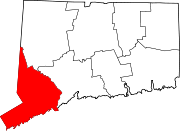
Trumbull, Connecticut — Town — 
FlagMotto: Pride in our Past, Faith in our Future Location in Fairfield County, Connecticut
Coordinates: 41°13′59″N 73°13′6″W / 41.23306°N 73.21833°WCoordinates: 41°13′59″N 73°13′6″W / 41.23306°N 73.21833°W Country United States State Connecticut County Fairfield NECTA Bridgeport-Stamford Region Greater Bridgeport Settled 1639 as Stratford Incorporated 1797 as Trumbull Government – Type First selectman-Town council – First selectman Timothy M. Herbst Area – Total 23.5 sq mi (60.9 km2) – Land 23.3 sq mi (60.3 km2) – Water 0.2 sq mi (0.6 km2) Elevation 266 ft (81 m) Population (2010) – Total 36,018 – Density 1,532/sq mi (597/km2) Time zone Eastern (UTC-5) – Summer (DST) Eastern (UTC-4) ZIP code 06611 Area code(s) 203, 475 FIPS code 09-77200 GNIS feature ID 0213518 Website http://www.trumbull-ct.gov/ Introduction
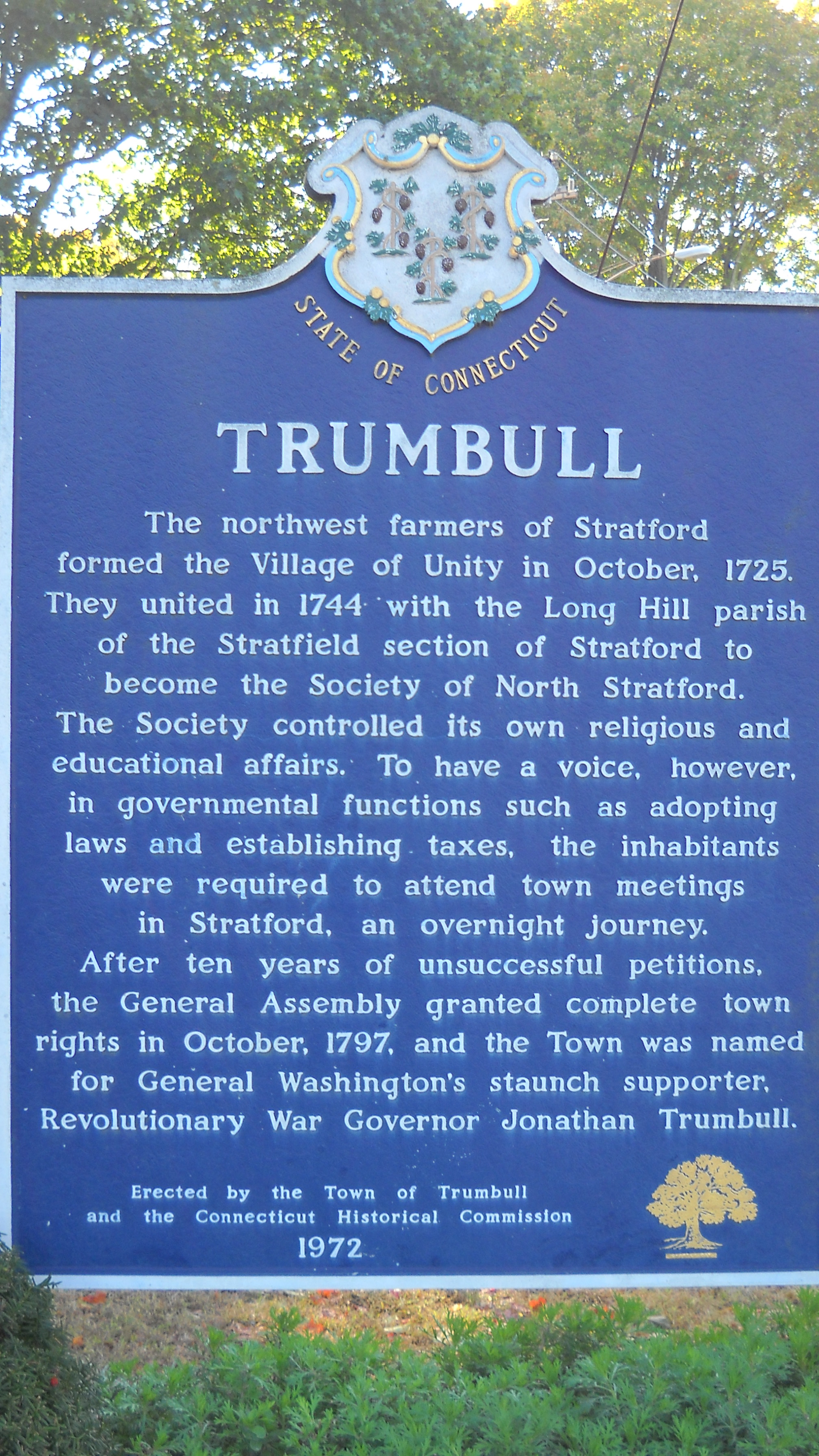
Trumbull, a town in Fairfield County, Connecticut in the New England region of the United States, was settled owned and controlled by the town of Stratford from 1639 until May 1725 when the northwest farmer's of Stratford petitioned the Colony of Connecticut to establish their own separate village. They proposed calling their new village Nickol's Farm's after the family that owned a large farm in its center at the time. The new parish was approved in October 1725 and called Unity.
In 1744, Unity merged with the Long Hill parish (organized in 1740) of the Stratfield section of Stratford to form the Society of North Stratford. North Stratford controlled its own religious and educational affairs. However, to have a voice in governmental functions such as adopting laws and establishing taxes, the inhabitants were required to attend town meetings in Stratford, an overnight journey.
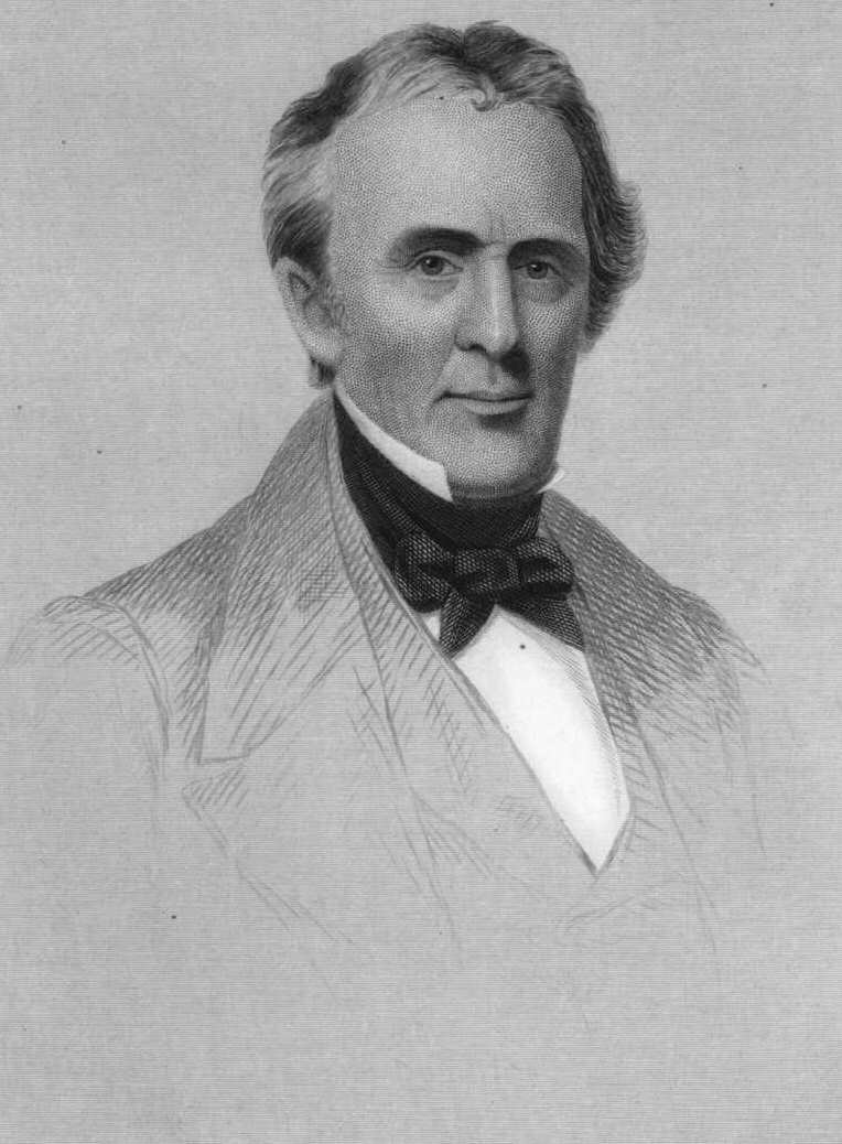
After ten years of unsuccessful petitions, the Connecticut General Assembly granted complete town rights in October 1797. The new town was named for George Washington's staunch supporter Revolutionary War Governor, patriot, statesman and merchant, Jonathan Trumbull (1710–1785).[1]
Native Americans
The Golden Hill Paugussett Indian Nation occupied the territory of Trumbull as a self-sustaining community for thousands of years before the arrival of the English in the late 1630s. The Indian Nation lived along the banks of the Pequonnock River in the Pequonnock River Valley and also around the natural lake first called Mischa Lake after the Indian Chief who resided there and now is known as Pinewood Lake.
After twelve to fifteen years had passed by, the Stratford settlement had grown so much in size that the displaced Indian Nation began to ask for compensation for land north of an east to west line 6 miles (9.7 km) north of Long Island Sound. This line was located within the present-day village of Nichols, Mischa Hill, Pinewood Lake and White Plains areas.[2] The original Stratford proprietors agreed and began to make several purchases from the Indians in the 1650s, however, relations between the English and the Indians became strained throughout the Colony of Connecticut as settlements continued to grow and displace the Native Americans.
In 1652, the Court at the Colony of Connecticut ordered that no Indian could walk near an Englishman's house either in town or at his farm on the Sabbath without being fined or imprisoned.[3] In 1656, it was ordered that no one in the Colony of Connecticut could sell an Indian a horse or mare or any boat or boat rigging without suffering a penalty of 5 to 1.[4] The tribe maintains a small reservation in the Nichols section of Trumbull that is considered to be the oldest continuing reservation in Connecticut and the smallest in the US.
Founding and Puritan era
Trumbull was originally settled as a part of Cupheag, the Pequonnock Indian word for harbor, a coastal settlement established in 1639 by Puritan leader Reverend Adam Blakeman (pronounced Blackman), William Beardsley and either 16 families—according to legend—or approximately 35 families—suggested by later research—who had recently arrived in Connecticut from England seeking religious freedom. The main village and stockade was built where the Housatonic River flows into Long Island Sound.[5] In 1643, the settlement changed its name to Stratford either in honor of William Beardsley who came from Stratford-upon-Avon, birthplace of William Shakespeare, or Stratford-le-Bow, England.[6]
Stratford is one of many towns in the northeastern American colonies founded as part of the Great Migration in the 1630s when Puritan families fled an increasingly polarized England in the decade before the civil war between Charles I and Parliament (led by Oliver Cromwell). Some of the Stratford settlers were from families who had first moved from England to the Netherlands to seek religious freedom, like their predecessors on the Mayflower, and decided to come to the New World when their children began to adopt the Dutch culture and language.
Like other Puritan towns founded during this time, early Stratford was a place where church leadership and town leadership were both united under the pastor of the church, in this case Reverend Blakeman. The goal of these communities was to create perfect outposts of religious idealism where the wilderness would separate them from the interference of kings, parliaments, or any other secular authority.
- Colonial period
 State Historic Marker Trumbull, Connecticut
By the mid 1650s, the Golden Hill Paugussett Indian Nation began to petition the Court of the Colony of Connecticut for compensation for lost territory taken by the encroaching English settlement. This legal action led the court to set the town boundary on May 15 1656 to include all of the territory 12 miles (19 km) inland from Long Island Sound between the Housatonic River and the Fairfield town line, including all of Trumbull.[7]
The English continued to purchase territory from the Native Americans entering the deeds of transfer into the land records. However, the first volume of such records has been lost. It took Lt. Joseph Judson, Joseph Hawley and John Minor, until April 1662 to secure the last written deed of transfer from the Paugussett Indian Nation for the western part of the town of Trumbull, referred to as the Long Hill purchase. This deed references that it was lying west of the land they had already purchased.[8]
Town formation and settlement patterns
- Common land
In 1661, the town voted to allow each inhabitant could take up a whole division of common land anywhere in the woods where they could find fit planting ground as long as it was not within two miles of the town meeting house and they were prohibited from making it their dwelling place without consent. Elder Phillip Groves, Captain William Curtiss and Lt. Joseph Judson, early farmers in Trumbull, were named to a committee to lay out the land as they saw fit.[9]
Up to 1670, individuals claimed planting fields wherever they could find fit land subject to the sanction of a committee or the town selectmen. By the spring of 1680, the town decided to lay out all undivided common land within six miles of the meeting house. This area would have included the southern third of Trumbull.[10] The division of the common land took until 1800 to complete entirely.
- Outliver's
In 1668, there were only five families recorded as being outlivers or living beyond two miles from the Stratford meetinghouse, however, by the 1670s, after numerous individuals were encouraged to and had received permission to dwell outside of the two mile limit, the Stratford selectmen stopped recording outlivers altogether.[11][12]
- Three-mile division
The three mile or woods division, was located three miles from the Stratford meeting house and included land up to six miles away from it. The common land grants were laid out in a fashion so that each tract had a share of a run of water, woods, natural meadow, plains, swamp and ledge. The grants were often a quarter of a mile north to south and one mile in length east to west, about 170 acres (69 ha) of land. Each freeman (Colonial) received division land according to his right or rank in the township and many exchanged or sold their grant after receiving it.
In 1685, some families filed complaints saying they were not receiving their land grants from the woods division in a timely manner. Therefore, the Court at the Connecticut Colony ordered the town to apportion all common land located between two and six miles from the Stratford meeting house, which included all the territory in the lower third of Trumbull.[13]
Nichols
Main article: Nichols, ConnecticutIt is not known exactly when the first settlers began to clear land and establish farms in the area due to the fact that the first volume of Stratford's land records were destroyed around 1650. By 1658, Lt. Joseph Judson, Jeremiah Judson and Joseph Curtiss, became freeman (Colonial) by the court of the Colony of Connecticut and established farm's there. A freeman had to own real property in their own name before they could be elected as freemen.[14][15]
The area now called Nichols, located in southeastern Trumbull, was first called Mischa Hill in the land records for the Native American who lived there. In the late 1660s, it was commonly called Lt. Joseph Judson's Farm, or Judson's Farm, after the owner of the largest farm on its hilltop. After Judson and others removed to establish the town of Woodbury, Connecticut in 1672 and abandoned their farms on Mischa Hill, it was called Old Farm's. In the early 1700s, it was called Nickol's Farm's, then in 1725 it became a part of Unity and in 1744, North Stratford. During the mid 1800s, the area was called Amblersville after the principal manufacturer in the center of the village.
- Abraham Nichols
It is thought that Abraham Nichols made the first permanent settlement within Trumbull around 1690 or 1700, depending on the source, and then other families subsequently ventured into the wilderness to establish mills, churches, and schools. Abraham Nichols landholdings were thought to total 1,000 acres (4.0 km2), however, there is no documentation to support this claim. The land records actually indicate that Abraham Nichols holdings were around 285 acres (1.15 km2) of land, in present-day Nichols center, of which around 55 acres (0.22 km2) remains as open space today.
According to Walter Nicholls, who wrote the History of the Nichols family in 1909, Abraham did not accompany his father to Woodbury in 1673, but remained in Trumbull to oversee the plantation. However, since Abraham was only eleven at the time (born 1662), it is likely that he did remove to Woodbury with his family and returned to Trumbull between 1696 and 1700.[16]
Walter Nicholls imaginative description of the Nichols homestead;
About 1700 Abraham Nicholls erected for himself a homestead upon his lordly domain, and which, according to the description vouchsafed by persons now living, who chanced to view it while yet standing in the early part of the nineteenth century, was an immense gambrel-roofed structure of a rambling style of architecture, situated upon an eminence, affording an unobstructed vista of the surrounding landscape and at the southward, about four miles distant, the shimmering bosom of Long Island Sound. There it stood for decades, without a neighboring habitation within a circuit of several miles; while the sepulchral quietude of its surroundings was rarely broken, even by the echo of a sound adequate to dispel the day dreams, or waken the nocturnal slumbers of its peaceful inhabitants, save that of the casual lowing of kine, the appealing cadence of the whop-poor-will at nightfall, or the grewsome howling of wolves. . . .It is a subject of profound regret on the part of many of the descendents of Abraham Nicholls that neither his will nor the inventory of his estate can be found of record.- Land purchases
Abraham Nichols bought or exchanged land to acquire several farms and large parcels of land, expanding his land holdings in Trumbull, beginning in 1696. Nichols exchanged land for 22 acres (0.089 km2) of Lt. Joseph Judsons old farm which had a barn on it, 54 acres (0.22 km2) or half the land owned by Jeremiah Judson, and 19 acres (0.077 km2) of land from Benjamin Curtiss.[17] All of these transactions are described in the land records as being located at or near the Old farm, Judson's farm's or Lt. Joseph Judson farm. Nichols purchased Reverend Zachariah Walker's entire farm in 1704 which was 36 acres (0.15 km2) in size. Furthermore, in a deed recorded in 1699, Lt. Ebenezer Curtiss received 15 acres (0.061 km2) of land from the three-mile division that was bounded west with Lt. Joseph Judson's farm, now belonging to Abraham Nichols.[18]
- Woods estate
Some of Abraham Nichols farm remained in the Nichols family for over two centuries. Florence Nichols, the last of the Nichols line, married George Woods in 1903. Soon after their deaths in 1973 and 1972 respectively, the property was deeded to the Nichols Methodist Church from whom the town of Trumbull purchased it in 1974. The remaining 13 acres (0.053 km2) homestead was then known as the Woods Estate and is now the home of the Trumbull Historical Society.[19]
Agriculture
The Nichols and White Plains areas were the first to be cultivated and settled within present-day Trumbull due their fertile soil, spring-fed ponds, natural meadows and close proximity to the Stratford meeting house; less than three miles away. In the mid seventeenth century in the Colony of Connecticut, it was very common for freemen to establish a farm, or several farms in the fertile upland or countryside while also maintaining a substantial townhouse in the main village or back in England.
- Early farmer's
The first individuals to own land in Trumbull were among the original founders of the Stratford settlement namely; Benjamin Beach, Zachariah Bostick (Bostwick), Richard Booth, Ephraim Booth, Paul Brinsmaid, John Curtiss, Benjamin Curtiss, Mr. Joseph Curtiss, Captain William Curtiss (Curtice), Ebenezer Curtiss, Israel Curtiss, Zachariah Curtiss, Joseph Fairchild, Elder Philip Groves (Graves, Grouse), Joseph Hawley, Ephraim Hawley, Captain John Hawley, Edward Hinman, Lt. Joseph Judson, Sgt. Jeremiah Judson, Isaac Judson, John Judson, Thomas Lake, Isaac Nichols, Caleb Nichols, Abraham Nichols, Samuel Ufford (Uffoot) and Reverend Zechariah Walker.[20]
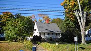
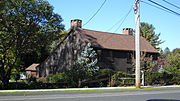
 Zachariah Curtiss House
The first families to reside permanently in Trumbull were descended from the; Beach, Beardsley, Blakeman, Booth, Bostick, Brinsmade, Clarke, Curtiss, Edwards, Fairchild, Hawley, Hinman, Hubbell, Judson, Lake, Lewis, Middlebrook, Nichols, Peet, Plumb, Seeley, Sherwood, Thompson, Uffoot, Walker and Wildman families.
 Ephraim Hawley House image before 1881
- Zachariah Curtiss
Before becoming a freeman (Colonial) in 1686, Zachariah Curtiss built a 1 1⁄2-story center-chimney farm house and small one-story barn on the south side of Mischa Hill.[21] His farm was located on land granted to him as a part of three-mile division and part on land gifted to him by his father, Captain William Curtiss, which was described as lying at Old Farm.[22][23]
- Ephraim Hawley
Ephraim Hawley built his farmhouse immediately south of Zachariah Curtiss, on the south side of Mischa Hill, on the eastern portion of the Hawley land grant, commonly called ye springs and white plains.[24] To be elected a freeman in the Connecticut Colony at this time, one had to own real property, a dwelling house, in his name.[21][25] It is presumed that Hawley built his house before becoming a freeman (Colonial) in 1687.
- Farm path
The path or road connecting the Curtiss and Hawley farms on the south side of Mischa Hill to Stratford Village, located 2 1⁄2-miles to the south, became known as the Farm Highway, present day Connecticut Route 108. The highway was completed and surveyed to the south side of Mischa Hill, at Zachariah Curtiss, his land and at Captain's Farm, in 1696, making it one of the oldest documented English highways in Connecticut.
Woodbury
- Religious rift
In the 1660s, Lt. Joseph Judson had a disagreement with the majority of elders in Stratford as he tried to introduce the half way covenant and this led to a major rift which lasted for many years and split the town.[26][27] In 1671, Judson received permission from then Governor John Winthrop, Jr. to create a new town called Woodbury 25 miles inland. Judson and Reverend Walker left Stratford with a dozen other families and moved to the newly created town abandoning their farms in the Trumbull area of Stratford. Judson and Walker died in Woodbury in 1690 and 1699 respectively.[28]
- Old Farm's
Joseph Judson, like many others, had established their farm's in Trumbull decades before leaving for Woodbury in 1671. These farms were not sold initially, but were just physically abandoned and were referred to in the land records as Old Farm's. Some of the other families to remove to Woodbury abandoning their farm's in Trumbull were; Caleb Nichols, Abraham's father, who removed to Woodbury and died there in 1690.[29] And, John Curtiss who gifted his entire farm in the woods on Misha (sic) Hill (Trumbull) to his son Benjamin in 1688 and removed to Woodbury.[27] In a deed recorded at Stratford in 1710, Sgt. John Curtiss, of Woodbury, sold 4 acres (0.016 km2) to Abraham Nichols that was located near the place called and known by the name of Lt. Joseph Judson's Farm.[30]
American Revolution
- North Stratford Train Band
In 1773, Robert Hawley was named Captain of the North Stratford or Second Train Band established in 1706. His Grandfather, Captain John Hawley, was its first Captain. At a special meeting held at the North Stratford meeting house on November 10, 1777, Hawley was also appointed to a committee to provide immediately all those necessaries for the Continental soldiers.[31]
- Valley Forge
On March 12, 1778, the parish of North Stratford raised money and over 200 pounds of cheese and gammon for those residents, including two slaves; Nero Hawley and Caesar Edwards and thirteen other residents serving in the southern army in Captain Beebe's Company, Huntington's Brigade, 2nd CT Regiment, stationed at Valley Forge under the command of General George Washington.[32][33]
- French soldiers
Huldah Hawley was born in 1755 and died in 1856 at the age of 101. The widow of Tory Chauncey Beardsley, Huldah took pleasure in talking of the exciting times of the Revolution and related during her lifetime about the time that two companies of French soldiers, under the command of French General Jean-Baptiste Donatien de Vimeur, comte de Rochambeau, encamped a whole winter during the American Revolutionary War on what is now known as Mountain Hill, a high rocky bluff in the central part of the Village of Nichols Farm's. This high rocky bluff, at the time, commanded a view of Long Island Sound for 70 miles (110 km), and was used to spy on British ships. Hawley said the soldiers ordered her to cook for them, and she furnished them with provisions for fear that they would kill her. French coins have since been found near the site of their camp in Abraham Nichols Park.[34]
In December 1780, two dozen Hussar horsemen deserted and discharged themselves from their winter quarters in Lebanon and fled into the Connecticut woods.[35]
- Lauzun's Legion
From June 28 until June 30, 1781, during the American Revolutionary War, units of the French army, called Lauzun's Legion or Hussars, encamped in North Stratford, now Trumbull.[36][37] The Legion was commanded by Colonel Armand Louis de Gontaut-Biron, duc de Lauzun and marched 15 miles (24 km) to the south to protect the flank of the main French army encamped in Newtown.[38] The army was marching in the Washington-Rochambeau Revolutionary Route south to reinforce American troops under the command of General George Washington at the Siege of Yorktown.[39]
- Benjamin Silliman
Benjamin Silliman was born in the Eliakim Beach tavern, built by mill owner Ebenezer Hawley in 1765, a few months after his mother Mary (Fish) Silliman (widow of John Noyes) fled from their Fairfield, Connecticut home to escape 2,000 invading British troops ordered to burn Fairfield. The British forces had taken Silliman's father, General Gold Selleck Silliman, prisoner in May of 1779.
- A Great Jubilee Day
A Great Jubilee Day to commemorate the end of major fighting in the Revolutionary War was held on Monday May 26, 1783 at the grounds of the North Stratford meeting house. This celebration included feasting, prayer, speeches, toasts, and two companies of militia performing maneuvers with cannon discharges.[40]
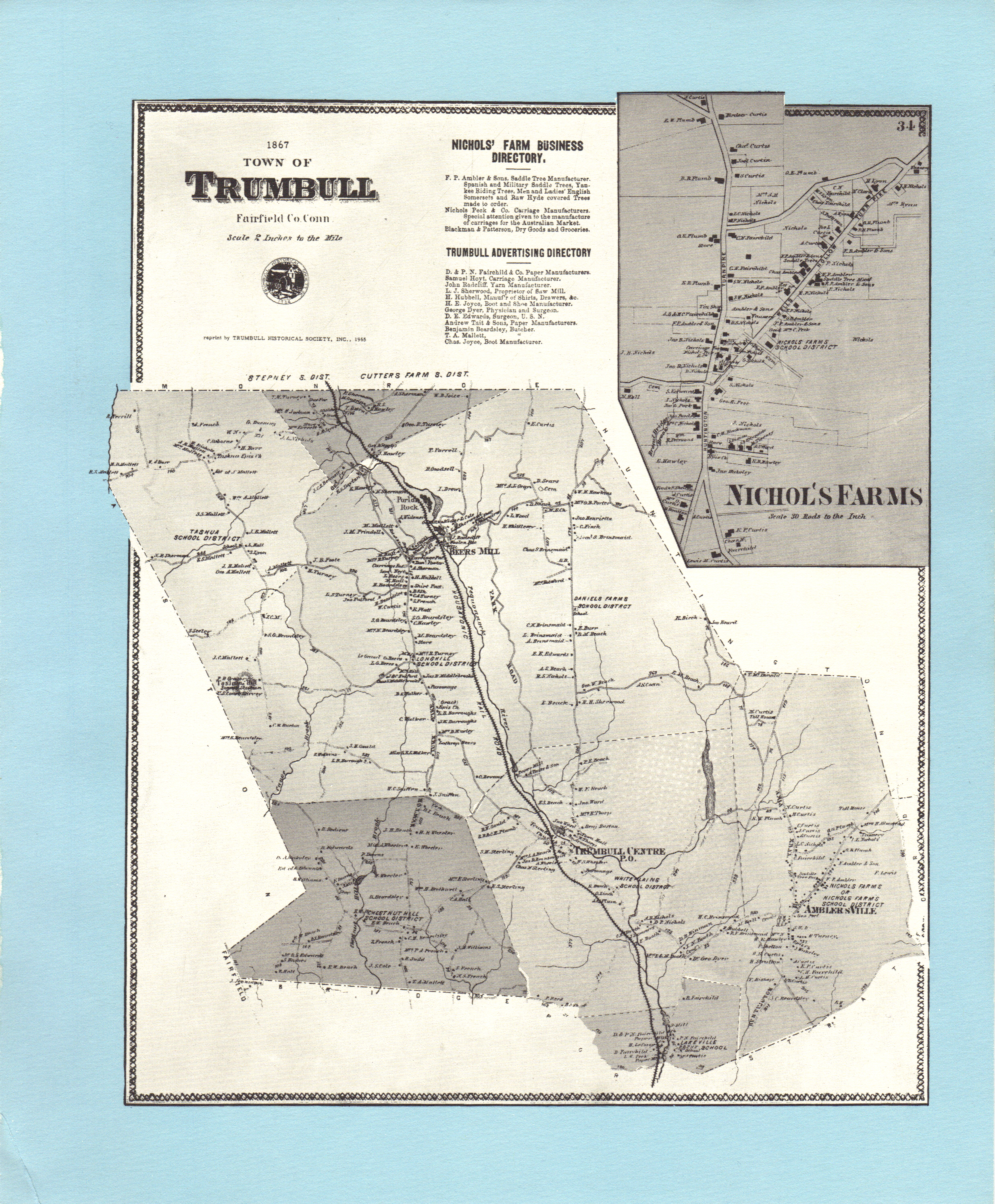
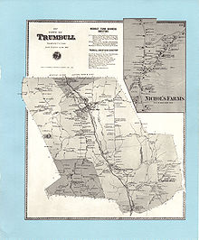 Beers 1867 map of Trumbull, Connecticut
American Civil War
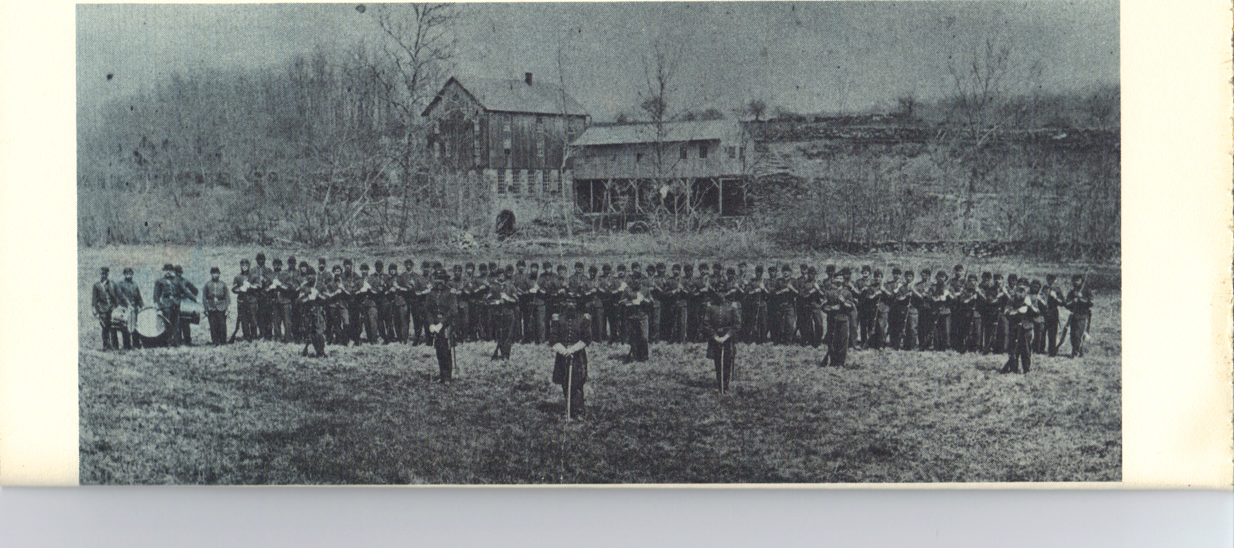
During the American Civil War, Company C of the 8th Connecticut Infantry Regiment of the Connecticut National Guard was formed in Trumbull under the command of Capt. Charles E. Plumb and was disbanded in 1871 after the war ended.
 Trumbull National Guard Unit Co. C 8th Regt. CNG, Capt. Charles E. Plumb Commanding, c. 1867. Grist Mill in background built by Gideon and Ephraim Hawley c. 1722 White Plains, Trumbull
Municipal development
Unity Parish
Main article: Nichols, ConnecticutIn May of 1725, the farmers of northwest Stratford at Nickol's Farm's, desiring to have their own meeting house, asked for permission to form their own parish or village. The legislature approved their application in October 1725 and named the new village Unity.[41] The Unity Congregational Church was established in 1730. The Reverend James Beebe was the parish leader from 1747 to 1785. The Unity Burial Ground still exists, its last burial was in 1935.
Long Hill
Main article: Long Hill, Trumbull, ConnecticutIn May 1740, upon the petition of Jonathan Edwards, the farmers gathered at Stratfield's winter parish on Long Hill and were granted their own individual parish and funding for education by the legislature.[42][43]
North Stratford
In 1744, Unity parish and the Long Hill parish of the Stratfield section of Stratford, asked permission to combine and become the Society of North Stratford. The General Assembly referred to the eastern boundaries of Unity, at the time, as ancient when they approved the new town called North Stratford in 1744.[44] North Stratford remained as a village under the control of the town of Stratford for a period of 53 years until it became a part of the town of Trumbull in 1797.
Trumbull Incorporated
After the Revolutionary War, citing their well-established population and the inconvenient distance to attend town meetings in Stratford, they petitioned the Connecticut General Assembly for status as an incorporated town. After several denials, the legislature granted their petition in October, 1797. On November 20, 1797, the first town meeting was held. The new town was named for Jonathan Trumbull, Connecticut governor during the Revolutionary War and a valued adviser to George Washington, who respectfully referred to him as Brother Jonathan.[45][1]
Society and religion
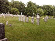
Unity Burial Ground
Main article: Unity Burial GroundThe Unity Burial Ground is a historic graveyard located on the southeast end of White Plain a few rods north of the site of the first meeting house that was built in the parish of Unity. The cemetery was laid out in 1730 and the first burial was that of 7 year old Samuel Bennitt on June 21, 1731.[46][47] There are over 110 gravestones and 90 unmarked field stones.[48]
 Unity Burial Ground established 1730
Christ Episcopal Church and Tashua Burial Ground
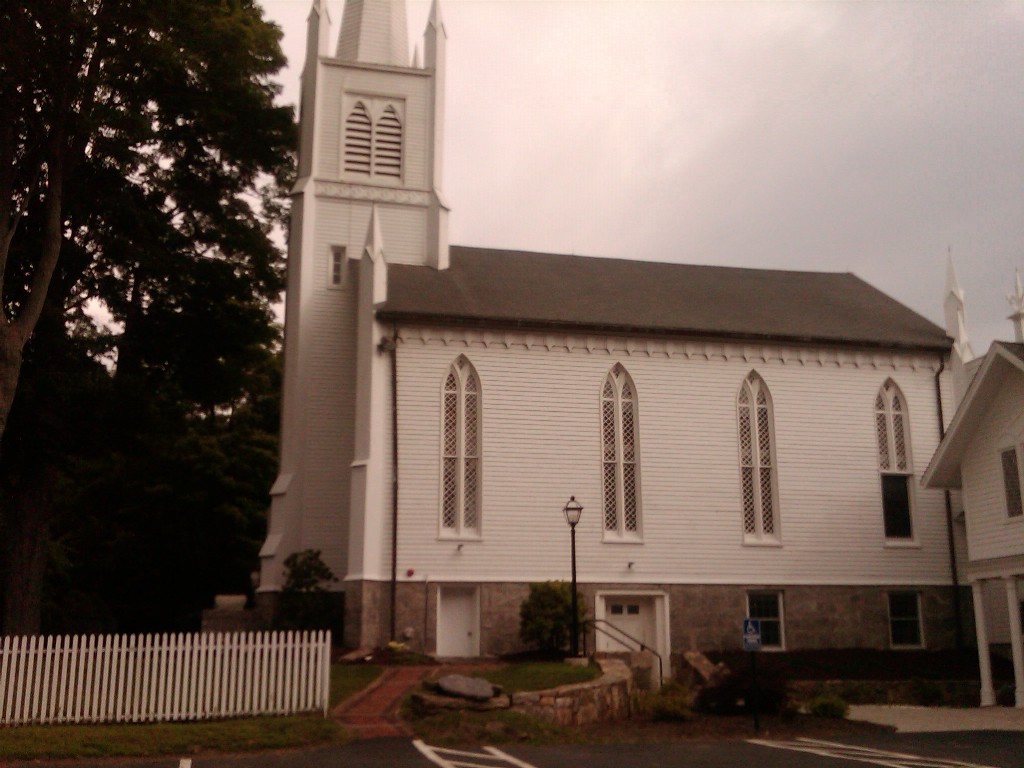
Christ Episcopal Church and Tashua Burial Ground is a historic site including an Episcopal Church building and cemetery at 5170 Madison Avenue in the Tashua section of Trumbull. The site was founded in 1760[49] and added to the National Register of Historic Places in 2001. Two prior churches had been on the site before the cornerstone of the existing church was laid in 1826. This building is believed to have been designed by Alexander Jackson Davis and was consecrated in 1847.[50] The original church was a 36’ X 26’ structure and stood at the north end of the graveyard. The second, larger church was built across from the first and consecrated in 1795 after the first church was abandoned five years earlier.[51]
 Christ Episcopal Church today.
The current church is an example of Carpenter Gothic, a variant of Neo-Gothic architecture. Christ Church displays the original Bible and Book of Common Prayer that was received by the church in 1762 from England. The church is still active, with two services held on Sunday mornings.[51] The graveyard on the site dates to 1766,[52] and includes 241 plots.
 Tashua Burial Ground established 1766
 Gregory's Four Corners Burial Ground established 1761
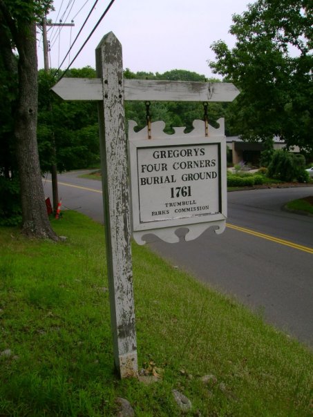
Gregory's Four Corners Burial Ground
Gregory's Four Corners Burial Ground is a historic cemetery just over the Monroe town line. It was established in 1761. It is most famous for being the final resting place of Hannah Cranna, often called the "Wicked Witch of Monroe".
Commerce and industry
- Farm Highway
Main article: Connecticut Route 108On December 7, 1696, the Farm Highway, present-day Nichols Avenue Connecticut Route 108, was laid out by the Stratford selectmen to the south side of Mischa Hill.[53] The highway was 12 rods wide, or 198 feet, where Broadbridge Brook runs off the south side of Mischa Hill, at Zachariah Curtiss, his land, and at Captain's Farm. Broadbridge Brook runs off Mischa Hill west of the present-day intersection of Route 108 and the Merritt Parkway and flows southwesterly to Broadbridge Avenue in Stratford.
The Captain the town recorder was referring to may have been Captain Joseph Hawley or Captain William Curtiss, who was Captain of the first Train Band and owned a farm at Turkey Hill at this time. This hill was located two miles from the meeting house, along the Farm Highway, on the way to Mischa Hill. The hill was also commonly called Second Hill, Good Hill and Grassy Hill as well.[54] The Captain could have also been John Hawley who owned the Ephraim Hawley House at this time which bordered Zachariah Curtiss land to the south. Hawley was Captain of the Second or North Train Band and was Justice of the Peace for Fairfield County.
In October 1725, when the Assembly of the Connecticut Colony approved the Parish of Unity, they referred to the Farm Highway as Nickol's Farm's Road.[55] The Nichols Avenue portion of Route 108 in Trumbull is considered to be the third-oldest documented highway in Connecticut after the Mohegan Road, Connecticut Route 32 in Norwich (1670) and the King's Highway, or Boston Post Road Route 1 (1673).[56]
- White Plains Road
In February 1694, Thomas Lake purchased land on the east side of the natural grassy flood plains of the Pequonnock River near an area called The Falls. By 1705 Route 110, White Plains Road, was laid out northerly past Lake's house to a natural rock outcropping called Pulpit Rock. Pulpit Rock is located north of the present day intersection of White Plains Road and Unity Road.[57] The first meetings of the Trumbull Congregational Church, established in 1730 as the Parish of Unity and later renamed Trumbull Congregational Church, were held at Pulpit Rock on White Plains Road. This church also served as a town meeting house until 1747 when a new church was built under the leadership of Rev. James Beebee.[58]
- Mills
At the August 1697 town meeting, John Seeley first proposed building a gristmill at the narrows of the Pequonnock River southward of Eassays Pond, however, it took until July 1704 to come to terms with the town and finish construction.[59]
On January 26, 1703, the Stratford selectmen granted Ebeneezer Curtiss, James Lewis and Edmund Lewis, County surveyor, permission to erect a sawmill near Mischa Hill.[60]
In December 1709, Captain Judson and Captain Coe agreed to build a dam at the Falls of the Pequonnock River as long as they maintained a mill or mills at the location and they satisfy all persons for land drowned by said dam.[61]
In January 1722, Gideon and Ephraim Hawley agreed to rebuild a mill or mills on the stream of the Pequonnock River at the narrows by White Plain.[62]
Reuben Fairchild and his brothers Daniel and Eben built the Fairchild Paper Mill in 1826 at a place commonly called since 1674 as the Falls of the Pequonnock River. They were guided in their endeavors by Andrew Tait who had learned the art of paper making in Scotland. Fairchild Paper Mill was the first mill to make white note paper. The company also ran a boarding house for its female employees. The mill stood to the west of White Plains Road near what is today the entrance to Fairchild Memorial Park.[63][64] As of 2010, it is the town boundary with the city of Bridgeport and has been made into Fairchild Park.[65] The Pequonnock River in the Paugussett Indian language meant place of slaughter or place of destruction.[66]
- Mines
The first mention of minerals at Saganawamps, or the Old Mine Park Archeological Site is found in the February 21, 1757 deed giving Howkins Nichols of Stratford a lease for 200 years of five acres "at a place commonly called Saganawam for obtaining ye ore or mineral substances."[67] Some time around 1818, Ephraim Lane took some samples of rocks he found at Saganawamps to Yale University Professor Benjamin Silliman for identification. Silliman reported, in his new American Journal of Science, that he had identified tungsten, tellurium, topaz and fluorite. In 1837 the first (and at the time only) prismatic barite ore of tungsten in the United States was discovered at the mine.
- Housatonic Railroad
From 1840 - 1931, a fifteen mile segment of the Housatonic Railroad ran along the Pequonnock River with stations at Bridgeport, North Bridgeport (Lyons), Trumbull, Long Hill, Stepney, Pepper (Pepper Crossing) and Botsford, terminating in New Milford, Connecticut. The Railroad also maintained the Parlor Rock Amusement Park in Trumbull.[68][69] The railroad was ripped up and replaced with Connecticut Route 8 up to Trumbull, north of which became the Pequonnock River Valley State Park.[70]
- Manufacturing
George R. Nichols embarked with his brother David Stiles Nichols in the manufacture of coaches during the 1840s, their business being mostly with Texas and the Southern States. David S. Nichols was succeeded by James K. Nichols, a brother of George K. Nichols. The firm of Nichols and Brother, encountered heavy losses during the Civil War. Before the war, Mr. George K. Nichols, who had successfully conducted a carriage repository in Broadway, New York, in the interest of the firm, had to return to Nichols' Farms to help supply the demand for carriages from the South. The Mexican coaches made by the firm were of high repute.[71]
Harvey Hubbell, like his contemporaries Edison, Ford and Westinghouse, contributed to both spheres of progress; new product design and manufacturing innovation. The first Harvey Hubbell, father of the Company's founder, was a partner in two clothing manufacturing firms in the late nineteenth century. The first factory was located in New York and the second was started in Trumbull in 1860 in a building located near the Hubbell farm on Main Street in the Long Hill section of Trumbull.[72][73][74]
 Igor Sikorsky flying VS-300 in 1941
Notable residents
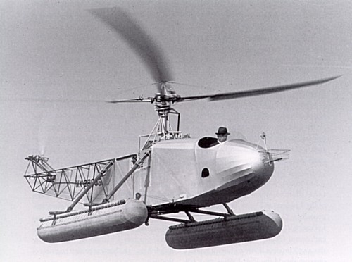
Helicopter inventor Igor Sikorsky lived in Trumbull from 1928, after moving his aircraft manufacturing company that bears his name from New York to Stratford, until 1951. The Sikorsky Manufacturing Company became a part of United Aircraft and Transport (now United Technologies Corporation) in July 1929.[75] The company manufactured flying boats, such as the S-42 "Clipper", used by Pan Am for trans-Atlantic flights.
Sikorsky also continued his earlier work on vertical flight. On February 14, 1929, he filed an application to patent a "direct lift" amphibian aircraft which used compressed air to power a direct lift "propeller" and two smaller propellers for thrust.[76] On June 27, 1931, Sikorsky filed for a patent for another "direct lift aircraft", and was awarded patent #1,994,488 on March 19, 1935.[77] His design eventually culminated in the first (tethered) flight of the Vought-Sikorsky VS-300 on September 14, 1939, with the first free flight occurring on May 26, 1940.
Sikorsky's success with the VS-300 led to the R-4, which became the world's first mass produced helicopter in 1942. Sikorsky's final VS-300 rotor configuration, comprising a single main rotor and a single antitorque tail rotor, has proven to be one of the most popular helicopter configurations, being used in most helicopters produced today.
Education and society
- Public school
The spirit of public education was fostered early in Trumbull when the selectmen voted on January 11, 1716 to allow the farmers at Long Hill, Fairchilds and Nichols Lakes the use of the forty shillings per thousand allowed by law for seven years ensuing, provided they educate their children according to law.[78]
Five school districts were formed in November 1761. Each district had its own committee, which was appointed regularly and consisted of three persons. The districts were called; Nichol's Farm, Daniel's Farm, Long Hill, White Plain and Cutler's Farm, for the area they served. The number was increased slightly in 1762 when Long Hill was split into Upper Long Hill and Lower Long Hill. Tashua School was first noted in 1769.
On December 2, 1795 a meeting was held to set off the eight school district new boundaries; Nichol's Farms, White Plain, Daniel's Farm, Booth's Hill, Long Hill South, Long Hill North, Tashua and Mount Moria. The description of the new districts listed landmark houses, roads and geographical locations in the boundary descriptions that included; Bears Den, Nichol's Farm Road, the place where Lt. Brinsmade's house once stood, Mischa Hill sawmill, Hedge Hog Brook, Daniel's Farm Road, Luff's Hill, James Daskom's, Widow Sterling's, Widow Beebe's, Booth Hill Brook, Mr. Joseph Nichol's, Mr. Edward Waylon's, Porter's Hill, Shagnawamps Road, Shagnawamps Brook, a large rock by the road between the house of Mr. Joshua Curtiss and Mr. Daniel Foot's, Canoe Brook, Daniel Salmon's, Mr. Seeley Burrough's, Mr. Benjamin Beardslee's, the Weston and Stratfield Parish town lines as well as Mr. Enoch Gregory's, Mr. John Jones, Mr. John Fitch and the Newtown Road.[79]
 Original Pine Brook Country Club cabins c. 1931
- Pine Brook Country Club
Main article: Pine Brook Country ClubBenjamin Plotkin purchased Pinewood Lake and the surrounding acreage and built an auditorium with a revolving stage, forty cabins and incorporated as the Pine Brook Country Club in 1930.[80] Plotkin's dream was to market the club as a summer resort for people to stay and enjoy theatrical productions. Pine Brook is best known for becoming the summer rehearsal headquarters of the most important experiment in the history of American Theatre. The Group Theatre (New York) was formed in New York City by Harold Clurman, Cheryl Crawford and Lee Strasberg in 1931. The group was made up of actors, directors, playwrights and producers and produced works by the most important American playwrights of the time on real life subject matter which changed stage and film forever.[81] In 1944, Pine Brook Country Club was sold, reorganized and chartered as the Pinewood Lake Association.[82]
Images
-

Ephraim Hawley House c. 1670–1690
-

Zachariah Curtiss Houses c. 1686 and c. 1721
-
Samuel French House ca. 1736
-
John Wildman House c. 1745
-

Daniel Beach House ca. 1750
-

Daniel Hawley House c. 1756
-
Captain Beardsley House c. 1756
-
John Wheeler House ca. 1770
-

Joseph Plumb House c. 1780
-

Dr. Elijah Middlebrook House ca. 1824
-

Joel Curtis House c. 1840
-

Nichols Farms Burial Ground est. 1850
-

Igor Sikorsky home 1928–1934
-

Igor Sikorsky home 1934–1945
-

Igor Sikorsky home 1945–1948
-

Igor Sikorsky home 1948–1951
Population change in Trumbull during the 19th century Year 1800 1810 1820 1830 1840 1850 1860 1870 1880 1890 Population 1,291 1,241 1,232 1,242 1,204 1,309 1,474 1,335 1,323 1,453 Source: Population change in Trumbull since 1900 Year 1900 1910 1920 1930 1940 1950 1960 1970 1980 1990 2000 2010 Population 1,587 1,642 2,597 3,624 5,294 8,641 20,379 31,394 32,989 32,016 34,243 36,018 Source: On the National Register of Historic Places
- Christ Episcopal Church and Tashua Burial Ground – 5170 Madison Ave. (added May 25, 2001)
- David Mallett Jr. House – 420 Tashua Road (added March 20, 1986)
- Kaatz Icehouse – 255 Whitney Ave. (added October 19, 1977)
- Nichols Farms Historic District – Center Road, 1681–1944 Huntington Turnpike, 5–34 Priscilla Place, and 30–172 Shelton Road (added September 20, 1987)
- Old Mine Park Archeological Site (added 1990)
See also
Notes
- ^ a b Jonathan Trumbull historic marker website retrieved on July 26, 2010
- ^ Orcutt, Vol. 1 p. 269
- ^ The Public Records of the Colony of Connecticut Vol. 1 p. 234
- ^ The Public Records of the Colony of Connecticut Vol. 1 p. 284
- ^ Orcutt Vol. 1 p. 86
- ^ The Hawley Record, Elias S. Hawley, 1890, p. 429
- ^ The Public Records of the Colony of Connecticut Vol. 1 p. 281
- ^ Orcutt, Vol. 1 p. 25
- ^ Orcutt, Vol. 1 p. 167
- ^ Orcutt, Vol. 1 p. 282
- ^ Orcutt Vol. 1, p. 273
- ^ Orcutt Vol. 1 p. 168
- ^ Colonial Connecticut Records 1636–1776 Vol. 3, p. 186
- ^ The Public Records of the Colony of Connecticut Vol. 1 p. 315
- ^ Orcutt, Vol. 2, p. 109
- ^ Orcutt Vol. 2 p. 1252
- ^ Stratford Land Records, Vol. 2 p. 82-86
- ^ Stratford Land Records Vol. 2 p. 108
- ^ Trumbull Historical Society website retrieved 2011 03-19
- ^ Stratford Land Records Vol. 2 p. 70-86
- ^ a b Colonial Records of Connecticut Vol. 3, p. 233
- ^ Orcutt, Vol. 3 p. 199
- ^ Last Will and Testament of William Curtiss (1618–1702)
- ^ Colonial Connecticut Records 1636–1776, Vol. 03, page 233
- ^ Orcutt, Vol. 2 p. 1219
- ^ History of Ancient Woodbury Connecticut From the First Indian Deed 1659 to 1872, William Cothren, 1872, Vol. 2 p. 916
- ^ a b Stratford Land Records Vol. 2 p. 70
- ^ Jacobus, Donald Lines, History and Genealogy of the Families of Old Fairfield, Volume: reprinted two volumes in three, Genealogical Publishing Co., Inc., Baltimore, Maryland, 1976, Original Date, 1930–1932 Page: Vol. I, pgs. 637-638
- ^ The Nichols Family website retrieved 2011 03-19
- ^ Stratford Land Records Vol. 2, p. 83
- ^ Orcutt, Vol. 1 p. 376
- ^ Sutherland p. 216
- ^ Orcutt, Vol. 1 p. 380
- ^ History of Trumbull Dodrasquicentennial 1797–1972 p. 18
- ^ Rochambeau's Cavalry: Lauzun's Legion in Connecticut 1780–1781, Robert Selig and Mary Donohue, Connecticut Historical Commission, 2000, p. 33 [1]
- ^ The Magazine of American History with Notes and Queries, Vol. IV, A.S. Barnes & Co., New York, 1880, p. 32 [2]
- ^ United States Congressional Serial Set, United States Government Printing Office, December 4, 1905 – June 30, 1906, Senate Documents, Washington, Vol. 32 p. 396 [3]
- ^ Life and Letters of Samuel Holden Parsons, Major General in the Continental Army and Chief Judge of the Northwestern Territory 1737 — 1789, Charles S. Hall 1905, p. 364 [4]
- ^ Newtown's History and Historian, Ezra Johnson, Newtown, CT, 1917, p. 139 [5]
- ^ Orcutt, Vol. 1, p. 402
- ^ Colonial Connecticut Records 1636–1776 Vol. 6 p. 568
- ^ Colonial Records Connecticut Vol. 8 p. 300
- ^ Orcutt Vol. 2 p. 1013
- ^ Colonial Connecticut Records 1636–1776 Vol. 9 p. 64
- ^ Publications of the Colonial Society of Massachusetts, Vol. VII Transactions 1900–1902, Boston, 1905, pp. 94–119
- ^ CT GENWEB website retrieved on 10-08-2010
- ^ Orcutt, Vol. 2 p. 1019
- ^ They Face the Rising Sun, E. Merrill Beach, Pequot Press, 1971
- ^ Images of Trumbull, Trumbull Historical Society, 1997 p27 ISBN 978-0-7524-0901-6
- ^ Images of Trumbull, Trumbull Historical Society, 1997 p23 ISBN 978-0-7524-0901-6
- ^ a b About Christ Church
- ^ Trumbull's Historic Churches
- ^ Orcutt, Vol. 2 p. 1049
- ^ Genealogy of the Bostwick family in America: The descendants of Arthur Bostwick of Stratford, CT, p. 56, Bryan Printing Co., 1901
- ^ Colonial Connecticut Records 1636–1776, Vol. 6 p. 568
- ^ Kurumi Connecticut Roads retrieved on 2008-04-11
- ^ Orcutt Vol. 2 p. 1,234
- ^ Trumbull Historical website retrieved on 2010-07-09
- ^ Stratford Town Acts 1675–1697 p. 9
- ^ Orcutt, Vol. 1 p. 295
- ^ Stratford Town Acts 1697–1775 p. 16a
- ^ Orcutt, Vol. 2 p. 1,007
- ^ Pictorial History of Trumbull pg. 57
- ^ Orcutt, Vol 2 pg. 1060
- ^ Orcutt, Vol 2 p. 1,060
- ^ Seeley p. 337
- ^ History and Minerals of Old Mine Park (Saganawamps), Earle Sullivan, Trumbull Historical Society, 1985, p. 7
- ^ Trumbull's Early Public Transportation
- ^ Pequonnock River Greenway
- ^ Housatonic Rail-Trail - Trumbull (Pequonnock Valley Greenway) | Connecticut Trails | TrailLink.com
- ^ Orcut Vol. 2 p. 1053
- ^ Images of America, Trumbull, Trumbull Historical Society, 1997
- ^ Hubbell website retrieved on 2010-09-10
- ^ Trumbull Historical Society website retrieved on 2010-09-10
- ^ Spenser 1998, pp. 15-17.
- ^ Google Patents retrieved November 25, 2010
- ^ Google Patents retrieved on November 25, 2010
- ^ Orcutt Vol. I p. 281
- ^ Orcutt, Vol. 2 p. 1,028
- ^ Images of America, Trumbull Historical Society, 1997, p. 122
- ^ Pinewood Lake website retrieved on 2010-09-10
- ^ Images of America, Trumbull Historical Society, 1997, p. 123
References
- Reverend Samuel Orcutt, A History of the Old Town of Stratford and the City of Bridgeport, Connecticut, Volume 1, Fairfield Historical Society, 1886
- Reverend Samuel Orcutt, A History of the Old Town of Stratford and the City of Bridgeport, Connecticut, Volume 2, Fairfield Historical Society, 1886
- History of Trumbull Dodrasquicentennial 1797–1972 Commemorative Book, Trumbull Historical Society, 1972
- Isaac William Stuart, Life of Jonathan Trumbull Sen., Governor of Connecticut, Crocker and Brewster, 1859
- Henry Phelps Johnston, The Yorktown Campaign and the Surrender of Cornwallis, 1781, Ayer Publishing, 1971
- Charles S. Hall, Life and Letters of Samuel Holden Parsons, Ostenigo Publishing Co., Binghamton, NY, 1905
- E. Merrill Beach, They Face the Rising Sun, Trumbull Historical Society, 1971
- E. Merrill Beach, Trumbull, Church and Town, Trumbull Historical Society, 1972
- Dorothy Seeley, Tales of Trumbull's Past, Trumbull Historical Society, 1984
- Jonathan Sutherland, African Americans at War: an encyclopedia Vol. 1, 2004
External links
- Jonathan Trumbull Historical Marker
- Trumbull Historical Society
- The USGenWeb Project, Fairfield County
 State of Connecticut
Topics - Index
- Culture
- Constitution
- Delegations
- Elections
- Geography
- Government
- History
- Images
- People
- Visitor Attractions
Regions Counties Cities Places Municipalities and communities of Fairfield County, Connecticut Cities Bridgeport | Danbury | Norwalk | Shelton | Stamford
Towns Bethel | Brookfield | Darien | Easton | Fairfield | Greenwich | Monroe | New Canaan | New Fairfield | Newtown | Redding | Ridgefield | Sherman | Stratford | Trumbull | Weston | Westport | Wilton
Borough Other
communitiesAspetuck | Botsford | Black Rock | Branchville | Byram | Cannondale | Compo | Cos Cob | Cranbury | East Norwalk | Georgetown | Glenbrook | Glenville | Greenfield Hill | Greens Farms | Hattertown | Hawleyville | Huntington Center | Long Ridge | Lordship | Mianus | Old Greenwich | Riverside | Round Hill | Rowayton | Sandy Hook | Silvermine | South Norwalk | Southport | Stepney | Springdale
Categories:- Trumbull, Connecticut
- Histories of cities in Connecticut
- Populated places established in 1639
- Populated places established in 1725
- Populated places established in 1744
- Populated places established in 1797


Wikimedia Foundation. 2010.