North Pine, British Columbia
- North Pine, British Columbia
-
Categories:
- Settlements in British Columbia
- British Columbia geography stubs
Wikimedia Foundation.
2010.
Look at other dictionaries:
British Columbia — British Columbian. a province in W Canada on the Pacific coast. 2,406,212; 366,255 sq. mi. (948,600 sq. km). Cap.: Victoria. * * * Province (pop., 2001: 3,907,738), western Canada. It is bounded by Yukon Territory, Northwest Territories, Alberta … Universalium
Geography of British Columbia — Continent North America Region Western Canada Coordinates … Wikipedia
British Columbia Highway 97 — Infobox road province=BC name notes= type=Hwy route=97 alternate name= length mi= length round= length ref= length notes= established=1953 direction a=South starting terminus= border junction=Hwy 3 in Osoyoos Hwy 3A in Kaleden Hwy 97C in… … Wikipedia
Prince George, British Columbia — Infobox Settlement official name = Prince George, British Columbia other name = native name = nickname = settlement type = motto = imagesize = image caption = imagesize = image caption = flag size = image seal size = image shield = shield size… … Wikipedia
Highway 37 (British Columbia) — Der British Columbia Highway 37 ist eine Straßenverbindung im Hinterland der Coast Mountains in British Columbia, die eine Verbindung zwischen dem Yellowhead Highway und dem Alaska Highway herstellt. Der nördliche Abschnitt zwischen Kitwanga und… … Deutsch Wikipedia
Clearwater River (British Columbia) — Clearwater River and Osprey Falls at outlet of Clearwater Lake The Clearwater River is the largest tributary of the North Thompson River, joining it at the community of Clearwater, British Columbia. The Clearwater rises from glaciers in the… … Wikipedia
Mount Hosmer (British Columbia) — Mount Hosmer Elevation 2,500 m (8,202 ft) … Wikipedia
Blue River, British Columbia — Blue River is a small community in British Columbia, situated on the Yellowhead Highway about halfway between Kamloops, British Columbia and Jasper, Alberta. It currently has 260 residents. The local economy is supported by logging, tourism and… … Wikipedia
Clearwater Lake (British Columbia) — Clearwater Lake Clearwater Lake Location British Columbia Coordinates … Wikipedia
Gold Bridge, British Columbia — Gold Bridge is an unincorporated community in the Squamish Lillooet Regional District in British Columbia, Canada. Although numbering only around 250 inhabitants, Gold Bridge is the service and supply centre for the upper basin of the Bridge… … Wikipedia
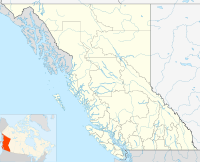
 North PineLocation of North Pine in British Columbia