- North–South connection (Brussels)
-
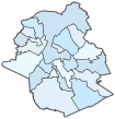
Brussels North–South connection 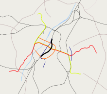
Map of the railway (shown in bold black)
in relation to the other Brussels railway and metro linesOverview Status Operational Locale Belgium Termini Brussels-North railway station
Brussels-South railway stationOperation Opened 1952 Operator(s) National Railway Company of Belgium Technical Line length 3.8 km (2.4 mi) No. of tracks six tracks Track gauge 1,435 mm (4 ft 8 1⁄2 in) Standard gauge Electrification 3 kV DC Route map Legend
Line from Antwerp, Liège and Halle 


Line to Ghent 


Line to Namur 
0.0 Brussels-North 

0.7 Brussels-Congress 
1.3 Brussels-Central 

2.0 Brussels-Chapel 2.6 Brussels-South 


to Schaerbeek Line to Charleroi 
Line to Ostend Line to Mons and Paris The North–South connection (French: Jonction Nord-Midi, Dutch: Noord-Zuidverbinding) is a railway link through the centre of Brussels, Belgium, that connects the major national and international railway stations in the city. It is line 0 (zero) of the Belgian rail network. With 1200 trains a day it is the busiest railway line in Belgium and the busiest railway tunnel in the world.[1] It has six tracks and is used principally for passenger trains. It is partially underground (around Brussels Central station) and partially raised above street level.
The idea of an underground railway line linking the city's two main railway stations was first suggested in the 1860s as part of a proposal for the covering of the Senne.[2] That proposal was never effected. The current version was planned before World War II, after a decision originally made in 1909, and it came into service on 5 October 1952.[3][4]
The stations on the line, from north to south, are:[5][6]
- Brussels North (French: Bruxelles-Nord (STIB: Gare du Nord), Dutch: Brussel-Noord (MIVB: Noordstation))
- Brussels Congress (French: Bruxelles-Congrès, Dutch: Brussel-Congres)
- Brussels Central (French: Bruxelles-Central (STIB: Gare Centrale), Dutch: Brussel-Centraal (MIVB: Centraal Station))
- Brussels Chapel (French: Bruxelles-Chapelle, Dutch: Brussel-Kapellekerk)
- Brussels South (French: Bruxelles-Midi (STIB: Gare du Midi), Dutch: Brussel-Zuid (MIVB: Zuidstation)) (the Eurostar, Thalys, TGV and ICE international terminal)
Most national (inter-city and local) trains that use the line stop at North, Central and South stations. The international Thalys, Eurostar and TGV services stop only at the international terminal of Brussels South. ICEs have an additional stop at Brussels North. Congress and Chapel stations are served only by a limited number of trains during weekday working hours.[7]
The line is used by very few freight trains. To avoid further congestion, most freight traffic crossing between the north and south of Brussels is routed instead along either line 26, to the east (Halle to Vilvoorde, via Merode),[8] or along line 28, to the west (Brussels South to Bockstael railway station via Brussels-West station and Simonis).[9]
The stations of Brussels North and Brussels South are also linked by the premetro north-south axis, which runs through the city centre to the west of the railway line.
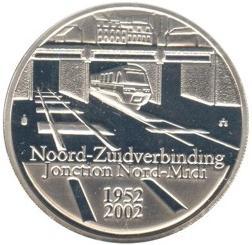
The North–South connection was selected as the main motif of a very high value collectors' coin: the Belgian 50th Anniversary of the North-South connection commemorative coin, minted in 2002. The obverse front side shows a train coming out of the North–South connection tunnel, it being one of the most famous rail links in Belgium. On the coin is written the words “Noord-Zuidverbinding Jonction Nord-Midi” (North-South connection in Dutch and French) and the years 1952 (representing the opening of the connection) and 2002.
-
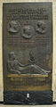
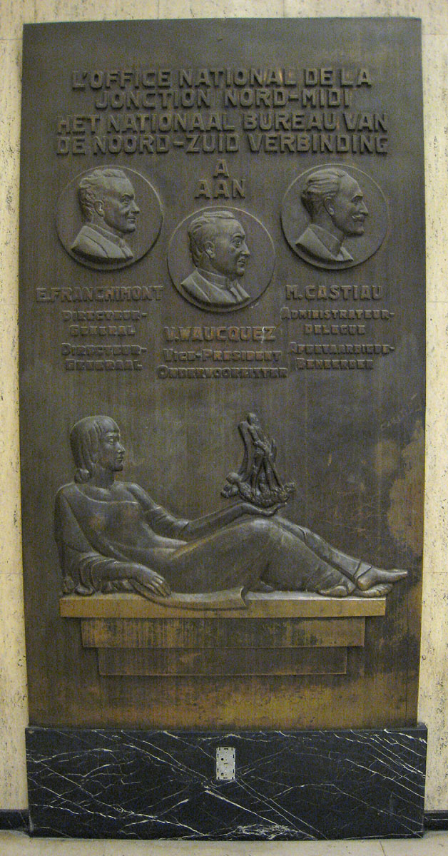
Plaque at Brussels Central commemorating the opening (panel 1)
-
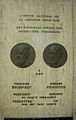
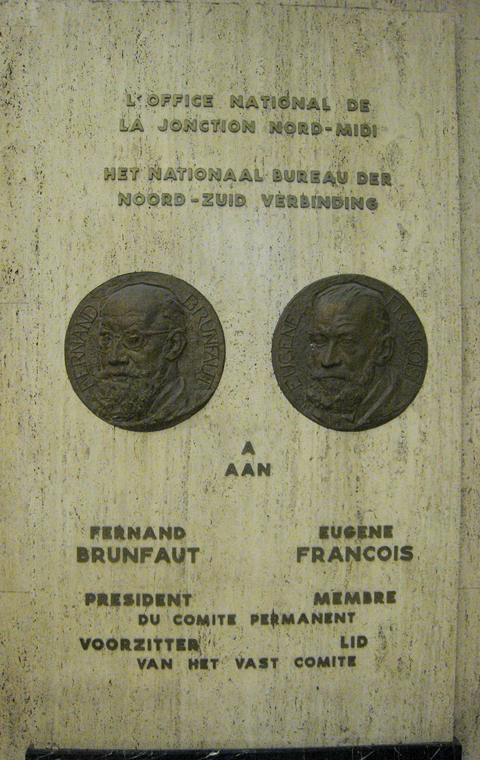
Plaque at Brussels Central commemorating the opening (panel 2)
-
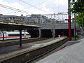
The southern end of the North-South connection tunnel, at Brussels Chapel station
References
- ^ "Spoorwegen leggen taboe op tafel (Dutch)". http://www.standaard.be/Artikel/Detail.aspx?artikelId=GN20U05T. Retrieved 21 January 2009.
- ^ Demey, 49.
- ^ "Ligne 0 : Jonction Nord-Midi" (in French). http://www.belrail.be/F/infrastructure/lignes/000.html. Retrieved 14 December 2009.
- ^ "Sur la jonction ferroviaire entre Bruxelles-Nord et Bruxelles-Midi" (in French) (pdf). http://www.persee.fr/articleAsPDF/geo_0003-4010_1953_num_62_332_13645/article_geo_0003-4010_1953_num_62_332_13645.pdf. Retrieved 14 December 2009.
- ^ "Back to the fifties" (in French). La Libre Belgique (Brussels). 17 April 2008. http://www.lalibre.be/culture/arts-visuels/article/415425/back-to-the-fifties.html. Retrieved 14 December 2009.
- ^ "Bruxelles Vie Pratique: Transport, Belgique – Guide pour expatriés, Expatriation" (in French). http://www.easyexpat.com/fr/bruxelles/pratique/transport.htm. Retrieved 14 December 2009.
- ^ "NMBS Route Planner". http://hari.b-holding.be/Hafas/bin/query.exe/en. Retrieved 1 March 2010.
- ^ "Freight in Brussels-Midi". http://www.railfaneurope.net/pix/de/car/freight/H/4-axle/pix.html. Retrieved 23 July 2008.[dead link]
- ^ "Planitram – SNCB – General Information". http://www.planitram.be/EN/sncb/ENpsncb.html. Retrieved 23 July 2008.
Print sources
- (French) Demey, Thierry. Bruxelles, chronique d’une capitale en chantier, Volume 1. Du voûtement de la Senne à la jonction Nord-Midi, Bruxelles, Paul Legrain/C.F.C.-Editions, 1990
See also
- History of rail transport in Belgium
- NMBS/SNCB (the Belgian national railway company)
- Rail transport in Belgium
- Transport in Brussels
 Brussels topicsHistory
- Fortifications
- 1695 bombardment
- 1746 siege
- Duchess of Richmond's ball
- Covering of the Senne
- Frenchification
- Expo 1897
- Liège International (1905)
- Expo 1910
- Expo 1958
- L'Innovation Department Store fire
- Heysel Stadium disaster
 Administration
- Government (Minister-President)
- Parliament
- Governor
Transport- Metro
- Brussels Airport
- Charleroi Airport
- North-South connection
- Trams
- Brussels Ring
- Small Ring
Other topicsLists- Buildings
- Notable persons
- Museums
- Railway stations
- Underground stations
Categories:- Railway lines in Brussels


Wikimedia Foundation. 2010.