- Noordeinde, Liemeer
-
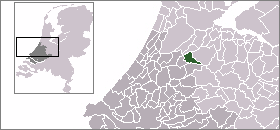
Noordeinde — Town —  Noordeinde in the municipality of Liemeer.
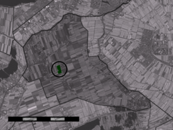
Coordinates: 52°12′N 4°46′E / 52.2°N 4.767°ECoordinates: 52°12′N 4°46′E / 52.2°N 4.767°E Country Netherlands Province South Holland Municipality Liemeer Population (2001) – Total 561 Time zone CET (UTC+1) – Summer (DST) CEST (UTC+2) Postal code Noordeinde is a town in the Dutch province of South Holland. It is a part of the municipality of Liemeer, and lies about 10 km northeast of Alphen aan den Rijn.
In 2001, the town of Noordeinde had 561 inhabitants. The built-up area of the town was 0.12 km², and contained 196 residences.[1]
References
- ^ Statistics Netherlands (CBS), Bevolkingskernen in Nederland 2001. (Statistics are for the continuous built-up area).
Categories:- Populated places in South Holland
- South Holland geography stubs

Wikimedia Foundation. 2010.