- Nkurenkuru
-
Nkurenkuru — Town — Location in Namibia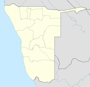
 Nkurenkuru
Coordinates: 17°37′S 18°36′E / 17.617°S 18.6°ECoordinates: 17°37′S 18°36′E / 17.617°S 18.6°E Country  Namibia
Region Kavango Region Constituency Mpungu Constituency Government - Mayor Heikki Hausiku (SWAPO) Elevation 1,093 m (3,586 ft) Population (2007) - Total 7,650 Time zone South African Standard Time (UTC+1) Area code(s) +66 Nkurenkuru (1.093 m above sea level) is a town on the south-western banks of the Kavango River in the Kavango Region, Namibia, 140 km west of Rundu. Nkurenkuru has a population of around 7.650 inhabitants and is homestead of the local Uukwangali kings and until 1936, also was capital for the entire region. Since then, the seat of the regional government was moved to Rundu, due to its strategically more central location.
On the opposite, north-eastern banks of the river lies Cuangar in Angola and the two towns are linked via a nearby border post. Today, Nkurenkuru is the second town of the Kavango region, after Rundu.
Contents
History
The history of Nkurenkuru (formerly also Kuring Kuru), Kwangali language: „the old place”, is closely linked with the history of the Kwangali people, the westernmost of the five kingdoms of the Kavango people.
The currently oldest deliverances date around the middle of the 18th century, when Uukwangali queen (hompa) Mate I. and her people left their former area of settlement on the Kwando River near Mashi and moved about 500 km to the west into an area near Makuzu 17°29′0″S 18°28′0″E / 17.483333°S 18.466667°E, around 20 km to the northwest of Nkurenkuru. Successor of Queen Mate I. became hompa Nankali (1750-1775)[1]. During her reign tensions arose with neighboring people and the Kwangali moved from Mazuku first to Sihangu near Mukukuta and then further to Karai (nearby today's Cuangar). Likely during the reign of hompa Siremo, Nkurenkuru was founded in 1820[2] and became homestead of the kings under Queen Mpande in 1880[3].
On December 30 1886, Portugal and Germany signed a bilateral agreement, in which the borders between Angola and South-West Africa were defined along the Okavango River. The tribes of the Kavango people, who at this time settled on both sides of the river, were informed about this new territorial setting only afterwards. On the north side of the river, the Portuguese started with the construction of a number of forts; among others Fort Cuangar, directly opposite of the residence of the Kwangali kings. On the south side, a number of military and missionary expeditions were carried out along the river[4]. On August 17 1909, Berengar von Zastrow, for the German administration, and King Himarua (1886-1910), for the Uukwangali hompas, signed a protection agreement (Schutzvertrag) with general authority for the government in Windhuk and land ownership of the kings[5]. In response to those forts on the northern side of the river, the German administration opened a police station in Nkurenkuru on June 17, 1910, which over the following years mainly assumed representative tasks. With the outbreak of World War I and a murdered German delegation at Naulila, the police station was used to launch an attack on Fort Cuangar on October 31, 1914, in which all present 30 Portugugese and Angolan soldiers were killed. With the end of the war the station was closed and first replaced by a temporary British occupation and from April 1921 onwards by a permanent governor for the newly established Kavango district. The new local government resulted in an extended political presence of the new League of Nations mandate government of South-West Africa, but already in 1936 the administration was moved to Rundu, which was also chosen as the new district capital. Consequently, during the following 50 years Nkurenkuru fell into increasing insignificance. During the Angolan Civil War (1975-2002) Nkurenkuru became home for a base of the South African Defence Force and in 1988 the Nkurenkuru high school was founded.
Since independence of Namibia in 1990 and in particularly since an ongoing decentralisation policy, Nkurenkuru has gained some investments. In 2006 Nkurenkuru was declared a town and second urban center of the Kavango Region.
Economy and traffic
Compared to many other cities in Namibia, Nkurenkuru is still underdeveloped. Like many towns in Northern Namibia, Nkurenkuru suffered from a bad infrastructure and the political unrest in neighboring Angola. Until then, the economy of Nkurenkuru was characterized by small farmers with only few general services: next to a post office, two schools, a small hospital and a petrol station, Nkurenkuru had only few other shops.
Since independence in 1990, Nkurenkuru gained only slowly from national infrastructure improvements. Only with an ongoing decentralisation policy of the government, which is to counterbalance rural migration, Nkurenkuru gained more economic prosperity. With the proclamation as a town, Nkurenkuru receives means for the establishment of a municipal administration and additional means for infrastructure and public services, which also led to more workplaces. Among the largest projects currently under way are the asphaltation of the river road to Rundu[6] as well as an irrigation project[7] for a more efficient agricultural use of the surrounding farmland. Since then, additional private investments have also followed - like the opening of additional shops and banks (e.g. Bank Windhoek) and the opening of lodges and guest houses along the river (e.g. Sunshine River Guest House).
Nepara Airfield (ICAO Code: FYNP), a former base of the South African Air Force, lies around 20 km southwest of Nkurenkuru and is used as a commercial airport for Nkurenkuru. About 35 km to the northwest lies the Katwitwi border post, from which a road leads further to Menongue in Angola.
Schools
- ELCIN Nkurenkuru High School
- Nkurenkuru Combined School
- Nkurenkuru Junior School
- Nkurenkuru Junior Primary School
Famous people
- Hompa Daniel Sitentu Mpasi, King of Vakwangali
- Anastasia Mbunze Murangi, Last born of Queen Kanuni KaHaruwodi
- Sirkka Ausiku, State Secretary, Ministry of Gender Equality and Child Welfare
- Rosalia Nghidinwa, Minister of Immigration and Home Affairs
- Frans Moses Kalinga, Kavango wood craver (Standard Bank Biennale Award 1999)
- Heiki Hausiku Ausiku, First Major of Nkurenkuru (2006-2010)
References
- ^ http://www.klausdierks.com/Chronology/3.htm
- ^ http://www.sdinet.co.za/static/pdf/national_informal_settlement_profiles_.pdf
- ^ http://www.rulers.org/namitrad.html
- ^ http://www.klausdierks.com/Chronology/60.htm
- ^ http://kups.ub.uni-köln.de/volltexte/2005/1321/pdf/Kavango.pdf Andreas Eckl, Konfrontation und Kooperation am Kavango (Nord-Namibia) von 1891 bis 1921, University of Cologne, 2004
- ^ http://www.economist.com.na/content/view/2203/53/ Namibia Economist, November 9th 2007
- ^ http://www.quantum.com.na/sihete/projects.html
External links
- http://www.enhs.iway.na/ ELCIN Nkurenkuru High School
Categories:- Kavango Region
- Angola–Namibia border crossings
- History of Namibia
- Towns in Namibia

Wikimedia Foundation. 2010.