- Nishi-ōjima Station
-
Nishi-ōjima Station西大島駅
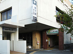
Entrance to Nishi-ōjima Station Location Prefecture Tokyo
(See other stations in Tokyo)Ward Kōtō Neighborhood etc. 2-41-19 Ōjima (in Japanese) 東京都江東区大島2-41-19 History Year opened 1978 Rail services Station number(s) S-14 Operator(s) Tokyo Metropolitan Bureau of Transportation (Toei) Line(s) Toei Shinjuku Line Statistics 23,329 passengers/day [1]  There is a bus stop near this station
Nishi-ōjima Station (西大島駅 Nishi-ōjima-eki) is a train station in Kōtō, Tokyo, Japan. Its station number is S-14. The station opened on December 21, 1978.
Contents
Platforms
Nishi-ōjima Station consists of a single island platform served by two tracks.
1 ○Toei Shinjuku Line for Bakuro-yokoyama, Shinjuku, Sasazuka, Hashimoto 2 ○Toei Shinjuku Line for Motoyawata Surrounding area
The station is located underneath the intersection of Tokyo Metropolitan Routes 50 (Shin-Ōhashi-dōri) and 306 (Meiji-dōri). The area is a mix of mid-rise office buildings and scattered apartment buildings, with the Ōjima 4-chōme danchi owned by Urban Renaissance to the southeast. Other points of interest include:
- Tokyo Metropolitan High School of Science and Technology
- Kōtō Municipal No. 1 Ōjima Elementary School
- Jōtō Health Center
- Jōtō Post Office
- Tokyo Metropolitan Jōtō Senior High School
- Kōtō Municipal Comprehensive Sports Center
- Jōtō Police Station
Connecting bus service
Toei Bus: Nishi-Ōjima-Ekimae
- To 07: for Monzen-Nakachō and Kinshichō stations
- Kin 18: for Shin-Kiba-Ekimae, Kinshichō Station
- Kyūkō 05: for National Museum of Emerging Science and Innovation, Kinshichō Station
- Ryō 28: for Kasaibashi, Rinkai garage, No. 6 Kasai Elementary School, Ryōgoku Station
- Kame 29: for Nishi-Kasai-Ekimae, Nagisa New Town
- Kame 23: for Minami-Sunamachi Station, Kōtō Geriatric Medical Center, Kameido Station
- Kin 28: for Higashi-Ōjima-Ekimae, Kinshichō Station
- Kusa 24: for Asakusa-Kotobukichō, Higashi-Ōjima-Ekimae via Ōjima Station
- Kame 24: for Kasaibashi; via Nishi-Ōjima Station for Kameido Station
Line
Adjacent stations
« Service » Toei Shinjuku Line Sumiyoshi Local Ōjima Express: no stop References
- ^ "Hamachō Station information" (in Japanese). Tokyo Metropolitan Bureau of Transportation. http://www.kotsu.metro.tokyo.jp/subway/stations/nishi-ojima/s14.html. Retrieved February 2010.
External links
Stations of the Toei Shinjuku Line (through to Sasazuka, Hashimoto -) Shinjuku - Shinjuku-sanchōme - Akebonobashi - Ichigaya - Kudanshita - Jimbōchō - Ogawamachi - Iwamotochō - Bakuro-yokoyama - Hamachō - Morishita - Kikukawa - Sumiyoshi - Nishi-ōjima - Ōjima - Higashi-ōjima - Funabori - Ichinoe - Mizue - Shinozaki - Motoyawata
Coordinates: 35°41′22″N 139°49′34″E / 35.689352°N 139.826219°ECategories:- Railway stations in Tokyo
- Railway stations opened in 1978
- Stations of Tokyo Metropolitan Bureau of Transportation

Wikimedia Foundation. 2010.