Newgate Street, Hertfordshire
- Newgate Street, Hertfordshire
-
Coordinates: 51°43′43″N 0°06′59″W / 51.728574°N 0.116405°W / 51.728574; -0.116405
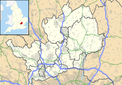
Newgate Street is a village near Cuffley, in the Welwyn Hatfield district of Hertfordshire, England. It is approximately six miles south-west of Hertford and has a population of 400.
The village has an Anglican church, a school (Ponsbourne St Mary's), an Italian restaurant (Nelito's), two pubs (The Crown and The Coach and Horses) and a hotel (Ponsbourne Park Hotel). There is also a small town hall, two outdoor tennis courts and a 9-hole golf course belonging to the hotel.
Originally in the Manor of Tolmers, the present Tolmers Park House dates from 1761. Since World War I it has been used as a military hospital, a girls' boarding school, a geriatric hospital and has now been converted to luxury apartments. Part of the estate became Tolmers Scout Camp in 1940. The house lies just to the South-West of the village.
External links
Newgate Street (A Guide to Old Hertfordshire)
Categories:
- Villages in Hertfordshire
- Hertfordshire geography stubs
Wikimedia Foundation.
2010.
Look at other dictionaries:
Newgate Street — refers to: Newgate and Newgate Street in London Newgate Street, Hertfordshire, a village in Hertfordshire Newgate Street, Newcastle, a shopping and entertainment street in Newcastle upon Tyne This disambiguation page lists articles associated… … Wikipedia
Newgate Street Village — infobox UK place country = England latitude=51.728574 longitude= 0.116405 official name= Newgate Street Village population= shire district= Welwyn Hatfield shire county = Hertfordshire region= East of England constituency westminster= Welwyn… … Wikipedia
List of places in Hertfordshire — This is a list of settlements in the ceremonial county of Hertfordshire, England. See the list of places in England for places in other counties.compactTOC NOTOC A*Abbots Langley, Adeyfield, Albury, Aldbury, Aldenham, Amwell, Apsley, Ashridge,… … Wikipedia
Фортескью, Адриан — В Википедии есть статьи о других людях с такой фамилией, см. Фортескью. Адриан Фортескью Sir Adrian Fortescue … Википедия
List of civil parishes in the City of London — This is a list of civil parishes in the ceremonial county of the City of London. There are currently no civil parishes in the City of London and it is entirely unparished.[1] Although it is possible to create new civil parishes in a London… … Wikipedia
List of High Sheriffs of the County of London — Below is a list of High Sheriffs of the County of London, from the creation of the county in 1889 to its abolition in 1965:*1889 ndash;1890: Alfred Charles de Rothschild, of Senmore Place [LondonGazette|issue=25922|startpage=2009|date=9 April… … Wikipedia
Ukrainian migration to the United Kingdom — Infobox Ethnic group group = Ukrainians in the United Kingdom caption = Notable Ukrainian Britons: Elena Baltacha Sergei Baltacha Jr. poptime = Est. over 100,000 0.16% of the UK population popplace = London, South East, Manchester, Nottingham,… … Wikipedia
List of churches in London — St. Paul s from the South London is the location of many famous churches, chapels and cathedrals, in a density unmatched anywhere else in England.[1] … Wikipedia
Moorgate — An old illustration of the gate circa 1650 Moorgate was a postern in the London Wall originally built by the Romans. It was turned into a gate in the 15th century. Though the gate was demolished in 1762, the name survives as a major street in the … Wikipedia
London — London † Catholic Encyclopedia ► London London, the capital of England and chief city of the British Empire, is situated about fifty miles from the mouth of the Thames, Lat. 51°30 , Long. 0°5 . The word London is used in widely… … Catholic encyclopedia
 Newgate Street