- New Canal Light
-
New Canal Light 
The 1890/1901 structure. Location New Orleans, Louisiana Year first constructed 1838 Year first lit 1890 (last lighthouse)
2005 (current pole light)Automated Yes Deactivated Lighthouse severely damaged by Hurricane Katrina 2005 Foundation Pile with platform Construction Wood Tower shape Square tower on top of house Markings / pattern White with red roof Focal height Lighthouse: 49 ft (15m)
Current pole light: 15 ft(5m)Original lens 5th order Fresnel lens Characteristic Lighthouse: Occulting White 5s
Current pole light: Fl 2 White 5sFog signal Previous: Bell, every ten seconds ARLHS number USA-556 USCG number 4-9992 New Canal Lighthouse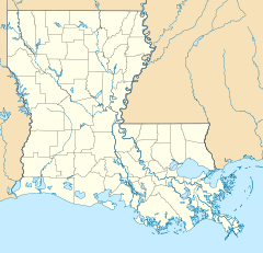

Location: West End Blvd. and Lakeshore Dr., New Orleans, Louisiana Coordinates: 30°1′37.76″N 90°6′47.55″W / 30.0271556°N 90.1132083°WCoordinates: 30°1′37.76″N 90°6′47.55″W / 30.0271556°N 90.1132083°W Built: 1890 Architect: New Orleans Canal and Banking Co. Governing body: US Coast Guard NRHP Reference#: 85003186
[4]Added to NRHP: December 30, 1985 The New Canal Light was first established in 1838 at the north end of the New Basin Canal which ran between Lake Ponchartrain and the Mississippi River. The canal was filled in around 1950, but the light remained active until severely damaged by Hurricane Katrina in 2005. It has been replaced by a light on a pole while efforts are underway to restore the house.
History
The original light was built in 1838 on a foundation of sheet piling filled in with shells. The tower was octagonal, built of cypress, about 28 feet (9 m) high. The tower deteriorated badly and was replaced in 1855 with a square wood dwelling on screw piles with an iron lantern and a 5th order Fresnel lens. In 1890 the structure was again replaced, with the light being raised to 49 feet (15 m). The 1890 structure was substantially rebuilt in 1901. It was damaged by hurricanes in 1903, 1915, 1926, and 1927. It was moved to its current location in 1910. After the 1927 damage it was raised on new concrete piers and in 1936, the breakwater surrounding it was filled in, putting land under the structure for the first time. From the 1960s through 2001 there was a USCG station at the site.[2] The building was partly destroyed by Katrina in 2005, with only the upper portion remaining intact. The Lake Pontchartrain Basin Foundation has disassembled and stored the remains of the building and is raising money to restore it.[5]
The light was added to the National Register of Historic Places in 1985 as New Canal Lighthouse.[4]
Wikimedia Commons has many images showing the lighthouse before and after Katrina.
 The 1855 lighthouse
 After Katrina, before collapse
 After collapse
References
- ^ (PDF) Light List, Volume IV, Gulf of Mexico. Light List. United States Coast Guard. 2009. p. 83. http://www.navcen.uscg.gov/pdf/lightLists/LightList%20V4.pdf.
- ^ a b "Historic Light Station Information and Photography: Louisiana". United States Coast Guard Historian's Office. http://www.uscg.mil/history/weblighthouses/LHLA.asp.
- ^ Rowlett, Russ (2010-01-10). "Lighthouses of Louisiana". The Lighthouse Directory. University of North Carolina at Chapel Hill. http://www.unc.edu/~rowlett/lighthouse/la.htm.
- ^ a b "National Register Information System". National Register of Historic Places. National Park Service. 2009-03-13. http://nrhp.focus.nps.gov/natreg/docs/All_Data.html.
- ^ "New Canal Lighthouse". Lake Pontchartrain Basin Foundation. http://www.saveourlake.org/lighthouse.htm. Retrieved 10 January 2010.[dead link]
Chandeleur Island Light · New Canal Light · Pass Manchac Light · Point Au Fer Reef Light · Sabine Pass Light · Southwest Reef Light · Tchefuncte River Range Lights · Trinity Shoal LightU.S. National Register of Historic Places Topics Lists by states Alabama • Alaska • Arizona • Arkansas • California • Colorado • Connecticut • Delaware • Florida • Georgia • Hawaii • Idaho • Illinois • Indiana • Iowa • Kansas • Kentucky • Louisiana • Maine • Maryland • Massachusetts • Michigan • Minnesota • Mississippi • Missouri • Montana • Nebraska • Nevada • New Hampshire • New Jersey • New Mexico • New York • North Carolina • North Dakota • Ohio • Oklahoma • Oregon • Pennsylvania • Rhode Island • South Carolina • South Dakota • Tennessee • Texas • Utah • Vermont • Virginia • Washington • West Virginia • Wisconsin • WyomingLists by territories Lists by associated states Other  Category:National Register of Historic Places •
  Portal:National Register of Historic PlacesCategories:
- Lighthouses in Louisiana
- National Register of Historic Places in Louisiana
- 1890s architecture in the United States
- Buildings and structures in New Orleans, Louisiana
- Structures affected by Hurricane Katrina
- Louisiana Registered Historic Place stubs


Wikimedia Foundation. 2010.