- Basford, Nottinghamshire
-
Coordinates: 52°58′40″N 1°10′07″W / 52.9778°N 1.1686°W
Basford 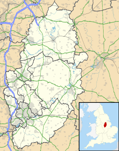
 Basford
Basford shown within NottinghamshireDistrict Nottingham Shire county Nottinghamshire Region East Midlands Country England Sovereign state United Kingdom Post town NOTTINGHAM Postcode district NG6 Dialling code 0115 Police Nottinghamshire Fire Nottinghamshire Ambulance East Midlands EU Parliament East Midlands UK Parliament Nottingham North List of places: UK • England • Nottinghamshire Basford (
 /ˈbeɪsfərd/)[1] is a suburb in northern Nottingham. Basford parish was absorbed into Nottingham in 1877. It gave its name to the Basford Rural District which existed from 1894 to 1974.
There is both an ‘Old Basford’ and a ‘New Basford’ although New Basford is mainly Victorian. Basford lies close to the River Leen, a tributary of the River Trent. Basford is located on the main route of the Nottingham Express Transit, which connects it to Nottingham City Centre to the south and Hucknall and Bulwell to the north.
Close to Basford Register Office is the site of a former workhouse, this was used for Basford and the neighbouring parishes. The workhouse later became a maternity hospital and then a psychiatric hospital. The hospital is due to be demolished.
The place name comes either from Old English "the ford near the home of Bassa" (Bassa's ford) or French le bas ford, 'the lower ford'.[2]
Near Vernon Park there used to be a complex of high rise flats which consisted of horizontal and vertical blocks connected together by ariel concrete walkways. These were demolished in 1983.
Basford has a good range of shops in the area. It is a large area. Home to Vernon Park, Basford also has football teams who play in the area, and is home to the Bulwell and Basford Rotary Club.[3]
Children in the Basford area usually attend Southwark Primary and Infants School or Old Basford School. The only senior school in the Basford area is the Ellis Guilford School and Sports College, located on Bar Lane. Ellis Guilford has been highly refurbished recently with a new school building, new changing rooms, new sports hall, tennis courts, and football pitches.
For many years one of the largest industries in Basford was the manufacturing of soap. A soap factory was established in Basford in the 1890s by Gerard Bros. In 1955 Gerard Bros. was acquired by Cussons Sons & Co., manufacturer of Cussons Imperial Leather soap. In 2005 the factory was closed and production was moved to Thailand.
Basford, Old and New was well served by railways with no less than three stations bearing its name in one form or another. Basford Vernon its first was built on the Midland Railway's Nottingham to Mansfield Line, which as is often the case with the first railway in an area still exists. The next built was on The Great Northern and bore various names, originally called Dob Park from the land it was built on, i.e. Dob Rark Hall Grounds. It later had two others including Basford: Basford North and Basford & Bulwell. Lastly came New Basford on The Great Central Main Line. This route joined with the Great Northern via a vast junction area called Bagthorpe.
Basford also had over the years three breweries, though probably only the main one, Shipstones, will be familiar. The other two were Basford Brewery (taken over via Shipstones) and the redundant Prince of Wales Brewery in Old Basford which closed over 90 years ago. However, its buildings remain pretty much as built in the form of Murphy's Chemical Works on Alpine Street.
See also
- St. Aidan's Church, Basford
- St. Leodegarius Church, Basford
References
- ^ G.M. Miller, BBC Pronouncing Dictionary of British Names (Oxford UP, 1971), p. 11.
- ^ Two At Large in New Basford, Nottingham
- ^ Club Homepage
External links
Nottingham About Nottingham Areas of Nottingham Arboretum · Aspley · Bakersfield · Bilborough · Bulwell · Basford · Carrington · Clifton · Dunkirk · Forest Fields · Hockley · Hyson Green · Lace Market · Lenton · Lenton Abbey · Mapperley · The Meadows · The Park · Radford · Sherwood · Sneinton · St Ann's · Strelley · Top Valley · Wilford · WollatonCeremonial county of Nottinghamshire Unitary authorities Boroughs or districts Major settlements Arnold · Beeston · Bingham · Bircotes · Blidworth · Carlton · Cotgrave · Eastwood · Harworth · Hucknall · Kimberley · Kirkby-in-Ashfield · Mansfield · Mansfield Woodhouse · Netherfield · Newark · Nottingham · Ollerton · Rainworth · Retford · Ruddington · Stapleford · Southwell · Sutton-in-Ashfield · West Bridgford · Worksop
See also: List of civil parishes in NottinghamshireTopics Categories:- Districts of Nottingham

Wikimedia Foundation. 2010.