- Neshkan
-
Neshkan (English)
Нешкан (Russian)- Rural locality[1] -
Selo[1]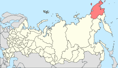
Location of Chukotka Autonomous Okrug in Russia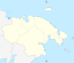
 NeshkanLocation of Neshkan in Chukotka Autonomous Okrug
Coordinates: 67°03′N 173°01′W / 67.05°N 173.017°WCoordinates: 67°03′N 173°01′W / 67.05°N 173.017°W Administrative status (as of June 2009) Country Russia Federal subject Chukotka Autonomous Okrug[1] Administrative district Chukotsky District[citation needed] Municipal status (as of November 2004) Municipal district Chukotsky Municipal District[2] Rural settlement Neshkan Rural Settlement[2] Administrative center of Neshkan Rural Settlement[2] Statistics Population (2003 est.) 704 inhabitants[3] Time zone MAGST (UTC+12:00)[4] Postal code(s) 689330[5] Dialing code(s) +7 42736[6] Neshkan (Russian: Нешкан; Naskuk in the Yupik language, meaning head of a ringed seal after a nearby hill[3]) is a rural locality (a selo) in Chukotsky District of Chukotka Autonomous Okrug, Russia.[1] It is located on the shores of the Chukchi Sea on a sandy spit that divides Neskyipilgyn Lagoon from the sea, close to Idlidlya Island. The village is small, with the 2003 population of 704 inhabitants, 662 of them indigenous people.[3]
Contents
History
Like many other villages in Chukotka, Neshkan was founded as a result of Soviet economics. In the 1950s, attempts to unify the itinerant reindeer herders of the area, consisting of the Nuteikvyn, Anayan, Tolgunen, and Vylkarney amongst others into a collective farm led to the creation of the village.[7] The village took its name from the Chukchi word Naskuk, meaning "Seal's Head", so called because one of the mountains surrounding the village looks like a seal's head when viewed from the sea.[3]
Neshkan has seen some benefit in recent years from the money that has been generated by the exploitation of the oil and gas present in the area, as a number of multi-story houses were built in the village in 2005.[8]
Economy
Unlike such villages as Tavayvaam, which have suffered serious economic hardships since the dissolution of the Soviet Union, when all the reindeer owned by the villagers were lost, leading to continuing high unemployment in the area, Neshkan's economy is still dominated by reindeer herding, with there being six separate herds maintained by the villagers, though this is also supplemented by fishing.[7]
However, the village still endures considerable economic isolation as a result of its geography. Only pensioners are paid in cash, while almost all other transactions are barter or coupons (which are often paid to state employees in the region in lieu of cash). What cash is available is spent on necessary supplies, which, due to the isolation of the village and the resulting difficulties in transporting food and other supplies, is often nearly double the price found elsewhere in the region.[9]
Transport
Like almost all Chukotkan settlements, there is no direct link from the village to any other settlement by permanent road. There are weekly flights from Lavrentiya to the village and the only other means of getting there is a four to five day off road journey.[7]
Earthquakes
Neshkan experienced a number of earthquakes throughout the 20th century, including several quakes during 1928 measuring 7.7 on the Richter Scale[10] and a number measuring between 5 and 6 throughout the second half of the century. At the time that these regular earthquakes began to affect the village, there was a lack of seismic stations in the okrug. In 2002, Bilibino was the site of the only working seismic station in the region and was over 700 km away. Prior to this, there had been a seismic station in Iultin, but this was still over 200 km away and neither was close enough to any epicentre to draw out any trends.[11]
In response to these earthquakes and the growing complaints from the inhabitants of Neshkan a permanent station was established in the village, which detected over 150 small quakes in little more than eighteen days,[12] leading geophysicists to suggest that the quakes have been caused by a previously unknown fault extending across this part of Chukotka, a view strengthened by the linear pattern of the quakes and the presence of hot springs in places like Lorino.[13]
The local toponymy suggests a more longstanding association between the indigenous people, with many geographical objects having names which conjour images of earthquakes such as the mountains Elyulivoigyn, Ivuichin, and Eletkun, meaning "shivering", "moving", and "dancing" mountain respectively, as well as nearby lake names such as Einekuem, meaning "buzzing lake".[14]
These earthquakes have been attributed to the newly-theorised Loloveem Fault, which runs from Cape Neshkan, where the village is situated, in a south-southwesterly direction through Neskynpilgyn Lagoon and Innuloon Lagoon.[15]
See also
References
Notes
- ^ a b c d Law #33-OZ, Article 13.2
- ^ a b c Law #47-OZ, Article 4
- ^ a b c d Red Cross of Chukotka. Chukotsky District (Archived)]
- ^ Правительство Российской Федерации. Постановление №725 от 31 августа 2011 г. «О составе территорий, образующих каждую часовую зону, и порядке исчисления времени в часовых зонах, а также о признании утратившими силу отдельных Постановлений Правительства Российской Федерации». Вступил в силу по истечении 7 дней после дня официального опубликования. Опубликован: "Российская Газета", №197, 6 сентября 2011 г. (Government of the Russian Federation. Resolution #725 of August 31, 2011 On the Composition of the Territories Included into Each Time Zone and on the Procedures of Timekeeping in the Time Zones, as Well as on Abrogation of Several Resolutions of the Government of the Russian Federation. Effective as of after 7 days following the day of the official publication).
- ^ Pochtovik Mail Delivery Service Chukotsky District
- ^ Ministry of Justice of the Russian Federation Chukotsky District
- ^ a b c Fute, p. 120f
- ^ Official website of Chukotsky District
- ^ East West Institute. Russian Regional Report, Vol. 4, No. 1, 14 January 1999
- ^ Mackey et al., p. 9
- ^ Mackey et al., p. 1
- ^ Mackey et al., p. 5
- ^ The Smithsonian/NASA Astrophysics Data System. A Seismic Swarm Near Neshkan, Chukotka, Far Northeastern Russia
- ^ Mackey et al., p. 7f
- ^ Mackey et al., Fig. 4
Sources
- Дума Чукотского автономного округа. Закон №33-ОЗ от 30 июня 1998 г. «Об административно-территориальном устройстве Чукотского автономного округа», в ред. Закона №73-ОЗ от 24 июня 2009 г. «О внесении изменений в Закон Чукотского автономного округа "Об административно-территориальном устройстве Чукотского автономного округа"». Вступил в силу по истечении десяти дней со дня его официального опубликования. Опубликован: "Ведомости", №7 (28), 14 мая 1999 г. (Duma of Chukotka Autonomous Okrug. Law #33-OZ of June 30, 1998 On the Administrative and Territorial Structure of Chukotka Autonomous Okrug, as amended by the Law #73-OZ of June 24, 2009 On Amending the Law of Chukotka Autonomous Okrug "On the Administrative and Territorial Structure of Chukotka Autonomous Okrug". Effective as of after ten days from the day of the official publication).
- Дума Чукотского автономного округа. Закон №47-ОЗ от 29 ноября 2004 г. «О статусе, границах и административных центрах муниципальных образований на территории Чукотского района Чукотского автономного округа». Вступил в силу через десять дней со дня официального опубликования. Опубликован: "Ведомости", №31/1 (178/1), 10 декабря 2004 г. (Duma of Chukotka Autonomous Okrug. Law #47-OZ of November 29, 2004 On the Status, Borders, and Administrative Centers of the Municipal Formations on the Territory of Chukotsky District of Chukotka Autonomous Okrug. Effective as of the day which is ten days after the official publication date).
- Petit Fute, Chukotka
- K. G. Mackey, et al. A seismic swarm near Neshkan, Chukotka, northeastern Russia and implications for the boundary of the Bering plate, Michigan State University.
External links
Administrative divisions of Chukotka Autonomous Okrug Administrative center: Anadyr Cities and towns 
Urban-type settlements Aliskerovo · Baranikha · Beringovsky · Bystry · Dalny · Egvekinot · Komsomolsky · Krasnoarmeysky · Leningradsky · Mys Shmidta · Otrozhny · Provideniya · Shakhtyorsky · Ugolnye Kopi · Valkumey · Vesenny · Vstrechny · YuzhnyAdministrative districts (raions) Categories:- Rural localities in Chukotka Autonomous Okrug
- Chukchi Sea
- Populated places of Arctic Russia


Wikimedia Foundation. 2010.